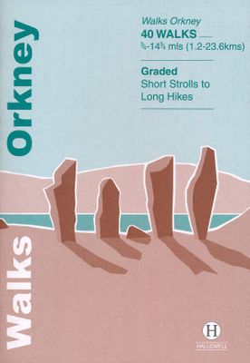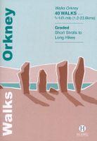
Wandelgids Walks Orkney | Hallewell Publications

0
Zeer handzaam gidsje met 40 wandelingen op de Okrneys. Handig als je een paar dagen op elk eiland verblijft. Verwacht geen lange wandelingen, maar je komt zo wel in de buurt van alle hoogtepunten. This guide brings together a selection of the best walks in Orkney. The walks include cliff-top and beach walks, as well as routes through farmland and ...

Verkopers met dit product

Verkoper
Bezorging
Prijs
DeZwerver.nl logo
DeZwerver.nl
2,95
5,95

Anderen bekeken ook

Wandelgids Walks Loch Lomond & The Trossachs | Hallewell Publications
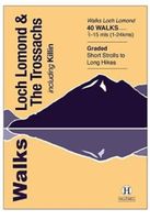
The area covered by this guide (much of it now a National Park) is one of the most popular walking districts in Scotland, and its hills, lochs, glens and woodlands provide an enormous range of routes within a small area.  Walks range from 0.5 miles to 15 miles (1-24km).  Routes include hill climbs such as Ben More & Stob Binnein, Ben Ledi, Ben A’an, The Cobbler and Ben Lomond, plus a number of shorter walks around the towns of Killin, Callander and Aberfoyle, routes by Lochs Katrine and Lomond and sections of the West Highland Way.  Previously published as Walks The Trossachs, the guide has been rewalked and the area covered expanded to inlcude west Loch Lomond.
5,95
Wandelgids Peebles, Selkirk & Lanark | Hallewell Publications
The latest in this popular series of pocket walking guides, including routes around the towns of Peebles, Selkirk and Lanark in the Scottish Borders. This guide covers the old counties of Peebles and Selkirk, as well as the the southern end of the old county of Lanark. The walks featured include a number of walks around the fine town of Peebles, on the banks of the River Tweed, climbs up Broad Law and The Three Brethren, a circuit aroud St Mary’s Loch and an overview of the John Buchan Way. This is a fine area with a great variety of walks to suit all abilities.
5,95
Wandelgids Walks Isle of Man | Hallewell Publications
The Isle of Man is a Crown Dpendency in the Irish Sea, equidistant from the UK and Ireland and is a terrific walking destination. Though the island is only 32 miles/51km long, it contains a wealth of different landscapes and walking types (moorland hills, coastal cliffs, woodland, farmland, sand dunes and beaches). There is a good network of signposted paths including a 102 mile/164km coastal path (Raad ny Foillan) and handsome towns and villages besides. This new guide features walks ranging from 1.5 - 11 miles (2.5 - 18kms) - highlights include the climb up Snaefell and the sea cliffs of Bradda Head and Spanish Head. This guide is part of a popular series of A6 pocket walking guides which describe routes which are suitable for walkers of all abilities and to suit all tastes. Route descriptions are accompanied by 2-colour sketch maps. The guides are illustrated with line illustrations, and will provide walkers with a good introduction to what each area covered has to offer.
5,95
Wandelgids Exmoor | Hallewell Publications
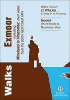
Rewalked and revised in 2021, Walks Exmoor features walks in the Exmoor National Park - a beautiful area including moorland, farmland, wooded valleys and stunning coastal scenery. (The major settlements - Minehead, Ilfracombe and Barnstaple - are all just outside the area.) The 20 walks in the guide range from 1 to 9 miles (1.6 14.4km). The bulk of the routes are in the northern coastal strip (the guide contains a number of short walks from the South West Coast Path), including the path from Lynmouth to the stunning Valley of Rocks and a group of linked walks on Bossington Hill (by Minehead). Elsewhere there is a fine riverside walk to the ancient footbridge of Tarr Steps. Walks Exmoor is part of a popular series of A6 pocket walking guides which describe routes which are suitable for walkers of all abilities and to suit all tastes. Route descriptions are accompanied by 2-colour sketch maps. The guides are illustrated with line illustrations, and will provide walkers with a good intro…
5,95
Wandelgids 078 Pathfinder Guides Anglesey, Lleyn and Snowdonia | Ordnance Survey
Fraaie, goed verzorgde wandelgidsjes met 28 wandelingen van max. een dag, (beginnend bij korte, eindigend bij langere wandelingen). Weergegeven op duidelijke topografische kaartjes (1:25.000). Bevat verder wetenswaardigheden en praktische informatie voor onderweg. Experience breathtaking north Wales with 28 unforgettable walks through Anglesey, the Lleyn Peninsula and the Snowdonia National Park. Find stunning views of the Welsh coast, the ‘holy isle’ of Ynys Mon and sublime Snowdonia with a range of walks graded by length and difficulty, from relaxed rambles to challenging climbs.   Featured Anglesey, Lleyn and Snowdonia walks include:   - Enjoy views of Snowdon from the shores of Llyn Padarn, dotted with remnants of the Llanberis slate quarries and a medieval castle - Climb to Holyhead Mountain, Anglesey’s highest point, through the South Stacks Cliff Nature Reserve - See the glorious Lleyn Heritage Coast from the headland of Trywn-y-Tâl, circling back to the pleasant village of Tre…
18,50
Wandelgids Pitlochry, Aberfeldy & North Perthshire | Hallewell Publications
Walks Pitlochry, Aberfeldy & North Perthshire covers the northern part of the county of Perthshire: from the wilderness of Rannoch Moor to the popular holiday town of Pitlochry. Formerly published as Walks North Perthshire the book has been rewalked and updated (2016) to reflect changes on the ground and the splendid riverside walk from Aberfeldy to Grandtully has been added. The walking is varied, with fine moorland walks, hill climbs and a great low-level path network around Pitlochry. The 27 walks featured range from 0.5 miles to 12 miles (1.2-19km). Routes include: Corrour to Rannoch Station, Schiehallion, Ben Lawers, Loch Faskally and The Birks of Aberfeldy. Part of a popular series of A6 pocket walking guides which describe routes which are suitable for walkers of all abilities and to suit all tastes. Route descriptions are accompanied by 2-colour sketch maps. The guides are illustrated with line illustrations, and will provide walkers with a good introduction to what the area c…
5,95

Klanten-reviews van Wandelgids Walks Orkney | Hallewell Publications

Er zijn nog geen beoordelingen voor dit productBen jij de eerste die een review plaatst?

Meer over Wandelgids Walks Orkney | Hallewell Publications

Productomschrijving

Zeer handzaam gidsje met 40 wandelingen op de Okrneys. Handig als je een paar dagen op elk eiland verblijft. Verwacht geen lange wandelingen, maar je komt zo wel in de buurt van alle hoogtepunten.

This guide brings together a selection of the best walks in Orkney. The walks include cliff-top and beach walks, as well as routes through farmland and hill climbs.

Verken gerelateerde categorieën

Webshop.nl maakt gebruik van cookies. Ga je verder op onze website, ga dan akkoord met het plaatsen van cookies en de verwerking van deze data door ons en vermelde partners.