webshop.nl
Categorieën
  Sluiten

Meer Hallewell Publications
Meer Hallewell Publications in Reisgidsen & talen boeken

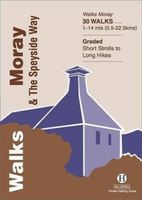
Wandelgids Walks Moray and the Speyside Way | Hallewell Publications

0
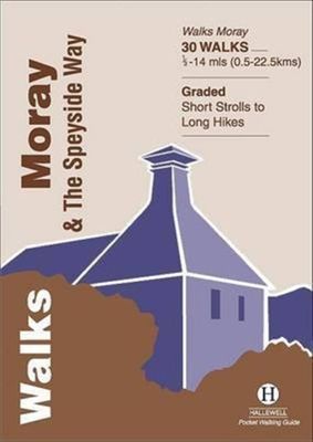
This guide covers the county of Moray in north-east Scotland – famous for its whisky distilleries.  Includes coastal walks and hill routes in the northern Cairngorms.  Walks range from 0.3 miles to 14 miles (0.5-22.5km).  Routes include: Portknockie to Cullen, Ben Rinnes and an overview of the Speyside Way with some of the best sections described....

Webshops met dit product

Webshop
Bezorging
Prijs

Anderen bekeken ook

Wandelgids The Speyside Way | Rucksack Readers
Deze gids een goede beschrijving van de lange afstands route. De kaarten zijn schetsmatig maar wel duidelijk. The Speyside Way is one of Scotland’s Great Trails. It runs for 80 miles (128 km) from the fishing port of Buckie to Aviemore in the foothills of the Cairngorms. Following the lovely valley of the River Spey, you walk through countryside rich in malt whisky and wildlife, along riverside paths, railway trackbed and forest and moorland tracks.   The second edition was fully revised, with mapping from Footprint in six panels, updated plans of villages along the Way, including a fresh Grantown plan and directions from the terminus in Buckie. In 2016 we released the revised version of this essential trail guide, with fresh photos, new mapping and many other updates. These included documenting the 6.5-mile route extension to Kincraig, which opened in 2015, and 11-mile Badenoch Way.   This guidebook contains all you need to plan and enjoy the Speyside Way:   the Way step-by-step, …
22,50
Wandelgids Fife | Hallewell Publications
Rewalked and updated in 2021, Walks Fife including St Andrews & the Lomond Hills covers the county of Fife, which lies between the estuaries of the Rivers Forth and Tay. There are a lot of coastal walks (along sections of the Fife Coastal Path), plus walks in and around the historic town of St Andrews and some good hill walks in the Lomond Hills. The 27 walks featured range from 0.5 miles to 13 miles (1.5-21km). Routes include: West and East Lomond, Bishop Hill and St Andrews to Crail. Now on its 3rd edition, Walks Fife is part of a popular series of A6 pocket walking guides which describe routes which are suitable for walkers of all abilities and to suit all tastes. Route descriptions are accompanied by 2-colour sketch maps. The guides are illustrated with line illustrations, and will provide walkers with a good introduction to what each area covered has to offer.
5,95
Wandelgids Walks Aviemore : Including Glenmore & Speyside | Hallewell
This guide covers an upper stretch of the Spey Valley, from Grantown-on-Spey in the north to Newtonmore in the south.  The main walking centres are Aviemore and Glenmore; the bulk of the walking is in the Cairngorm Mountains, the pine woods around Loch Morlich, and the low and rolling Monadhliaths.  Walks range from 1 mile to 21 miles (1.5-34kms).  Routes include: Loch Garten, Cairn Gorm, Loch Morlich to Lairig Ghru, Loch an Eilein and Creag Bheag.  This book was previously published as Walks Speyside, but has been rewalked and revised.
5,95
Wandelgids Weekend Walks Moray | Pocket Mountains
The Moray coastline has a string of superb sandy beaches, and towns such as Buckie, Lossiemouth and Nairn (historically part of Morayshire) have long been popular for family holidays.   For the walker there are cliffs, arches and stacks as well as sand and dunes, whilst offshore it may be possible to glimpse the famous Moray Firth dolphins. Set back from the coast are fine stone-built towns such as Forres and the small Cathedral city of Elgin.   From here heading southwards the character of the countryside changes to one of wide, spacious glens and sweeping, purple heather moors and hills. This is Speyside - Malt whisky country par excellence. The main centres here are Keith, Aberlour and attractive Dufftown, as the hills slowly merge into the Cairngorms National Park.   This latest pocket guide features 40 of the best walks in this popular area in an attractive and accessible format.
10,95
Wandelgids East Lothian | Hallewell Publications
Rewalked and updated in 2017, Walks East Lothian including Haddington, North Berwick & Dunbar covers the county of East Lothian, which lies to the east of Edinburgh. Walks include a number of coastal paths along the Firth of Forth and the North Sea, some paths through the county's fertile farmland plus some hill walks on the edge of the Lammermuir Hills. The 21 walks featured range from 0.5 miles to 11 miles (1-18km). Routes include: Dunbar Clifftop Trail, Traprain Law, Haddington Riverside and Gullane to North Berwick. Part of a regularly updated popular series of A6 pocket walking guides which describe routes which are suitable for walkers of all abilities and to suit all tastes. Route descriptions are accompanied by 2-colour sketch maps. The guides are illustrated with line illustrations, and will provide walkers with a good introduction to what each area covered has to offer.
5,95

Klanten-reviews van Wandelgids Walks Moray and the Speyside Way | Hallewell Publications

Er zijn nog geen beoordelingen voor dit productBen jij de eerste die een review plaatst?

Meer over Wandelgids Walks Moray and the Speyside Way | Hallewell Publications

Productomschrijving

This guide covers the county of Moray in north-east Scotland – famous for its whisky distilleries.  Includes coastal walks and hill routes in the northern Cairngorms.  Walks range from 0.3 miles to 14 miles (0.5-22.5km).  Routes include: Portknockie to Cullen, Ben Rinnes and an overview of the Speyside Way with some of the best sections described.

Productspecificaties

Artikelnummer(s)
Brand
Hallewell Publications

Verken gerelateerde categorieën

Webshop.nl maakt gebruik van cookies. Ga je verder op onze website, ga dan akkoord met het plaatsen van cookies en de verwerking van deze data door ons en vermelde partners.