Wandelgids Walks Mallaig and Ardnamurchan | Hallewell Publications

0
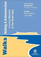
This guide covers the vast and spectacular west of Lochaber, and includes moorland walks, hill climbs, beach walks as well as walks on the Small Isles and Knoydart.  Walks range from 0.5 miles to 9 miles (1-14.5km).  Routes include: Mallaig Circular, Loch Morar, Castle Tioram, The Silver Walk and Ben Hiant.  ...

Verkopers met dit product

Webshop
Bezorging
Prijs
DeZwerver.nl logo
DeZwerver.nl
niet bekend
5,95

Anderen bekeken ook

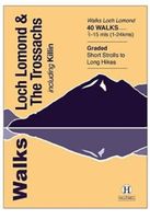
Wandelgids Walks Loch Lomond & The Trossachs | Hallewell Publications
The area covered by this guide (much of it now a National Park) is one of the most popular walking districts in Scotland, and its hills, lochs, glens and woodlands provide an enormous range of routes within a small area.  Walks range from 0.5 miles to 15 miles (1-24km).  Routes include hill climbs such as Ben More & Stob Binnein, Ben Ledi, Ben A’an, The Cobbler and Ben Lomond, plus a number of shorter walks around the towns of Killin, Callander and Aberfoyle, routes by Lochs Katrine and Lomond and sections of the West Highland Way.  Previously published as Walks The Trossachs, the guide has been rewalked and the area covered expanded to inlcude west Loch Lomond.
5,95
Wandelgids Pitlochry, Aberfeldy & North Perthshire | Hallewell Publications
Walks Pitlochry, Aberfeldy & North Perthshire covers the northern part of the county of Perthshire: from the wilderness of Rannoch Moor to the popular holiday town of Pitlochry. Formerly published as Walks North Perthshire the book has been rewalked and updated (2016) to reflect changes on the ground and the splendid riverside walk from Aberfeldy to Grandtully has been added. The walking is varied, with fine moorland walks, hill climbs and a great low-level path network around Pitlochry. The 27 walks featured range from 0.5 miles to 12 miles (1.2-19km). Routes include: Corrour to Rannoch Station, Schiehallion, Ben Lawers, Loch Faskally and The Birks of Aberfeldy. Part of a popular series of A6 pocket walking guides which describe routes which are suitable for walkers of all abilities and to suit all tastes. Route descriptions are accompanied by 2-colour sketch maps. The guides are illustrated with line illustrations, and will provide walkers with a good introduction to what the area c…
5,95
Wandelgids Ullswater and the Eastern Lakes | Hallewell Publications
Rewalked and updated in 2016, Walks Ullswater & the Eastern Lakes features walks in The Lake District - the famous area of spectacular peaks and lakes in the north-west of England. This guide covers the eastern part of the district, with most of the routes clustered around Ullswater. The routes included are largely hill climbs, plus some lower lakeside routes. The 25 walks featured range from 1.5 miles to 8 miles (2.5-13km). Routes include: Brothers Water, Angle Tarn and walks from Patterdale and Glenridding. Part of a popular series of A6 pocket walking guides that describe routes which are suitable for walkers of all abilities and to suit all tastes. Route descriptions are accompanied by 2-colour sketch maps. The guides are illustrated with line illustrations, and will provide walkers with a good introduction to what each area covered has to offer.  
5,95
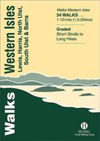
Wandelgids Walks Western Isles | Hallewell Publications
This guide includes walks on every island in the Western Isles (or ‘Outer Hebrides’ – you will see either on maps) which can be reached by public transport.  The islands are a wonderful place for walkers – it is a big area with a small population and a wide range of landscapes, from the wide heather moors of Lewis and the rocky hill country of Harris to the sand dunes and machair of the west side of North and South Uist.  Walks featured range from 1 mile to 12.5 miles (1.5-20km).  Routes include: Callanish Standing Stones, An Cliseam a tour of northern Eriskay and routes on Barra and Vatersay.
5,95
Wandelgids 100 outstanding British Walks | Ordnance Survey
Beschrijving van de 100 mooiste Pathfinder wandelingen in Engeland, Wales en Schotland. Uitstekende beschrijving van de route met een zeer duidelijke topografische kaart waarop de route is ingetekend.  This magnificent compendium of outstanding British walks brings together the finest selection of Pathfinder Walks in Britain s officially designated places of scenic beauty and historic interest: National Parks, Areas of Outstanding Natural Beauty, National Scenic Areas, Heritage Coast, National Trails and UNESCO World Heritage Sites. There are 100 walking gems in this collection, recommended by a group of experienced authors and guides. The walks span a range of distances and degrees of challenge and are organised by region with coverage across England, Wales and Scotland. 100 Outstanding British Walks is lavishly illustrated with stunning landscape photography and informative introductions to each of the walks. It is designed to be enjoyed at home, while the OS Maps app provides the p…
27,95
Wandelgids Keswick and the Northern Lakes | Hallewell Publications
Rewalked and updated in 2021 - Walks Keswick & the Northern Lakes features walks in The Lake District - the famous area of spectacular peaks and lakes in the north-west of England. This guide covers the northern part of the area. Many of the walks included are near the town of Keswick, with others in Borrowdale and by Buttermere and Crummock Water. They range in nature from serious hill climbs to gentler, lower-level routes. The 26 walks featured range from 2 miles to 10 miles (3-16km). Routes include: Skiddaw, Cat Bells & Derwent Water, Hay Stacks and a circuit of Buttermere. Now in its 4th edition, Walks Keswick is part of a popular series of A6 pocket walking guides which describe routes which are suitable for walkers of all abilities and to suit all tastes. Route descriptions are accompanied by 2-colour sketch maps. The guides are illustrated with line illustrations, and will provide walkers with a good introduction to what each area covered has to offer.  
5,95

Klanten-reviews van Wandelgids Walks Mallaig and Ardnamurchan | Hallewell Publications

Er zijn nog geen beoordelingen voor dit productBen jij de eerste die een review plaatst?

Meer over Wandelgids Walks Mallaig and Ardnamurchan | Hallewell Publications

Productomschrijving

This guide covers the vast and spectacular west of Lochaber, and includes moorland walks, hill climbs, beach walks as well as walks on the Small Isles and Knoydart.  Walks range from 0.5 miles to 9 miles (1-14.5km).  Routes include: Mallaig Circular, Loch Morar, Castle Tioram, The Silver Walk and Ben Hiant.  

Verken gerelateerde categorieën

Webshop.nl maakt gebruik van cookies. Ga je verder op onze website, ga dan akkoord met het plaatsen van cookies en de verwerking van deze data door ons en vermelde partners.