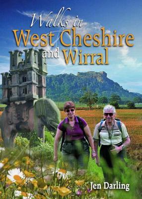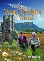
Wandelgids Walks in West Cheshire and Wirral | Northern Eye Books

0
A Cheshire walking classic. With this book you’ll discover parts of Cheshire and Wirral you never knew existed.   Ranging from 3-7 miles/5-11 kilometres in length, each of the walks features a reader-friendly factfile, clear route map and matching numbered walks directions, plentiful black and white and colour photographs, as well as fascinating s...

Verkopers met dit product

Verkoper
Bezorging
Prijs
DeZwerver.nl logo
DeZwerver.nl
niet bekend
14,95

Anderen bekeken ook

Wandelgids Cheshire & Wirral Pub Walks | Northern Eye Books
These attractive and cleverly structured guides will give walkers ten of the best themed short circular walks to Cheshire's finest pubs. With clear information, an overview and introduction for each walk, expertly written directions, large scale Ordnance Survey maps, superb photographs, and interpretation of points of interest along the way, these guides set a new standard in clarity and ease-of-use. Featured walks in Cheshire Pub Walks include: Brewery Tap, West Kirby; Harp Inn, Neston; Ring o' Bells, Frodsham; George and Dragon, Great Budworth; Boot Inn, Kelsall; Pheasant Inn, Burwardsley; Swan, Marbury; Swan Inn, Wybunbury; White Lion, Barthomley and the Ship Inn, Wincle.  
10,95
Wandelgids Best Pub Walks in Cheshire | Northern Eye Books
CHESHIRE IS WELL KNOWN for both its beautiful countryside and its country pubs. This fully revised and updated, 3rd edition of a classic guide book combines the two with superb walks through varied countryside, each one visiting a walker-friendly pub that is well known for its food and drink.   The 220-page book ideal for those with a connoisseur’s interest in Real Ale, and for walkers wanting a convenient starting point and route directions – plus some of the best pub lunches in Cheshire.   There are 30 circular walks included, covering the entire county from west to east and north to south. Each walk is graded in terms of mileage and difficulty — so families with young children can choose the easy ones, and enthusiasts can find more challenging routes to work up a thirst!
16,50
Wandelgids Walks to Lighthouses Wales | Northern Eye Books
Klein, handzaam wandelgidsje met spectaculaire wandelingen naar vuurtorens. Met goede kaartjes van Ordnance Survey. This attractive and cleverly structured guide gives walkers ten of the finest walks to the ten most spectacular lighthouses in Wales in a popular pocketable format. With clear information, an overview and introduction for each walk, expertly written numbered directions, large scale Ordnance Survey maps, superb eye-grabbing panoramic photographs, and interpretation of points of interest along the way, these guides set a new standard in clarity and ease-of-use. Featured walks include: Talacre and Great Orme, North Wales Coast; Penmon Point, South Stack and Llandwyn Island, Anglesey; Strumble Head and St Anne's Head, Pembrokeshire; Whiteford, Carmarthen Bay; and Nash Point, South Wales Coast. The ten walks featured here highlight the very best Welsh lighthouses and huge variety of the coastline of Wales.   From vast expanses of sand, sea and sky, such as at Whiteford Point …
10,95
Wandelgids North Wales Coast walks | Northern Eye Books
Zeer handzaam boekje van een tiental rondwandelingen, met goede kaarten en beschrijving. Leuke toevoeging op de route of als je alleen maar naar die streek gaat en op zoek bent naar mooie dagtochten.   One of a series of nine books in the new Top 10 Walks: Wales Coast Path series. Handy, pocket-sized, full colour walking guides written by experts. The perfect impulse buy. Each volume outlines the most popular circular walks along key sections of the Wales Coast Path. Other titles in the series include: Isle of Anglesey, Llyn Peninsula, Cardigan Bay North, Ceredigion Coast Path, Pembrokeshire North, Pembrokeshire South, Carmarthen Bay & Gower and South Wales Coast. These attractive and cleverly structured guidebooks give walkers the ten finest circular routes on a section of the Wales Coast Path in a popular pocketable format. With clear information, an overview and introduction for each walk, expertly written numbered directions, enhanced Ordnance Survey maps, eye-grabbing panoramic p…
10,95
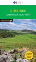
Wandelgids 042 Pathfinder Guides Cheshire | Ordnance Survey
175 miles of delightfully pastoral country walking from Thurstaston Common on the Wirral to Tegg's Nose on the north-western fringes of the Peak District National Park . . .   Uncover 28 beautiful walks around Cheshire with the OS Pathfinder Guidebooks, graded by length and ranging from 3 ½ to 10 ½ miles.   The routes range from extended strolls to longer hikes, something for all levels! Each walk includes a detailed description, an OS map, GPS waypoints, and notes of key features and things to see.   This is one of a series of books with great walking routes covering the most popular and scenic areas of Britain. Printed with weather-resistant covers featuring durable rounded corners, they are the perfect companion for country walking throughout Britain.   Publication Date: 2019   Walks in this book:   Wirswall Hill and Big Mere Bollington and Nab Head Little Budworth Country Park Styal and the Bollin Valley Dane Valley Chester and the River Dee Boothsdale Astbury mere and Vil…
18,50
Wandelgids Brecon Beacons | Northern Eye Books
This good looking, modern walking book will take you on ten short circular themed walks across South Wales’ ever-popular Brecon Beacons National Park.   The Brecon Beacons was Britain’s 10th National Park, established in 1957 to preserve and highlight the unique landscape of the area. The Brecon Beacons are said to be named after the historical practice of lighting beacons of fire upon hilltops to forewarn neighbouring valleys of invasion.    The Brecon Beacons cover 1,344 square kilometres / 519 square miles with it’s spectacular waterfalls, valleys and expanse of hilly terrain; the Black Mountain to the west, the Fforest Fawr Geopark, Waterfall Country and the Pen y Fan range at the centre, and The Black Mountains to the east.   The variety of flora and fauna is as vast as the landscape. Rare sub-arctic, alpine plants thrive within this unique climate. Mammals you’re likely to spot include include wild mountain ponies, horseshoe bats, otters and water voles. Often seen birds of prey…
10,95
Wandelgids North Cornwall Coast | Northern Eye Books
Bude to Land’s End The ten walking routes featured here highlight the best short circular walks along the North Cornwall Coast section of the popular, 630-mile long South West Coast Path (SWCP).   From Bude to the western-most tip of England at Land’s End, Cornwall’s northern coast has a character all its own. Much of its 140 miles is set against the open Atlantic, whose winter storms and thundering waves have sculpted a rugged coastline of formidable cliffs.   Tiny, wave-washed coves and zawns contrast expansive beaches and dunes, the wild scenery often spilling offshore to half submerged reefs, stacks and rocky islands.   The holiday resorts of St Ives and Newquay can attract summer crowds, but elsewhere, the coast is often deserted, with only birds for company and the delights of nature as distractions.   The five-book series of ‘Top Ten Walks’ covers the whole of the UK’s famous South West Coast Path. Each book explores the highlights along the way; showcasing its natural beauty, …
10,95
Wandelgids Bernese Oberland & Valais | Sunflower books
Wandelgids: vele dagtochten worden degelijk beschreven met openbaar vervoer informatie, goede routebeschrijvingen en kaartmateriaal. Tevens enkele autotochten. Deze gids staat goed bekend!  This new guide – in Sunflower’s new, wider format – covers the most popular destinations in western Switzerland, countryside blessed with a most dramatic and spectacular landscape. Mountains, glaciers, lakes, rivers, gorges, and waterfalls are plentiful natural elements into which cultural influences blend. Although a car is the best way to explore much of the Oberland and Valais, Switzerland boasts the world’s best public transport system. You can see a vast majority of its mountain landscapes by public transport. There are many suggested train tours in the guide. But where trains don’t go, buses will – even to remote valleys and hamlets.   Switzerland is a hiker’s paradise (you would expect nothing less of a country which has an article in its constitution regulating the responsibilities of those…
20,95
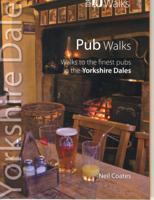
Wandelgids Pub Walks | Northern Eye Books
One of six books in the Yorkshire Dales: Top 10 Walks series. This attractive and cleverly structured guide gives walkers ten of the finest pub walks in the Yorkshire Dales National Park in a popular pocketable format. With clear information, an overview and introduction for each walk, expertly written numbered directions, Ordnance Survey maps, superb, eye-grabbing panoramic photographs, and interpretation of points of interest along the way, these guides set a new standard in clarity and ease-of-use.   Featured walks include: the White Lion Inn, Cray; Rose & Crown Inn, Bainbridge; Buck Hotel, Reeth; New Inn, Clapham; George & Dragon, Dent; Craven Arms, Appletreewick; Falcon Inn, Littondale; Bolton Arms, Redmire; Buck Inn, Malham; Red Lion, Langthwaite.
10,95
Wandelgids Dolomites Vol 1 - North and West | Sunflower books
Wandelgids: vele dagtochten worden degelijk beschreven met openbaar vervoer informatie, goede routebeschrijvingen en kaartmateriaal. Tevens enkele autotochten. Deze gids staat goed bekend! Engelstalig The go-to Dolomites walking guide for discovering the best walks and bike tours.   Strap on your boots and discover the Dolomites on foot with the Sunflower Dolomites travel guide which covers the North and West including Scillar/Schlern and Cainaccio/Rosengarten.   The Sunflower Dolomites guide is indispensable for hiking in the Dolomites. Gentle green valleys and towering limestone pinnacles: the Dolomites are a holiday paradise for lovers of the countryside. This guide for touring and walking explores the Val Pusteria and lesser-known valleys to the north, as well as the Valle Isarco bordering the A22 motorway. Highlights include Val di Funes, Sciliar and the Alpi di Siusi, Catinaccio, Puez-Odle and the Tre Cime. The book is an ideal companion for motorists, walkers and cyclists, but …
24,95

Klanten-reviews van Wandelgids Walks in West Cheshire and Wirral | Northern Eye Books

Er zijn nog geen beoordelingen voor dit productBen jij de eerste die een review plaatst?

Meer over Wandelgids Walks in West Cheshire and Wirral | Northern Eye Books

Productomschrijving

A Cheshire walking classic. With this book you’ll discover parts of Cheshire and Wirral you never knew existed.   Ranging from 3-7 miles/5-11 kilometres in length, each of the walks features a reader-friendly factfile, clear route map and matching numbered walks directions, plentiful black and white and colour photographs, as well as fascinating snippets on local history, folklore, architecture and wildlife.

Verken gerelateerde categorieën

Webshop.nl maakt gebruik van cookies. Ga je verder op onze website, ga dan akkoord met het plaatsen van cookies en de verwerking van deze data door ons en vermelde partners.