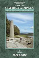
Wandelgids Walks in Silverdale and Arnside - rand van Lake District | Cicerone

0
Second edition of a popular walking guide to Silverdale and Arnside Area of Outstanding Natural Beauty (AONB), at the top of Morecambe Bay in Cumbria and Lancashire, north west England, overlooking the Lake District. 21 day walks climbing wooded hills and limestone escarpments, visiting nature reserves, crossing the Bay and tracking the canal. Man...

Verkopers met dit product

Verkoper
Bezorging
Prijs
DeZwerver.nl logo
DeZwerver.nl
niet bekend
2,95
17,50

Anderen bekeken ook

Wandelgids Walks in Silverdale and Arnside - rand van Lake District | Cicerone
Second edition of a popular walking guide to Silverdale and Arnside Area of Outstanding Natural Beauty (AONB), at the top of Morecambe Bay in Cumbria and Lancashire, north west England, overlooking the Lake District. 21 day walks climbing wooded hills and limestone escarpments, visiting nature reserves, crossing the Bay and tracking the canal. Many are the visitors who have speeded up the M6 to the Lake District or the Yorkshire Dales, who, when they do turn off to Silverdale or Arnside, wonder why they didn’t come before. The combination of the best coastal scenery and the highest concentration of intricate woodland paths in north-west England make the Silverdale area a paradise for walkers. An added bonus are the views over the glistening channels of Morecambe Bay and the Lakeland fells. The routes explore an area of low densely wooded limestone hills rich in flora and fauna either side of the M6 in north Lancashire and south Cumbria. Summits include Warton Crag, Arnside Knott, Farl…
17,50
Wandelgids 15 Short Walks Arnside and Silverdale | Cicerone
David Jordan has chosen 15 of the best short walks around Arnside and Silverdale for you to explore. Our guide comes with easy-to-read Ordnance Survey maps and clear route descriptions, perfect if you're new to walking or are looking for something you can enjoy with the whole family. We've included information on local beauty spots and tasty refreshment stops, and most of the walks can be completed in under 3 hours.   We haven't included any walks with challenging terrain or complicated navigation, and all you'll need to take with you are a waterproof jacket and a pair of comfortable trainers.
13,95
Wandelgids Lake District High Level and Fell Walks | Cicerone
A guidebook to 30 high level day walks in the Lake District, exploring some of the best mountains, ridgewalks, fells and summits within the national park. Mostly circular except for a few linear routes that make use of public transport links, the walks are graded according to difficulty, ensuring there is something for all levels of fitness and experience. The walks range from 7 to 24km (4–15 miles) in length and can be completed in between 3 and 9 hours.   They are arranged geographically into 6 areas: Keswick, Borrowdale and Buttermere, the Western Valleys, Coniston and Langdale, Ambleside and Windermere, and Ullswater. 1:50,000 OS maps for each walkGPX files available to downloadDetailed information on terrain, refreshments and public transport for each walkInformation given on local history and archaeologyHighlights include Scafell Pike, Scafell, Helvellyn, Skiddaw, Newlands Round and the Fairfield Horseshoe   Pocket-sized guide to 30 of the best walks on the higher Lake District…
18,50
Wandelgids 15 Short Walks in the Lake District: Windermere Ambleside and Grasmere | Cicerone
Our authors have chosen 15 of the best short walks around Windermere, Ambleside and Grasmere for you to explore. Our guide comes with easy-to-read Ordnance Survey maps and clear route descriptions, perfect if you're new to walking or are looking for something you can enjoy with the whole family.   We've included information on local beauty spots and tasty refreshment stops, and most of the walks can be completed in under 3 hours.   We haven't included any walks with challenging terrain or complicated navigation, and all you'll need to take with you are a waterproof jacket and a pair of comfortable trainers.
13,95
Wandelgids The Cumbria Coastal Way | Cicerone
This guidebook follows the continuous 298km (182 mile) walking route from Silverdale, on Morecambe Bay, towards Gretna on the Scottish border. The route links a number of gems of landscape, wildlife, archaeology and history along this often little-known coastline. A walk of 10-14 days suitable for all levels of ability.   THE CUMBRIA COASTAL WAY is a continuous 298km (182 mile) walking route from north Lancashire towards the Scottish border, and links a number of gems of landscape, wildlife, archaeology and history that are found on this often little-known coastline.   Starting at Silverdale, on Morecambe Bay, and edging the coast up towards Gretna, the coastal way can be walked in its entirety (10–14 days), or in sections, by people of all ages and abilities. Much of the route-finding is easy, and the route, which rarely climbs higher than 100m above sea level, has been designed to link with public transport.    This is a totally new edition of the guidebook written by two walkers wh…
18,50
Wandelgids Tour of the Lake District | Cicerone
Engelstalige beschrijving van de mooiste wandeltocht in het Lake district. De gids voldoet aan alle verwachtingen die je kunt hebben, het enige dat je mist is een overzichtskaart. Inclusief gidsje met routekaarten van 1:25000 The Lake District National Park is England's most popular mountain region and is designated as a UNESCO World Heritage site. Suitable for most reasonably fit hillwalkers, the 145km (90 mile) Tour of the Lake District takes in the best of this beautiful region in a circular tour. The route is presented in nine stages, plus an optional 'prologue' stage from Windermere station to the start-point in Ambleside, and can be compressed into one week or extended over two weeks, giving time to visit many attractions on the way.   In addition to the main (non-waymarked) route, which links the main towns and valleys of the national park, five interchangeable high-level stages are also offered, enabling you to visit some of the region's most celebrated high peaks - including …
20,95
Wandelgids Walking in Cumbria's Eden Valley - Lake district | Cicerone
Uitstekende Engelstalige wandelgids van dit prachtige gebied op de grens van Engeland en Schotland. Guidebook to 30 of the best walks in Cumbria's enchanting Eden Valley. The graded routes, which range from 3 to 15 miles, explore the region's diverse landscapes and offer dramatic views, either of the Pennines, the Lake District or the Scottish hills.  The walks, which work well from bases such as Kirkby Steven, Dufton and Appleby, are predominantly circular. Some of the linear routes link with the Settle-Carlisle railway. Map extracts from the 1:50K OS Landranger series accompany route description, and the handy route summary table makes it easy for walkers to compare routes. Invaluable information on transport, accommodation, clothing, equipment and safety is included, as are notes on the region's geology, wildlife and history.   Situated next to the iconic Lake District, the Eden Valley is often overlooked as a walking destination. This works in its favour - it is as quiet as it is …
18,50
Wandelgids Walking in the Salzkammergut - the Austrian Lake District | Cicerone
Guidebook describing 30 day walks among the lakes and mountains of Austria's Salzkammergut. Easily accessible from Salzburg, the area is sometimes described as the Austrian Lake District. Routes range from easy lakeside strolls and walks to local points of interest to more strenuous through-routes and ascents of the neighbouring peaks. Guidebook of 30 stunning day walks in the beautiful Salzkammergut lake district of Austria. Easy to get to from Linz and Salzburg, the area is studded with lakes and bristling with mountain peaks, and has a great range of waymarked trails, from lakeside strolls to challenging mountain walks. The routes in this book are within the capabilities of any reasonably fit walker, many are suitable for family hiking, and cablecars and lifts can often be used to make walks shorter or easier. Walks range from 6 to 16km and a simple grading system makes it easy to choose the right one.   Walks are centred around a number of bases, such as Bad Ischl, Fuschl am See, …
24,95
Mountainbikegids Mountain Biking in the Lake District | Cicerone
Mountain biking in the Lake District describes 24 routes in the Lakes, offering some of the best MTB riding in the UK. The routes are suitable for all abilities of riders, arranged by difficulty, from Kendal to Cleator Moor in the far north-west and Keswick to Winster in the Lyth Valley.SeasonsAlthough it is recommended that a few of the routes should only be done during periods of good weather, most can be ridden all year round.CentresThrelkeld, Pooley Bridge, Cleator Moor, Muncaster, Torver, Grizedale, Hawkshead, Ambleside, Elterwater, Kendal, Staveley, High Newton, Spark Bridge, WinsterDifficultyRoutes are graded blue (medium), red (hard) and black (very hard). Novice MTBers with reasonable bike-handling skills should be able to complete the blue routes, while experts should be challenged by the red and, more so, the black routes.Must SeeThe dramatic Garburn and Gatesgarth passes; views of Coniston Water, Esthwaite Water, Grasmere, Rydal Water, Elterwater, Ulswater, Derwent Water an…
19,95
Wandelgids The Lake District Fells Langdale | Cicerone
Uitstekende wandelgids voor dit uitdagende wandelgebied. This guide describes ascents of 25 Lake District fells that can be climbed from Langdale and the Vale of Grasmere. Easily accessible from the popular bases of Grasmere and Ambleside, this area offers stunning scenery and fantastic walking, from the 'small but perfectly made' Loughrigg - ideal for a Sunday afternoon hike - to eye-catching Helm Crag ('the Lion and the Lamb'), from the lofty heights of Bowfell to the iconic Langdale Pikes. England's highest mountain, Scafell Pike, is also included in this volume.   Unlike other guidebooks which describe a single or limited number of routes to a particular destination, the aim of the Walking the Lake District Fells series is to offer all the options. These are presented as numbered sections which can be combined to create infinite possibilities - from simple ascents to longer ridge routes. You'll find the classics and popular routes alongside less traditional alternatives perfect fo…
20,95

Klanten-reviews van Wandelgids Walks in Silverdale and Arnside - rand van Lake District | Cicerone

Er zijn nog geen beoordelingen voor dit productBen jij de eerste die een review plaatst?

Meer over Wandelgids Walks in Silverdale and Arnside - rand van Lake District | Cicerone

Productomschrijving

Second edition of a popular walking guide to Silverdale and Arnside Area of Outstanding Natural Beauty (AONB), at the top of Morecambe Bay in Cumbria and Lancashire, north west England, overlooking the Lake District. 21 day walks climbing wooded hills and limestone escarpments, visiting nature reserves, crossing the Bay and tracking the canal.

Many are the visitors who have speeded up the M6 to the Lake District or the Yorkshire Dales, who, when they do turn off to Silverdale or Arnside, wonder why they didn’t come before. The combination of the best coastal scenery and the highest concentration of intricate woodland paths in north-west England make the Silverdale area a paradise for walkers. An added bonus are the views over the glistening channels of Morecambe Bay and the Lakeland fells.

The routes explore an area of low densely wooded limestone hills rich in flora and fauna either side of the M6 in north Lancashire and south Cumbria. Summits include Warton Crag, Arnside Knott, Farleton Knott, Holme Park Fell and Hutton Roof Crags and the many nature reserves include Leighton Moss RSPB reserve. Historical features abound, from pele towers to remains of quarrying and copper mining.

walks between 2 and 8 miles which can be combined for longer days out
beautifully hand illustrated throughout, including detailed route maps
new edition fully updated with routes fully rewalked and colour photography

the villages of Silverdale, Arnside and Warton have small shops; more facilities are available at Milnthorpe and Carnforth; accommodation in the area is plentiful, including hotels, guest houses, B&B and campsites

Productinformatie

    Verken gerelateerde categorieën

    Webshop.nl maakt gebruik van cookies. Ga je verder op onze website, ga dan akkoord met het plaatsen van cookies en de verwerking van deze data door ons en vermelde partners.