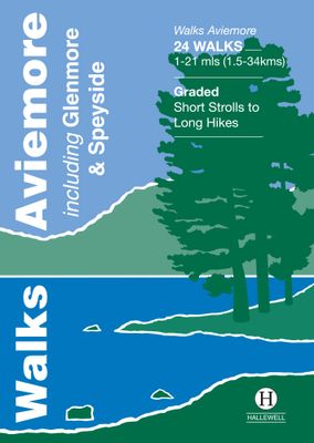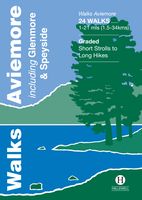
Wandelgids Walks Aviemore : Including Glenmore & Speyside | Hallewell Publications

0
This guide covers an upper stretch of the Spey Valley, from Grantown-on-Spey in the north to Newtonmore in the south.  The main walking centres are Aviemore and Glenmore; the bulk of the walking is in the Cairngorm Mountains, the pine woods around Loch Morlich, and the low and rolling Monadhliaths.  Walks range from 1 mile to 21 miles (1.5-34kms)....

Verkopers met dit product

Verkoper
Bezorging
Prijs
DeZwerver.nl logo
DeZwerver.nl
2,95
5,95

Anderen bekeken ook

Wandelgids Walks Aviemore : Including Glenmore & Speyside | Hallewell Publications
This guide covers an upper stretch of the Spey Valley, from Grantown-on-Spey in the north to Newtonmore in the south.  The main walking centres are Aviemore and Glenmore; the bulk of the walking is in the Cairngorm Mountains, the pine woods around Loch Morlich, and the low and rolling Monadhliaths.  Walks range from 1 mile to 21 miles (1.5-34kms).  Routes include: Loch Garten, Cairn Gorm, Loch Morlich to Lairig Ghru, Loch an Eilein and Creag Bheag.  This book was previously published as Walks Speyside, but has been rewalked and revised.  
5,95
Wandelgids Aviemore and the Cairngorms | Pocket Mountains
Handige compacte wandelgids met 40 dagwandelingen. Deze gids bevat kleine kaartjes en leuke uitgebreide informatie over wat er langs de route te zien is. Goede wandelkaarten zijn echter we noodzakelijk voor deze tochten: de Ordnance Survey explorer maps of Landanger maps zijn zeer geschikt. 'Aviemore and the Cairngorms' features 40 shorter walks, including many perfect for families, stretching from the ancient region of Badenoch and the uppermost reaches of the Spey Valley, through the outdoor hub of Aviemore to Grantown and Tomintoul, then over Ballater and Royal Deeside to Braemar. Plaatsen in het boekje Abernethy Forest, An Lochan Uaine, Anagach Woods, Aviemore, Badenoch Way, Ballater, Balmoral Estate, Balnagowan Wood, Black Wood, Boat of Garten, Braemar, Bridge of Brown, Burn o’Vat, Cairngorm Club Bridge, Cairngorm Ski Centre, Calder Bridge, Carn Daimh, Carrbridge, Castle Roy, Coire an t-Sneachda, Colonel’s Bed, Coylumbridge, Craigellachie Woods, Craigendarroch, Craigmore Wood, Cr…
10,95
Wandelgids Aviemore and the Cairngorms | Ordnance Survey
Get outside in the Cairngorms, Britain’s largest national park, with ten tried-and-tested accessible walks along the Spey Valley. Discover ancient Caledonian woodland, beautiful lochs and sparkling rivers against a backdrop of snow-capped mountains, waiting for the whole family to enjoy.   Aviemore and the Cairngorms Short Walks Made Easy include:   - Explore Loch Garten and Loch Mallachie, an RSPB Reserve and a haven for ospreys, and pine woodland filled with rare wildlife - Follow the line of the Strathspey Railway and see steam trains chugging past from Aviemore to the ‘osprey village’ of Boat of Garten - Go for a woodland ramble through Glenmore Forest Park to glacial Loch Morlich, where you can stroll the red sands of the highest beach in Britain - Wander the enchanted shores of Loch an Eileen, where a ruined castle stands on the loch’s one island - Stroll through wildflower-rich meadows on the banks of the Calder and the Spey as you circle Newtonmore - See the iconic Old Packhor…
10,-
Wandelgids The Speyside Way | Rucksack Readers
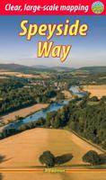
Deze gids een goede beschrijving van de lange afstands route. De kaarten zijn schetsmatig maar wel duidelijk. The Speyside Way is one of Scotland’s Great Trails. It runs for 80 miles (128 km) from the fishing port of Buckie to Aviemore in the foothills of the Cairngorms. Following the lovely valley of the River Spey, you walk through countryside rich in malt whisky and wildlife, along riverside paths, railway trackbed and forest and moorland tracks.   The second edition was fully revised, with mapping from Footprint in six panels, updated plans of villages along the Way, including a fresh Grantown plan and directions from the terminus in Buckie. In 2016 we released the revised version of this essential trail guide, with fresh photos, new mapping and many other updates. These included documenting the 6.5-mile route extension to Kincraig, which opened in 2015, and 11-mile Badenoch Way.   This guidebook contains all you need to plan and enjoy the Speyside Way:   the Way step-by-step,…
22,50
Wandelgids Walks Loch Lomond & The Trossachs | Hallewell Publications
The area covered by this guide (much of it now a National Park) is one of the most popular walking districts in Scotland, and its hills, lochs, glens and woodlands provide an enormous range of routes within a small area.  Walks range from 0.5 miles to 15 miles (1-24km).  Routes include hill climbs such as Ben More & Stob Binnein, Ben Ledi, Ben A’an, The Cobbler and Ben Lomond, plus a number of shorter walks around the towns of Killin, Callander and Aberfoyle, routes by Lochs Katrine and Lomond and sections of the West Highland Way.  Previously published as Walks The Trossachs, the guide has been rewalked and the area covered expanded to inlcude west Loch Lomond.
5,95
Wandelgids Crieff, Comrie & Kinross | Hallewell Publications
Walks Crieff, Comrie & Kinross includes walks in the south Perthshire hills, around Loch Earn and Loch Tay, and the Ochils, as well as the path network around Crieff. The 22 walks featured range from 0.5 miles to 15 miles (1-24km). Routes include: The Knock (Crieff), Ben Vorlich, Comrie to Callander and a fine circuit of Loch Leven. Previously published as Walks South Perthshire, the book has been rewalked and updated in 2016 to reflect changes on the ground. Part of a popular series of A6 pocket walking guides which describe routes which are suitable for walkers of all abilities and to suit all tastes. Route descriptions are accompanied by 2-colour sketch maps. The guides are illustrated with line illustrations, and will provide walkers with a good introduction to what each area covered has to offer.  
5,95

Klanten-reviews van Wandelgids Walks Aviemore : Including Glenmore & Speyside | Hallewell Publications

Er zijn nog geen beoordelingen voor dit productBen jij de eerste die een review plaatst?

Meer over Wandelgids Walks Aviemore : Including Glenmore & Speyside | Hallewell Publications

Productomschrijving

This guide covers an upper stretch of the Spey Valley, from Grantown-on-Spey in the north to Newtonmore in the south.  The main walking centres are Aviemore and Glenmore; the bulk of the walking is in the Cairngorm Mountains, the pine woods around Loch Morlich, and the low and rolling Monadhliaths.  Walks range from 1 mile to 21 miles (1.5-34kms).  Routes include: Loch Garten, Cairn Gorm, Loch Morlich to Lairig Ghru, Loch an Eilein and Creag Bheag.  This book was previously published as Walks Speyside, but has been rewalked and revised.  

Productinformatie

    Verken gerelateerde categorieën

    Webshop.nl maakt gebruik van cookies. Ga je verder op onze website, ga dan akkoord met het plaatsen van cookies en de verwerking van deze data door ons en vermelde partners.