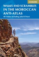
Wandelgids Walks and Scrambles in the Moroccan Anti-Atlas - Marokko | Cicerone

0
Uitstekende wandelgids van dit geweldige gebied. goed beschreven met veel praktische informatie om de route te kunnen lopen, inclusief redelijke kaarten. The walks and scrambles in this guidebook explore the wild and rugged landscapes of the Anti-Atlas mountains of southern Morocco, with Tafraout and the Ameln Valley as the main base. 41 adventuro...

Verkopers met dit product

Verkoper
Bezorging
Prijs
DeZwerver.nl logo
DeZwerver.nl
2,95
24,95

Anderen bekeken ook

Wandelgids The Swiss Alps | Cicerone
  The Swiss Alps are home to the highest and most spectacular mountains in Western Europe. This stunning guidebook describes each mountain area throughout Switzerland – the peaks, passes, valleys and bases – to help you identify the best destinations to plan your trip.   Questions such as ‘Where to walk, climb or ski?’, ‘What multi-day treks are available’ and ‘Where do they go?’, ‘Where are the mountain huts, what are their facilities, which peaks do they serve?’ And where are the most suitable valley bases?’ – all these and more are addressed in detail in this essential guidebook.   The Swiss Alps does not give detailed route directions but information is given about all the guides and maps available for every region.   The Swiss Alps by Kev Reynolds is the third book in Cicerone’s World Mountain Ranges series, which include The Pyrenees and Scotland.   descriptions of all the Swiss Alps, area-by-area from the Chablais Alps in the south west to the Silvretta in the north east classi…
34,95
Wandelgids Walking in the Thames Valley | Cicerone
Walking in the Thames Valley offers 25 challenging circular walks around the River Thames and River Kennet in the south of England, taking in the Southern Chilterns, the Berkshire and North Hampshire Downs, Southern Oxfordshire and the eastern edge of Wiltshire. All routes are within easy reach of Reading, Newbury, Abingdon and London. While some walks visit Iron Age hill forts, others pass more modern features such as Wilton Windmill and the Kennet and Avon Canal. Some follow sections of the Ridgeway, while others meander along the banks of the Thames. What they all have in common is that they take the keen rambler to some of the best parts of the Thames Valley – a patchwork of open chalk grassland, broadleaved woodland and farmland and home to two Areas of Outstanding Natural Beauty. • walks from 10 to 18 miles, including one 2-day route • shorter, less strenuous alternatives for many of the walks • detailed route descriptions with information on local points of interest, OS mapping…
18,50
Wandelgids Scrambles in Scrambles in Snowdonia | Cicerone
This revised edition of Steve Ashton's classic guide presents 80 scrambles in the stunning Snowdonia National Park, offering challenge, adventure and exhilaration, but also breathtaking scenery and an unparalleled opportunity to connect with the mountains of North Wales. The graded routes range from introductory traverses to demanding climbs involving technicality and exposure, recommended only for those with considerable experience, a strong head for heights and solid grounding in basic rope technique.   It is now easier than ever to explore the Carneddau, Glyders and Snowdon Group, plus the finest scrambling in Eifionydd, the Moelwyns, Rhinogs and Cadair Idris. The favourites are all here – the Snowdon Horseshoe, North Ridge of Tryfan, Bristly Ridge and Cneifion and Cyfrwy Arêtes – as well as a number of lesser-known routes, including 16 not included in the previous guide.    Photo topos illustrate the ascent routes, alongside comprehensive route description detailing the preferred …
20,95
Wandelgids Korfoe - The Corfu Trail and 20 Day-Walks | Cicerone
This guidebook describes 22 day walks on the Greek island of Corfu, along with the 150km long Corfu Trail. Ranging from easy holiday strolls to challenging traverses, the day walks give a taste of the many different landscapes on Corfu, and visit olive groves, coastal paths, sandy beaches and quiet mountain villages. The Corfu Trail runs the length of the island from Kavos north to Agios Spiridonas. Described in 10 day stages, it is suitable for novices and experienced walkers alike. The walks in this guidebook can be done year round, but accommodation is easier to find in May to October. Although Corfu is known as a beach holiday destination, this book allows the walker to experience the island's laidback atmosphere and beautiful landscapes away from the crowded resorts. Highlights include golden beaches on the west coast, the spectacular Angelokastro fortress, the dramatic cliffs of Cape Drastis and the twin coves of Porto Timoni. The day walks begin from points across the island, i…
23,50
Wandelgids Trekking in the Silvretta and Ratikon Alps | Cicerone
Aanbevolen wandelkaarten bij deze gids: Schaal 1:60.000 Wandelkaart 14 Unterengadin | Kümmerly & Frey Wandelkaart 13 Davos - Arosa | Kümmerly & Frey Of schaal 1:25.000 Wandelkaart 26 Alpenvereinskarte Silvrettagruppe This guide describes three treks, between 5 and 8 days, in the Silvretta and Rätikon Alps starting near Klosters, and 12 half-day hut-to-hut routes. These contrasting ranges form a line on the borders of Switzerland, Austria and Liechtenstein. The Tour of the Silvretta, the Prättigauer Höhenweg and the Rätikon Höhenweg. Straddling the borders of Austria, Switzerland and Liechtenstein, the limestone Rätikon Alps reach into the snow-bound and glacier-hung Silvretta Alps to provide a richly diverse series of landscapes. The Tour of the Silvretta, the Prättigauer Höhenweg and the Rätikon Höhenweg, all within easy reach of Klosters, have been devised to help trekkers explore the best of the region. Given sifficient time they can also be combined to create a continuous 2-week t…
25,95
Wandelgids Walking in the Engadine - Engadin | Cicerone
Uitstekende wandelgids van Engadin. Goed beschreven met veel praktische informatie om de routes te kunnen lopen, kaartmateriaal is echter wel beperkt. A guidebook to 100 of author Kev Reynold's favourite routes in the Engadine. Varying from gentle rambles to adventurous high-level routes for the experienced mountain walker. Each graded route ranges from 2 to 10 miles long, visiting forests and meadows, high mountain landscapes, lakes and passes. There's something for every walker's taste: gentle valley rambles for a family outing; craggy mid-mountain walks for the more adventurous; high-level routes that lead across glacier, snowfield and rugged passes for the experienced mountain trekker. Tucked away in the south-east corner of Switzerland, the Engadine is a region of lakes and mountains, home of the country's only national park, guardian of the Romansch language and location for some of the most sublime villages in all the Alps. These walks not only reveal breathtaking views, but ta…
23,95
Wandelgids Walking on the Costa Blanca Walks | Cicerone
Uitstekende wandelgids van dit geweldige gebied. Goed beschreven met veel praktische informatie om de route te kunnen lopen, inclusief redelijke kaarten. This guidebook describes 50 circular walks and scrambles exploring the Costa Blanca mountains, around the resorts of Alicante, Benidorm and Calp. These routes range from gentle strolls to demanding days with steep climbs, and from 3-20km in distance. The Mediterranean coast is one of Europe's most popular winter sun adventure destinations. In general UK visitors are best suited to the heat from late autumn to early spring. Beyond the beaches and high rises lies a completely different world of accessible, rocky mountains and knife-edge ridges that stretch away in long chains of gleaming white limestone pinnacles, and the range of walks ensures that everyone can enjoy this spectacular Spanish landscape. Walking on Costa Blanca also includes background information on local geology, wildlife and history, and planning details on where to …
23,50
Wandelgids The High Tatras - Hoge Tatra | Cicerone
Uitstekende wandelgids van dit geweldige gebied. goed beschreven met veel praktische informatie om de route te kunnen lopen, inclusief redelijke kaarten. Guidebook detailing walks and scrambles in the High Tatras mountains of Poland and Slovakia. Varied routes among the strikingly beautiful craggy peaks of the High, Western and White Tatras range from easy to strenuous. Includes useful lists of summits as well as practical advice on accommodation and facilities, travel, mapping and language. With breathtaking scenery, some 600km of well-maintained, waymarked paths and a selection of characterful resorts, the Tatras mountains have all the elements of a perfect walking holiday. Straddling the border between Slovakia and Poland, the region boasts stunning mountain landscapes: rocky pinnacles, craggy peaks, jagged ridges and towering cliffs, mirror-surfaced tarns and dancing waterfalls.    This comprehensive guidebook contains all the information you need to plan a successful trip to the …
24,95
Wandelgids The Yorkshire Dales - Walking in the North and East | Cicerone
This guidebook contains 43 circular day walks in the north and east Yorkshire Dales. It explores the dales, hills and moors between Kirkby Stephen and Pateley Bridge. Walking ranges from gentle three-mile strolls to more strenuous day-long rambles across the Howgills, Wensleydale, Swaledale, Nidderdale, Mallerstang and Coverdale   In this guidebook, 43 circular walks, ranging from 3-mile strolls to full-day adventures are explored in the northern and eastern Dales. Few areas in England are as appealing as the Yorkshire Dales and this volume of a two-part guide provides walkers with a comprehensive walking guide to the whole of the region.     Each valley has a character and history of its own and this guide covers the varied fell and dale landscapes of the Howgills, Mallerstang, Swaledale, Wensleydale, Coverdale and Nidderdale. Spectacular waterfalls, dramatic gorges, expansive heather moors, rich woodlands and colourful flower meadows are just some of the natural delights encountered…
19,95
Wandelgids Walking in Sicily - Sicilie | Cicerone
Uitstekende wandelgids van Abruzzo. Goed beschreven met veel praktische informatie om de routes te kunnen lopen, inclusief redelijke kaarten. Exploring this breathtaking island on foot is a journey through time. Sicily offers wild valleys pitted with Greek and Roman temples and ancient ruins - reminders of long-gone peoples. Mule tracks and age-old pathways have survived and reserve a wealth of surprises, starting with the carpets of brilliant wildflowers. Landscapes are grandiose. Olive groves thrive alongside citrus orchards, never far from snow-clad mountain ranges presided over by imposing volcanoes - ranging from extinct and visitable, through to placidly smoking, and to constantly active giants Etna and Stromboli from which fiery rivers of lava issue. In dramatic contrast is the string of peaceful offshore islands set in turquoise waters, which are pure Mediterranean in character.Sicily's stunning range of scenery, combined with its mild winters and hot dry summers, make rewardi…
20,95

Klanten-reviews van Wandelgids Walks and Scrambles in the Moroccan Anti-Atlas - Marokko | Cicerone

Er zijn nog geen beoordelingen voor dit productBen jij de eerste die een review plaatst?

Meer over Wandelgids Walks and Scrambles in the Moroccan Anti-Atlas - Marokko | Cicerone

Productomschrijving

Uitstekende wandelgids van dit geweldige gebied. goed beschreven met veel praktische informatie om de route te kunnen lopen, inclusief redelijke kaarten.

The walks and scrambles in this guidebook explore the wild and rugged landscapes of the Anti-Atlas mountains of southern Morocco, with Tafraout and the Ameln Valley as the main base. 41 adventurous routes of between 3 and 40km include Jebel el Kest, Adra Mkorn and Ait Mansour, with an outline of a 1 week long-distance trek across the north-west Anti-Atlas. Walks are mainly moderate to difficult, and scrambles are Grade 1 to Grade 3+, with ropes being required for some sections. Often remote and challenging, the routes are suitable for confident walkers and scramblers with good navigation skills.

Each route description is accompanied by mapping, with some photo topos to aid route finding in tricky sections. The guidebook also gives background information on the people, culture and history of the region, as well as a wealth of advice on planning a trip, making it an indispensable guide to exploring this dramatic region.

The mountains and landscapes of the Anti-Atlas extend over 300km north east from the Atlantic Ocean to Jebel Sirwa (3305m). This guidebook covers an area of more than 4000m2 in the north-west of the region. The spectacular, rugged surroundings include mountains, gorges, valleys and desert landscapes - whether it is the iconic Lion's Face which dominates the Ameln Valley and the Tafraout oasis, the deep canyons of Ait Mansour, the ancient villages of the Ameln Valley, or the Tanalt backcountry.

Steden en Dorpen

Tafraout and the Ameln Valley are the major bases with the Kasbah Tizourgane at Ida Ougnidif providing a shorter-stay option.

Verken gerelateerde categorieën

Webshop.nl maakt gebruik van cookies. Ga je verder op onze website, ga dan akkoord met het plaatsen van cookies en de verwerking van deze data door ons en vermelde partners.