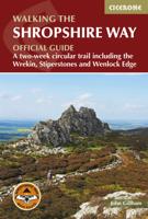
Wandelgids Walking the Shropshire Way | Cicerone

0
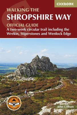
This is the official guide to the Shropshire Way, which consists of a northern and southern loop that both start in Shrewsbury. Each loop can be completed in a week or combined to form a two week 182 mile (290km) circuit that visits Stiperstones, Ludlow, Wenlock Edge, Ironbridge and the Wrekin. Split into 15 stages, this walk requires moderate fit...

Verkopers met dit product

Verkoper
Bezorging
Prijs
DeZwerver.nl logo
DeZwerver.nl
2,95
20,95

Anderen bekeken ook

Wandelgids Walking the Shropshire Way | Cicerone
This is the official guide to the Shropshire Way, which consists of a northern and southern loop that both start in Shrewsbury. Each loop can be completed in a week or combined to form a two week 182 mile (290km) circuit that visits Stiperstones, Ludlow, Wenlock Edge, Ironbridge and the Wrekin. Split into 15 stages, this walk requires moderate fitness to cover the daily distance of 10 to 15 miles. The guide also includes the Stretton Skyline Walk, a 20 mile (32km) walk over Shropshire's peaks and ridges, which can be split over two days with an overnight stay in Church Stretton.   For both the main route and the higher-level Stretton Skyline Walk, this guide provides in-depth route description and 1:50,000 OS mapping to aid navigation, along with information about accommodation, public transport and local services. The guide also offers plenty of insight into Shropshire's vibrant history and fascinating geology.   The Shropshire Way visits some of England's most serene and beautiful s…
20,95
Wandelkaart Shropshire Way | Harvey Maps
Mooie, duidelijke kaart van de Shropshire Way in het midden van Engeland. Geplastificeerd met veel extra informatie en uitsnedes van de route.   Shropshire Way, Shropshire Hills   Map of the Shropshire Way Shropshire Hills section.   Tough, light and 100% wateproof   Compact and light - the map itself weighs just 60gms - a third of the weight of a laminated map, and much less bulky. And you can fold or refold it time and again, or stuff it in your back pocket and it won't fall to pieces. Shows the routes in the southern (Shropshire Hills) section   Information on finding accommodation, camping, food. Directions to the start. Also Ranger Service contact numbers and enlargements of towns/villages showing facilities available and tips on weather and clothing     Detailed mapping, full legend. National Grid - can be used with GPS. 1:40,000 scale. Waterproof. Supplied in clear plastic pocket
25,95
Reisgids Slow Travel Shropshire | Bradt Travel Guides
Een bijzondere serie van Bradt guides, waarin een gedeelte van Engeland uitgebreid beschreven wordt. Met veelv aandacht voor kleine details die je niet ao gauw elders zult vinden. Naast de beschrijvende informatie vind je ook een schat aan praktische informatie als accommodatie-adfressen of leuke pubs. Een aanrader! This new, thoroughly updated second edition of Bradt's Shropshire remains the only full-blown guidebook to this remarkable and oft-overlooked county. Written by Shropshire lover Marie Kreft, it places an emphasis on car-free travel, local produce and characterful accommodation and includes detailed descriptions of place, historical overviews, ghost stories and folk tales, and first-hand accounts from Shropshire locals. It also offers hand-picked restaurant recommendations based on long-standing knowledge and consultation with locals. New for this edition is coverage of the ever-expanding food and drink scene, from craft beers to gingerbread heritage, plus details of new in…
20,95
Wandelgids Walking the Wicklow Way | Cicerone
The Wicklow Way was the first long-distance walking trail to be established in Ireland. Coming in at 130km (81 miles), the route traverses the county of Wicklow, from Marlay Park on the outskirts of Dublin to Clonegal, just over the county border in neighbouring Carlow, and can be comfortably completed in a week. The guide also details several adjacent trails that can be interchanged with the main route, and short detours off-route (also described) lead to welcoming villages offering accommodation and a range of other facilities. The route is presented in seven stages, each with an overview followed by clear route description and mapping. There are elevation profiles and notes on local points of interest. In addition to background information about the county's history, geology, plants and wildlife, you will find all the information you need to walk the route, with helpful advice on transport, accommodation and kit. Accommodation listings, useful contacts and a glossary of Irish place…
18,95
Wandelgids Walking the Dartmoor Way | Cicerone
This guidebook presents the Dartmoor Way, a 175km (109 mile) walk around Dartmoor National Park in Devon. Walked in 10 day-long stages between 12.75 and 20.5km (8 and 12.75 miles) in length, this waymarked route skirts the edge of England's largest granite moorland, passing through towns including Ivybridge, Ashburton, Okehampton and Tavistock. Also included is the 2-day High Moor Link, which crosses the moor's higher ground.   With 1:50,000 scale OS maps for each stage, the book includes notes on nature, history and local landmarks such as Haytor Rocks, the Teign gorge and Dewerstone crags. Taking in ancient paths, tracks and quiet lanes, the route is mostly at low level and is suitable for most walkers, although some stages involve short, steep climbs and descents. Accommodation, parking and public transport are covered, allowing walkers to choose whether to tackle the route in one go or as individual day walks.   Each stage includes low-level detours in case of bad weather, as well…
23,95
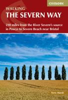
Wandelgids The Severn Way | Cicerone
Uitstekende wandelgids van de Severn Way, waarbij naast alle noodzakelijke informatie ook gebruik gemaakt wordt van de echte topografische kaart.    Guidebook to walking the Severn Way, a 210 mile (338km) walk through the Welsh borders. Beginning near the source of the River Severn in Powys, mid-Wales, and finishing in Bristol, the history-rich route is described over 22 stages (ranging from 3 to 14 miles), passing through the counties of Powys, Shropshire, Worcestershire and Gloucestershire.   Seasons May to September should avoid the usual periods of flooding and the muddy aftermath they bring.   Centres main centres are Worcester and Gloucester. Other centres are Newtown, Welshpool, Shrewsbury, Bridgnorth, Stourport and Tewkesbury, plus numerous small villages and hamlets.   Difficulty a regular walker should find no difficulty following the Severn Way. Once descended from the Hafren Forest and the upper Severn, easy river walking ensues all the way to Severn Beach. Equipment and c…
18,50
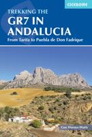
Wandelgids Walking the GR7 in Andalucia | Cicerone
Uitstekende wandelgids van een gerenommeerde Engelse uitgever. De tochten zijn met zorg beschreven en voorzien van allerhande nuttige informatie. With its white sandy beaches, pine forests, snow-capped peaks, traditional villages, lush river valleys and olive groves, the GR7 in Andalucía takes you on a journey through the most geographically diverse region on the Iberian peninsula. This wonderfully varied route starts at the southernmost tip of Spain at Tarifa, and meanders through the provinces of Cádiz and Málaga before dividing. The northern route heads through Córdoba and Jaén provinces (711km in total), whilst the southern route passes through Almería and Granada (720km). The route crosses seven stunning natural parks and the Sierra Nevada national park. • The first guide to cover the whole of the GR7 in Andalucía. • Detailed route description for around 60 days of walking, with options for creating shorter sections and days. • Information on all the villages en route offering ac…
26,50
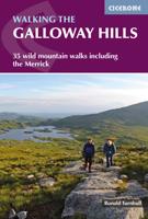
Wandelgids Walking the Galloway Hills | Cicerone
Uitstekende wandelgids van galloway!   This guide covers 35 day walks and one long-distance route in the wild and remote hills of Galloway. Although there are some shorter and easier routes, many of these hill walks are long and on rugged terrain, so are more suitable for experienced walkers. The walks cover the evocative areas of The Merrick, The Awful Hand, The Rhinns of Kells, the Minnigaff hills and Cairnsmore of Fleet, among others.   The guide uses OS 1:50,000 maps with detailed route descriptions and inspirational photos accompanying each route. Key information such as distance, time, and ascent are given. A 'harshness' grade gives an indication of how rough the ground is expected to be, and suggestions of variants, shortcuts and ways to extend each walk are also given. Plenty of background information is given on the region's fascinating and important history.   If you like your wild landscape really wild… If you like your lakes to have whooper swans in the middle and no ice-c…
18,50
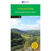
Wandelgids 080 Pathfinder Guides Shropshire | Ordnance Survey
Fraaie, goed verzorgde wandelgidsjes met 28 wandelingen van max. een dag, (beginnend bij korte, eindigend bij langere wandelingen). Weergegeven op duidelijke topografische kaartjes (1:25.000). Bevat verder wetenswaardigheden en praktische informatie voor onderweg.   In this Pathfinder guide clear and easy to follow directions are accompanied by detailed 1:25,000 scale maps from Ordnance Survey and specially commissioned photographs. With 28 colour-coded routes to choose from, all tried and tested by seasoned walkers and varying from extended strolls to exhilarating hikes, there is a walk to suit all situations. The guide introduces you to the area and highlights the most scenic walks. Details are included for useful organisations, refreshment stops and places to leave your car. GPS waypoints are included.
18,50

Klanten-reviews van Wandelgids Walking the Shropshire Way | Cicerone

Er zijn nog geen beoordelingen voor dit productBen jij de eerste die een review plaatst?

Meer over Wandelgids Walking the Shropshire Way | Cicerone

Productomschrijving

This is the official guide to the Shropshire Way, which consists of a northern and southern loop that both start in Shrewsbury. Each loop can be completed in a week or combined to form a two week 182 mile (290km) circuit that visits Stiperstones, Ludlow, Wenlock Edge, Ironbridge and the Wrekin. Split into 15 stages, this walk requires moderate fitness to cover the daily distance of 10 to 15 miles. The guide also includes the Stretton Skyline Walk, a 20 mile (32km) walk over Shropshire's peaks and ridges, which can be split over two days with an overnight stay in Church Stretton.   For both the main route and the higher-level Stretton Skyline Walk, this guide provides in-depth route description and 1:50,000 OS mapping to aid navigation, along with information about accommodation, public transport and local services. The guide also offers plenty of insight into Shropshire's vibrant history and fascinating geology.   The Shropshire Way visits some of England's most serene and beautiful scenery, as well as key historical sites including Ironbridge, the birthplace of the Industrial Revolution. Through tranquil countryside and medieval market towns, this route explores all the best that the Shropshire Hills Area of Outstanding National Beauty (AONB) has to offer.

Productinformatie

    Verken gerelateerde categorieën

    Webshop.nl maakt gebruik van cookies. Ga je verder op onze website, ga dan akkoord met het plaatsen van cookies en de verwerking van deze data door ons en vermelde partners.