webshop.nl
Categorieën
  Sluiten

Meer Cicerone

Wandelgids Walking the Pembrokeshire Coast Path map booklet | Cicerone

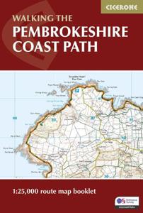
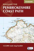
A booklet of all the mapping needed to walk the Pembrokeshire Coast Path National Trail between Amroth near Tenby and St Dogmaels by Cardigan. Covering 290km (180 miles) and over 10,500m of ascent, this trail takes around 2 weeks to complete. The full route is shown on 1:25,000 OS maps The map booklet can be used to walk the trail in either directi...
15,95

Webshops met dit product

Webshop
Bezorging
Prijs

Anderen bekeken ook

Wandelgids Walking the Pembrokeshire Coast Path map booklet | Cicerone
A booklet of all the mapping needed to walk the Pembrokeshire Coast Path National Trail between Amroth near Tenby and St Dogmaels by Cardigan. Covering 290km (180 miles) and over 10,500m of ascent, this trail takes around 2 weeks to complete. The full route is shown on 1:25,000 OS maps The map booklet can be used to walk the trail in either direction Sized to easily fit in a jacket pocket or rucksack The relevant extract from the OS Explorer map legend is includedHigh tide and military range closure alternate routes are providedAn accompanying Cicerone guidebook – Walking the Pembrokeshire Coast Path is also available, which includes a copy of this map booklet   Both native Lancastrians, Dennis and Jan Kelsall have long held a passion for countryside and hill walking. Since their first Cicerone title was published in 1995, they have written and illustrated around 35 guides covering some of Britain’s most popular walking areas and have become regular contributors to various outdoor mag…
15,95
Wandelgids Walking the Pembrokeshire Coast Path | Cicerone
Engelstalige beschrijving van een mooie wandeltocht in Wales. De gids voldoet aan alle verwachtingen die je kunt hebben. Met apart gidsje met prima wandelkaarten.  This guidebook describes the Pembrokeshire Coast Path National Trail, a scenic 180-mile long-distance walk from Amroth, near Tenby, to St Dogmaels, north of Newport. The route, which takes roughly two weeks to complete, is divided into 14 stages of between 9 and 16 miles. Neither technically demanding nor difficult to navigate, the trail is suitable both for experienced distance walkers and those looking to cut their teeth on a long-distance route.   Detailed two-way route instructions are accompanied by 1:100,000 OS mapping. A route summary table and comprehensive trek planner are also included, with invaluable information on transport, accommodation and facilities en route. The guidebook is packed with interesting snippets of information about the places, landscapes and wildlife encountered along the way. It also includes …
25,95
Wandelgids Walking the Wales Coast Path | Cicerone
The Wales Coast Path offers an unparalleled opportunity to walk a nation's coastline in its entirety. Stretching 1400km (870 miles) from Chester to Chepstow, including Anglesey, the waymarked trail takes 2-3 months to complete but can easily be broken into shorter sections. The walking is generally not difficult, although there are occasional rugged sections, steep ascents and descents and more remote stretches with fewer facilities.   The route is presented in 57 stages, ranging from 16 to 32km, each featuring clear route description illustrated with 1:100,000 mapping, overview statistics and notes on the availability of accommodation, facilities and public transport links. You'll find plenty of helpful advice for planning your walk, plus background information on Welsh history, geology, plants, wildlife and local points of interest.   Passing through the Snowdonia and Pembrokeshire Coast National Parks, as well as numerous AONBs and sections of Heritage Coast, the Wales Coast Path ta…
22,50
Wandelgids South West Coast Path Map Booklet | Cicerone
A booklet of all the mapping needed to walk the South West Coast Path between Minehead and St Ives. Covering the northern section of this 1014km (630 mile) National Trail along the north Devon and Cornish coastline.   The full route is shown on 1:25,000 OS maps Route passes through Lynmouth, Westward Ho!, Clovelly, Bude, Padstow, Newquay The map booklet can be used to walk the path in either direction Sized to easily fit in a jacket pocket The relevant extract from the OS Explorer map legend is included An accompanying Cicerone guidebook – The South West Coast Path – is also available
19,50
Wandelgids Walking the North Downs Way Map Booklet | Cicerone
All the mapping you need to walk the 130 mile (208km) North Downs Way National Trail between Farnham and Dover. One of the easier National Trails, it can be comfortably walked in 11-12 days and includes an optional detour via Canterbury.   This map booklet contains all the OS 1:25,000 Explorer mapping you need to walk the route, saving the space, weight and expense of multiple map sheets. Conveniently sized to slip in a jacket pocket or rucksack top, it comes in a clear PVC sleeve.   NOTE An accompanying Cicerone guidebook - The North Downs Way - describes the full route from West to East with lots of other practical and historical information. The accompanying guidebook INCLUDES a copy of this map booklet.
13,95
Wandelatlas Hadrian's Wall Path Map Booklet | Cicerone
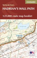
All the mapping you need to walk the 84 mile (135km) Hadrian's Wall Path from Bowness-on-Solway in Cumbria to Wallsend, Newcastle. This booklet of Ordnance Survey 1:25,000 Explorer maps has been designed for convenient use on the trail. It shows the full and up-to-date line of the Hadrian's Wall Path, along with the relevant extract from the OS Explorer map legend. It can be used when walking the trail west-east or east-west, and includes an extension to the east coast at South Shields. It is conveniently sized for slipping into a jacket pocket or top of a rucksack. This booklet is included with the Cicerone guidebook to Hadrian's Wall Path National Trail.
17,95
Wandelkaart The Coast to Coast Map Booklet | Cicerone
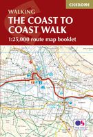
All the mapping you need to complete the 185-mile (296km) unwaymarked Coast to Coast Walk from St Bees in Cumbria to Robin Hood's Bay, North Yorkshire.   This booklet of Ordnance Survey 1:25,000 Explorer maps has been designed for convenient use on the trail. It shows the full line of the Coast to Coast Walk, along with the relevant extract from the OS Explorer map legend. It can be used when walking the trail west-east or east-west, and includes low-level and high-level options between Keld and Reeth. Conveniently sized for slipping into a jacket pocket or top of a rucksack, it comes in a clear PVC sleeve.   This booklet accompanies Cicerone's guidebook to the Coast to Coast Walk by Terry Marsh. The map booklet is INCLUDED with the guidebook.
13,95

Klanten-reviews van Wandelgids Walking the Pembrokeshire Coast Path map booklet | Cicerone

Er zijn nog geen beoordelingen voor dit productBen jij de eerste die een review plaatst?

Meer over Wandelgids Walking the Pembrokeshire Coast Path map booklet | Cicerone

Productomschrijving

A booklet of all the mapping needed to walk the Pembrokeshire Coast Path National Trail between Amroth near Tenby and St Dogmaels by Cardigan. Covering 290km (180 miles) and over 10,500m of ascent, this trail takes around 2 weeks to complete. The full route is shown on 1:25,000 OS maps The map booklet can be used to walk the trail in either direction Sized to easily fit in a jacket pocket or rucksack The relevant extract from the OS Explorer map legend is includedHigh tide and military range closure alternate routes are providedAn accompanying Cicerone guidebook – Walking the Pembrokeshire Coast Path is also available, which includes a copy of this map booklet   Both native Lancastrians, Dennis and Jan Kelsall have long held a passion for countryside and hill walking. Since their first Cicerone title was published in 1995, they have written and illustrated around 35 guides covering some of Britain’s most popular walking areas and have become regular contributors to various outdoor magazines. Their enjoyment of the countryside extends far beyond a love of fresh air, the freedom of open spaces and an appreciation of scenery. Over the years Dennis and Jan have developed a wider interest in the environment, its geology and wildlife, as well as an enthusiasm for delving into the local history that so often provides clues to interpreting the landscape.

Productspecificaties

Artikelnummer(s)
Brand
Cicerone
Webshop.nl maakt gebruik van cookies. Ga je verder op onze website, ga dan akkoord met het plaatsen van cookies en de verwerking van deze data door ons en vermelde partners.