Wandelgids Walking the GR7 in Andalucia | Cicerone

0
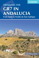
Uitstekende wandelgids van een gerenommeerde Engelse uitgever. De tochten zijn met zorg beschreven en voorzien van allerhande nuttige informatie. With its white sandy beaches, pine forests, snow-capped peaks, traditional villages, lush river valleys and olive groves, the GR7 in Andalucía takes you on a journey through the most geographically diver...

Verkopers met dit product

Verkoper
Bezorging
Prijs
DeZwerver.nl logo
DeZwerver.nl
2,95
26,50

Anderen bekeken ook

Wandelgids Walking the GR7 in Andalucia | Cicerone
Uitstekende wandelgids van een gerenommeerde Engelse uitgever. De tochten zijn met zorg beschreven en voorzien van allerhande nuttige informatie. With its white sandy beaches, pine forests, snow-capped peaks, traditional villages, lush river valleys and olive groves, the GR7 in Andalucía takes you on a journey through the most geographically diverse region on the Iberian peninsula. This wonderfully varied route starts at the southernmost tip of Spain at Tarifa, and meanders through the provinces of Cádiz and Málaga before dividing. The northern route heads through Córdoba and Jaén provinces (711km in total), whilst the southern route passes through Almería and Granada (720km). The route crosses seven stunning natural parks and the Sierra Nevada national park. • The first guide to cover the whole of the GR7 in Andalucía. • Detailed route description for around 60 days of walking, with options for creating shorter sections and days. • Information on all the villages en route offering ac…
26,50
Wandelgids Walking in Andalucia - Andalusië | Cicerone
Mooi en duidelijke wandelgids over bepaalde streken in Andalusië: goed beschreven wandelingen met een redelijke kaart. De tekst is behoorlijk kompleet. Daarnaast ook praktische informatie per route. This guidebook explores six of Andalucía's most beautiful Natural Parks, the Sierra Nevada regions of Aracena, Grazalema, Los Alcornocales and the Gaucín, La Axarquía, the Alpujarras and Cazorla, along the great belt of the Cordillera Bética mountains. The thirty-six half-day and full-day mostly circular walks are evenly split within these six regions, and range in length from 4 to 21km. Walks are graded and some involve steep ascents and descents, all within the capabilities of a reasonably fit walker. The vast mountain range of the Cordillera Bética offers some of the finest year-round walking in Europe. Towering above the Mediterranean, the highest peaks of the Sierra Nevada rise to almost 3500m, mainland Spain's highest mountains. And wrapped within this mighty belt of mountains are s…
22,95
Wandelgids The Andalucian Coast to Coast Walk - Andalusie | Cicerone
Wandelgids met goed beschreven etappes met veel praktische informatie om de route te kunnen lopen, inclusief redelijke kaarten. Kaartmateriaal is vrij beperkt, maar het is moeilijk om deze route geheel met kaarten te dekken, dan heb je er wel erg veel nodig. De beschrijvinen zijn echter best goed, met wat gepuzzel ter plekke is het prima te doen.  Guidebook to the Andalucian Coast to Coast Walk, a 440km, 21-day route from Maro on the Mediterranean coast to Bolonia, on the Atlantic. The route, which passes through 7 Natural Parks, links some of Andalucía's most beautiful villages and passes historical sites of both Roman and Moorish origins, including Ronda and Tarifa.   Seasons Seasons Andalucía's mild winter climate means that this is a region that is suited to year-round walking, apart from July and August when temperatures are generally too hot for comfortable hiking.   Centres Centres Frigiliana, Cómpeta, Alcaucín, Riogordo, Villanueva de la Concepción, El Chorro, Carratraca, El B…
20,95
Wandelgids Walking the Wicklow Way | Cicerone
The Wicklow Way was the first long-distance walking trail to be established in Ireland. Coming in at 130km (81 miles), the route traverses the county of Wicklow, from Marlay Park on the outskirts of Dublin to Clonegal, just over the county border in neighbouring Carlow, and can be comfortably completed in a week. The guide also details several adjacent trails that can be interchanged with the main route, and short detours off-route (also described) lead to welcoming villages offering accommodation and a range of other facilities. The route is presented in seven stages, each with an overview followed by clear route description and mapping. There are elevation profiles and notes on local points of interest. In addition to background information about the county's history, geology, plants and wildlife, you will find all the information you need to walk the route, with helpful advice on transport, accommodation and kit. Accommodation listings, useful contacts and a glossary of Irish place…
18,95
Wandelgids Andalucia - Andalucië | Sunflower books
Wandelgids: vele dagtochten worden degelijk beschreven met openbaar vervoer informatie, goede routebeschrijvingen en kaartmateriaal. Tevens enkele autotochten: Engelstalig Over the years, Sunflower had more requests for a book about Andalucía than any other destination. And now here is the second edition of this guide that captures the very essence of this most evocative part of Spain. An ever-changing landscape awaits your discovery, from the 'white villages' and ancient towns to the never-ending sierras, interspersed with razor-sharp gorges and gentler, verdant valleys. 7 car tours, 60 long and short walks,  This guide book captures the very essence of this most evocative part of Spain. An ever-changing landscape awaits your discovery whether you are driving or walking in Andalucía — from the ‘white villages’ and ancient towns to the never-ending sierras, razor-sharp gorges and gentle verdant valleys. Since many people will explore Andalucía by car, most of the walks are circular.  …
23,50
Wandelgids Walking the Dartmoor Way | Cicerone
This guidebook presents the Dartmoor Way, a 175km (109 mile) walk around Dartmoor National Park in Devon. Walked in 10 day-long stages between 12.75 and 20.5km (8 and 12.75 miles) in length, this waymarked route skirts the edge of England's largest granite moorland, passing through towns including Ivybridge, Ashburton, Okehampton and Tavistock. Also included is the 2-day High Moor Link, which crosses the moor's higher ground.   With 1:50,000 scale OS maps for each stage, the book includes notes on nature, history and local landmarks such as Haytor Rocks, the Teign gorge and Dewerstone crags. Taking in ancient paths, tracks and quiet lanes, the route is mostly at low level and is suitable for most walkers, although some stages involve short, steep climbs and descents. Accommodation, parking and public transport are covered, allowing walkers to choose whether to tackle the route in one go or as individual day walks.   Each stage includes low-level detours in case of bad weather, as well…
23,95
Wandelgids Walking the Shropshire Way | Cicerone
This is the official guide to the Shropshire Way, which consists of a northern and southern loop that both start in Shrewsbury. Each loop can be completed in a week or combined to form a two week 182 mile (290km) circuit that visits Stiperstones, Ludlow, Wenlock Edge, Ironbridge and the Wrekin. Split into 15 stages, this walk requires moderate fitness to cover the daily distance of 10 to 15 miles. The guide also includes the Stretton Skyline Walk, a 20 mile (32km) walk over Shropshire's peaks and ridges, which can be split over two days with an overnight stay in Church Stretton.   For both the main route and the higher-level Stretton Skyline Walk, this guide provides in-depth route description and 1:50,000 OS mapping to aid navigation, along with information about accommodation, public transport and local services. The guide also offers plenty of insight into Shropshire's vibrant history and fascinating geology.   The Shropshire Way visits some of England's most serene and beautiful s…
20,95
Wandelgids Walking The End to End Trail | Cicerone
Een droomroute voor velen: helemaal van het zuidelijkste puntje van Engeland naar het noordelijkste puntje van Schotland, zo'n slordige 1956 km door fabelachtig mooie afwisselende landschappen. Zeer gedetailleerd beschreven met alle noodzakelijke informatie! Kaartmateriaal - zelf gemaakt door de schijver - werkt zeer verhelderend en voldoet uitstekend ter plaatse. Je hebt alle informatie in één boek! This guidebook to UK's ultimate challenge walk, the End to End, describes a 1956km (1215 mile) walking route from Land's End in Cornwall to John o' Groats in Scotland's far north - the two points on mainland Britain that are the furthest apart. The recommended route avoids road walking as much as possible and frequently takes advantage of existing long-distance trails, including the South West Coast Path, Pennine Way and West Highland Way. Passing through remote terrain at times and keeping to the hills where practical, it is intended for experienced hill-walkers.   The guide includes rou…
27,95
Wandelgids Walking in the Thames Valley | Cicerone
Walking in the Thames Valley offers 25 challenging circular walks around the River Thames and River Kennet in the south of England, taking in the Southern Chilterns, the Berkshire and North Hampshire Downs, Southern Oxfordshire and the eastern edge of Wiltshire. All routes are within easy reach of Reading, Newbury, Abingdon and London. While some walks visit Iron Age hill forts, others pass more modern features such as Wilton Windmill and the Kennet and Avon Canal. Some follow sections of the Ridgeway, while others meander along the banks of the Thames. What they all have in common is that they take the keen rambler to some of the best parts of the Thames Valley – a patchwork of open chalk grassland, broadleaved woodland and farmland and home to two Areas of Outstanding Natural Beauty. • walks from 10 to 18 miles, including one 2-day route • shorter, less strenuous alternatives for many of the walks • detailed route descriptions with information on local points of interest, OS mapping…
18,50
Wandelgids Walking the Cammino Materano | Cicerone
A guidebook to walking to Matera on the Via Peuceta, Via Ellenica and Via Lucana, three long-distance cammino routes through southern Italy's Puglia and Basilicata regions. The three routes are presented in 7, 14 and 6 stages of between 10 and 30km (7 and 19 miles), including variant routes, accompanied by information on facilities, accommodation and where to get your cammino accreditation. The routes are suitable for most abilities. 1:100,000 maps and profiles included for each stage GPX files available to download Handy route summary tables and stage facilities planners help you plan your itinerary Refreshment and accommodation information given for each stage Advice on planning and preparation  
24,95

Klanten-reviews van Wandelgids Walking the GR7 in Andalucia | Cicerone

Er zijn nog geen beoordelingen voor dit productBen jij de eerste die een review plaatst?

Meer over Wandelgids Walking the GR7 in Andalucia | Cicerone

Productomschrijving

Uitstekende wandelgids van een gerenommeerde Engelse uitgever. De tochten zijn met zorg beschreven en voorzien van allerhande nuttige informatie.

With its white sandy beaches, pine forests, snow-capped peaks, traditional villages, lush river valleys and olive groves, the GR7 in Andalucía takes you on a journey through the most geographically diverse region on the Iberian peninsula.

This wonderfully varied route starts at the southernmost tip of Spain at Tarifa, and meanders through the provinces of Cádiz and Málaga before dividing. The northern route heads through Córdoba and Jaén provinces (711km in total), whilst the southern route passes through Almería and Granada (720km). The route crosses seven stunning natural parks and the Sierra Nevada national park.

• The first guide to cover the whole of the GR7 in Andalucía.
• Detailed route description for around 60 days of walking, with options for creating shorter sections and days.
• Information on all the villages en route offering accommodation so that you can plan your own route.

The GR7 is one of Europe's longest GR long-distance routes, stretching from Tarifa, the southernmost town of continental Europe, through Spain, Andorra and France to Alsace. This guide presents the Andalucian section of the route, which offers well over 700km of fantastic walking through the diverse landscapes of one of Spain's most evocative regions. The route splits at the small village of Villanueva de Cauche, and the guide describes both the northern and southern variants. Although walking is on good footpaths, country tracks and, occasionally, minor roads, some of the stages are long and can involve considerable ascent, meaning that a good level of fitness is required. The full Andalucian GR7 takes well over a month to walk; however, the guide also includes suggestions for highlight sections that can be walked in a week or fortnight.   In addition to clear route description, mapping and elevation profiles, the guide provides background information on local history, plants and wildlife, and advice for planning your trip, such as when to go, what to take and where to stay.   The route showcases Andalucia's rich history and culture and varied landscapes, which include pine forests, semi-arid desert, snow-capped peaks, fertile plains, lush valleys, olive groves, cultivated terraces and hills of cork woodland. Historic towns and traditional whitewashed villages offer overnight accommodation and a chance to sample local cuisine.
Productinformatie

    Verken gerelateerde categorieën

    Webshop.nl maakt gebruik van cookies. Ga je verder op onze website, ga dan akkoord met het plaatsen van cookies en de verwerking van deze data door ons en vermelde partners.