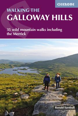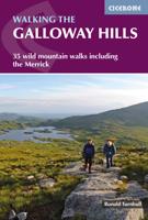
Wandelgids Walking the Galloway Hills | Cicerone

0
Uitstekende wandelgids van galloway!   This guide covers 35 day walks and one long-distance route in the wild and remote hills of Galloway. Although there are some shorter and easier routes, many of these hill walks are long and on rugged terrain, so are more suitable for experienced walkers. The walks cover the evocative areas of The Merrick, The...

Verkopers met dit product

Verkoper
Bezorging
Prijs
DeZwerver.nl logo
DeZwerver.nl
2,95
18,50

Anderen bekeken ook

Wandelgids Walking the Galloway Hills | Cicerone
Uitstekende wandelgids van galloway!   This guide covers 35 day walks and one long-distance route in the wild and remote hills of Galloway. Although there are some shorter and easier routes, many of these hill walks are long and on rugged terrain, so are more suitable for experienced walkers. The walks cover the evocative areas of The Merrick, The Awful Hand, The Rhinns of Kells, the Minnigaff hills and Cairnsmore of Fleet, among others.   The guide uses OS 1:50,000 maps with detailed route descriptions and inspirational photos accompanying each route. Key information such as distance, time, and ascent are given. A 'harshness' grade gives an indication of how rough the ground is expected to be, and suggestions of variants, shortcuts and ways to extend each walk are also given. Plenty of background information is given on the region's fascinating and important history.   If you like your wild landscape really wild… If you like your lakes to have whooper swans in the middle and no ice-c…
18,50
Wandelgids 15 Short Walks Dumfries and Galloway | Cicerone
Ronald Turnbull has chosen 15 of the best short walks around Dumfries and Galloway for you to explore. Our guide comes with easy-to-read Ordnance Survey maps and clear route descriptions, perfect if you're new to walking or are looking for something you can enjoy with the whole family. We've included information on local beauty spots and tasty refreshment stops, and most of the walks can be completed in under 4 hours.   We haven't included any walks with challenging terrain or complicated navigation, and all you'll need to take with you are a waterproof jacket and a pair of comfortable trainers.
13,95
Wandelgids Walking the Cammino Materano | Cicerone
A guidebook to walking to Matera on the Via Peuceta, Via Ellenica and Via Lucana, three long-distance cammino routes through southern Italy's Puglia and Basilicata regions. The three routes are presented in 7, 14 and 6 stages of between 10 and 30km (7 and 19 miles), including variant routes, accompanied by information on facilities, accommodation and where to get your cammino accreditation. The routes are suitable for most abilities. 1:100,000 maps and profiles included for each stage GPX files available to download Handy route summary tables and stage facilities planners help you plan your itinerary Refreshment and accommodation information given for each stage Advice on planning and preparation  
24,95
Wandelgids Walking in the Southern Uplands | Cicerone
This guidebook describes 44 routes and over 100 summits stretching across the Southern Uplands of Scotland, stretching south-west from Edinburgh to the English border, including the Galloway and Pentland Hills. The walks range between 2 and 29km, suitable for walkers of all abilities.   The Scottish Southern Uplands is a range that is about as big as the English Pennines. It is wild hill country, with over 80 hills of 2000ft or more, and it boasts a real remoteness that is difficult to find elsewhere. All hillwalkers should experience these wonderfully characterful landscapes: green and gentle, but with hidden surprises and remote escapes.   The routes are suitable from spring to autumn, and on winter days with good weather and snow conditions. Each route provides OS mapping, information on distance, ascent, time, maximum altitude and terrain, as well as details of any variants or shortcuts. With notes on points of interest along the way as well as on transport and accommodation, the …
21,95
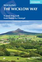
Wandelgids Walking the Wicklow Way | Cicerone
The Wicklow Way was the first long-distance walking trail to be established in Ireland. Coming in at 130km (81 miles), the route traverses the county of Wicklow, from Marlay Park on the outskirts of Dublin to Clonegal, just over the county border in neighbouring Carlow, and can be comfortably completed in a week. The guide also details several adjacent trails that can be interchanged with the main route, and short detours off-route (also described) lead to welcoming villages offering accommodation and a range of other facilities. The route is presented in seven stages, each with an overview followed by clear route description and mapping. There are elevation profiles and notes on local points of interest. In addition to background information about the county's history, geology, plants and wildlife, you will find all the information you need to walk the route, with helpful advice on transport, accommodation and kit. Accommodation listings, useful contacts and a glossary of Irish place…
18,95
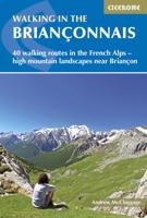
Wandelgids Walking in the Briançonnais | Cicerone
Handige duidelijke wandelgids van een mooi wandelgebied. De routes zijn accuraat beschreven met praktische informatie erbij. Kaartmateriaal is redelijk, soms wat schetsmatig. In berggebieden zijn wandelkaarten wel belangrijk! Bij de routes worden de juiste kaartnummers gegeven.    This guidebook presents 40 walks exploring the area around Briançon in France. The walks are divided into 6 sections covering the valleys of Clarée, Cerveyrette, Ayes, Durance and Guisane, as well as the area around Vallouise and Montgenèvre. The walks are circular and range in distance from 4 to 21 km. Graded easy to very hard, there is a walk to suit all abilities.    Dominated on all sides by jagged peaks, and perched on a rocky spur at the nucleus of five beautiful valleys, the city of Briançon lies almost at the southernmost tip of the main Alpine range. The Briançonnais, the surrounding region to which it gives its name, is a stunning mountain wilderness packed with everything one would expect from a h…
23,95
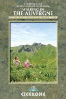
Wandelgids Walking in the Auvergne | Cicerone
Uitgebreide wandelgids van de Auvergne: goede beschrijvingen, veel keuze, kaarten wat minder goed. This handy guidebook offers the finest day walks in five different areas of the Auvergne, an often-forgotten region in central France perfect for accessible day walking in a unique and spectacular landscape. Towns such as Vichy, Clermont-Ferrand and Puy-en-Velay also offer delightful places to base yourself for that perfect walking holiday. The ridges, rocky peaks and verdant valleys of the Cantal supervolcano dominate south-western Auvergne. The centre of the region hosts the unique chain of 'puys' with their pudding bowl forms and the pristine crater lakes of the Sancy massif. In the north, the Montagne Bourbonnaise preserves a pastoral way of life which is quintessentially French while the Haute Loire's rivers and medieval abbeys reward those venturing further off the beaten track. Notes on the geology and history of points of interest passed en route help you to get the most out of y…
19,95
Wandelgids Walking in the Thames Valley | Cicerone
Walking in the Thames Valley offers 25 challenging circular walks around the River Thames and River Kennet in the south of England, taking in the Southern Chilterns, the Berkshire and North Hampshire Downs, Southern Oxfordshire and the eastern edge of Wiltshire. All routes are within easy reach of Reading, Newbury, Abingdon and London. While some walks visit Iron Age hill forts, others pass more modern features such as Wilton Windmill and the Kennet and Avon Canal. Some follow sections of the Ridgeway, while others meander along the banks of the Thames. What they all have in common is that they take the keen rambler to some of the best parts of the Thames Valley – a patchwork of open chalk grassland, broadleaved woodland and farmland and home to two Areas of Outstanding Natural Beauty. • walks from 10 to 18 miles, including one 2-day route • shorter, less strenuous alternatives for many of the walks • detailed route descriptions with information on local points of interest, OS mapping…
18,50
Wandelgids Walking on the Gower | Cicerone
Wandelgids met 30 wandelroutes in het zuiden van Wales This guidebook presents 30 circular day walks across the Gower Area of Outstanding Natural Beauty, taking in the rich variety of landscapes across this beautiful area of South Wales. Ranging from 2½ to 14 miles long, there are walks to suit all abilities. The peninsula is famous for its spectacularly steep, rugged coastline and golden sandy beaches but this guide also takes walkers to the inland valleys, hills and ridges little explored by most holidaymakers.   Routes are illustrated with OS mapping extracts and inspiring photography and accompanied by a route summary table to help you choose walks to suit your location and ability. Along the way, the author provides a wealth of information on plants, animals, geology, history and archaeology of a region. There is something for everyone, all within a compact area easily accessible from Swansea and Mumbles.   Coastal areas such as those around Langland, Oxwich and Port Eynon are we…
19,50
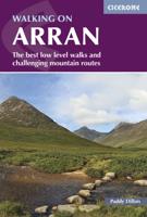
Wandelgids Walking on Arran | Cicerone
Uitstekende wandelgids voor dit uitdagende wandelgebied in Schotland. Dagtochten. The 45 walking routes in this Isle of Arran guidebook range from easy 3km (2 miles) nature trails to long arduous mountain routes with scrambles (up to 32km) providing thorough coverage of Arran, including the ascent of Goatfell and nearby Holy Isle. Most routes are 10km to 15km long but many give opportunities to create longer cross island walks. This guidebook presents a selection of 45 day walks on the popular and accessible Isle of Arran. The routes are between 2 miles (3km) and 20 miles (32km) in length, from easy waymarked forest trails to more arduous mountain walks, exposed ridge routes and scrambles. There are linear and circular walks to choose from, and opportunities to link routes together and create longer walks across the length and breadth of the island. With highlights including Goatfell, Beinn Tarsuinn, the Sannox Horseshoe, Glen Rosa and the Cock of Arran, there's something here to suit…
23,95

Klanten-reviews van Wandelgids Walking the Galloway Hills | Cicerone

Er zijn nog geen beoordelingen voor dit productBen jij de eerste die een review plaatst?

Meer over Wandelgids Walking the Galloway Hills | Cicerone

Productomschrijving

Uitstekende wandelgids van galloway!   This guide covers 35 day walks and one long-distance route in the wild and remote hills of Galloway. Although there are some shorter and easier routes, many of these hill walks are long and on rugged terrain, so are more suitable for experienced walkers. The walks cover the evocative areas of The Merrick, The Awful Hand, The Rhinns of Kells, the Minnigaff hills and Cairnsmore of Fleet, among others.   The guide uses OS 1:50,000 maps with detailed route descriptions and inspirational photos accompanying each route. Key information such as distance, time, and ascent are given. A 'harshness' grade gives an indication of how rough the ground is expected to be, and suggestions of variants, shortcuts and ways to extend each walk are also given. Plenty of background information is given on the region's fascinating and important history.   If you like your wild landscape really wild… If you like your lakes to have whooper swans in the middle and no ice-cream vans around the edge… If you like to have one foot on bare rock and the other one deep in a peat bog… If you like your granite with goats on… Then Galloway is the place to go.   Steden en Dorpen Newton Stewart; Glen Trool (Glentrool village and Loch Trool); Dalmellington (Ayrshire); Carsphairn and St John's Town of Dalry (Glenkens).

Productinformatie

    Verken gerelateerde categorieën

    Webshop.nl maakt gebruik van cookies. Ga je verder op onze website, ga dan akkoord met het plaatsen van cookies en de verwerking van deze data door ons en vermelde partners.