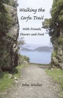
Wandelgids Walking the Corfu Trail - With Friends, Flowers and Food | Yannis

0
Engelstalige reisverslag van de het lange afstandswandelpad om te wandelen dwars over Korfoe. Het gidsje bevat naast ervaringen van de schrijver tijdens de tocht, kleurkopieen van de Freytag & Berndt Korfu kaart met de Corfutrail ingetekend, lijst van bloemen met foto's, interviews met bewoners, etc.Walking the Corfu Trail, With Friends, Flowers an...

Verkopers met dit product

Verkoper
Bezorging
Prijs
DeZwerver.nl logo
DeZwerver.nl
2,95
17,50

Anderen bekeken ook

Wandelgids Walking the Corfu Trail - With Friends, Flowers and Food | Yannis
Engelstalige reisverslag van de het lange afstandswandelpad om te wandelen dwars over Korfoe. Het gidsje bevat naast ervaringen van de schrijver tijdens de tocht, kleurkopieen van de Freytag & Berndt Korfu kaart met de Corfutrail ingetekend, lijst van bloemen met foto's, interviews met bewoners, etc.Walking the Corfu Trail, With Friends, Flowers and Food describes a 180km part of the Corfu Trail in eight days, from 18-30s Kavos to picturesque Agni. With maps and description of this walk will be invaluable for those who want to experience this spectacular and hilarious hike. The book contains 288 pages, 32 colour, 6 Freytag & Berndt maps, 16 views and scenes, 10 vistas of flowers, list of 173 flowers seen (over 30 orchids), 14 recipes of food and 15 interviews with interesting locals.Three septuagenarians walk 180km of the Corfu Trail in eight days, from 18-30s Kavos to picturesque Agni. The three oldies photograph flowers and sample Corfiot cuisine. Each day their local guest-walkers t…
17,50
Wandelkaart Tour & Trail Corfu - Korfoe | Discovery Walking Guides
Goede wandelkaart van Korfoe. Scheur- en watervast. Corfu Tour & Trail Super-Durable Map is the most detailed, accurate, toughest, large scale map of the island that you can buy. Super-Durable Maps now come with a 2 year adventurous use wear and tear guarantee, see Discovery Walking Guides website for details. Our large 1:40,000 scale produces a double sided map sheet of 840mm by 680mm; big enough to show masses of detail but compact enough to use in the car or on the trail.   Corfu North is on the facing sheet of the map with Corfu South on the reverse side, including a generous overlap between the two sides. Our special concertina map fold means your map is easy to unfold, and more importantly easy to refold back to its pocket size. You get the most detailed map of Corfu that is produced including our 'Tour & Trail' level of detail ranging from major roads to secondary roads to minor roads to streets and narrow country roads, plus dirt roads and walking trails.   We have a new metho…
15,95
Wandelgids Korfoe - The Corfu Trail and 20 Day-Walks | Cicerone
This guidebook describes 22 day walks on the Greek island of Corfu, along with the 150km long Corfu Trail. Ranging from easy holiday strolls to challenging traverses, the day walks give a taste of the many different landscapes on Corfu, and visit olive groves, coastal paths, sandy beaches and quiet mountain villages. The Corfu Trail runs the length of the island from Kavos north to Agios Spiridonas. Described in 10 day stages, it is suitable for novices and experienced walkers alike. The walks in this guidebook can be done year round, but accommodation is easier to find in May to October. Although Corfu is known as a beach holiday destination, this book allows the walker to experience the island's laidback atmosphere and beautiful landscapes away from the crowded resorts. Highlights include golden beaches on the west coast, the spectacular Angelokastro fortress, the dramatic cliffs of Cape Drastis and the twin coves of Porto Timoni. The day walks begin from points across the island, i…
23,50
Wandelgids Walking the John o' Groats Trail | Cicerone
Guide to the John o' Groats Trail, a 233km walking route linking Inverness with John o' Groats on the northeast tip of mainland Britain. Much of the walking is coastal, with the northern half characterised by its spectacular seacliffs; however, there is some inland walking too, and the scenery is varied, ranging from dunes and deserted sandy beaches to beautiful woodland. With rough ground and some exposed clifftop walking, the route is suited to experienced hikers.   It takes around a fortnight to complete. The route is described in 14 stages, each of which includes: an overview map; step-by-step route description illustrated with custom mapping; details of accommodation, facilities and transport links; and information on local points of interest. While the main route description is from south to north, notes are supplied for southbound walkers.   Also included is a bonus route linking the trail with the Great Glen, for the benefit of walkers undertaking the Land's End to John o' Gro…
23,95
Wandelgids Walking The End to End Trail | Cicerone
Een droomroute voor velen: helemaal van het zuidelijkste puntje van Engeland naar het noordelijkste puntje van Schotland, zo'n slordige 1956 km door fabelachtig mooie afwisselende landschappen. Zeer gedetailleerd beschreven met alle noodzakelijke informatie! Kaartmateriaal - zelf gemaakt door de schijver - werkt zeer verhelderend en voldoet uitstekend ter plaatse. Je hebt alle informatie in één boek! This guidebook to UK's ultimate challenge walk, the End to End, describes a 1956km (1215 mile) walking route from Land's End in Cornwall to John o' Groats in Scotland's far north - the two points on mainland Britain that are the furthest apart. The recommended route avoids road walking as much as possible and frequently takes advantage of existing long-distance trails, including the South West Coast Path, Pennine Way and West Highland Way. Passing through remote terrain at times and keeping to the hills where practical, it is intended for experienced hill-walkers.   The guide includes rou…
27,95
Wandelgids Walking the Pembrokeshire Coast Path | Cicerone
Engelstalige beschrijving van een mooie wandeltocht in Wales. De gids voldoet aan alle verwachtingen die je kunt hebben. Met apart gidsje met prima wandelkaarten.  This guidebook describes the Pembrokeshire Coast Path National Trail, a scenic 180-mile long-distance walk from Amroth, near Tenby, to St Dogmaels, north of Newport. The route, which takes roughly two weeks to complete, is divided into 14 stages of between 9 and 16 miles. Neither technically demanding nor difficult to navigate, the trail is suitable both for experienced distance walkers and those looking to cut their teeth on a long-distance route.   Detailed two-way route instructions are accompanied by 1:100,000 OS mapping. A route summary table and comprehensive trek planner are also included, with invaluable information on transport, accommodation and facilities en route. The guidebook is packed with interesting snippets of information about the places, landscapes and wildlife encountered along the way. It also includes…
25,95
Wandelgids Walking on Lanzarote and Fuerteventura | Cicerone
Uitgebreide wandelgids van Lanzarote en Fuerteventura: goede beschrijvingen, veel keuze, kaarten wat minder goed.   This book offers 21 walks on Lanzarote, two on Isla La Graciosa (off Lanzarote's northern coast) and 22 on Fuerteventura, including 14 walks on the GR 131 trail, which crosses both islands. These 45 traditional routes link several villages and span a range of arid agricultural and natural areas. Both popular holiday destinations, Lanzarote and Fuerteventura are two remarkably different islands. Lanzarote has a fascinating volcanic national park at Timanfaya, and vineyards fill huge areas of black volcanic ash at La Geria; Fuerteventura is famous for extensive golden beaches, but its splendid mountain paths are less well-known. Both islands are crossed by new waymarked trails.   These traditional routes span a range of arid, agricultural and natural areas, including hill and mountain trails, coastal walks including Fuerteventura’s golden beaches, and some walks visit vill…
21,95
Wandelgids Walking the Pembrokeshire Coast Path map booklet | Cicerone
A booklet of all the mapping needed to walk the Pembrokeshire Coast Path National Trail between Amroth near Tenby and St Dogmaels by Cardigan. Covering 290km (180 miles) and over 10,500m of ascent, this trail takes around 2 weeks to complete. The full route is shown on 1:25,000 OS maps The map booklet can be used to walk the trail in either direction Sized to easily fit in a jacket pocket or rucksack The relevant extract from the OS Explorer map legend is includedHigh tide and military range closure alternate routes are providedAn accompanying Cicerone guidebook – Walking the Pembrokeshire Coast Path is also available, which includes a copy of this map booklet   Both native Lancastrians, Dennis and Jan Kelsall have long held a passion for countryside and hill walking. Since their first Cicerone title was published in 1995, they have written and illustrated around 35 guides covering some of Britain’s most popular walking areas and have become regular contributors to various outdoor ma…
15,95
Wandelgids Walking on the Gower | Cicerone
Wandelgids met 30 wandelroutes in het zuiden van Wales This guidebook presents 30 circular day walks across the Gower Area of Outstanding Natural Beauty, taking in the rich variety of landscapes across this beautiful area of South Wales. Ranging from 2½ to 14 miles long, there are walks to suit all abilities. The peninsula is famous for its spectacularly steep, rugged coastline and golden sandy beaches but this guide also takes walkers to the inland valleys, hills and ridges little explored by most holidaymakers.   Routes are illustrated with OS mapping extracts and inspiring photography and accompanied by a route summary table to help you choose walks to suit your location and ability. Along the way, the author provides a wealth of information on plants, animals, geology, history and archaeology of a region. There is something for everyone, all within a compact area easily accessible from Swansea and Mumbles.   Coastal areas such as those around Langland, Oxwich and Port Eynon are we…
19,50
Wandelgids Walking the Wicklow Way | Cicerone
The Wicklow Way was the first long-distance walking trail to be established in Ireland. Coming in at 130km (81 miles), the route traverses the county of Wicklow, from Marlay Park on the outskirts of Dublin to Clonegal, just over the county border in neighbouring Carlow, and can be comfortably completed in a week. The guide also details several adjacent trails that can be interchanged with the main route, and short detours off-route (also described) lead to welcoming villages offering accommodation and a range of other facilities. The route is presented in seven stages, each with an overview followed by clear route description and mapping. There are elevation profiles and notes on local points of interest. In addition to background information about the county's history, geology, plants and wildlife, you will find all the information you need to walk the route, with helpful advice on transport, accommodation and kit. Accommodation listings, useful contacts and a glossary of Irish place…
18,95

Klanten-reviews van Wandelgids Walking the Corfu Trail - With Friends, Flowers and Food | Yannis

Er zijn nog geen beoordelingen voor dit productBen jij de eerste die een review plaatst?

Meer over Wandelgids Walking the Corfu Trail - With Friends, Flowers and Food | Yannis

Productomschrijving

Engelstalige reisverslag van de het lange afstandswandelpad om te wandelen dwars over Korfoe. Het gidsje bevat naast ervaringen van de schrijver tijdens de tocht, kleurkopieen van de Freytag & Berndt Korfu kaart met de Corfutrail ingetekend, lijst van bloemen met foto's, interviews met bewoners, etc.

Walking the Corfu Trail, With Friends, Flowers and Food describes a 180km part of the Corfu Trail in eight days, from 18-30s Kavos to picturesque Agni. With maps and description of this walk will be invaluable for those who want to experience this spectacular and hilarious hike.
The book contains 288 pages, 32 colour, 6 Freytag & Berndt maps, 16 views and scenes, 10 vistas of flowers, list of 173 flowers seen (over 30 orchids), 14 recipes of food and 15 interviews with interesting locals.

Three septuagenarians walk 180km of the Corfu Trail in eight days, from 18-30s Kavos to picturesque Agni. The three oldies photograph flowers and sample Corfiot cuisine. Each day their local guest-walkers tell their stories. These 15 interviews help one understand Corfu. The maps and description of their walk will be invaluable for those who want to experience this spectacular and hilarious hike. The photos of the flowers are the first published for the island.

"No one feels the beat of Corfu's heart more keenly than John Waller. His latest book, 'Walking the Corfu Trail', captures the magic of this beautiful island in such a way that by the end of the journey you know the place so well that you can almost call it home."
Mark Palmer, Daily Mail

"An enchanting book and a great companion for the walker and lover of nature and flowers."
Tony Maniscolco, Ramblers World Wide Holidays

Productinformatie

    Verken gerelateerde categorieën

    Webshop.nl maakt gebruik van cookies. Ga je verder op onze website, ga dan akkoord met het plaatsen van cookies en de verwerking van deze data door ons en vermelde partners.