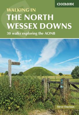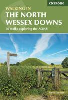
Wandelgids Walking on the North Wessex Downs | Cicerone

0
Guidebook to 30 circular walks in the North Wessex Downs Area of Outstanding Natural Beauty (AONB). The routes, which range from 7 to 21km (4 to 13 miles), take in parts of four counties - Berkshire, Hampshire, Wiltshire and Oxfordshire.   The North Wessex Downs are accessible hills rising above the towns and rural plains of southern England and r...

Verkopers met dit product

Verkoper
Bezorging
Prijs
DeZwerver.nl logo
DeZwerver.nl
2,95
19,95

Anderen bekeken ook

Wandelgids Walking on the North Wessex Downs | Cicerone
Guidebook to 30 circular walks in the North Wessex Downs Area of Outstanding Natural Beauty (AONB). The routes, which range from 7 to 21km (4 to 13 miles), take in parts of four counties - Berkshire, Hampshire, Wiltshire and Oxfordshire.   The North Wessex Downs are accessible hills rising above the towns and rural plains of southern England and rolling gently west from Reading and Basingstoke to Swindon and down past Marlborough to Andover. The walks allow you to explore parts of the Ridgeway National Trail, the Kennet and Avon Canal and stunning historic sites such as Avebury, the 3000-year-old Uffington White Horse, impressive Neolithic long barrows and Iron Age hill forts.   Alongside clear route descriptions and OS maps are plenty of details about points of interest, as well as practical information on the area, from public transport links to ideal refreshment stops on each walk. The result is an ideal companion to exploring both the popular and untouched corners of the North Wes…
19,95
Wandelgids Walking the North Downs Way Map Booklet | Cicerone
All the mapping you need to walk the 130 mile (208km) North Downs Way National Trail between Farnham and Dover. One of the easier National Trails, it can be comfortably walked in 11-12 days and includes an optional detour via Canterbury.   This map booklet contains all the OS 1:25,000 Explorer mapping you need to walk the route, saving the space, weight and expense of multiple map sheets. Conveniently sized to slip in a jacket pocket or rucksack top, it comes in a clear PVC sleeve.   NOTE An accompanying Cicerone guidebook - The North Downs Way - describes the full route from West to East with lots of other practical and historical information. The accompanying guidebook INCLUDES a copy of this map booklet.
13,95
Wandelgids Walking in the Thames Valley | Cicerone
Walking in the Thames Valley offers 25 challenging circular walks around the River Thames and River Kennet in the south of England, taking in the Southern Chilterns, the Berkshire and North Hampshire Downs, Southern Oxfordshire and the eastern edge of Wiltshire. All routes are within easy reach of Reading, Newbury, Abingdon and London. While some walks visit Iron Age hill forts, others pass more modern features such as Wilton Windmill and the Kennet and Avon Canal. Some follow sections of the Ridgeway, while others meander along the banks of the Thames. What they all have in common is that they take the keen rambler to some of the best parts of the Thames Valley – a patchwork of open chalk grassland, broadleaved woodland and farmland and home to two Areas of Outstanding Natural Beauty. • walks from 10 to 18 miles, including one 2-day route • shorter, less strenuous alternatives for many of the walks • detailed route descriptions with information on local points of interest, OS mapping…
18,50
Wandelgids Walking on the Gower | Cicerone
Wandelgids met 30 wandelroutes in het zuiden van Wales This guidebook presents 30 circular day walks across the Gower Area of Outstanding Natural Beauty, taking in the rich variety of landscapes across this beautiful area of South Wales. Ranging from 2½ to 14 miles long, there are walks to suit all abilities. The peninsula is famous for its spectacularly steep, rugged coastline and golden sandy beaches but this guide also takes walkers to the inland valleys, hills and ridges little explored by most holidaymakers.   Routes are illustrated with OS mapping extracts and inspiring photography and accompanied by a route summary table to help you choose walks to suit your location and ability. Along the way, the author provides a wealth of information on plants, animals, geology, history and archaeology of a region. There is something for everyone, all within a compact area easily accessible from Swansea and Mumbles.   Coastal areas such as those around Langland, Oxwich and Port Eynon are we…
19,50
Wandelgids Walking in the North Pennines | Cicerone
Uitstekende wandelgids van dit geweldige gebied. goed beschreven met veel praktische informatie om de route te kunnen lopen, inclusief redelijke kaarten. This guidebook describes 50 day walks across the North Pennines, England's remotest Area of Outstanding Natural Beauty taking in parts of Cumbria, County Durham and Northumberland. Most of the routes are circular and they range from 5 to 14 miles, with something to suit all abilities. Route descriptions are accompanied by 1:50K OS mapping. A guidebook to day walks in the North Pennines Area of Outstanding Natural Beauty (AONB), across Cumbria, County Durham and Northumberland. The book includes 50 walks exploring England’s ‘last wilderness’, ranging from 5 miles (8km) to 14 miles (23km). Most are circular, though there are some linear routes, and there is something to suit all abilities over a variety of terrain. Route descriptions are illustrated with OS mapping and colour photographs, and the book includes details of local transpor…
19,95
Wandelgids Walking on the Brecon Beacons | Cicerone
Uitstekende wandelgids van dit geweldige gebied. goed beschreven met veel praktische informatie om de route te kunnen lopen, inclusief redelijke kaarten. Guidebook to 45 graded circular walks in the Brecon Beacons National Park, perfect for those wishing to discover the diversity of the region, away from the crowds. The routes range from 4 to 24km and cover the north-eastern, eastern and south-western valleys and ridges, Fforest Fawr, Waterfall Country, the Black Mountain (Mynydd Du) and the Black Mountains (y Mynyddoedd Duon). Designed to include all the interesting facts an expert park ranger would provide, the guide contains a wealth of information about local geology, botany, archaeology, history, mythology, industrial heritage and environmental issues.   Clear route description is illustrated with 1:50,000 OS Landranger mapping, summary statistics are provided for each walk and handy tables make it easy to compare routes or choose according to points of interest.   A remarkably v…
20,95
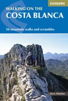
Wandelgids Walking on the Costa Blanca Walks | Cicerone
Uitstekende wandelgids van dit geweldige gebied. Goed beschreven met veel praktische informatie om de route te kunnen lopen, inclusief redelijke kaarten. This guidebook describes 50 circular walks and scrambles exploring the Costa Blanca mountains, around the resorts of Alicante, Benidorm and Calp. These routes range from gentle strolls to demanding days with steep climbs, and from 3-20km in distance. The Mediterranean coast is one of Europe's most popular winter sun adventure destinations. In general UK visitors are best suited to the heat from late autumn to early spring. Beyond the beaches and high rises lies a completely different world of accessible, rocky mountains and knife-edge ridges that stretch away in long chains of gleaming white limestone pinnacles, and the range of walks ensures that everyone can enjoy this spectacular Spanish landscape. Walking on Costa Blanca also includes background information on local geology, wildlife and history, and planning details on where to …
23,50
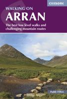
Wandelgids Walking on Arran | Cicerone
Uitstekende wandelgids voor dit uitdagende wandelgebied in Schotland. Dagtochten. The 45 walking routes in this Isle of Arran guidebook range from easy 3km (2 miles) nature trails to long arduous mountain routes with scrambles (up to 32km) providing thorough coverage of Arran, including the ascent of Goatfell and nearby Holy Isle. Most routes are 10km to 15km long but many give opportunities to create longer cross island walks. This guidebook presents a selection of 45 day walks on the popular and accessible Isle of Arran. The routes are between 2 miles (3km) and 20 miles (32km) in length, from easy waymarked forest trails to more arduous mountain walks, exposed ridge routes and scrambles. There are linear and circular walks to choose from, and opportunities to link routes together and create longer walks across the length and breadth of the island. With highlights including Goatfell, Beinn Tarsuinn, the Sannox Horseshoe, Glen Rosa and the Cock of Arran, there's something here to suit…
23,95
Wandelgids Walking on Dartmoor | Cicerone
A guidebook to 39 day walks and one two-day Ten Tors challenge across the Dartmoor National Park and its surrounding area. The guide contains low-level shorter walks and higher level more strenuous and challenging routes, therefore there's a walk suitable for all abilities, allowing you to explore all of what Devon's national park has to offer. Each walk contains a detailed route description, 1:50,000 OS maps and colour photography, alongside practical information on public transport links and refreshment stops on each walk.   Dartmoor, a National Park since 1951, is wild, and at times isolated. Its a land of blanket bogs and grass moors dotted with fascinating tors, old stone clapper bridges, tree-shaded river valleys and a diverse range of wildlife. Our ancestors have left behind a fascinating treasure trove from intriguing stone rows to fascinating stones circles and burial cairns to hut circles.   There are also the stark ruins of Dartmoor's mining heritage, picturesque villages a…
20,95
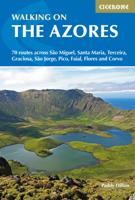
Wandelgids Walking on the Azores - Azoren | Cicerone
Uitstekende Engelstalige wandelgids waarbij de wandelingen goed beschreven staan met daarnaast een behoorlijke hoeveelheid praktische informatie als zwaarte, hoogtemeters maar ook bereikheid met OV en mogelijke eetgelegenheden. Kaartmateriaal - afhankelijk van het land - is duidelijk waarbij de route goed is ingetekend. De variatie in de wandelingen is vaak groot: van tamelijk eenvoudig tot loodzware dagtochten, veel keuze voor elke wandelaar.  A comprehensive guide to walking in the Portuguese Azores, an archipelago of nine lush green islands in the North Atlantic Ocean. The 70 routes cover the three island groups: the Eastern Group (São Miguel and Santa Maria), Central Group (Terceira, Graciosa, São Jorge, Pico and Faial) and Western Group (Flores and Corvo). Routes range from hour-long strolls to full-day outings and most use the islands' network of official waymarked trails, including sections of the multi-day GR1. Also included is an ascent of Pico, the highest mountain on Portug…
23,95

Klanten-reviews van Wandelgids Walking on the North Wessex Downs | Cicerone

Er zijn nog geen beoordelingen voor dit productBen jij de eerste die een review plaatst?

Meer over Wandelgids Walking on the North Wessex Downs | Cicerone

Productomschrijving

Guidebook to 30 circular walks in the North Wessex Downs Area of Outstanding Natural Beauty (AONB). The routes, which range from 7 to 21km (4 to 13 miles), take in parts of four counties - Berkshire, Hampshire, Wiltshire and Oxfordshire.   The North Wessex Downs are accessible hills rising above the towns and rural plains of southern England and rolling gently west from Reading and Basingstoke to Swindon and down past Marlborough to Andover. The walks allow you to explore parts of the Ridgeway National Trail, the Kennet and Avon Canal and stunning historic sites such as Avebury, the 3000-year-old Uffington White Horse, impressive Neolithic long barrows and Iron Age hill forts.   Alongside clear route descriptions and OS maps are plenty of details about points of interest, as well as practical information on the area, from public transport links to ideal refreshment stops on each walk. The result is an ideal companion to exploring both the popular and untouched corners of the North Wessex Downs.

Productinformatie

    Verken gerelateerde categorieën

    Webshop.nl maakt gebruik van cookies. Ga je verder op onze website, ga dan akkoord met het plaatsen van cookies en de verwerking van deze data door ons en vermelde partners.