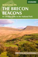
Wandelgids Walking on the Brecon Beacons | Cicerone

0
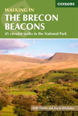
Uitstekende wandelgids van dit geweldige gebied. goed beschreven met veel praktische informatie om de route te kunnen lopen, inclusief redelijke kaarten. Guidebook to 45 graded circular walks in the Brecon Beacons National Park, perfect for those wishing to discover the diversity of the region, away from the crowds. The routes range from 4 to 24km...

Verkopers met dit product

Verkoper
Bezorging
Prijs
DeZwerver.nl logo
DeZwerver.nl
niet bekend
2,95
20,95

Anderen bekeken ook

Wandelgids Walking on the Brecon Beacons | Cicerone
Uitstekende wandelgids van dit geweldige gebied. goed beschreven met veel praktische informatie om de route te kunnen lopen, inclusief redelijke kaarten. Guidebook to 45 graded circular walks in the Brecon Beacons National Park, perfect for those wishing to discover the diversity of the region, away from the crowds. The routes range from 4 to 24km and cover the north-eastern, eastern and south-western valleys and ridges, Fforest Fawr, Waterfall Country, the Black Mountain (Mynydd Du) and the Black Mountains (y Mynyddoedd Duon). Designed to include all the interesting facts an expert park ranger would provide, the guide contains a wealth of information about local geology, botany, archaeology, history, mythology, industrial heritage and environmental issues.   Clear route description is illustrated with 1:50,000 OS Landranger mapping, summary statistics are provided for each walk and handy tables make it easy to compare routes or choose according to points of interest.   A remarkably v…
20,95
Wandelgids Brecon Beacons | Northern Eye Books
This good looking, modern walking book will take you on ten short circular themed walks across South Wales’ ever-popular Brecon Beacons National Park.   The Brecon Beacons was Britain’s 10th National Park, established in 1957 to preserve and highlight the unique landscape of the area. The Brecon Beacons are said to be named after the historical practice of lighting beacons of fire upon hilltops to forewarn neighbouring valleys of invasion.    The Brecon Beacons cover 1,344 square kilometres / 519 square miles with it’s spectacular waterfalls, valleys and expanse of hilly terrain; the Black Mountain to the west, the Fforest Fawr Geopark, Waterfall Country and the Pen y Fan range at the centre, and The Black Mountains to the east.   The variety of flora and fauna is as vast as the landscape. Rare sub-arctic, alpine plants thrive within this unique climate. Mammals you’re likely to spot include include wild mountain ponies, horseshoe bats, otters and water voles. Often seen birds of prey…
10,95
Wandelgids Brecon Beacons | Ordnance Survey
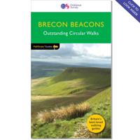
Get outside and enjoy ten short leisurely strolls across the Brecon Beacons National Park, indulging in wonderful mountain views across Southern Britain’s hilliest terrain. With routes for all abilities, enjoy a diverse range of experiences, including waterfalls, woodlands, riversides and even 12th century castle ruins.   Brecon Beacons Short Walks Made Easy routes include:       • Discover great mountain views from relatively level ground with routes at Mynydd Illtud and Craig y Cilau   • Or for a more strenuous walk, the ascent of Sugar Loaf will reward your uphill efforts with stupendous views across the national park   • Enjoy the thunderous sounds of the spectacular cascading waterfalls of Sgd Clun-gwyn and Sgd yr Eira, some of Wales most impressive!   • Delve into the Usk Valley for soothing riverside rambles from Brecon and Abergavenny, blessed with stunning views southwards towards the park’s highest peaks   • Spot an abundance of wildlife from the towpath along the Monmouthsh…
12,95
Wandelgids 15 Short Walks Bannau Brycheiniog - Brecon Beacons | Cicerone
Would you like to explore the best of the Brecon Beacons? This guidebook covers 15 of the best short walks in the area (between 4 and 9km), including Henrhyd Falls, Pen y Fan, Table Mountain, Sugar Loaf, Craig y Cilau and Ysgyryd Fawr.   Why choose this guidebook?   Walks under three hours, plus one challenge route Easy to follow with clear route descriptions Facilities, parking and highlights for every route No specialist gear needed, walk all year round Ordnance Survey mapping Cicerone’s Short Walks guidebooks contain everything you need to get outdoors and discover the best of an area. The routes are perfect if you’re new to walking or looking for something you can enjoy with the whole family. Let the adventures begin!
13,95
Wandelgids Brecon Beacons | Pocket Mountains
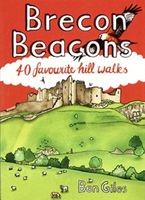
The Brecon Beacons National Park is home to some of the most spectacular mountain and moorland scenary in Britain. Bridging South and Mid Wales, the park can be divided into three distinct upland areas, with the central flat-topped peaks of the Brecon Beacons massif sandwiched by the rolling ridges of the Black Mountains in the East and the similarly named, but quite different, Black Mountain region in the West. As well as being packed full of standing stones, castles, wildlife and waterfalls, the park is also home to the Fforest Fawr UNESCO Global Geopark and is recognised as an International Dark Sky Reserve.   The 40 circular routes in the volume cover all the most popular peaks, as well as highlighting some lesser-known gems in one of Britain's best-loved national parks.  
10,95
Wandelgids 018 Pathfinder Guides Brecon Beacons | Ordnance Survey
Wandelgids van een deel van Engeland. Deze gids bevat 28 dagwandelingen, variërend van korte tochten tot pittige dagtochten. De bijbehorende kaarten zijn uitstekend: men heeft de topografische kaarten van Ordnance Survey gebruikt waarop de route is ingetekend. Daarnaast praktische informatie over de wandeling en wat beschrijvingen van het gebied.   28 fabulous country walks in the Becon Beacons National Park, graded by length and ranging from 3 to 10 miles.   All routes come with a clear, large-scale OS map, GPS waypoints and highlight where to park, good pubs and places of interest en route.   Within the boundaries of the Brecon Beacons National Park there are four separate mountain ranges, including the Black Mountains as well as the Beacons themselves. Most of the area is underlain by old red sandstone, which distinguishes it from the more rugged mountains of North Wales, and several walks explore this terrain of smooth, sweeping grassy uplands and wide, open vistas, including the …
18,50
Wandelgids Walking on the Azores - Azoren | Cicerone
Uitstekende Engelstalige wandelgids waarbij de wandelingen goed beschreven staan met daarnaast een behoorlijke hoeveelheid praktische informatie als zwaarte, hoogtemeters maar ook bereikheid met OV en mogelijke eetgelegenheden. Kaartmateriaal - afhankelijk van het land - is duidelijk waarbij de route goed is ingetekend. De variatie in de wandelingen is vaak groot: van tamelijk eenvoudig tot loodzware dagtochten, veel keuze voor elke wandelaar.  A comprehensive guide to walking in the Portuguese Azores, an archipelago of nine lush green islands in the North Atlantic Ocean. The 70 routes cover the three island groups: the Eastern Group (São Miguel and Santa Maria), Central Group (Terceira, Graciosa, São Jorge, Pico and Faial) and Western Group (Flores and Corvo). Routes range from hour-long strolls to full-day outings and most use the islands' network of official waymarked trails, including sections of the multi-day GR1. Also included is an ascent of Pico, the highest mountain on Portug…
23,95
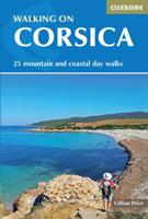
Wandelgids Walking on Corsica | Cicerone
Uitstekende wandelgids van Corsica met dagwandelingen. Goed beschreven met veel praktische informatie om de routes te kunnen lopen, inclusief redelijke kaarten. With stunning coastlines and impressive craggy mountains, Corsica is an island with diverse landscapes for day walkers of all abilities to enjoy. Across 25 day walks, this guidebook explores sandy beaches, forested river valleys, and waterfalls, as well as high mountain passes to lookouts and glacial lakes. This guidebook is a brilliant introduction to walking on Corsica, and offers plenty of information on food, plant life, and history. Bases include coastal towns of Bastia, Bonifacio, Porto Vecchio, and Ajaccio, as well as mountain villages of Corte, Evisa and Zonza.   Each walk features detailed mapping alongside comprehensive route description. All the walks are graded for difficulty and range from easy-going low-level walks on good tracks or paths, to challenging and exposed high-level routes for experienced walkers. The …
19,95
Wandelgids 031 Pathfinder Short Walks Brecon Beacons | Ordnance Survey
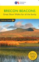
Wandelgids van een deel van Wales. Deze gids bevat 20 wandelingen, geschikt voor de hele familie. De bijbehorende kaarten zijn uitstekend: men heeft de topografische kaarten van Ordnance Survey gebruikt waarop de route is ingetekend. Daarnaast praktische informatie over de wandeling en wat beschrijvingen van het gebied. et outside and get active with all the family in the gorgeous Brecon Beacons with these 20 hand-picked and lovingly illustrated short walks. Everybody can enjoy country walking amidst mountains, lakes and forests and there are even accessible routes up the Sugar Loaf, around the Usk Reservoir and to the top of Pen y Fan.   Featured Brecon Beacons Short Walks include:   - Cross the Usk Bridge and see castle ruins on the riverside walk at Castle Meadows - Discover a legendary lake at Llyn y Fan Fach - Climb grassy mountain paths to the rocky summit of the iconic Sugar Loaf - Enjoy great views from an Iron Age Fort at Mynnyd Illtud - See the dazzling Ystradfellte waterfal…
11,50
Wandelgids Walking on Dartmoor | Cicerone
A guidebook to 39 day walks and one two-day Ten Tors challenge across the Dartmoor National Park and its surrounding area. The guide contains low-level shorter walks and higher level more strenuous and challenging routes, therefore there's a walk suitable for all abilities, allowing you to explore all of what Devon's national park has to offer. Each walk contains a detailed route description, 1:50,000 OS maps and colour photography, alongside practical information on public transport links and refreshment stops on each walk.   Dartmoor, a National Park since 1951, is wild, and at times isolated. Its a land of blanket bogs and grass moors dotted with fascinating tors, old stone clapper bridges, tree-shaded river valleys and a diverse range of wildlife. Our ancestors have left behind a fascinating treasure trove from intriguing stone rows to fascinating stones circles and burial cairns to hut circles.   There are also the stark ruins of Dartmoor's mining heritage, picturesque villages a…
20,95

Klanten-reviews van Wandelgids Walking on the Brecon Beacons | Cicerone

Er zijn nog geen beoordelingen voor dit productBen jij de eerste die een review plaatst?

Meer over Wandelgids Walking on the Brecon Beacons | Cicerone

Productomschrijving

Uitstekende wandelgids van dit geweldige gebied. goed beschreven met veel praktische informatie om de route te kunnen lopen, inclusief redelijke kaarten.

Guidebook to 45 graded circular walks in the Brecon Beacons National Park, perfect for those wishing to discover the diversity of the region, away from the crowds. The routes range from 4 to 24km and cover the north-eastern, eastern and south-western valleys and ridges, Fforest Fawr, Waterfall Country, the Black Mountain (Mynydd Du) and the Black Mountains (y Mynyddoedd Duon). Designed to include all the interesting facts an expert park ranger would provide, the guide contains a wealth of information about local geology, botany, archaeology, history, mythology, industrial heritage and environmental issues.   Clear route description is illustrated with 1:50,000 OS Landranger mapping, summary statistics are provided for each walk and handy tables make it easy to compare routes or choose according to points of interest.   A remarkably varied landscape, the Brecon Beacons National Park showcases some of the best scenery in Wales. The walks take in mountain peaks and ridges, waterfalls, wooded river gorges and remote upland valleys, with highlights including Pen y Fan, the highest peak in south Wales, and the spectacular Sgwd Gwladus (White Lady Falls), Sgwd yr Eira and Sgwd Clun-gwyn waterfalls. Picturesque market towns on the edges of the park, such as Llandovery, Brecon, Crickhowell and Abergavenny, are also great places to explore and ideal bases for a walking holiday.

Productinformatie

    Verken gerelateerde categorieën

    Webshop.nl maakt gebruik van cookies. Ga je verder op onze website, ga dan akkoord met het plaatsen van cookies en de verwerking van deze data door ons en vermelde partners.