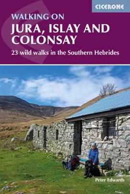
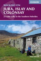
Wandelgids Walking on Jura, Islay and Colonsay | Cicerone

0
Uitstekende wandelgids van deze weldadige eilanden. goed beschreven met veel praktische informatie om de route te kunnen lopen, inclusief redelijke kaarten. This guidebook presents a selection of 23 walking routes on the wild and beautiful southern islands of Scotland's Inner Hebrides, with nine walks on Jura, one on neighbouring Scarba, seven on ...

Verkopers met dit product

Verkoper
Bezorging
Prijs
DeZwerver.nl logo
DeZwerver.nl
2,95
20,95

Anderen bekeken ook

Wandelgids Walking on Jura, Islay and Colonsay | Cicerone
Uitstekende wandelgids van deze weldadige eilanden. goed beschreven met veel praktische informatie om de route te kunnen lopen, inclusief redelijke kaarten. This guidebook presents a selection of 23 walking routes on the wild and beautiful southern islands of Scotland's Inner Hebrides, with nine walks on Jura, one on neighbouring Scarba, seven on Islay and five on Colonsay, plus a spectacular 5-day trek along Jura's dramatic west coast. The wildest of the southern Hebrides, the walking on Jura is frequently rugged, with many routes crossing remote and often pathless terrain that calls for fitness, self-reliance and navigational competence. The routes on the other islands are somewhat easier, but should still not be underestimated.   In addition to clear route description illustrated with 1:50,000 OS mapping, the guide offers practical advice on the various options for getting to the islands, accommodation and amenities. There are suggestions for linking walks and notes on the islands'…
20,95
Wandelgids Islay, Jura & Colonsay | Hallewell Publications
Walks Islay, Jura & Colonsay features walks on the three inner Hebridean islands. Each island has it's own distinct character and the 26 walks featured give a good feel for this. The walks range in length from 1 mile to 16 miles (1.6-25km). Routes include 6 walks on each Colonsay and Jura and 14 on the larger island of Islay. Part of a popular series of A6 pocket walking guides which describe routes which are suitable for walkers of all abilities and to suit all tastes. Route descriptions are accompanied by 2-colour sketch maps. The guides are illustrated with line illustrations, and will provide walkers with a good introduction to what each area covered has to offer.  
5,95
Wandelgids Walking on Malta | Cicerone
Wandelgids met 33 dagtochten op Malta, Gozo en Comino. Goede omschrijvingen, veel praktische informatie. Redelijk kaartmateriaal. (goede wandelkaart Kompass / zie landkaarten) The Maltese Islands of Malta, Gozo and Comino bask in sunshine at the heart of the Mediterranean, between Europe and Africa. History has ensured that the islands have been colonised time and time again, leaving them with a colourful and complex history and heritage. The islands are a popular tourist destination. They offer plenty of historic walks, stunningly beautiful and dramatic architecture, and a good amount of excellent scenery, especially around the cliffs and coastlines. This guidebook describes 33 walks on Malta and its neighbouring islands of Gozo and Comino. Walks generally range from 3 to 17 km, and include Valetta, heritage trails, coastal walks and explorations inland, including the 30km 'Victoria Lines' route between Mgarr and Bahar ic-Caghaq. Malta offers year-round walking. This guidebook descri…
21,95
Wandelgids Walking on Lanzarote and Fuerteventura | Cicerone
Uitgebreide wandelgids van Lanzarote en Fuerteventura: goede beschrijvingen, veel keuze, kaarten wat minder goed.   This book offers 21 walks on Lanzarote, two on Isla La Graciosa (off Lanzarote's northern coast) and 22 on Fuerteventura, including 14 walks on the GR 131 trail, which crosses both islands. These 45 traditional routes link several villages and span a range of arid agricultural and natural areas. Both popular holiday destinations, Lanzarote and Fuerteventura are two remarkably different islands. Lanzarote has a fascinating volcanic national park at Timanfaya, and vineyards fill huge areas of black volcanic ash at La Geria; Fuerteventura is famous for extensive golden beaches, but its splendid mountain paths are less well-known. Both islands are crossed by new waymarked trails.   These traditional routes span a range of arid, agricultural and natural areas, including hill and mountain trails, coastal walks including Fuerteventura’s golden beaches, and some walks visit vill…
21,95
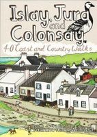
Wandelgids Islay, Jura and Colonsay | Pocket Mountains
Handige compacte wandelgids met 40 dagwandelingen. Deze gids bevat kleine kaartjes en leuke uitgebreide informatie over wat er langs de route te zien is. Goede wandelkaarten zijn echter wel aan te raden voor deze tochten: de Ordnance Survey explorer maps of Landranger maps zijn zeer geschikt. Islay, Jura and Colonsay make up the most southerly Hebridean island group and are famed for their outstanding wildlife, glorious sandy beaches, fascinating historical treasures, rugged hills and dramatic coastlines, and – on Jura, but especially on Islay – legendary distilleries which produce distinctively peaty whisky.   This book aims to help you get the most from your visit to these islands. Most of the 40 walks are a half day or shorter, with many suitable for families, but there are also a few more challenging hillwalks for those who can’t resist the allure of reaching an island summit.
10,95
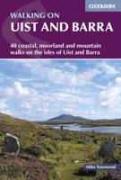
Wandelgids Walking on Uist and Barra - Schotland | Cicerone
This guide offers 40 varied and graded walking routes on the unique 100km cluster of islands that make up Uist and Barra. From short, flat beach walks beside crystal clear waters to long excursions across wild mountainous terrain, the routes visit all the major islands from Berneray to Vatersay but also those smaller and offshore such as Eriskay and Mingulay. Walking across these landscapes, especially the hill country, gives a sense of remoteness and peaceful solitude that cannot be found in the mainland's National Parks or on the Munros busy with peak baggers. Despite a relatively narrow area, Uist and Barra's diverse islands offer a contrasting walking terrain and many ancient historic sites such as chambered cairns and standing stones as well as lots of local wildlife. Upland areas are home to red deer and golden and white-tailed eagles, while along the coast grey seals are common and thousands of birds set up their breeding grounds in the machair. Daily flights between Glasgow an…
23,95
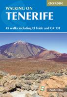
Wandelgids Walking on Tenerife | Cicerone
  From easy strolls to hands-on scrambling and from simple day walks to long-distance routes along the GR131, Tenerife offers a variety of year round walking routes, all set in stunning natural scenery. Paddy Dillon's latest book in his Canary Islands series features 45 of the best - suitable for a wide range of abilities and easily combined to form longer expeditions.   The largest of the Canary Islands, Tenerife is dominated by the highest mountain on Spanish territory, El Teide, which rises up dramatically right in the centre of the island. The whole central area surrounding it is protected as a national park and packed with diverse and interesting trails. The altitude on these routes is generally above 2000m and the island's central high-altitude region is often blessed with blue skies and sunny conditions, even when other areas are covered in cloud or experiencing rain.   Terrain includes volcanic cones, lava flows and ash slopes, while the landscape ranges from semi-desert to lu…
24,95
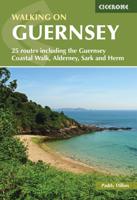
Wandelgids Walking on Guernsey, Alderney, Sark and Herm | Cicerone
Guidebook to 24 easy day walks on the Channel Islands of Guernsey, Alderney, Sark and Herm, and the 3-day Guernsey Coastal Walk. Making up part of the Channel Islands Way, the routes follow paths, tracks and quiet roads and total around 240km (150 miles). Uses detailed 1:15,000 scale States of Guernsey maps, with notes on travel, accommodation, plants and wildlife and the islands' fascinating history.   Seasons all year round, but particularly good in spring when the wild flowers are at their most colourful; busy during the summer, with long, sunny days; quieter in autumn; sometimes bleak in the winter   Centres St Peter Port; St Sampson   Difficulty good paths and tracks are used, along with quiet country roads, avoiding main roads wherever possible; gradients are often gentle, but there are some rugged cliff paths and occasional steep slopes and flights of steps; short walks can be combined to make longer ones   Must See excellent cliff coastline, rocky and sandy beaches; nature res…
19,95
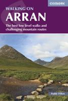
Wandelgids Walking on Arran | Cicerone
Uitstekende wandelgids voor dit uitdagende wandelgebied in Schotland. Dagtochten. The 45 walking routes in this Isle of Arran guidebook range from easy 3km (2 miles) nature trails to long arduous mountain routes with scrambles (up to 32km) providing thorough coverage of Arran, including the ascent of Goatfell and nearby Holy Isle. Most routes are 10km to 15km long but many give opportunities to create longer cross island walks. This guidebook presents a selection of 45 day walks on the popular and accessible Isle of Arran. The routes are between 2 miles (3km) and 20 miles (32km) in length, from easy waymarked forest trails to more arduous mountain walks, exposed ridge routes and scrambles. There are linear and circular walks to choose from, and opportunities to link routes together and create longer walks across the length and breadth of the island. With highlights including Goatfell, Beinn Tarsuinn, the Sannox Horseshoe, Glen Rosa and the Cock of Arran, there's something here to suit…
23,95
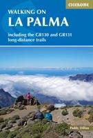
Wandelgids Walking on La Palma | Cicerone
Uitstekende wandelgids voor dit uitdagende wandelgebied. Goede beschrijvingen en detail informatie. Voor kaartmateriaal zouden we toch de kompass kaart adviseren, de kaarten in het boek schieten wat dat betreft te kort. The dramatic volcanic landscape of La Palma, reputed to be one of the steepest islands in the world, is little known outside the Canaries, but offers an ideal winter walking destination for walkers of most abilities.   This guidebook explores the way-marked trail networks on the island of La Palma. Despite its small size, there are routes of all types – from easy strolls to hands-on scrambling, from simple day walks to long distance treks.   These cover rocky treks and mountain paths over the GR130 that circumnavigates the island and a part of the island hopping GR131. As these routes are fully signposted, walkers can follow them with confidence and enjoy the island to the maximum.   45 routes described with clear contour mapping includes the Caldera de Taburiente na…
20,95

Klanten-reviews van Wandelgids Walking on Jura, Islay and Colonsay | Cicerone

Er zijn nog geen beoordelingen voor dit productBen jij de eerste die een review plaatst?

Meer over Wandelgids Walking on Jura, Islay and Colonsay | Cicerone

Productomschrijving

Uitstekende wandelgids van deze weldadige eilanden. goed beschreven met veel praktische informatie om de route te kunnen lopen, inclusief redelijke kaarten.

This guidebook presents a selection of 23 walking routes on the wild and beautiful southern islands of Scotland's Inner Hebrides, with nine walks on Jura, one on neighbouring Scarba, seven on Islay and five on Colonsay, plus a spectacular 5-day trek along Jura's dramatic west coast. The wildest of the southern Hebrides, the walking on Jura is frequently rugged, with many routes crossing remote and often pathless terrain that calls for fitness, self-reliance and navigational competence. The routes on the other islands are somewhat easier, but should still not be underestimated.   In addition to clear route description illustrated with 1:50,000 OS mapping, the guide offers practical advice on the various options for getting to the islands, accommodation and amenities. There are suggestions for linking walks and notes on the islands' bothies and wild-camping recommendations, making it easy to devise longer day walks or multi-day itineraries. Also included are fascinating overviews of the islands' rich history, geology, plants and wildlife. Beautiful colour photography completes the package.   The routes showcase the islands' magnificent scenery, which is as diverse as it is beautiful, ranging from wild moorland to flower-strewn machair and small pockets of native woodland. The coastline is arguably the jewel in the crown, with geological wonders aplenty: sea-cliffs, caves, stacks and arches, sand and shingle bays and the characteristic Hebridean raised beaches. Abundant wildlife and birdlife is a further highlight. These carefully chosen walks will inspire you to get out and discover the magic of these captivating islands.   Steden en Dorpen JURA - Feolin, Craighouse, Tarbert, Ardlussa, Kinuachdrachd, Glengarrisdale, Ruantallain, Cruib, Glenbatrick Bay ISLAY - Port Askaig, Port Ellen, Port Charlotte, Bowmore, Bridgend, Ballygrant, Bunnahabhain, Ardbeg COLONSAY - Scalasaig, Oronsay, Kilchattan, Kiloran SCARBA - Kilmory Lodge, Gleann a' Mhaoil bothy
Productinformatie

    Verken gerelateerde categorieën

    Webshop.nl maakt gebruik van cookies. Ga je verder op onze website, ga dan akkoord met het plaatsen van cookies en de verwerking van deze data door ons en vermelde partners.