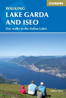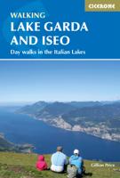
Wandelgids Walking Lake Garda and Iseo | Cicerone

0
Wandelgids met 20 dagtochten.. Goede omschrijvingen, veel praktische informatie. Redelijk kaartmateriaal Guidebook to 20 day walks around the majestic Italian lakes of Garda and Iseo. The routes, which range from leisurely strolls to more strenuous routes up panoramic peaks, offer something to suit all walkers. Invaluable practical information abo...

Verkopers met dit product

Verkoper
Bezorging
Prijs
DeZwerver.nl logo
DeZwerver.nl
2,95
20,95

Anderen bekeken ook

Wandelgids Lake Como and Maggiore | Cicerone
Uitstekende wandelgids van dit geweldige gebied. goed beschreven met veel praktische informatie om de route te kunnen lopen, inclusief redelijke kaarten. This guidebook describes 28 day walks and the Sentiero del Viandante trek around Lakes Como and Maggiore in Northern Italy. The day routes range from 3 to 20km in length are graded 1 to 3. The mini trek up the eastern shore of Lago di Como from Lecco to Colicocan can also be cut into one-day stages if desired.   There is something for everyone, from easy leisurely strolls for first-time walkers to strenuous climbs up panoramic peaks. The clear maps, inspirational photographs and information about accommodation and public transport options help to make this guidebook an ideal companion to exploring the exceptional scenery, views and culture of the Italian Lakes. A basic English-Italian glossary is also included.   Picturesque Lago Maggiore has been working its magic on writers and visitors for centuries. Blessed with a mild clima…
20,95
Wandelgids Walking in Tuscany - Toscane | Cicerone
Uitstekende wandelgids van Toscane. Goed beschreven met veel praktische informatie om de route te kunnen lopen, inclusief redelijke kaarten. Aanbevolen wandelkaarten De meeste wandelingen (maar lang niet allemaal!) in deze gids worden gedekt door wandelkaart: Wandelkaart - Fietskaart 2440 Toscana | Kompass Voor de andere gebieden staan de kaarten hier onder per gebied genoemd. A guidebook to walks in the Italian region of Tuscany. 43 graded routes range from 2.5 to 18km, and take in the Renaissance splendour of Florence and Siena, the World Heritage scenery of Val d'Orcia and San Gimignano and the stunning island of Elba. Alongside detailed route descriptions and clear mapping there is essential practical information on public transport and food and drink, as well as a comprehensive list of accommodation, and a useful Italian–English glossary. The guide is packed with interesting details about the area’s wildlife, landscape, culture and history, making it a perfect companion to gettin…
23,95
Klimgids - Klettersteiggids - Wandelgids 2 Via Ferratas of the Italian Dolomites: Vol 2 | Cicerone
This guide covers 77 via ferrata routes in the Italian Dolomites. As part of a two-volume set of guides to the Dolomite via ferratas, this volume includes the southern Dolomite regions, in 10 areas including those of Belluno, Brenta, Trento, Lake Garda, the 'Piccole Dolomites' and San Martino di Castrozza. As well as the detailed route descriptions, the guide includes maps, advice on how to climb via ferratas, information on the local area's history and geology, how to travel to and around the Dolomites and and the best places to stay.   Many via ferratas were originally built to aid the movements of alpine military units during the First World War, and now they represent one of the major attractions in the Dolomites. They are a range of protected routes, with fixed cables, ladders and even gorge-spanning bridges, which aid ascent to places normally reserved for expert rock climbers. In recent years, old wartime routes have been restored and many new routes added to give a network of …
27,95
Wandelkaart 102 Gardasee - Lago di Garda - Lake Garda | Kompass
Goede wandelkaart van omgeving Gardameer met vrijwel alle topografische details als hoogtelijnen, vegetatie, schaduwtekening maar ook de ingetekende wandelroutes en in veel gevallen ook fietsroutes (MTB). Gevaarlijke routes worden als zodanig weergegeven met een bepaalde markering. Berghutten en campings zijn goed terug te vinden op deze kaarten.   Daarnaast staan de toeristische bezienswaardigheden met symbolen vermeld. Kleurgebruik kan soms vrij fel overkomen, daardoor oogt deze detailkaart wellicht wat druk, maar het blijft een goed leesbare kaart. Sommige kaarten zijn geplastificeerd, maar helaas niet allemaal. De graden staan aan de zijkanten van de kaart, daardoor te gebruiken voor GPS.   Met Aktiv guide: een boekje met wandelroutes.   Steden/dorpen/gebieden: Condino, Riva del Garda, Storo, Limone sul Garda, Malcesine, Gargano, Toscolano-Maderno, Torri del Benaco, Brentino-Belluno, Caprino Veronese, Salo (Salò), Garda, Lazise, Desenzano del Garda, Peschiera del Garda   Bergen/da…
16,95
Wandelkaart 689 Parco Alto Garda Bresciano | Kompass
Goede wandelkaart met vrijwel alle topografische details als hoogtelijnen, vegetatie, schaduwtekening maar ook de ingetekende wandelroutes en in veel gevallen ook fietsroutes (MTB). Gevaarlijke routes worden als zodanig weergegeven met een bepaalde markering. Berghutten en campings zijn goed terug te vinden op deze kaarten.   Daarnaast staan de toeristische bezienswaardigheden met symbolen vermeld. Kleurgebruik kan soms vrij fel overkomen, daardoor oogt deze detailkaart wellicht wat druk, maar het blijft een goed leesbare kaart. Sommige kaarten zijn geplastificeerd, maar helaas niet allemaal. De graden staan aan de zijkanten van de kaart, daardoor te gebruiken voor GPS.   Steden/dorpen/gebieden: Storo, Limone sul Garda, Tremosine, Malcesine, Tignale, Valvestino, Gargnano, Vobarno, Toscolano, Salò, Gavardo, Torri del Benaco, Garda   Rivieren/meren: Lago di Garda (Nord), Lago di Valvestino   Die KOMPASS Wanderkarte ist jetzt noch übersichtlicher und besser lesbar. Die kostenlose App fü…
12,95
Wandelgids Trekking in the Apennines - Apennijnen | Cicerone
Uitstekende wandelgids die in etappes de route nauwkeurig beschijft; ook de zijtakken en alternatieve routes koman aan bod. Kaarten zijn schetsmatig en in onze ogen onvoldoende bij slechte weersomstandigheden. Wij raden dan ook om er losse kaarten bij te kopen, voor zover verkrijgbaar! Guidebook to the Grand Apennines Trek, or Grande Escursione Appenninica (GEA). Through Tuscany and Emilia-Romagna and two National Parks, this 400km, 23 day trail explores the mountains, forests and hills of central Italy. Suitable for a range of walkers, it can be split into shorter sections or day walks if needed. This guidebook describes the Grande Escursione Appenninica (GEA), a nearly 400km long, three week trek crossing the Appenines in 23 stages, from Bocca Trabaria to Passo Due Santi on the edge of Liguria. The route dips in and out of Tuscany and Emilia-Romagna, never dropping below 400 metres. Best walked between spring and autumn, it is suitable for any reasonably fit walker. Highlights inclu…
22,95
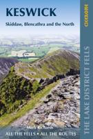
Wandelgids Walking the Lake District Fells - Keswick and the North | Cicerone
Uitstekende wandelgids voor dit uitdagende wandelgebied. This guide describes ascents of 30 Lake District fells that can be climbed from Keswick, the Whinlatter Pass, Bassenthwaite, Hesket Newmarket, Mungrisdale and Threlkeld. The giants of the region Skiddaw and Blencathra need little introduction, their myriad routes attracting many a visitor and promising fantastic far-reaching views. The summits to the north, however, are less frequented, offering probably the closest experience to wilderness walking the Lakes has to offer, whereas to the west, the Whinlatter group present a sylvan alternative.Unlike other guidebooks which describe a single or limited number of routes to a particular destination, the aim of the Walking the Lake District Fells series is to offer all the options. These are presented as numbered sections which can be combined to create infinite possibilities - from simple ascents to longer ridge routes. You'll find the classics and popular routes alongside less tradi…
20,95
Wandelgids Walking in the Aosta Valley | Cicerone
Uitstekende wandelgids van Aosta en omgeving. Goed beschreven met veel praktische informatie om de routes te kunnen lopen, inclusief redelijke kaarten. Guidebook to hiking in the Aosta Valley, a stunning, autonomous region in the Italian Alps. Describes 32 scenic routes (ranging from 4 to 20km) within both the main valley and those to the north, including the Lys valley, Valpelline, Valtournenche, and Grand St Bernard. Also provides info on the via ferrata and trail running options in the region. A stunning, autonomous region in the Italian Alps, the Aosta valley is a walker's paradise. This guidebook describes 32 varied and scenic routes both within the main valley and those to the north (including the Lys valley, Valpelline, Valtournenche and Grand St Bernard). The routes vary in difficulty and distance, offering something for walkers of all ability. 1:50K mapping together with gradient profiles complement clear and concise route descriptions. Also included is invaluable practical i…
22,95
Wandelgids The Lake District Fells Borrowdale walking guide | Cicerone
Uitstekende uitgebreide wandelgids van een bepaald deel vsn het Lake District, één van de mooiste wandelgebieden van Engeland. De routes zijn goed beschreven, met prima kaartmateriaal. Zolang je niet van de route afwijkt is deze gids voldoende om de wandelroute te lopen.  Part of the Walking the Lake District Fells series, this guidebook covers a wide range of routes to 28 Lakeland summits that can be climbed from the Borrowdale and Thirlmere valleys - both easily accessed from Keswick - with highlights including Catbells, Great Gable and Scafell Pike. Suggestions for longer ridge routes are also included. This guide describes ascents of 28 Lake District fells that can be climbed from Borrowdale and the Newlands and Thirlmere valleys, including Catbells, a perennial favourite, and the mighty Scafell Pike, Great End and Great Gable. Easily accessed from Keswick, Borrowdale is a valley of exquisite natural beauty, with the lower wooded and heather-clad slopes giving way to sweeping moor…
20,95
Wandelgids The Lake District Fells Coniston walking guide | Cicerone
Uitstekende uitgebreide wandelgids van een bepaald deel vsn het Lake District, één van de mooiste wandelgebieden van Engeland. De routes zijn goed beschreven, met prima kaartmateriaal. Zolang je niet van de route afwijkt is deze gids voldoende om de wandelroute te lopen.  Part of the Walking the Lake District Fells series, this guidebook covers a wide range of routes to 24 Lakeland summits that can be climbed from Coniston, Torver, the Duddon valley and the Birker Fell road, with highlights including Coniston Old Man, Swirl How, Wetherlam and Black Combe. Suggestions for longer ridge routes are also included. This guide describes ascents of 24 Lake District fells that can be climbed from Coniston and the Duddon and Eskdale valleys, including Coniston Old Man, Swirl How, Wetherlam and Dow Crag. The Coniston Fells - much loved for their classic ridges and wide-reaching views - need little introduction; however, to the west the less-frequented summits of the Birker and Corney Fell massif…
20,95

Klanten-reviews van Wandelgids Walking Lake Garda and Iseo | Cicerone

Er zijn nog geen beoordelingen voor dit productBen jij de eerste die een review plaatst?

Meer over Wandelgids Walking Lake Garda and Iseo | Cicerone

Productomschrijving

Wandelgids met 20 dagtochten.. Goede omschrijvingen, veel praktische informatie. Redelijk kaartmateriaal

Guidebook to 20 day walks around the majestic Italian lakes of Garda and Iseo. The routes, which range from leisurely strolls to more strenuous routes up panoramic peaks, offer something to suit all walkers. Invaluable practical information about public transport, accommodation and walking kit is included, together with a handy Italian glossary.

Dorpen en Steden

Malcesine, Riva del Garda, Limone, Gargnano on Lago di Garda. Iseo and Lovere on Lago d'Iseo

Productinformatie

    Verken gerelateerde categorieën

    Webshop.nl maakt gebruik van cookies. Ga je verder op onze website, ga dan akkoord met het plaatsen van cookies en de verwerking van deze data door ons en vermelde partners.