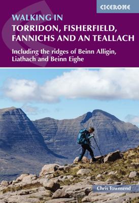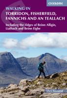
Wandelgids Walking in Torridon, Fisherfield, Fannichs and An Teallach | Cicerone

0
Guide to 50 walks and easy scrambles in north-western Scotland, covering Southern Torridon, Northern Torridon, Letterewe and Fisherfield, and the Fannichs. Ascents of 27 Munros, 20 Corbetts and 14 Grahams are included, with highlights including Liathach, Beinn Eighe, Beinn Alligin, An Teallach and Slioch. The walks are suitable for those with good...

Verkopers met dit product

Verkoper
Bezorging
Prijs
DeZwerver.nl logo
DeZwerver.nl
2,95
23,95

Anderen bekeken ook

Wandelgids Walking in Torridon, Fisherfield, Fannichs and An Teallach | Cicerone
Guide to 50 walks and easy scrambles in north-western Scotland, covering Southern Torridon, Northern Torridon, Letterewe and Fisherfield, and the Fannichs. Ascents of 27 Munros, 20 Corbetts and 14 Grahams are included, with highlights including Liathach, Beinn Eighe, Beinn Alligin, An Teallach and Slioch. The walks are suitable for those with good navigation skills who are competent in a mountain environment.   All the walks in the guide are graded, with summary statistics provided, and each includes clear route description and mapping. There's also a route summary table to help with choosing appropriate walks. Background information on local geology, wildlife and history, and planning details on when to go, where to stay and what to take are included to make the most out of any trip to Torridon.   The region boasts spectacular and distinctive landscapes and breathtaking views. Steep-sided rocky mountains rise above long winding lochs, both freshwater and sea. From the hills there are…
23,95
Wandelgids Walking in Catalunya - Barcelona | Cicerone
Uitstekende wandelgids van dit gebied. goed beschreven met veel praktische informatie om de route te kunnen lopen, inclusief redelijke kaarten. The delights of Spain's Catalunya region are revealed in this new walking guide, which covers 32 graded walks of 6.5 to 28km across Montseny, Sant Llorenç del Munt I l-Obac, Montserrat and Penedès and Garraf - all within easy access of Barcelona. Walks are included for all abilities, from easy strolls to more demanding walks, and some of the walks are accessible by public transport.   The guide provides detailed route descriptions, 1:50,000 mapping and a route summary table to help with choosing appropriate walks. All the walks are illustrated with stunning photos. A list of local campsites and other useful contacts is included at the back, plus notes on refreshment opportunities along the routes. There's also background information on local geology, wildlife and history, and planning details on when to go, where to stay and what to take.   Wh…
22,95
Wandelgids Walking in Carmarthenshire | Cicerone
This guidebook presents 30 contrasting day walks exploring the mountains, valleys and coastline of Carmarthernshire in south-west Wales. Ranging from 2 to 10 miles in length and suitable for walkers of all abilities, the routes introduce the varied walking on offer in this county, including parts of the Brecon Beacons and the Cambrian Mountains.   Alongside detailed route descriptions and clear OS mapping, the book is packed with interesting information about the places and heritage encountered. Notes on landscape, geology and wildlife of the area are included, and for each walk there is useful practical information on transport and refreshments.   A county of contrasts with around 1850 miles of footpaths, Carmarthernshire is a walker's paradise. Highlights include the Black Mountains (Mynydd Du), the Teifi Valley, Camarthen Bay, the southwestern Coast, and 'Dylan Thomas Country' around Laugharne.   Activities Walking   Seasons The walks can be done at any time of year, but the drier …
19,50
Wandelgids Walking in the Auvergne | Cicerone
Uitgebreide wandelgids van de Auvergne: goede beschrijvingen, veel keuze, kaarten wat minder goed. This handy guidebook offers the finest day walks in five different areas of the Auvergne, an often-forgotten region in central France perfect for accessible day walking in a unique and spectacular landscape. Towns such as Vichy, Clermont-Ferrand and Puy-en-Velay also offer delightful places to base yourself for that perfect walking holiday. The ridges, rocky peaks and verdant valleys of the Cantal supervolcano dominate south-western Auvergne. The centre of the region hosts the unique chain of 'puys' with their pudding bowl forms and the pristine crater lakes of the Sancy massif. In the north, the Montagne Bourbonnaise preserves a pastoral way of life which is quintessentially French while the Haute Loire's rivers and medieval abbeys reward those venturing further off the beaten track. Notes on the geology and history of points of interest passed en route help you to get the most out of y…
19,95
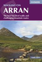
Wandelgids Walking on Arran | Cicerone
Uitstekende wandelgids voor dit uitdagende wandelgebied in Schotland. Dagtochten. The 45 walking routes in this Isle of Arran guidebook range from easy 3km (2 miles) nature trails to long arduous mountain routes with scrambles (up to 32km) providing thorough coverage of Arran, including the ascent of Goatfell and nearby Holy Isle. Most routes are 10km to 15km long but many give opportunities to create longer cross island walks. This guidebook presents a selection of 45 day walks on the popular and accessible Isle of Arran. The routes are between 2 miles (3km) and 20 miles (32km) in length, from easy waymarked forest trails to more arduous mountain walks, exposed ridge routes and scrambles. There are linear and circular walks to choose from, and opportunities to link routes together and create longer walks across the length and breadth of the island. With highlights including Goatfell, Beinn Tarsuinn, the Sannox Horseshoe, Glen Rosa and the Cock of Arran, there's something here to suit…
23,95
Wandelgids Walking in Cyprus | Cicerone
Uitstekende wandelgids, goed beschreven met veel praktische informatie om de route te kunnen lopen, inclusief redelijke kaarten There's far more to Cyprus than just the bustling resorts: the favourable climate, attractive scenery and many kilometres of footpaths and nature trails make it an ideal destination for walkers. This guidebook presents 44 graded walks spread across the island, covering both southern and northern Cyprus, with a slight focus on the central Troodos region. Clear description and mapping is presented for each route and a route summary table makes it easy to choose an appropriate walk.   The walks, of 3 to 20km, range from gentle strolls to longer, more demanding routes, sometimes involving steep ascents, difficult terrain or navigational challenge. They showcase Cyprus's captivating landscapes, from the sun-kissed coastline lapped by clear turquoise waters to the pine-clad slopes of the Troodos and Besparmak Mountains. Many visit sites of historical interest – inc…
23,95
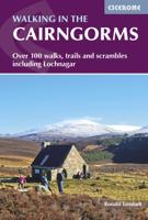
Wandelgids Walking in the Cairngorms | Cicerone
Uitstekende wandelgids, sommige meerdaags, voor dit uitdagende wandelgebied in Schotland. This guidebook contains over 100 routes for walking in the Scottish Cairngorms. It includes 18 Munro summits and smaller viewpoint hills. Walks range in length from 1 to 26 miles and are graded for difficulty.    For the adventurous there are the best of the area's rocky scrambles, and the classic through-routes including the Lairig Ghru. For those looking for a more gentle alternative, there are easy, sandy trails wandering among the tall pines and along the banks of the great rivers Spey, Nethy and Dee.    Britain's biggest mountain range is home to exceptional and varied scenery - from the ancient Caledonian forest to the granite plateau, the glacial glens and high corries where green lochans lie below great crags of the plateau rim.  Along with the main Cairngorm range between Speyside and Deeside, the guidebook covers Lochnagar. It includes practical information on snack stops, public …
20,95
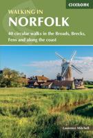
Wandelgids Walking in Norfolk | Cicerone
This guidebook describes 40 circular walks in Norfolk, including walks along the coast and walks exploring the Fens and the Broads. From 4 to 12 miles, these mostly flat walks use footpaths, bridleways and quiet country lanes, and some involve parts of long-distance paths, including the Peddars Way, Norfolk Coast Path, Boudica's Way and Weavers Way. The walks are divided into five sections: walks on the northeast coast and the Broads; walks in south Norfolk, the Yare and Waveney; walks in North Norfolk and the Coast; walks in Central Norfolk and Breckland; and walks in West Norfolk and the Fens. All routes are easy to moderate and can be done by anyone of reasonable fitness and enjoyed all year round.   Each route is described step-by-step, illustrated with 1:40K OS map extracts and packed with historical, geological and other information about the landscape the route passes through. The Fenland region of Norfolk's far west is flat and low-lying, as are the marshes and waterways of t…
20,95
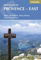
Wandelgids Walking in Provence - East | Cicerone
This guide offers 30 circular day walks in the eastern half of Provence, the large sun-kissed coastal region of south-east France. Spanning from the red rocks in the Ésterel on the Mediterranean to high mountains inland, the walks are set in the areas of the Alpes Maritimes, the Alpes de Haute-Provence and the Mercantour. Provence’s sunshine and Mediterranean charm attract many visitors to its coast, yet the area also has much more to offer the walker. The countryside inland boasts a range of scenery from remote mountaintops to spectacular gorges. History is everywhere, in medieval villages, arcaded streets, abbeys, churches and castles.    This guide covers the eastern regions, with its companion volume, Walking in Provence: West, covering the rest of this fascinating and historic landscape. The walking is incredibly diverse, and explores the country that hugs the Côte d'Azur and Italian border. The Alpes Maritimes rise craggy and wild above towns as unique as Grasse, Cannes and Mona…
21,95
Wandelgids walking in the Dordogne | Cicerone
Uitstekende wandelgids van dit geweldige gebied. goed beschreven met veel praktische informatie om de route te kunnen lopen, inclusief redelijke kaarten. Guidebook to 35 half-day and day walks in France's beautiful Dordogne region, based around Bergerac, Lalinde, Sarlat and Souillac (Lot). The walks, which range from 6 to 18.5km, take in the region’s myriad delights, from spectacular gorges to enchanting chateaux and charming medieval villages. All walks are within the capacity of the average walker, and are on well-marked paths or quiet roads. They are graded easy or medium; there are no long, steep climbs or abrupt descents.    There are step-by-step descriptions and maps for each route. Also included is information on the history, flora and fauna of the region, together with practical pointers such as what to take and when to go, as well as notes on waymarking, accommodation and transport. A route summary table and glossary are also provided.   Lying in south west France, the Dordo…
20,95

Klanten-reviews van Wandelgids Walking in Torridon, Fisherfield, Fannichs and An Teallach | Cicerone

Er zijn nog geen beoordelingen voor dit productBen jij de eerste die een review plaatst?

Meer over Wandelgids Walking in Torridon, Fisherfield, Fannichs and An Teallach | Cicerone

Productomschrijving

Guide to 50 walks and easy scrambles in north-western Scotland, covering Southern Torridon, Northern Torridon, Letterewe and Fisherfield, and the Fannichs. Ascents of 27 Munros, 20 Corbetts and 14 Grahams are included, with highlights including Liathach, Beinn Eighe, Beinn Alligin, An Teallach and Slioch. The walks are suitable for those with good navigation skills who are competent in a mountain environment.   All the walks in the guide are graded, with summary statistics provided, and each includes clear route description and mapping. There's also a route summary table to help with choosing appropriate walks. Background information on local geology, wildlife and history, and planning details on when to go, where to stay and what to take are included to make the most out of any trip to Torridon.   The region boasts spectacular and distinctive landscapes and breathtaking views. Steep-sided rocky mountains rise above long winding lochs, both freshwater and sea. From the hills there are vast panoramas out across the sea to the Hebrides and of mountains stretching out to the north, south and east. This is a land for those who love open spaces, vast horizons, and the domination of nature.

Productinformatie

    Verken gerelateerde categorieën

    Webshop.nl maakt gebruik van cookies. Ga je verder op onze website, ga dan akkoord met het plaatsen van cookies en de verwerking van deze data door ons en vermelde partners.