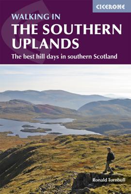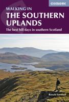
Wandelgids Walking in the Southern Uplands | Cicerone

0
This guidebook describes 44 routes and over 100 summits stretching across the Southern Uplands of Scotland, stretching south-west from Edinburgh to the English border, including the Galloway and Pentland Hills. The walks range between 2 and 29km, suitable for walkers of all abilities.   The Scottish Southern Uplands is a range that is about as big...

Verkopers met dit product

Verkoper
Bezorging
Prijs
DeZwerver.nl logo
DeZwerver.nl
2,95
21,95

Anderen bekeken ook

Wandelgids Walking in the Southern Uplands | Cicerone
This guidebook describes 44 routes and over 100 summits stretching across the Southern Uplands of Scotland, stretching south-west from Edinburgh to the English border, including the Galloway and Pentland Hills. The walks range between 2 and 29km, suitable for walkers of all abilities.   The Scottish Southern Uplands is a range that is about as big as the English Pennines. It is wild hill country, with over 80 hills of 2000ft or more, and it boasts a real remoteness that is difficult to find elsewhere. All hillwalkers should experience these wonderfully characterful landscapes: green and gentle, but with hidden surprises and remote escapes.   The routes are suitable from spring to autumn, and on winter days with good weather and snow conditions. Each route provides OS mapping, information on distance, ascent, time, maximum altitude and terrain, as well as details of any variants or shortcuts. With notes on points of interest along the way as well as on transport and accommodation, the …
21,95
Wandelgids The Southern Upland Way | Cicerone
Uitstekende wandelgids van de Southern Upland Way, waarbij naast alle noodzakelijke informatie ook gebruik gemaakt wordt van de echte topografische kaart.   The Southern Upland Way is Scotland's coast-to-coast walk and the longest of the nation's Great Trails. 215 miles long, it links the pretty harbour village of Portpatrick on the west coast with Cockburnspath, a little south of Dunbar, in the east. The walk is at times a strenuous one, crossing the remote high moorland of the Galloway Hills, Carsphairn range, Lowthers, Ettrick Hills and Lammermuirs, calling for competence, fitness and self-reliance.    This guide presents advice on how best to plan and tackle this challenging but highly rewarding journey. The waymarked trail is presented in fourteen stages of 9–19 miles and suggestions for a rest day exploring Moffat and its environs are also included. It is possible either to backpack, taking advantage of five bothies and unlimited wild camping possibilities, or to stay in town…
20,95
Wandelgids Mountain Walking in Southern Catalunya | Cicerone
First English-language guide to mountain and coastal walking near Tortosa, Southern Catalunya, Spain, in the Parc Natural dels Ports, on the Card and Montsia massifs and along the coast. All easily accessible from Barcelona, Valencia and Reus but unknown outside the region. 30 idyllic winter routes for walkers of all experience and abilities.Seasonsgood walking from October through to May; when strong winds or the occasional dusting of snow arrive on the high ridges the sheltered coastal slopes provide good routesCentresTortosaDifficultyfrom broad tracks to airy scrambles round huge cliffs; walks graded for routefinding, scrambling and exposure; all within capabilities of experienced hill walkers rockclimbing skills and equipment are not neededMust SeeParc Natural dels Ports, herb-covered hillsides, high pine forest, Templar castles, picturesque hill villagesA dramatic coastal mountain region of great natural beauty, Southern Catalunya is mysteriously unknown outside Spain. In the moun…
20,50
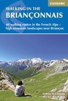
Wandelgids Walking in the Briançonnais | Cicerone
Handige duidelijke wandelgids van een mooi wandelgebied. De routes zijn accuraat beschreven met praktische informatie erbij. Kaartmateriaal is redelijk, soms wat schetsmatig. In berggebieden zijn wandelkaarten wel belangrijk! Bij de routes worden de juiste kaartnummers gegeven.    This guidebook presents 40 walks exploring the area around Briançon in France. The walks are divided into 6 sections covering the valleys of Clarée, Cerveyrette, Ayes, Durance and Guisane, as well as the area around Vallouise and Montgenèvre. The walks are circular and range in distance from 4 to 21 km. Graded easy to very hard, there is a walk to suit all abilities.    Dominated on all sides by jagged peaks, and perched on a rocky spur at the nucleus of five beautiful valleys, the city of Briançon lies almost at the southernmost tip of the main Alpine range. The Briançonnais, the surrounding region to which it gives its name, is a stunning mountain wilderness packed with everything one would expect from a h…
23,95
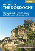
Wandelgids walking in the Dordogne | Cicerone
Uitstekende wandelgids van dit geweldige gebied. goed beschreven met veel praktische informatie om de route te kunnen lopen, inclusief redelijke kaarten. Guidebook to 35 half-day and day walks in France's beautiful Dordogne region, based around Bergerac, Lalinde, Sarlat and Souillac (Lot). The walks, which range from 6 to 18.5km, take in the region’s myriad delights, from spectacular gorges to enchanting chateaux and charming medieval villages. All walks are within the capacity of the average walker, and are on well-marked paths or quiet roads. They are graded easy or medium; there are no long, steep climbs or abrupt descents.    There are step-by-step descriptions and maps for each route. Also included is information on the history, flora and fauna of the region, together with practical pointers such as what to take and when to go, as well as notes on waymarking, accommodation and transport. A route summary table and glossary are also provided.   Lying in south west France, the Dordo…
20,95
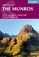
Wandelgids 1 Walking The Munros Vol 1 Southern, Central and Western Highlands - Schotland | Cicerone
Uitstekende wandelgids van het zuiden, midden en westen van de Schotse Hooglanden. Goed beschreven met veel praktische informatie om de route te kunnen lopen, inclusief redelijke kaarten. Guidebook to walking the Munros in southern, central and western Highlands. Describes 69 challenging routes across 139 of the iconic 3000ft+ mountains covering areas such as Glencoe, Bridge of Orchy and Mull. Includes routes up Ben More, Ben Alder, Ben Lomond and Ben Nevis, the highest mountain in the British Isles. Volume 1 of two guidebooks.   Seasons The guide is intended for summer hillwalkers (usually April/May to October in Scotland). In winter conditions the routes become more serious mountaineering expeditions requiring appropriate skills, equipment and experience.   Centres Arrochar, Crianlarich, Killin, Pitlochry, Tyndrum, Glencoe, Fort William, Spean Bridge, Dalwhinnie, Braemar, Glenshee   Difficulty Most of the Munros are straightforward walks but some involve ridge walking, sc…
20,95
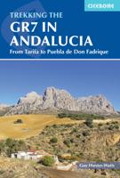
Wandelgids Walking the GR7 in Andalucia | Cicerone
Uitstekende wandelgids van een gerenommeerde Engelse uitgever. De tochten zijn met zorg beschreven en voorzien van allerhande nuttige informatie. With its white sandy beaches, pine forests, snow-capped peaks, traditional villages, lush river valleys and olive groves, the GR7 in Andalucía takes you on a journey through the most geographically diverse region on the Iberian peninsula. This wonderfully varied route starts at the southernmost tip of Spain at Tarifa, and meanders through the provinces of Cádiz and Málaga before dividing. The northern route heads through Córdoba and Jaén provinces (711km in total), whilst the southern route passes through Almería and Granada (720km). The route crosses seven stunning natural parks and the Sierra Nevada national park. • The first guide to cover the whole of the GR7 in Andalucía. • Detailed route description for around 60 days of walking, with options for creating shorter sections and days. • Information on all the villages en route offering ac…
26,50
Wandelgids Walking in the Algarve | Cicerone
Uitstekende wandelgids van de Algarve. Goed beschreven met veel praktische informatie om de routes te kunnen lopen, inclusief redelijke kaarten. This guidebook describes 33 walks in the beautiful Algarve in southern Portugal. Boasting good weather, easy access, stunning scenery and some great hiking trails, the region is a perfect destination for a walking holiday. It is best known for its spectacular coastline: the coastal trails presented here afford ample opportunity to admire the plunging sinkholes, striking sea-cliffs and rock-hugged beaches. However, the interior is every bit as beautiful and other walks explore the forested slopes of Monchique and the tranquil countryside between the mountains and coast.   The routes range from 3.5 to 17km and cover the sun-kissed south coast, the rugged Vicentina Coast, the Monchique mountains and traditional villages of the eastern Algarve. Many can be accessed by public transport and details, along with tips on refreshment opportunities on r…
23,95
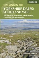
Wandelgids Walking in the Yorkshire Dales: South and West | Cicerone
Veelzijdige wandelgids van een deel van de Yorkshire Dales, goede kaarten en beschrijvingen en veel keuze uit een behoorlijk aantal wandelingen. Part of a two-book set, this guidebook describes 44 walks in the southern and western Yorkshire Dales, including the famous 23 mile Three Peaks circuit over Pen-y-Ghent, Whernside and Ingleborough. The other, mostly circular routes of 3½ to 13 miles cover the scenic region between Sedbergh, Kirkby Lonsdale, Settle, Skipton and Grassington. The Yorkshire Dales need little introduction: their picturesque scenery and hundreds of miles of footpaths, tracks and bridleways have been attracting walkers for decades. Part of a two-volume set, this guidebook presents over 40 routes in the south and west of the National Park, with bases including Sedburgh, Malham, Grassington, Skipton, Settle and Kirkby Lonsdale. The walks cover the valleys of Wharfedale, Littondale, Malhamdale, Ribblesdale and Dentdale – each with its own distinctive landscape and char…
19,95
Wandelgids Walking in the Isles of Scilly | Cicerone
Uitstekende wandelgids van dit geweldige gebied. goed beschreven met veel praktische informatie om de route te kunnen lopen, inclusief redelijke kaarten. This guidebook to walking on the Scilly Isles at the south-western edge of Britain includes 11 day walks and 4 boat trips, perfect for a fortnight away from it all. The walks are between 2 and 16km long, and explore the larger islands such as Tresco, St Martin's, St Mary's, St Agnes and Bryher as well as smaller islands in the archipelago. Alongside the walks, which are suitable for walkers of all abilities, are 4 Boat Trips which explore Annet and the Western Rocks, the Norrard Rocks, St Helens and Teän as well as the Eastern Isles.   With their mild climate and relaxing atmosphere, the Isles make an ideal destination for a retreat, with stunning scenery, rich bird life and myriad wildflowers. Basking in sunshine, rising green and pleasant from the blue Atlantic Ocean, fringed by rugged cliffs and sandy beaches, they reveal their ch…
12,95

Klanten-reviews van Wandelgids Walking in the Southern Uplands | Cicerone

Er zijn nog geen beoordelingen voor dit productBen jij de eerste die een review plaatst?

Meer over Wandelgids Walking in the Southern Uplands | Cicerone

Productomschrijving

This guidebook describes 44 routes and over 100 summits stretching across the Southern Uplands of Scotland, stretching south-west from Edinburgh to the English border, including the Galloway and Pentland Hills. The walks range between 2 and 29km, suitable for walkers of all abilities.   The Scottish Southern Uplands is a range that is about as big as the English Pennines. It is wild hill country, with over 80 hills of 2000ft or more, and it boasts a real remoteness that is difficult to find elsewhere. All hillwalkers should experience these wonderfully characterful landscapes: green and gentle, but with hidden surprises and remote escapes.   The routes are suitable from spring to autumn, and on winter days with good weather and snow conditions. Each route provides OS mapping, information on distance, ascent, time, maximum altitude and terrain, as well as details of any variants or shortcuts. With notes on points of interest along the way as well as on transport and accommodation, the guide gives all the information walkers need.

Productinformatie

    Verken gerelateerde categorieën

    Webshop.nl maakt gebruik van cookies. Ga je verder op onze website, ga dan akkoord met het plaatsen van cookies en de verwerking van deze data door ons en vermelde partners.