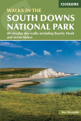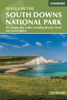
Wandelgids Walking in the South Downs National Park | Cicerone

0
Goede wandelgids uit de bekende Cicerone serie, dus met mooie foto's en duidelijke routebeschrijvingen en kaartjes. A guidebook to 40 circular day walks in the South Downs National Park. Exploring the beautiful chalk hills between Eastbourne and Winchester, there’s something for beginner and experienced walkers alike.   The walks range in lengt...

Verkopers met dit product

Verkoper
Bezorging
Prijs
DeZwerver.nl logo
DeZwerver.nl
2,95
21,95

Anderen bekeken ook

Wandelgids Walking in the South Downs National Park | Cicerone
Goede wandelgids uit de bekende Cicerone serie, dus met mooie foto's en duidelijke routebeschrijvingen en kaartjes. A guidebook to 40 circular day walks in the South Downs National Park. Exploring the beautiful chalk hills between Eastbourne and Winchester, there’s something for beginner and experienced walkers alike.   The walks range in length from 8 to 18km (5–11 miles), each is circular and where possible begins and ends at a place accessible by public transport.   1:50,000 OS maps are included for each walk Detailed information on public transport, accommodation and car parking Highlights include Beachy Head and Seven Sisters Easy access from Brighton and Worthing  
21,95
Wandelgids Walking in the Yorkshire Dales: South and West | Cicerone
Veelzijdige wandelgids van een deel van de Yorkshire Dales, goede kaarten en beschrijvingen en veel keuze uit een behoorlijk aantal wandelingen. Part of a two-book set, this guidebook describes 44 walks in the southern and western Yorkshire Dales, including the famous 23 mile Three Peaks circuit over Pen-y-Ghent, Whernside and Ingleborough. The other, mostly circular routes of 3½ to 13 miles cover the scenic region between Sedbergh, Kirkby Lonsdale, Settle, Skipton and Grassington. The Yorkshire Dales need little introduction: their picturesque scenery and hundreds of miles of footpaths, tracks and bridleways have been attracting walkers for decades. Part of a two-volume set, this guidebook presents over 40 routes in the south and west of the National Park, with bases including Sedburgh, Malham, Grassington, Skipton, Settle and Kirkby Lonsdale. The walks cover the valleys of Wharfedale, Littondale, Malhamdale, Ribblesdale and Dentdale – each with its own distinctive landscape and char…
19,95
Wandelgids Walking in the Haute Savoie: South | Cicerone
Uitstekende wandelgids van dit geweldige gebied. goed beschreven met veel praktische informatie om de route te kunnen lopen, inclusief redelijke kaarten.   A guidebook of walks in the lovely Haute Savoie mountains of France. This guide describes 30 circular routes of between 7 and 20km, based around Annecy, La Clusaz, Grand Bornand, Plateau d'Assy, Samoëns, Sixt, Sallanches, Thônes, la Roche-sur-Foron. Graded from easy to difficult, there are walks to suit most abilities, but a few have some exposed sections and need a head for heights.   The guidebook is divided into 6 areas covering the Arve Valley, the Haut Giffre valley, the Chaîne des Aravis (north and south), Plateau de la Borne and Lake Annecy. Alongside a detailed route description and map, each walk has a summary of all you need to know before you set out (distance, time to walk, ascent, maximum altitude, grade and instructions for accessing the start). There is advice on travel, accommodation and equipment, as well as inform…
20,95
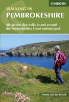
Wandelgids Walking in Pembrokeshire | Cicerone
Uitstekende wandelgids van dit mooie gebied aan de kust van Wales: het Pembrokeshire Coast national park. Goed beschreven met veel praktische informatie om de route te kunnen lopen, inclusief redelijke kaarten. Guidebook to 40 circular walks in Pembrokeshire in Wales. The routes, which range from 1 to 12 miles, take in the dramatic beauty of the national park and its coast, the Daugleddau and the Preseli Hills, while exploring wooded gorges, prehistoric hillforts and medieval castles.   Step-by-step route descriptions are accompanied by 1:50,000 mapping. For each route, information is also given regarding parking and public transport options, as well as toilets and refreshments available along the way. The guide also includes a useful route summary table, plus information on tides, the terrain, and weather in the region.   This collection of walks includes something for everyone, from novices to experienced ramblers. None of the walks demand technical skill and, in good weather, pose …
18,50
Wandelgids Walking on the North Wessex Downs | Cicerone
Guidebook to 30 circular walks in the North Wessex Downs Area of Outstanding Natural Beauty (AONB). The routes, which range from 7 to 21km (4 to 13 miles), take in parts of four counties - Berkshire, Hampshire, Wiltshire and Oxfordshire.   The North Wessex Downs are accessible hills rising above the towns and rural plains of southern England and rolling gently west from Reading and Basingstoke to Swindon and down past Marlborough to Andover. The walks allow you to explore parts of the Ridgeway National Trail, the Kennet and Avon Canal and stunning historic sites such as Avebury, the 3000-year-old Uffington White Horse, impressive Neolithic long barrows and Iron Age hill forts.   Alongside clear route descriptions and OS maps are plenty of details about points of interest, as well as practical information on the area, from public transport links to ideal refreshment stops on each walk. The result is an ideal companion to exploring both the popular and untouched corners of the North Wes…
19,95
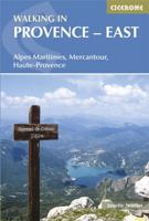
Wandelgids Walking in Provence - East | Cicerone
This guide offers 30 circular day walks in the eastern half of Provence, the large sun-kissed coastal region of south-east France. Spanning from the red rocks in the Ésterel on the Mediterranean to high mountains inland, the walks are set in the areas of the Alpes Maritimes, the Alpes de Haute-Provence and the Mercantour. Provence’s sunshine and Mediterranean charm attract many visitors to its coast, yet the area also has much more to offer the walker. The countryside inland boasts a range of scenery from remote mountaintops to spectacular gorges. History is everywhere, in medieval villages, arcaded streets, abbeys, churches and castles.    This guide covers the eastern regions, with its companion volume, Walking in Provence: West, covering the rest of this fascinating and historic landscape. The walking is incredibly diverse, and explores the country that hugs the Côte d'Azur and Italian border. The Alpes Maritimes rise craggy and wild above towns as unique as Grasse, Cannes and Mona…
21,95
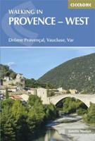
Wandelgids Walking in Provence - West | Cicerone
This guide offers 30 circular day walks in the western half of Provence, the large sun-kissed coastal region of south-east France. Spanning from the Baronnies in the north to the Ste-Baume ridge in the south, the walks are set in the areas of the Drôme Provençale, Vaucluse and the Var. Provence’s sunshine and Mediterranean charm attract many visitors to its coast, yet the area also has much more to offer the walker. The countryside inland boasts a range of scenery from remote mountaintops to spectacular gorges. History is everywhere, in medieval villages, arcaded streets, abbeys, churches and castles.    This guide covers the western regions, with its companion volume, Walking in Provence: East, covering the rest of this fascinating and historic landscape. The walking is incredibly diverse; from the green waves of the Barronies hills in Drôme Provençale, to the unforgettable silhouette of Mont Ventoux giving way to limestone plateaux cut with ravines in the Vauclause. Further south li…
21,95
Wandelgids Walking in Italy's Stelvio National Park | Cicerone
Wandelgids voor de Stelvio Nationaal Park in de Rätische Alpen ( Alpi Retiche ) ten zuiden van de Splügenpas op de grens met het Zwitserse Graubünden. Engelstalige beschrijving van 38 dagwandelingen.   Aanbevolen wandelkaarten 1:25.000 voor deze gids Wandelkaart 008 Ortles - Cevedale - Ortlergebiet | Tabacco Editrice   Wandelkaart 045 Latsch - Martell - Schlanders- Laces - Val Martello - Silandro | Tabacco Editrice   Wandelkaart 048 Val di Peio - Val di Rabbi - Val di Sole | Tabacco Editrice   The wide range of 38 summer day walks in this guide explore the renowned Stelvio National Park in the Italian Rhaetian Alps. Bordering the Dolomites to the east, and Switzerland to the west, the Stelvio is one of the largest protected areas in all of the Alps. Its unspoilt landscape ranges from valley farmland to forested hillsides and alpine meadows, and up to a wilderness of rugged glaciated summits and ridges, the highest of which is Ortler, at 3905m.   The walks, a selection of routes from e…
20,95
Wandelgids Walking in the North Pennines | Cicerone
Uitstekende wandelgids van dit geweldige gebied. goed beschreven met veel praktische informatie om de route te kunnen lopen, inclusief redelijke kaarten. This guidebook describes 50 day walks across the North Pennines, England's remotest Area of Outstanding Natural Beauty taking in parts of Cumbria, County Durham and Northumberland. Most of the routes are circular and they range from 5 to 14 miles, with something to suit all abilities. Route descriptions are accompanied by 1:50K OS mapping. A guidebook to day walks in the North Pennines Area of Outstanding Natural Beauty (AONB), across Cumbria, County Durham and Northumberland. The book includes 50 walks exploring England’s ‘last wilderness’, ranging from 5 miles (8km) to 14 miles (23km). Most are circular, though there are some linear routes, and there is something to suit all abilities over a variety of terrain. Route descriptions are illustrated with OS mapping and colour photographs, and the book includes details of local transpor…
19,95
Wandelgids Walking in Northumberland | Cicerone
De wandelgidsen van Cicerone zijn toonaangevend als het gaat om kwaliteit en de hoeveelheid verschillende bestemmingen. De routes zijn helder en duidelijk beschreven, kaartmateriaal is veelal van de topografische dienst op schaal 1:50.000 en de praktische informatie is bondig maar zeer relevant.    A guidebook to 36 walks exploring Northumberland, including the national park, coast, Cheviots, North Pennines and Kielder. The walks cover a wide variety of terrain and include full days on the hills and coast and shorter walks at lower levels, so there is something for everyone. The walks are graded (although none present any technical difficulties) and accessible from bases such as Alnwick, Rothbury and Hexham.   They range from 7 to 21km (4–13 miles) and can be enjoyed in 2–7 hours. 1:50,000 OS maps included for each walkHighlights include Hadrian's Wall, Lindisfarne Priory, The Cheviot, Berwick and Bamburgh and Dunstanburgh CastlesNotes on refreshments and public transportBackground…
20,95

Klanten-reviews van Wandelgids Walking in the South Downs National Park | Cicerone

Er zijn nog geen beoordelingen voor dit productBen jij de eerste die een review plaatst?

Meer over Wandelgids Walking in the South Downs National Park | Cicerone

Productomschrijving

Goede wandelgids uit de bekende Cicerone serie, dus met mooie foto's en duidelijke routebeschrijvingen en kaartjes.

A guidebook to 40 circular day walks in the South Downs National Park. Exploring the beautiful chalk hills between Eastbourne and Winchester, there’s something for beginner and experienced walkers alike.   The walks range in length from 8 to 18km (5–11 miles), each is circular and where possible begins and ends at a place accessible by public transport.   1:50,000 OS maps are included for each walk Detailed information on public transport, accommodation and car parking Highlights include Beachy Head and Seven Sisters Easy access from Brighton and Worthing


Productinformatie

    Verken gerelateerde categorieën

    Webshop.nl maakt gebruik van cookies. Ga je verder op onze website, ga dan akkoord met het plaatsen van cookies en de verwerking van deze data door ons en vermelde partners.