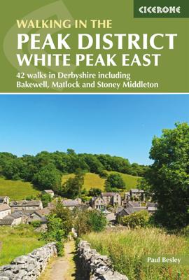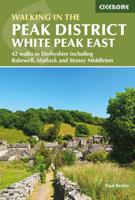
Wandelgids Walking in the Peak District - White Peak East | Cicerone

0
Uitstekende wandelgids van het Peak District van de gerenommeerde uitgever Cicerone.   This guidebook provides 35 day walks and 7 longer walks and trails exploring the eastern section of Derbyshire's limestone area. The walks are spread across the area, starting in pleasant towns and villages including Bakewell, Tissington, Eyam and Middleton. Lar...

Verkopers met dit product

Verkoper
Bezorging
Prijs
DeZwerver.nl logo
DeZwerver.nl
2,95
18,95

Anderen bekeken ook

Wandelgids Walking in Provence - East | Cicerone
This guide offers 30 circular day walks in the eastern half of Provence, the large sun-kissed coastal region of south-east France. Spanning from the red rocks in the Ésterel on the Mediterranean to high mountains inland, the walks are set in the areas of the Alpes Maritimes, the Alpes de Haute-Provence and the Mercantour. Provence’s sunshine and Mediterranean charm attract many visitors to its coast, yet the area also has much more to offer the walker. The countryside inland boasts a range of scenery from remote mountaintops to spectacular gorges. History is everywhere, in medieval villages, arcaded streets, abbeys, churches and castles.    This guide covers the eastern regions, with its companion volume, Walking in Provence: West, covering the rest of this fascinating and historic landscape. The walking is incredibly diverse, and explores the country that hugs the Côte d'Azur and Italian border. The Alpes Maritimes rise craggy and wild above towns as unique as Grasse, Cannes and Mona…
21,95
Wandelgids Walking in the Salzkammergut - the Austrian Lake District | Cicerone
Guidebook describing 30 day walks among the lakes and mountains of Austria's Salzkammergut. Easily accessible from Salzburg, the area is sometimes described as the Austrian Lake District. Routes range from easy lakeside strolls and walks to local points of interest to more strenuous through-routes and ascents of the neighbouring peaks. Guidebook of 30 stunning day walks in the beautiful Salzkammergut lake district of Austria. Easy to get to from Linz and Salzburg, the area is studded with lakes and bristling with mountain peaks, and has a great range of waymarked trails, from lakeside strolls to challenging mountain walks. The routes in this book are within the capabilities of any reasonably fit walker, many are suitable for family hiking, and cablecars and lifts can often be used to make walks shorter or easier. Walks range from 6 to 16km and a simple grading system makes it easy to choose the right one.   Walks are centred around a number of bases, such as Bad Ischl, Fuschl am See, …
24,95
Wandelgids Walking in the Auvergne | Cicerone
Uitgebreide wandelgids van de Auvergne: goede beschrijvingen, veel keuze, kaarten wat minder goed. This handy guidebook offers the finest day walks in five different areas of the Auvergne, an often-forgotten region in central France perfect for accessible day walking in a unique and spectacular landscape. Towns such as Vichy, Clermont-Ferrand and Puy-en-Velay also offer delightful places to base yourself for that perfect walking holiday. The ridges, rocky peaks and verdant valleys of the Cantal supervolcano dominate south-western Auvergne. The centre of the region hosts the unique chain of 'puys' with their pudding bowl forms and the pristine crater lakes of the Sancy massif. In the north, the Montagne Bourbonnaise preserves a pastoral way of life which is quintessentially French while the Haute Loire's rivers and medieval abbeys reward those venturing further off the beaten track. Notes on the geology and history of points of interest passed en route help you to get the most out of y…
19,95
Wandelgids Karawanken - Slovenie - Walking in the Karavanke | Cicerone
Goede wandelgids met veel dagtochten; redelijk kaartmateriaal en goede praktische informatie. This guidebook offers 23 walking routes set across the magnificent 120km-long Karavanke mountain range, which forms a natural border between Austria and Slovenia. Commonly known as 'the way the Alps used to be', as it is yet to experience the extent of commercial development known by the Western Alps, it is one of the longest ranges in Western Europe but it remains genuinely unspoilt and relatively unvisited by English-speaking hillwalkers. The guide's walks begin in pretty towns and villages, and most of them access the peaks from the relatively more gentle Slovenian side of the range, where forest-clad slopes lead to grassy summits where spectacular views can be enjoyed. Arranged by peak from west to east along the range, most of the summits can be reached by waymarked paths and trails. The guide gives all the practical details you need on transport, accessing the routes, accommodation and …
20,95
Wandelgids Walking in Andalucia - Andalusië | Cicerone
Mooi en duidelijke wandelgids over bepaalde streken in Andalusië: goed beschreven wandelingen met een redelijke kaart. De tekst is behoorlijk kompleet. Daarnaast ook praktische informatie per route. This guidebook explores six of Andalucía's most beautiful Natural Parks, the Sierra Nevada regions of Aracena, Grazalema, Los Alcornocales and the Gaucín, La Axarquía, the Alpujarras and Cazorla, along the great belt of the Cordillera Bética mountains. The thirty-six half-day and full-day mostly circular walks are evenly split within these six regions, and range in length from 4 to 21km. Walks are graded and some involve steep ascents and descents, all within the capabilities of a reasonably fit walker. The vast mountain range of the Cordillera Bética offers some of the finest year-round walking in Europe. Towering above the Mediterranean, the highest peaks of the Sierra Nevada rise to almost 3500m, mainland Spain's highest mountains. And wrapped within this mighty belt of mountains are s…
22,95
Wandelgids Walking in the Thames Valley | Cicerone
Walking in the Thames Valley offers 25 challenging circular walks around the River Thames and River Kennet in the south of England, taking in the Southern Chilterns, the Berkshire and North Hampshire Downs, Southern Oxfordshire and the eastern edge of Wiltshire. All routes are within easy reach of Reading, Newbury, Abingdon and London. While some walks visit Iron Age hill forts, others pass more modern features such as Wilton Windmill and the Kennet and Avon Canal. Some follow sections of the Ridgeway, while others meander along the banks of the Thames. What they all have in common is that they take the keen rambler to some of the best parts of the Thames Valley – a patchwork of open chalk grassland, broadleaved woodland and farmland and home to two Areas of Outstanding Natural Beauty. • walks from 10 to 18 miles, including one 2-day route • shorter, less strenuous alternatives for many of the walks • detailed route descriptions with information on local points of interest, OS mapping…
18,50
Wandelgids Beieren - Walking in the Bavarian Alps | Cicerone
Wandelgids met dagtochten: goed beschreven met veel praktische informatie om de route te kunnen lopen, inclusief redelijke kaarten. Enorm veel keus in een groot gebied! This guidebook of walks explores Germany's Bavarian Alps. Lying along the German-Austrian border in a thin sliver of land roughly 300km long, this area contains some of the most spectacular walking and beautiful scenery that Germany has to offer. 70 graded walks explore mountain landscapes, wild mountain gorges and alpine meadows as well as the region's picturesque villages, opulent baroque churches and fairy-tale castles like Neuschwanstein. The walks are divided into six mountain areas, grouped around base towns to make planning a walking holiday as easy as possible. Bases include Oberstdorf, Garmisch-Partenkirchen, Mittenwald, Marquartstein, Inzell, Oberammergau and Ramsau among others. Mountain walks are mainly between 3 and 8 hours duration, though some longer walks are included staying at mountain huts. The guide…
24,95
Wandelgids Walking in Zermatt and Saas-Fee | Cicerone
Wandelgids met dagtochten: goed beschreven met veel praktische informatie om de route te kunnen lopen, inclusief redelijke kaarten. Enorm veel keus in een groot gebied! Guidebook describing 50 varied walks in the Valais region in the heart of the Swiss Alps. The graded day walks based around the popular resort towns of Zermatt and Saas-Fee explore the Mattertal and Saastal valleys and the surrounding mountains. Ranging from 4 to 18km, the easily accessible routes make use of the area's extensive network of well-made mountain paths and its lift system. There are walks here to suit all tastes, from low-level lake walks or easy strolls up to mountain restaurants, through to serious mountain outings on steep and rocky trails. Distance, walking time and difficulty are shown for each route, and the detailed route description is accompanied by clear mapping.   Dominated by 4000m the giants, the Matterhorn and Monte Rosa, this is a land of contrasts, with snow-capped mountains and glaciers ab…
23,95
Wandelgids South Peak District : Including Bakewell and Dovedale | Hallewell Publications
Rewalked and updated in 2017/19, Walks South Peak District features walks in the gentler, southern half of the Peak District National Park; an area of low, green hills intersected by narrow valleys. The area's limestone is worked into numerous rock formations notably the famous spires and caves in Dovedale, and the long, low 'edges' above Curbar and Baslow. The main towns in the area are Buxton and Bakewell, but the walks pass numerous picturesque villages, as well as the splendid stately home of Chatsworth House. Walks range from 2 to 7.5 miles (3-12kms). Routes include Curbar Edge, Bakewell to Chatsworth, Thor's Cave & Wetton Hill, Dovedale and Mill Dale and The Roaches. This guide is part of a popular series of A6 pocket walking guides which describe routes which are suitable for walkers of all abilities and to suit all tastes. Route descriptions are accompanied by 2-colour sketch maps. The guides are illustrated with line illustrations, and will provide walkers with a good introdu…
5,95
Wandelgids Walking on Madeira | Cicerone
Zeer goede wandelgids van deze gerenommeerde Engelse uitgever. Met veel detail worden de wandelingen beschreven, voorzien van goede kaarten en ook nog praktische informatie. Veelal veel keuze uit het grote aantal dagtochten dat beschreven wordt. De afstand is tussen de 5 en 18 kilometer, al naar gelang wat je als wandelaar in gedachte hebt.    This guide describes a varied selection of 57 walks on the Portuguese island of Madeira, exploring the dramatic cliff coastline, scenic levadas (irrigation channels), dense laurisilva 'cloud' forests and high mountain peaks, plus three walks on neighbouring Porto Santo. There are routes to suit all abilities, from easy, level levada walks to steep and rugged mountain paths – some with exposed sections calling for a sure foot and good head for heights. Since the steep terrain of Madeira does not easily support circular walks, many of the routes are linear, however most can be accessed by public transport and there is the option to link routes to …
24,95

Klanten-reviews van Wandelgids Walking in the Peak District - White Peak East | Cicerone

Er zijn nog geen beoordelingen voor dit productBen jij de eerste die een review plaatst?

Meer over Wandelgids Walking in the Peak District - White Peak East | Cicerone

Productomschrijving

Uitstekende wandelgids van het Peak District van de gerenommeerde uitgever Cicerone.   This guidebook provides 35 day walks and 7 longer walks and trails exploring the eastern section of Derbyshire's limestone area. The walks are spread across the area, starting in pleasant towns and villages including Bakewell, Tissington, Eyam and Middleton. Largely travelling along well-marked paths over gentle rolling landscapes, these walks are suitable for walkers of all abilities.   The day walks range between 4 and 12 miles in length, and are illustrated with extracts of 1:50,000 OS mapping, while the longer walks and trails are covered by 1:100,000 scale mapping. Walkers can use the longer trails to link day walks into longer routes or explore the area on the three-day White Peak Circular, starting in Birchover.   While geologically fascinating with its layers of limestone and gritstone, the White Peak is also a landscape rich in history and art. These walks visit sites including medieval churches, the UNESCO World Heritage Site of Cromford Mill, and Eyam, a village devastated by plague in the 1660s. Out on the hills are stone circles and ancient sites such as the Neolithic burial site of Arbor Low.   Steden en Dorpen Ashbourne, Bakewell, Calver, Chatsworth, Cromford, Eyam, Hope, Matlock, Middleton, Monyash, Parwich, Stoney Middleton, Tissington, Tideswell, Youlgrave, Wirksworth, Winster

Productinformatie

    Verken gerelateerde categorieën

    Webshop.nl maakt gebruik van cookies. Ga je verder op onze website, ga dan akkoord met het plaatsen van cookies en de verwerking van deze data door ons en vermelde partners.