webshop.nl
Categorieën
  Sluiten

Meer Cicerone
Meer Cicerone in Literatuur boeken

Wandelgids Walking in the North Pennines | Cicerone

0
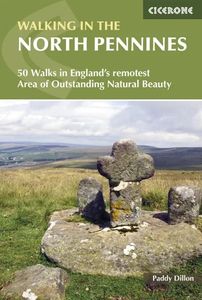
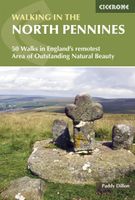
Uitstekende wandelgids van dit geweldige gebied. goed beschreven met veel praktische informatie om de route te kunnen lopen, inclusief redelijke kaarten. This guidebook describes 50 day walks across the North Pennines, England's remotest Area of Outstanding Natural Beauty taking in parts of Cumbria, County Durham and Northumberland. Most of the rou...

Webshops met dit product

Webshop
Bezorging
Prijs

Anderen bekeken ook

Wandelgids Walking in the North Pennines | Cicerone
Uitstekende wandelgids van dit geweldige gebied. goed beschreven met veel praktische informatie om de route te kunnen lopen, inclusief redelijke kaarten. This guidebook describes 50 day walks across the North Pennines, England's remotest Area of Outstanding Natural Beauty taking in parts of Cumbria, County Durham and Northumberland. Most of the routes are circular and they range from 5 to 14 miles, with something to suit all abilities. Route descriptions are accompanied by 1:50K OS mapping. A guidebook to day walks in the North Pennines Area of Outstanding Natural Beauty (AONB), across Cumbria, County Durham and Northumberland. The book includes 50 walks exploring England’s ‘last wilderness’, ranging from 5 miles (8km) to 14 miles (23km). Most are circular, though there are some linear routes, and there is something to suit all abilities over a variety of terrain. Route descriptions are illustrated with OS mapping and colour photographs, and the book includes details of local transport…
19,95
Wandelgids 39 Pathfinder Guides Durham, north Pennines and Tyne and We
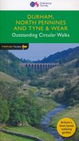
Wandelgids van een deel van Engeland, Schotland of Wales. Deze gids bevat 28 dagwandelingen, variërend van korte tochten tot pittige dagtochten. De bijbehorende kaarten zijn uitstekend: men heeft de topografische kaarten van Ordnance Survey gebruikt waarop de route is ingetekend. Daarnaast praktische informatie over de wandeling en wat beschrijvingen van het gebied. This Pathfinder walking guide covers both the Cumbrian and Durham sides of the North Pennines, a designated Area of Outstanding Beauty, and also extends eastwards to Durham to the North Sea Coast. The area contains some of the finest moorland in the country, walks across Bowes Moor and Holwick as well as low-level walks beside rivers, through woodlands and forests, by the coast, and former railway tracks.   There are 28 circular walks, graded by difficulty and created by seasoned walkers. Each route includes and extract of the OS Explorer map, route notes, photos and key features to look for on the way. There is a route to …
18,50
Wandelgids Walking in the Thames Valley | Cicerone
Walking in the Thames Valley offers 25 challenging circular walks around the River Thames and River Kennet in the south of England, taking in the Southern Chilterns, the Berkshire and North Hampshire Downs, Southern Oxfordshire and the eastern edge of Wiltshire. All routes are within easy reach of Reading, Newbury, Abingdon and London. While some walks visit Iron Age hill forts, others pass more modern features such as Wilton Windmill and the Kennet and Avon Canal. Some follow sections of the Ridgeway, while others meander along the banks of the Thames. What they all have in common is that they take the keen rambler to some of the best parts of the Thames Valley – a patchwork of open chalk grassland, broadleaved woodland and farmland and home to two Areas of Outstanding Natural Beauty. • walks from 10 to 18 miles, including one 2-day route • shorter, less strenuous alternatives for many of the walks • detailed route descriptions with information on local points of interest, OS mapping …
18,50
Wandelgids Walking in the New Forest | Cicerone
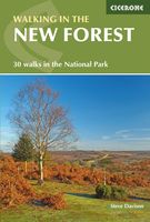
Goede wandelgids met veel dagtochten, geschikt voor iedereen.   A guidebook to 30 walks of between 3 and 10 miles set throughout the New Forest National Park in Hampshire and Wiltshire. Routes explore ancient woodland, heather-clad heath and dramatic coastline, all within easy reach of Southampton, Bournemouth and Salisbury. Walks for all abilities, easily combined to create longer challenges.   This guidebook presents 30 walks in the New Forest in Hampshire and Wiltshire, Britain's smallest National Park. Easily accessible from Southampton, Bournemouth, Salisbury and Winchester, the New Forest encompasses varied landscapes, from ancient woodlands to open heaths, rivers and coastline. Routes of between 5 and 16km (3 and 10 miles) explore the Forest, mainly on fairly flat terrain, often on well-defined tracks and paths. Most walks are suitable for all the family and many can be combined to make longer outings. Each walk is described in detail, highlighting the many points of interest …
18,50
Wandelgids Walking in Cumbria's Eden Valley - Lake district | Cicerone
Uitstekende Engelstalige wandelgids van dit prachtige gebied op de grens van Engeland en Schotland. Guidebook to 30 of the best walks in Cumbria's enchanting Eden Valley. The graded routes, which range from 3 to 15 miles, explore the region's diverse landscapes and offer dramatic views, either of the Pennines, the Lake District or the Scottish hills.  The walks, which work well from bases such as Kirkby Steven, Dufton and Appleby, are predominantly circular. Some of the linear routes link with the Settle-Carlisle railway. Map extracts from the 1:50K OS Landranger series accompany route description, and the handy route summary table makes it easy for walkers to compare routes. Invaluable information on transport, accommodation, clothing, equipment and safety is included, as are notes on the region's geology, wildlife and history.   Situated next to the iconic Lake District, the Eden Valley is often overlooked as a walking destination. This works in its favour - it is as quiet as it is s…
18,50
Wandelgids Walking in the Auvergne | Cicerone
Uitgebreide wandelgids van de Auvergne: goede beschrijvingen, veel keuze, kaarten wat minder goed. This handy guidebook offers the finest day walks in five different areas of the Auvergne, an often-forgotten region in central France perfect for accessible day walking in a unique and spectacular landscape. Towns such as Vichy, Clermont-Ferrand and Puy-en-Velay also offer delightful places to base yourself for that perfect walking holiday. The ridges, rocky peaks and verdant valleys of the Cantal supervolcano dominate south-western Auvergne. The centre of the region hosts the unique chain of 'puys' with their pudding bowl forms and the pristine crater lakes of the Sancy massif. In the north, the Montagne Bourbonnaise preserves a pastoral way of life which is quintessentially French while the Haute Loire's rivers and medieval abbeys reward those venturing further off the beaten track. Notes on the geology and history of points of interest passed en route help you to get the most out of yo…
19,95

Klanten-reviews van Wandelgids Walking in the North Pennines | Cicerone

Er zijn nog geen beoordelingen voor dit productBen jij de eerste die een review plaatst?

Meer over Wandelgids Walking in the North Pennines | Cicerone

Productomschrijving

Uitstekende wandelgids van dit geweldige gebied. goed beschreven met veel praktische informatie om de route te kunnen lopen, inclusief redelijke kaarten. This guidebook describes 50 day walks across the North Pennines, England's remotest Area of Outstanding Natural Beauty taking in parts of Cumbria, County Durham and Northumberland. Most of the routes are circular and they range from 5 to 14 miles, with something to suit all abilities. Route descriptions are accompanied by 1:50K OS mapping. A guidebook to day walks in the North Pennines Area of Outstanding Natural Beauty (AONB), across Cumbria, County Durham and Northumberland. The book includes 50 walks exploring England’s ‘last wilderness’, ranging from 5 miles (8km) to 14 miles (23km). Most are circular, though there are some linear routes, and there is something to suit all abilities over a variety of terrain. Route descriptions are illustrated with OS mapping and colour photographs, and the book includes details of local transport services, accommodation and tourist information centres. The walks cover a variety of terrain, from flat railway trackbeds to  pathless moorland, and provide the opportunity to explore the striking geological features and fascinating industrial heritage of the area.

Productspecificaties

Artikelnummer(s)
Brand
Cicerone

Verken gerelateerde categorieën

Webshop.nl maakt gebruik van cookies. Ga je verder op onze website, ga dan akkoord met het plaatsen van cookies en de verwerking van deze data door ons en vermelde partners.