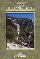
Wandelgids Walking in the Languedoc | Cicerone

0
Uitstekende wandelgids van dit geweldige gebied. goed beschreven met veel praktische informatie om de route te kunnen lopen, inclusief redelijke kaarten. 31 walks in the stunningly beautiful Parc Naturel du Haut-Languedoc. The climate is warm, the vineyards stretch out below you, and above is the towering Espinouse Massif. The Languedoc has for to...

Verkopers met dit product

Verkoper
Bezorging
Prijs
DeZwerver.nl logo
DeZwerver.nl
2,95
20,95

Anderen bekeken ook

Wandelgids Walking in the Languedoc | Cicerone
Uitstekende wandelgids van dit geweldige gebied. goed beschreven met veel praktische informatie om de route te kunnen lopen, inclusief redelijke kaarten. 31 walks in the stunningly beautiful Parc Naturel du Haut-Languedoc. The climate is warm, the vineyards stretch out below you, and above is the towering Espinouse Massif. The Languedoc has for too long been in the shadow of Provence. Sharing the same Mediterranean climate and vegetation, it has not had done to it what Peter Mayle did for the Luberon - yet! Apart from its beaches, it is a quiet, beautiful place which retains more than a hint of the old France. This book is the fruit of 10 years' exploration of the central part of the Languedoc, north of Béziers. Much of this area forms the Parc Naturel du Haut-Languedoc, at the heart of which is the stunning Espinouse massif, rising abruptly some 850m from the valley floor. Close by is the valley of Lac du Salagou, an enormous man-made lake surrounded by impressive hills. A little fur…
20,95
Wandelgids Walking in the Thames Valley | Cicerone
Walking in the Thames Valley offers 25 challenging circular walks around the River Thames and River Kennet in the south of England, taking in the Southern Chilterns, the Berkshire and North Hampshire Downs, Southern Oxfordshire and the eastern edge of Wiltshire. All routes are within easy reach of Reading, Newbury, Abingdon and London. While some walks visit Iron Age hill forts, others pass more modern features such as Wilton Windmill and the Kennet and Avon Canal. Some follow sections of the Ridgeway, while others meander along the banks of the Thames. What they all have in common is that they take the keen rambler to some of the best parts of the Thames Valley – a patchwork of open chalk grassland, broadleaved woodland and farmland and home to two Areas of Outstanding Natural Beauty. • walks from 10 to 18 miles, including one 2-day route • shorter, less strenuous alternatives for many of the walks • detailed route descriptions with information on local points of interest, OS mapping…
18,50
Wandelgids Walking in the Auvergne | Cicerone
Uitgebreide wandelgids van de Auvergne: goede beschrijvingen, veel keuze, kaarten wat minder goed. This handy guidebook offers the finest day walks in five different areas of the Auvergne, an often-forgotten region in central France perfect for accessible day walking in a unique and spectacular landscape. Towns such as Vichy, Clermont-Ferrand and Puy-en-Velay also offer delightful places to base yourself for that perfect walking holiday. The ridges, rocky peaks and verdant valleys of the Cantal supervolcano dominate south-western Auvergne. The centre of the region hosts the unique chain of 'puys' with their pudding bowl forms and the pristine crater lakes of the Sancy massif. In the north, the Montagne Bourbonnaise preserves a pastoral way of life which is quintessentially French while the Haute Loire's rivers and medieval abbeys reward those venturing further off the beaten track. Notes on the geology and history of points of interest passed en route help you to get the most out of y…
19,95
Wandelgids Walking in the Briançonnais | Cicerone
Handige duidelijke wandelgids van een mooi wandelgebied. De routes zijn accuraat beschreven met praktische informatie erbij. Kaartmateriaal is redelijk, soms wat schetsmatig. In berggebieden zijn wandelkaarten wel belangrijk! Bij de routes worden de juiste kaartnummers gegeven.    This guidebook presents 40 walks exploring the area around Briançon in France. The walks are divided into 6 sections covering the valleys of Clarée, Cerveyrette, Ayes, Durance and Guisane, as well as the area around Vallouise and Montgenèvre. The walks are circular and range in distance from 4 to 21 km. Graded easy to very hard, there is a walk to suit all abilities.    Dominated on all sides by jagged peaks, and perched on a rocky spur at the nucleus of five beautiful valleys, the city of Briançon lies almost at the southernmost tip of the main Alpine range. The Briançonnais, the surrounding region to which it gives its name, is a stunning mountain wilderness packed with everything one would expect from a h…
23,95
Wandelgids walking in the Dordogne | Cicerone
Uitstekende wandelgids van dit geweldige gebied. goed beschreven met veel praktische informatie om de route te kunnen lopen, inclusief redelijke kaarten. Guidebook to 35 half-day and day walks in France's beautiful Dordogne region, based around Bergerac, Lalinde, Sarlat and Souillac (Lot). The walks, which range from 6 to 18.5km, take in the region’s myriad delights, from spectacular gorges to enchanting chateaux and charming medieval villages. All walks are within the capacity of the average walker, and are on well-marked paths or quiet roads. They are graded easy or medium; there are no long, steep climbs or abrupt descents.    There are step-by-step descriptions and maps for each route. Also included is information on the history, flora and fauna of the region, together with practical pointers such as what to take and when to go, as well as notes on waymarking, accommodation and transport. A route summary table and glossary are also provided.   Lying in south west France, the Dordo…
20,95
Wandelgids Walking in Essex | Cicerone
Wandelgids met 25 dagtochten en een meerdaagse tocht in Essex.  Goede omschrijvingen, veel praktische informatie. Redelijk kaartmateriaal   This guidebook describes 25 coastal and inland day walks covering the whole of the county of Essex, stretching from the Lea Valley in the west and the Thames in the south over to the North Sea and up to the River Stour in the north. Walks range from 4 to 18 miles and are mostly circular. Also included is a description of the Essex Way which crosses the county in 11 stages from Manor Park, on the fringes of London, to the port of Harwich - a distance of 96 miles. The walks are suitable for all abilities and there are shorter alternatives for many of the longer routes.   With a huge variety of scenery and walking landscapes, Essex surprises and delights in equal measure. It boasts a 350-mile coastline (which, away from the busy seaside resorts, is barely known), numerous estuaries and river valleys, great and ancient forests, and more green lanes th…
18,95
Wandelgids Walking in the Forest of Bowland and Pendle | Cicerone
This handy guidebook contains 40 diverse circular day walks suitable for walkers with navigational skills. There is a variety of terrain covered in the Forest of Bowland and Pendle which makes it perfect for those who wish to explore an AONB. Some of the routes covered include: Ward's Stone, Pendle Hill, Longridge Fell and Fair Snape Fell. The Forest of Bowland and Pendle provide vastly differing terrain – from the lush farmlands of the Ribble valley to the more rugged rough pastures of the Forest of Bowland uplands and the huge boggy uplifts of the main Bowland massif itself.   The walks in this guidebook are suitable for those who already have good navigational skills and range from 3 miles to 12.5. For walkers who like to ‘collect’ summits, there are six Marilyns within the area of the Forest of Bowland and Pendle, only two of which (White Hill and Easington Fell) are not included in any of the walks. However, this guidebook does offer information on how to access both for those wh…
7,50
Wandelgids Walking in the Isles of Scilly | Cicerone
Uitstekende wandelgids van dit geweldige gebied. goed beschreven met veel praktische informatie om de route te kunnen lopen, inclusief redelijke kaarten. This guidebook to walking on the Scilly Isles at the south-western edge of Britain includes 11 day walks and 4 boat trips, perfect for a fortnight away from it all. The walks are between 2 and 16km long, and explore the larger islands such as Tresco, St Martin's, St Mary's, St Agnes and Bryher as well as smaller islands in the archipelago. Alongside the walks, which are suitable for walkers of all abilities, are 4 Boat Trips which explore Annet and the Western Rocks, the Norrard Rocks, St Helens and Teän as well as the Eastern Isles.   With their mild climate and relaxing atmosphere, the Isles make an ideal destination for a retreat, with stunning scenery, rich bird life and myriad wildflowers. Basking in sunshine, rising green and pleasant from the blue Atlantic Ocean, fringed by rugged cliffs and sandy beaches, they reveal their ch…
12,95
Wandelgids Walking in the Scottish Borders | Cicerone
This guidebook provides 45 day walks in the Scottish Borders. Separated into six sections, these walks are divided between the north and south Cheviots, Tweed, Ettrick, Moffat and Manor hills and feature main centres including Wooler, Kelso, Melrose, Peebles and Moffat. The guide's seventh section outlines long distance routes, including a walk along the Border from Gretna to Berwick-on-Tweed. The Scottish Borders are rich in both history and geology. These walks explore many historical sites, from Iron Age forts on hillsides to bastles and towers dating from the Border Reivers era. The stunning and varied scenery is a result of complex geological processes; a visit to Dobb's Linn showcases preserved fossils, while the coastline at St Abbs Head features iconic folded rock formations which are home to a myriad of birds including guillemots. Each walk features 1:50,000 OS mapping, comprehensive route description and plenty of information about points of interest along the route. The wal…
18,50
Wandelgids Walking in the Bernese Oberland | Cicerone
A guidebook to 50 day walks in Switzerland's Jungfrau region from the main bases of Grindelwald, Wengen, the Lauterbrunnen valley and Murren. These graded walks range from grade 1 almost level short walks through to grade 4 challenging Alpine routes, however, most are grades 2 or 3 and are suitable for walkers with some experience. Ranging in length from 5 to 23.5km the routes visit valleys, waterfalls and alpine huts.   Many also take advantage of the widespread public transport and lifts around the Bernese Oberland to provide options for walks at a higher altitude. Along with a detailed route description, each walk has 1:50,000 mapping and information on public transport access to the start and end points. Details of accommodation, alpine huts and facilities are also provided.
24,95

Klanten-reviews van Wandelgids Walking in the Languedoc | Cicerone

Er zijn nog geen beoordelingen voor dit productBen jij de eerste die een review plaatst?

Meer over Wandelgids Walking in the Languedoc | Cicerone

Productomschrijving

Uitstekende wandelgids van dit geweldige gebied. goed beschreven met veel praktische informatie om de route te kunnen lopen, inclusief redelijke kaarten.

31 walks in the stunningly beautiful Parc Naturel du Haut-Languedoc. The climate is warm, the vineyards stretch out below you, and above is the towering Espinouse Massif.

The Languedoc has for too long been in the shadow of Provence. Sharing the same Mediterranean climate and vegetation, it has not had done to it what Peter Mayle did for the Luberon - yet! Apart from its beaches, it is a quiet, beautiful place which retains more than a hint of the old France.

This book is the fruit of 10 years' exploration of the central part of the Languedoc, north of Béziers. Much of this area forms the Parc Naturel du Haut-Languedoc, at the heart of which is the stunning Espinouse massif, rising abruptly some 850m from the valley floor. Close by is the valley of Lac du Salagou, an enormous man-made lake surrounded by impressive hills. A little further east is the valley of the river Hérault, which provides the explorer with wonderful limestone gorges, caves and cliffs. All three of these areas are well provided with footpaths on which it is rare to see another human being; and, because this is France, a fine dinner awaits you at the end of the day.

The book aims to provide walks into these areas for hikers of all standards; some are very straightforward, others are for the very fit and experienced. All the walks described are circular.

Productinformatie

    Verken gerelateerde categorieën

    Webshop.nl maakt gebruik van cookies. Ga je verder op onze website, ga dan akkoord met het plaatsen van cookies en de verwerking van deze data door ons en vermelde partners.