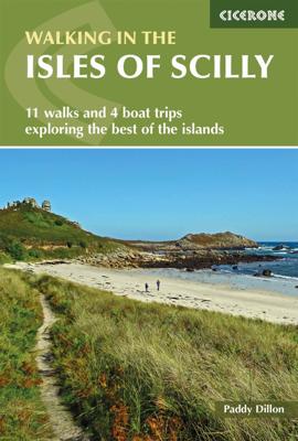
Wandelgids Walking in the Isles of Scilly | Cicerone

0
Uitstekende wandelgids van dit geweldige gebied. goed beschreven met veel praktische informatie om de route te kunnen lopen, inclusief redelijke kaarten. This guidebook to walking on the Scilly Isles at the south-western edge of Britain includes 11 day walks and 4 boat trips, perfect for a fortnight away from it all. The walks are between 2 and 16...

Verkopers met dit product

Verkoper
Bezorging
Prijs
DeZwerver.nl logo
DeZwerver.nl
2,95
12,95

Anderen bekeken ook

Wandelgids Walking in the Isles of Scilly | Cicerone
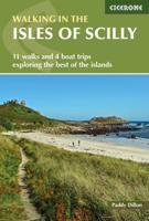
Uitstekende wandelgids van dit geweldige gebied. goed beschreven met veel praktische informatie om de route te kunnen lopen, inclusief redelijke kaarten. This guidebook to walking on the Scilly Isles at the south-western edge of Britain includes 11 day walks and 4 boat trips, perfect for a fortnight away from it all. The walks are between 2 and 16km long, and explore the larger islands such as Tresco, St Martin's, St Mary's, St Agnes and Bryher as well as smaller islands in the archipelago. Alongside the walks, which are suitable for walkers of all abilities, are 4 Boat Trips which explore Annet and the Western Rocks, the Norrard Rocks, St Helens and Teän as well as the Eastern Isles.   With their mild climate and relaxing atmosphere, the Isles make an ideal destination for a retreat, with stunning scenery, rich bird life and myriad wildflowers. Basking in sunshine, rising green and pleasant from the blue Atlantic Ocean, fringed by rugged cliffs and sandy beaches, they reveal their ch…
12,95
Wandelgids Walking on Rum and the Small Isles - Schotland | Cicerone
  A handy guidebook to walking and backpacking in the Western Isles of Scotland on Rum, Eigg, Muck, Canna, Coll and Tiree including a tough 55km backpack around the coast of Rum, a circuit of the Rum Cuillin and an ascent of An Sgurr (Eigg). 16 routes across all the islands suitable for a range of abilities exploring coasts, mountains and wilderness. The Small Isles, and the nearby Hebridean twins Coll and Tiree, offer adventurous walkers a fine range of routes, from the jagged volcanic peaks of the Cuillin on Rum to the beaches, dunes and machair pastures of its lower-lying neighbours. Many of the walks follow sublime coastlines, dotted with striking geological formations and teeming with wildlife.   Easier routes on Rum, along long-established paths, explore the National Nature Reserve with opportunities to spot deer, golden eagles, feral goats and Rum ponies along the way, and detailed information is included on each island's history, geology, wildlife, plants and flowers to help w…
20,95
Wandelgids Walking in Sicily - Sicilie | Cicerone
Uitstekende wandelgids van Abruzzo. Goed beschreven met veel praktische informatie om de routes te kunnen lopen, inclusief redelijke kaarten. Exploring this breathtaking island on foot is a journey through time. Sicily offers wild valleys pitted with Greek and Roman temples and ancient ruins - reminders of long-gone peoples. Mule tracks and age-old pathways have survived and reserve a wealth of surprises, starting with the carpets of brilliant wildflowers. Landscapes are grandiose. Olive groves thrive alongside citrus orchards, never far from snow-clad mountain ranges presided over by imposing volcanoes - ranging from extinct and visitable, through to placidly smoking, and to constantly active giants Etna and Stromboli from which fiery rivers of lava issue. In dramatic contrast is the string of peaceful offshore islands set in turquoise waters, which are pure Mediterranean in character.Sicily's stunning range of scenery, combined with its mild winters and hot dry summers, make rewardi…
20,95
Wandelgids Walking on Malta | Cicerone
Wandelgids met 33 dagtochten op Malta, Gozo en Comino. Goede omschrijvingen, veel praktische informatie. Redelijk kaartmateriaal. (goede wandelkaart Kompass / zie landkaarten) The Maltese Islands of Malta, Gozo and Comino bask in sunshine at the heart of the Mediterranean, between Europe and Africa. History has ensured that the islands have been colonised time and time again, leaving them with a colourful and complex history and heritage. The islands are a popular tourist destination. They offer plenty of historic walks, stunningly beautiful and dramatic architecture, and a good amount of excellent scenery, especially around the cliffs and coastlines. This guidebook describes 33 walks on Malta and its neighbouring islands of Gozo and Comino. Walks generally range from 3 to 17 km, and include Valetta, heritage trails, coastal walks and explorations inland, including the 30km 'Victoria Lines' route between Mgarr and Bahar ic-Caghaq. Malta offers year-round walking. This guidebook descri…
21,95
Wandelgids Walking in Cyprus | Cicerone
Uitstekende wandelgids, goed beschreven met veel praktische informatie om de route te kunnen lopen, inclusief redelijke kaarten There's far more to Cyprus than just the bustling resorts: the favourable climate, attractive scenery and many kilometres of footpaths and nature trails make it an ideal destination for walkers. This guidebook presents 44 graded walks spread across the island, covering both southern and northern Cyprus, with a slight focus on the central Troodos region. Clear description and mapping is presented for each route and a route summary table makes it easy to choose an appropriate walk.   The walks, of 3 to 20km, range from gentle strolls to longer, more demanding routes, sometimes involving steep ascents, difficult terrain or navigational challenge. They showcase Cyprus's captivating landscapes, from the sun-kissed coastline lapped by clear turquoise waters to the pine-clad slopes of the Troodos and Besparmak Mountains. Many visit sites of historical interest – inc…
23,95
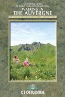
Wandelgids Walking in the Auvergne | Cicerone
Uitgebreide wandelgids van de Auvergne: goede beschrijvingen, veel keuze, kaarten wat minder goed. This handy guidebook offers the finest day walks in five different areas of the Auvergne, an often-forgotten region in central France perfect for accessible day walking in a unique and spectacular landscape. Towns such as Vichy, Clermont-Ferrand and Puy-en-Velay also offer delightful places to base yourself for that perfect walking holiday. The ridges, rocky peaks and verdant valleys of the Cantal supervolcano dominate south-western Auvergne. The centre of the region hosts the unique chain of 'puys' with their pudding bowl forms and the pristine crater lakes of the Sancy massif. In the north, the Montagne Bourbonnaise preserves a pastoral way of life which is quintessentially French while the Haute Loire's rivers and medieval abbeys reward those venturing further off the beaten track. Notes on the geology and history of points of interest passed en route help you to get the most out of y…
19,95
Wandelgids Walking in the Thames Valley | Cicerone
Walking in the Thames Valley offers 25 challenging circular walks around the River Thames and River Kennet in the south of England, taking in the Southern Chilterns, the Berkshire and North Hampshire Downs, Southern Oxfordshire and the eastern edge of Wiltshire. All routes are within easy reach of Reading, Newbury, Abingdon and London. While some walks visit Iron Age hill forts, others pass more modern features such as Wilton Windmill and the Kennet and Avon Canal. Some follow sections of the Ridgeway, while others meander along the banks of the Thames. What they all have in common is that they take the keen rambler to some of the best parts of the Thames Valley – a patchwork of open chalk grassland, broadleaved woodland and farmland and home to two Areas of Outstanding Natural Beauty. • walks from 10 to 18 miles, including one 2-day route • shorter, less strenuous alternatives for many of the walks • detailed route descriptions with information on local points of interest, OS mapping…
18,50
Wandelgids Walking on Guernsey, Alderney, Sark and Herm | Cicerone
Guidebook to 24 easy day walks on the Channel Islands of Guernsey, Alderney, Sark and Herm, and the 3-day Guernsey Coastal Walk. Making up part of the Channel Islands Way, the routes follow paths, tracks and quiet roads and total around 240km (150 miles). Uses detailed 1:15,000 scale States of Guernsey maps, with notes on travel, accommodation, plants and wildlife and the islands' fascinating history.   Seasons all year round, but particularly good in spring when the wild flowers are at their most colourful; busy during the summer, with long, sunny days; quieter in autumn; sometimes bleak in the winter   Centres St Peter Port; St Sampson   Difficulty good paths and tracks are used, along with quiet country roads, avoiding main roads wherever possible; gradients are often gentle, but there are some rugged cliff paths and occasional steep slopes and flights of steps; short walks can be combined to make longer ones   Must See excellent cliff coastline, rocky and sandy beaches; nature res…
19,95
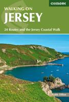
Wandelgids Walking on Jersey | Cicerone
This guidebook to Walking on Jersey describes 24 coastal and inland walks, ranging from 2 to 8 miles in length, visiting St Helier, St Aubin, St John, St Ouen and Grouville among other places. Almost all of the walks link directly with one or two othes, allowing all kinds of extensions to the routes to suit your timescale and ability. The walks can also be joined together to create the 48-mile Jersey Coastal Walk, and the Channel Island Way.   The walks described use good paths and tracks as well as quiet country roads. Occasional more rugged paths explore the island's excellent cliff coastline. Famous for sunshine, year-round walking, history and a wonderful coastline, Jersey is an intriguing destination for travellers. Outwardly British but with French overtones, the island has a long tourist season. It also has plenty of interesting historical sites and attractions to visit including castles, churches and museums.   24 coastal and inland walks suitable for most abilities historical…
19,95
Wandelgids Walking in the Briançonnais | Cicerone
Handige duidelijke wandelgids van een mooi wandelgebied. De routes zijn accuraat beschreven met praktische informatie erbij. Kaartmateriaal is redelijk, soms wat schetsmatig. In berggebieden zijn wandelkaarten wel belangrijk! Bij de routes worden de juiste kaartnummers gegeven.    This guidebook presents 40 walks exploring the area around Briançon in France. The walks are divided into 6 sections covering the valleys of Clarée, Cerveyrette, Ayes, Durance and Guisane, as well as the area around Vallouise and Montgenèvre. The walks are circular and range in distance from 4 to 21 km. Graded easy to very hard, there is a walk to suit all abilities.    Dominated on all sides by jagged peaks, and perched on a rocky spur at the nucleus of five beautiful valleys, the city of Briançon lies almost at the southernmost tip of the main Alpine range. The Briançonnais, the surrounding region to which it gives its name, is a stunning mountain wilderness packed with everything one would expect from a h…
23,95

Klanten-reviews van Wandelgids Walking in the Isles of Scilly | Cicerone

Er zijn nog geen beoordelingen voor dit productBen jij de eerste die een review plaatst?

Meer over Wandelgids Walking in the Isles of Scilly | Cicerone

Productomschrijving

Uitstekende wandelgids van dit geweldige gebied. goed beschreven met veel praktische informatie om de route te kunnen lopen, inclusief redelijke kaarten.

This guidebook to walking on the Scilly Isles at the south-western edge of Britain includes 11 day walks and 4 boat trips, perfect for a fortnight away from it all. The walks are between 2 and 16km long, and explore the larger islands such as Tresco, St Martin's, St Mary's, St Agnes and Bryher as well as smaller islands in the archipelago. Alongside the walks, which are suitable for walkers of all abilities, are 4 Boat Trips which explore Annet and the Western Rocks, the Norrard Rocks, St Helens and Teän as well as the Eastern Isles.   With their mild climate and relaxing atmosphere, the Isles make an ideal destination for a retreat, with stunning scenery, rich bird life and myriad wildflowers. Basking in sunshine, rising green and pleasant from the blue Atlantic Ocean, fringed by rugged cliffs and sandy beaches, they reveal their charms to those who walk the headlands, sail from island to island and take time to observe the sights, sounds and scents of the landscape. All routes are illustrated with OS mapping and contain lots of background information on the history, geology and ecology of the islands. There is also practical information on public transport services and accommodation.   Activities Walking, boat trips, birdwatching   Seasons Mild climate all year round. You should pre-book accommodation in August, as it gets busy.   Centres Hugh Town, St Agnes, Bryher, Tresco, St Martin's   Difficulty All easy, low-level walks   Must See Wildflowers, Hugh Town Garrison, Tresco Abbey Garden, boat trips (including the 'Seabird Specials'), Bird Life

Productinformatie

    Verken gerelateerde categorieën

    Webshop.nl maakt gebruik van cookies. Ga je verder op onze website, ga dan akkoord met het plaatsen van cookies en de verwerking van deze data door ons en vermelde partners.