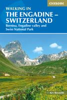
Wandelgids Walking in the Engadine - Engadin | Cicerone

0
Uitstekende wandelgids van Engadin. Goed beschreven met veel praktische informatie om de routes te kunnen lopen, kaartmateriaal is echter wel beperkt. A guidebook to 100 of author Kev Reynold's favourite routes in the Engadine. Varying from gentle rambles to adventurous high-level routes for the experienced mountain walker. Each graded route range...

Verkopers met dit product

Verkoper
Bezorging
Prijs
DeZwerver.nl logo
DeZwerver.nl
2,95
23,95

Anderen bekeken ook

Wandelgids Walking in the Cairngorms | Cicerone
Uitstekende wandelgids, sommige meerdaags, voor dit uitdagende wandelgebied in Schotland. This guidebook contains over 100 routes for walking in the Scottish Cairngorms. It includes 18 Munro summits and smaller viewpoint hills. Walks range in length from 1 to 26 miles and are graded for difficulty.    For the adventurous there are the best of the area's rocky scrambles, and the classic through-routes including the Lairig Ghru. For those looking for a more gentle alternative, there are easy, sandy trails wandering among the tall pines and along the banks of the great rivers Spey, Nethy and Dee.    Britain's biggest mountain range is home to exceptional and varied scenery - from the ancient Caledonian forest to the granite plateau, the glacial glens and high corries where green lochans lie below great crags of the plateau rim.  Along with the main Cairngorm range between Speyside and Deeside, the guidebook covers Lochnagar. It includes practical information on snack stops, public …
20,95
Wandelgids Walking in the Alps | Cicerone
Geweldig overzichtswerk van prachtige wandelroutes in de Alpen. Suggests many routes, and covers the range from the Maritime Alps of southern France to the Julian Alps of Slovenia. Walks vary from undemanding to long and tough, and everything in between. Walking is unquestionably the best method of exploring, and it is the mountain walker for whom journeys in the Alps reveal some of the finest views, the greatest contrasts. This book then is a definitive guide to the many thousands of possible routes, with a geographical span that ranges from the Maritime Alps of southern France to the Julians of Slovenia, from Italy's Gran Paradiso to the little-known Turnitzer Alps of eastern Austria, from the ice-bound giants of the Bernese Oberland to the green rolling Kitzbuheler Alps and the bizarre towers of the Dolomites of South Tirol, showing the amazing diversity of this wonderful mountain chain. There are walks to suit every taste: gentle and undemanding, long and tough, and everything in …
33,95
Wandelgids Karawanken - Slovenie - Walking in the Karavanke | Cicerone
Goede wandelgids met veel dagtochten; redelijk kaartmateriaal en goede praktische informatie. This guidebook offers 23 walking routes set across the magnificent 120km-long Karavanke mountain range, which forms a natural border between Austria and Slovenia. Commonly known as 'the way the Alps used to be', as it is yet to experience the extent of commercial development known by the Western Alps, it is one of the longest ranges in Western Europe but it remains genuinely unspoilt and relatively unvisited by English-speaking hillwalkers. The guide's walks begin in pretty towns and villages, and most of them access the peaks from the relatively more gentle Slovenian side of the range, where forest-clad slopes lead to grassy summits where spectacular views can be enjoyed. Arranged by peak from west to east along the range, most of the summits can be reached by waymarked paths and trails. The guide gives all the practical details you need on transport, accessing the routes, accommodation and …
20,95
Wandelgids Walking in the Thames Valley | Cicerone
Walking in the Thames Valley offers 25 challenging circular walks around the River Thames and River Kennet in the south of England, taking in the Southern Chilterns, the Berkshire and North Hampshire Downs, Southern Oxfordshire and the eastern edge of Wiltshire. All routes are within easy reach of Reading, Newbury, Abingdon and London. While some walks visit Iron Age hill forts, others pass more modern features such as Wilton Windmill and the Kennet and Avon Canal. Some follow sections of the Ridgeway, while others meander along the banks of the Thames. What they all have in common is that they take the keen rambler to some of the best parts of the Thames Valley – a patchwork of open chalk grassland, broadleaved woodland and farmland and home to two Areas of Outstanding Natural Beauty. • walks from 10 to 18 miles, including one 2-day route • shorter, less strenuous alternatives for many of the walks • detailed route descriptions with information on local points of interest, OS mapping…
18,50
Wandelgids The Hebrides - De Hebriden Schotland | Cicerone
This inspirational guide offers 50 varied hiking and backpacking routes on the Scottish Hebrides islands, set out in a large guidebook to be savoured. The hikes highlight all the very best landscapes and scenery to be found on the spectacular islands of the Hebrides, a wonderland for adventurous walkers to return to time and time again. Inspirational guidebook to walking in Scotland's Hebrides islands. 50 adventurous walks on well-known and remote islands; from Syke, Mull, Rum, the Uists and Barra, Ulva, Iona, Eigg and Muck and more besides. Most of the walks provide a full day for experienced walkers, with a few multi-day adventures as well as some shorter routes. The terrain is often rough, rugged and pathless, while waymarking and public transport can, in many places, be hard to find. The challenge of wild walking, and the self-reliance needed to discover the best of the Hebrides, make the islands all the more appealing for adventurous walkers.   The walks also include Hebrides cla…
28,50
Wandelgids Mountain Walking in Southern Catalunya | Cicerone
First English-language guide to mountain and coastal walking near Tortosa, Southern Catalunya, Spain, in the Parc Natural dels Ports, on the Cardó and Montsia massifs and along the coast. All easily accessible from Barcelona, Valencia and Reus but unknown outside the region. 30 idyllic winter routes for walkers of all experience and abilities.Seasonsgood walking from October through to May; when strong winds or the occasional dusting of snow arrive on the high ridges the sheltered coastal slopes provide good routesCentresTortosaDifficultyfrom broad tracks to airy scrambles round huge cliffs; walks graded for routefinding, scrambling and exposure; all within capabilities of experienced hill walkers - rockclimbing skills and equipment are not neededMust SeeParc Natural dels Ports, herb-covered hillsides, high pine forest, Templar castles, picturesque hill villagesA dramatic coastal mountain region of great natural beauty, Southern Catalunya is mysteriously unknown outside Spain. In the m…
20,50
Wandelgids Walking in the Salzkammergut - the Austrian Lake District | Cicerone
Guidebook describing 30 day walks among the lakes and mountains of Austria's Salzkammergut. Easily accessible from Salzburg, the area is sometimes described as the Austrian Lake District. Routes range from easy lakeside strolls and walks to local points of interest to more strenuous through-routes and ascents of the neighbouring peaks. Guidebook of 30 stunning day walks in the beautiful Salzkammergut lake district of Austria. Easy to get to from Linz and Salzburg, the area is studded with lakes and bristling with mountain peaks, and has a great range of waymarked trails, from lakeside strolls to challenging mountain walks. The routes in this book are within the capabilities of any reasonably fit walker, many are suitable for family hiking, and cablecars and lifts can often be used to make walks shorter or easier. Walks range from 6 to 16km and a simple grading system makes it easy to choose the right one.   Walks are centred around a number of bases, such as Bad Ischl, Fuschl am See, …
24,95
Wandelgids Walking on Corsica | Cicerone
Uitstekende wandelgids van Corsica met dagwandelingen. Goed beschreven met veel praktische informatie om de routes te kunnen lopen, inclusief redelijke kaarten. With stunning coastlines and impressive craggy mountains, Corsica is an island with diverse landscapes for day walkers of all abilities to enjoy. Across 25 day walks, this guidebook explores sandy beaches, forested river valleys, and waterfalls, as well as high mountain passes to lookouts and glacial lakes. This guidebook is a brilliant introduction to walking on Corsica, and offers plenty of information on food, plant life, and history. Bases include coastal towns of Bastia, Bonifacio, Porto Vecchio, and Ajaccio, as well as mountain villages of Corte, Evisa and Zonza.   Each walk features detailed mapping alongside comprehensive route description. All the walks are graded for difficulty and range from easy-going low-level walks on good tracks or paths, to challenging and exposed high-level routes for experienced walkers. The …
19,95
Wandelgids Walking in Italy's Stelvio National Park | Cicerone
Wandelgids voor de Stelvio Nationaal Park in de Rätische Alpen ( Alpi Retiche ) ten zuiden van de Splügenpas op de grens met het Zwitserse Graubünden. Engelstalige beschrijving van 38 dagwandelingen.   Aanbevolen wandelkaarten 1:25.000 voor deze gids Wandelkaart 008 Ortles - Cevedale - Ortlergebiet | Tabacco Editrice   Wandelkaart 045 Latsch - Martell - Schlanders- Laces - Val Martello - Silandro | Tabacco Editrice   Wandelkaart 048 Val di Peio - Val di Rabbi - Val di Sole | Tabacco Editrice   The wide range of 38 summer day walks in this guide explore the renowned Stelvio National Park in the Italian Rhaetian Alps. Bordering the Dolomites to the east, and Switzerland to the west, the Stelvio is one of the largest protected areas in all of the Alps. Its unspoilt landscape ranges from valley farmland to forested hillsides and alpine meadows, and up to a wilderness of rugged glaciated summits and ridges, the highest of which is Ortler, at 3905m.   The walks, a selection of routes from e…
20,95
Wandelgids Oostenrijk - Walking in Austria | Cicerone
Uitstekende wandelgids van dit geweldige gebied. goed beschreven met veel praktische informatie om de route te kunnen lopen, inclusief redelijke kaarten. Bedenk wel - zie het overzicht- dat het voornamelijk routes zijn in het westen en zuiden van Oostenrijk. A comprehensive guidebook detailing walking routes in Austria. The 101 walks reflect the diversity of this popular region and cover Austria's magnificent Alps - including the Rätikon, Silvretta, Stubai and Zillertal - as well as the Dachsteingebirge, Hohe Tauern and the Karawanken. Graded according to difficulty and ranging from short walks of a few kilometres to day hikes and multi-day hut-to-hut tours, from the classic to the lesser-known, there is something to suit every level of ability and ambition.    A full description of each route is accompanied by clear sketch maps. This book has all the information you need to make the most of an active walking holiday in Austria, including information on public transport, accommodation…
24,95

Klanten-reviews van Wandelgids Walking in the Engadine - Engadin | Cicerone

Er zijn nog geen beoordelingen voor dit productBen jij de eerste die een review plaatst?

Meer over Wandelgids Walking in the Engadine - Engadin | Cicerone

Productomschrijving

Uitstekende wandelgids van Engadin. Goed beschreven met veel praktische informatie om de routes te kunnen lopen, kaartmateriaal is echter wel beperkt.

A guidebook to 100 of author Kev Reynold's favourite routes in the Engadine. Varying from gentle rambles to adventurous high-level routes for the experienced mountain walker. Each graded route ranges from 2 to 10 miles long, visiting forests and meadows, high mountain landscapes, lakes and passes. There's something for every walker's taste: gentle valley rambles for a family outing; craggy mid-mountain walks for the more adventurous; high-level routes that lead across glacier, snowfield and rugged passes for the experienced mountain trekker.

Tucked away in the south-east corner of Switzerland, the Engadine is a region of lakes and mountains, home of the country's only national park, guardian of the Romansch language and location for some of the most sublime villages in all the Alps. These walks not only reveal breathtaking views, but take the walker into secretive inner glens and onto remote alp pastures bypassed by the 21st century.

The guide includes detailed route descriptions with recommended maps and sketch maps of the region, plus lots of practical information for planning your trip and a German-Romansch-English glossary.

Steden en Dorpen

St Moritz, Maloja, Vicosoprano, Muottas Muragl, Pontresina, S-charl, Guarda, Zernez

Productinformatie

    Verken gerelateerde categorieën

    Webshop.nl maakt gebruik van cookies. Ga je verder op onze website, ga dan akkoord met het plaatsen van cookies en de verwerking van deze data door ons en vermelde partners.