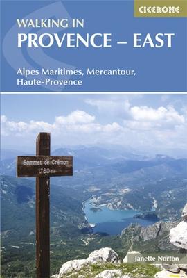
Wandelgids Walking in Provence - East | Cicerone

0
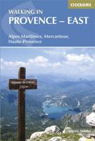
This guide offers 30 circular day walks in the eastern half of Provence, the large sun-kissed coastal region of south-east France. Spanning from the red rocks in the Ésterel on the Mediterranean to high mountains inland, the walks are set in the areas of the Alpes Maritimes, the Alpes de Haute-Provence and the Mercantour. Provence’s sunshine and M...

Verkopers met dit product

Verkoper
Bezorging
Prijs
DeZwerver.nl logo
DeZwerver.nl
2,95
21,95

Anderen bekeken ook

Wandelgids Walking in Provence - East | Cicerone
This guide offers 30 circular day walks in the eastern half of Provence, the large sun-kissed coastal region of south-east France. Spanning from the red rocks in the Ésterel on the Mediterranean to high mountains inland, the walks are set in the areas of the Alpes Maritimes, the Alpes de Haute-Provence and the Mercantour. Provence’s sunshine and Mediterranean charm attract many visitors to its coast, yet the area also has much more to offer the walker. The countryside inland boasts a range of scenery from remote mountaintops to spectacular gorges. History is everywhere, in medieval villages, arcaded streets, abbeys, churches and castles.    This guide covers the eastern regions, with its companion volume, Walking in Provence: West, covering the rest of this fascinating and historic landscape. The walking is incredibly diverse, and explores the country that hugs the Côte d'Azur and Italian border. The Alpes Maritimes rise craggy and wild above towns as unique as Grasse, Cannes and Mona…
21,95
Wandelgids Walking in Provence - West | Cicerone
This guide offers 30 circular day walks in the western half of Provence, the large sun-kissed coastal region of south-east France. Spanning from the Baronnies in the north to the Ste-Baume ridge in the south, the walks are set in the areas of the Drôme Provençale, Vaucluse and the Var. Provence’s sunshine and Mediterranean charm attract many visitors to its coast, yet the area also has much more to offer the walker. The countryside inland boasts a range of scenery from remote mountaintops to spectacular gorges. History is everywhere, in medieval villages, arcaded streets, abbeys, churches and castles.    This guide covers the western regions, with its companion volume, Walking in Provence: East, covering the rest of this fascinating and historic landscape. The walking is incredibly diverse; from the green waves of the Barronies hills in Drôme Provençale, to the unforgettable silhouette of Mont Ventoux giving way to limestone plateaux cut with ravines in the Vauclause. Further south li…
21,95
Wandelgids Walking in Carmarthenshire | Cicerone
This guidebook presents 30 contrasting day walks exploring the mountains, valleys and coastline of Carmarthernshire in south-west Wales. Ranging from 2 to 10 miles in length and suitable for walkers of all abilities, the routes introduce the varied walking on offer in this county, including parts of the Brecon Beacons and the Cambrian Mountains.   Alongside detailed route descriptions and clear OS mapping, the book is packed with interesting information about the places and heritage encountered. Notes on landscape, geology and wildlife of the area are included, and for each walk there is useful practical information on transport and refreshments.   A county of contrasts with around 1850 miles of footpaths, Carmarthernshire is a walker's paradise. Highlights include the Black Mountains (Mynydd Du), the Teifi Valley, Camarthen Bay, the southwestern Coast, and 'Dylan Thomas Country' around Laugharne.   Activities Walking   Seasons The walks can be done at any time of year, but the drier …
19,50
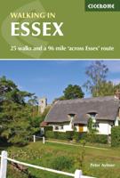
Wandelgids Walking in Essex | Cicerone
Wandelgids met 25 dagtochten en een meerdaagse tocht in Essex.  Goede omschrijvingen, veel praktische informatie. Redelijk kaartmateriaal   This guidebook describes 25 coastal and inland day walks covering the whole of the county of Essex, stretching from the Lea Valley in the west and the Thames in the south over to the North Sea and up to the River Stour in the north. Walks range from 4 to 18 miles and are mostly circular. Also included is a description of the Essex Way which crosses the county in 11 stages from Manor Park, on the fringes of London, to the port of Harwich - a distance of 96 miles. The walks are suitable for all abilities and there are shorter alternatives for many of the longer routes.   With a huge variety of scenery and walking landscapes, Essex surprises and delights in equal measure. It boasts a 350-mile coastline (which, away from the busy seaside resorts, is barely known), numerous estuaries and river valleys, great and ancient forests, and more green lanes th…
18,95
Wandelgids Walking in the Haute Savoie North | Cicerone
Uitstekende wandelgids van dit geweldige gebied. Goed beschreven met veel praktische informatie om de route te kunnen lopen, inclusief redelijke kaarten. A guidebook of half and full-day walks in the lovely Haute Savoie mountains of France. This guide describes 30 circular routes of between 7 and 13km, based around Evian-les-Bains, Morzine, Abondance, Châtel, St-Julien-en-Genevois, Bellevaux, Boège and Habère-Poche. Graded from easy to difficult, there are walks to suit most abilities, but a few have some exposed sections and need a head for heights.   The guide is divided into 6 areas covering the Salève and Vuache, the Vallée Verte, the Vallée du Brevon, Pre-Alpes du Léman and Val d'Abondance. Alongside a detailed route description and map, each walk has a summary of all you need to know before you set out (distance, time to walk, ascent, maximum altitude and instructions for accessing the start). The guidebook includes advice on travel, accommodation and equipment, as well as infor…
20,95
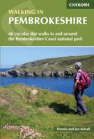
Wandelgids Walking in Pembrokeshire | Cicerone
Uitstekende wandelgids van dit mooie gebied aan de kust van Wales: het Pembrokeshire Coast national park. Goed beschreven met veel praktische informatie om de route te kunnen lopen, inclusief redelijke kaarten. Guidebook to 40 circular walks in Pembrokeshire in Wales. The routes, which range from 1 to 12 miles, take in the dramatic beauty of the national park and its coast, the Daugleddau and the Preseli Hills, while exploring wooded gorges, prehistoric hillforts and medieval castles.   Step-by-step route descriptions are accompanied by 1:50,000 mapping. For each route, information is also given regarding parking and public transport options, as well as toilets and refreshments available along the way. The guide also includes a useful route summary table, plus information on tides, the terrain, and weather in the region.   This collection of walks includes something for everyone, from novices to experienced ramblers. None of the walks demand technical skill and, in good weather, pose …
18,50
Wandelgids Walking in Cyprus | Cicerone
Uitstekende wandelgids, goed beschreven met veel praktische informatie om de route te kunnen lopen, inclusief redelijke kaarten There's far more to Cyprus than just the bustling resorts: the favourable climate, attractive scenery and many kilometres of footpaths and nature trails make it an ideal destination for walkers. This guidebook presents 44 graded walks spread across the island, covering both southern and northern Cyprus, with a slight focus on the central Troodos region. Clear description and mapping is presented for each route and a route summary table makes it easy to choose an appropriate walk.   The walks, of 3 to 20km, range from gentle strolls to longer, more demanding routes, sometimes involving steep ascents, difficult terrain or navigational challenge. They showcase Cyprus's captivating landscapes, from the sun-kissed coastline lapped by clear turquoise waters to the pine-clad slopes of the Troodos and Besparmak Mountains. Many visit sites of historical interest – inc…
23,95
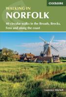
Wandelgids Walking in Norfolk | Cicerone
This guidebook describes 40 circular walks in Norfolk, including walks along the coast and walks exploring the Fens and the Broads. From 4 to 12 miles, these mostly flat walks use footpaths, bridleways and quiet country lanes, and some involve parts of long-distance paths, including the Peddars Way, Norfolk Coast Path, Boudica's Way and Weavers Way. The walks are divided into five sections: walks on the northeast coast and the Broads; walks in south Norfolk, the Yare and Waveney; walks in North Norfolk and the Coast; walks in Central Norfolk and Breckland; and walks in West Norfolk and the Fens. All routes are easy to moderate and can be done by anyone of reasonable fitness and enjoyed all year round.   Each route is described step-by-step, illustrated with 1:40K OS map extracts and packed with historical, geological and other information about the landscape the route passes through. The Fenland region of Norfolk's far west is flat and low-lying, as are the marshes and waterways of t…
20,95
Wandelgids Walking in Tuscany - Toscane | Cicerone
Uitstekende wandelgids van Toscane. Goed beschreven met veel praktische informatie om de route te kunnen lopen, inclusief redelijke kaarten. Aanbevolen wandelkaarten De meeste wandelingen (maar lang niet allemaal!) in deze gids worden gedekt door wandelkaart: Wandelkaart - Fietskaart 2440 Toscana | Kompass Voor de andere gebieden staan de kaarten hier onder per gebied genoemd. A guidebook to walks in the Italian region of Tuscany. 43 graded routes range from 2.5 to 18km, and take in the Renaissance splendour of Florence and Siena, the World Heritage scenery of Val d'Orcia and San Gimignano and the stunning island of Elba. Alongside detailed route descriptions and clear mapping there is essential practical information on public transport and food and drink, as well as a comprehensive list of accommodation, and a useful Italian–English glossary. The guide is packed with interesting details about the area’s wildlife, landscape, culture and history, making it a perfect companion to gettin…
23,95
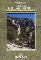
Wandelgids Walking in the Languedoc | Cicerone
Uitstekende wandelgids van dit geweldige gebied. goed beschreven met veel praktische informatie om de route te kunnen lopen, inclusief redelijke kaarten. 31 walks in the stunningly beautiful Parc Naturel du Haut-Languedoc. The climate is warm, the vineyards stretch out below you, and above is the towering Espinouse Massif. The Languedoc has for too long been in the shadow of Provence. Sharing the same Mediterranean climate and vegetation, it has not had done to it what Peter Mayle did for the Luberon - yet! Apart from its beaches, it is a quiet, beautiful place which retains more than a hint of the old France. This book is the fruit of 10 years' exploration of the central part of the Languedoc, north of Béziers. Much of this area forms the Parc Naturel du Haut-Languedoc, at the heart of which is the stunning Espinouse massif, rising abruptly some 850m from the valley floor. Close by is the valley of Lac du Salagou, an enormous man-made lake surrounded by impressive hills. A little fur…
20,95

Klanten-reviews van Wandelgids Walking in Provence - East | Cicerone

Er zijn nog geen beoordelingen voor dit productBen jij de eerste die een review plaatst?

Meer over Wandelgids Walking in Provence - East | Cicerone

Productomschrijving

This guide offers 30 circular day walks in the eastern half of Provence, the large sun-kissed coastal region of south-east France. Spanning from the red rocks in the Ésterel on the Mediterranean to high mountains inland, the walks are set in the areas of the Alpes Maritimes, the Alpes de Haute-Provence and the Mercantour.

Provence’s sunshine and Mediterranean charm attract many visitors to its coast, yet the area also has much more to offer the walker. The countryside inland boasts a range of scenery from remote mountaintops to spectacular gorges. History is everywhere, in medieval villages, arcaded streets, abbeys, churches and castles.    This guide covers the eastern regions, with its companion volume, Walking in Provence: West, covering the rest of this fascinating and historic landscape. The walking is incredibly diverse, and explores the country that hugs the Côte d'Azur and Italian border. The Alpes Maritimes rise craggy and wild above towns as unique as Grasse, Cannes and Monaco. The Mercantour National Park in contrast is a partially uninhabited area of high mountains, alpine lakes and red rock gorges known for its wildlife. Further north in the Alpes de Haute-Provence is a largely unspoilt geological playground, including such spectacles as the Verdon Gorge with villages and ancient sites throughout.   Suitable for all walkers of average fitness levels, the walks range from 4 to 21 kilometres in length, and are graded for difficulty from short, easy routes to more challenging walks that can include precipitous sections, but no special equipment is needed.
  • 30 day walks in the Alpes Maritimes, Alpes de Haute-Provence and Mercantour in the sunny south-east corner of France
  • walks illustrated with clear sketch maps and height profiles, as well as inspiring photographs
  • all the practical information required for a perfect trip from public transport to maps and market days
Seasons walks near the coast can be made at any time of the year, but the high trails in the Mercantour are restricted to snow-free months in summer and autumn   Centres Vence and Grasse (Alpes Maritimes); Digne-les-Bains and Castellane (Alpes de Haute-Provence); Guillaumes and the Val d'Entraunes (Mercantour)   Difficulty circular day walks, suitable for averagely fit people and graded Easy, Medium or Difficult, depending on length, total ascent and terrain; easy walks are short, while difficult ones take up to eight hours and may include sections which are precipitous or difficult to navigate; no special equipment is needed.   Must See dramatic mountain ridges, alpine lakes and deep river gorges; perched medieval villages, ruined castles and churches; the red rocks in the Estérel on the Mediterranean coast to high mountains in the Mercantour   Wandelingen Alpes Maritimes Walk 1 Baou des Noirs and Baou des Blancs Walk 2 Baou de St-Jeannet Walk 3 Chemin du Paradis Walk 4 Pic de Courmettes and Puy de Tourrettes Walk 5 Baou de St-Jean Walk 6 The Route Napoléon Walk 7 Vallée de la Siagne Walk 8 Pic du Cap Roux Walk 9 Estérel Circuit and Lac de l’Ecureuil Walk 10 Mont Vinaigre   Alpes de Haute-Provence Location of Walks Walk 11 Three Chapels Walk from Digne-les-Bains Walk 12 Walk in the Réserve Géologique Walk 13 Bigue du Siron Walk 14 The Cousson Walk 15 The Cucuyon Walk 16 Rochers des Mées Walk 17 Gorges de Trévans Walk 18 The Verdon Gorge – Sentier Blanc-Martel Walk 19 Lower Verdon Gorge Walk 20 Sommet de Crémon   Mercantour Location of Walks Walk 21 Moulin de la Barlatte Walk 22 Plateau de la Lare from Sauze Walk 23 Gorges de Daluis Walk 24 Circuit from St-Martin d’Entraunes Walk 25 Col des Champs from Entraunes Walk 26 Lakes Circuit from the Col de la Cayolle Walk 27 Mont Pelat Walk 28 Circuit above Péone Walk 29 Mont Mounier Walk 30 Around Mont d’Auvare
 

Productinformatie

    Verken gerelateerde categorieën

    Webshop.nl maakt gebruik van cookies. Ga je verder op onze website, ga dan akkoord met het plaatsen van cookies en de verwerking van deze data door ons en vermelde partners.