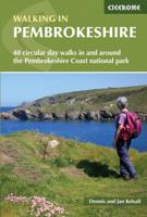
Wandelgids Walking in Pembrokeshire | Cicerone

0
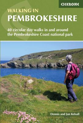
Uitstekende wandelgids van dit mooie gebied aan de kust van Wales: het Pembrokeshire Coast national park. Goed beschreven met veel praktische informatie om de route te kunnen lopen, inclusief redelijke kaarten. Guidebook to 40 circular walks in Pembrokeshire in Wales. The routes, which range from 1 to 12 miles, take in the dramatic beauty of the n...

Verkopers met dit product

Verkoper
Bezorging
Prijs
DeZwerver.nl logo
DeZwerver.nl
2,95
18,50

Anderen bekeken ook

Wandelgids Pembrokeshire | Northern Eye Books
OS Map Books: Wales Coast Path: Pembrokeshire Coast Path Map Atlas | Ordnance Survey ‘Explorer’ Large-scale 1:25,000 maps for the Pembrokeshire Coast in compact book format | Pocket Atlas | Walking Wales | UK Long-Distance Trails | Hiking | Adventure   One of seven handy Ordnance Survey Map Books covering the entire 870 mile/1400 kilometre-long, world-class Wales Coast Path — from Chester in the north to Chepstow in the south.   Enjoy enhanced, large scale (1:25,000) Ordnance Survey Explorer mapping in compact atlas format with all the detailed mapping you need to walk the Pembrokeshire Coast section of the Wales Coast Path.   Continuous, full colour OS mapping covering the Wales Coast Path between Cardigan and Amroth. Contains extracts from large scale Explorer maps OL 35 and OL 36. The enhanced OS 1:25,000 maps are accurate, up-to-date and reliable. Additional map symbols show tea shops, cafes, extra parking, and public toilets.   A brief introduction to Pembrokeshire Coast includes…
17,50
Nieuw
Wandelgids Walking in Norfolk | Cicerone
This guidebook describes 40 circular walks in Norfolk, including walks along the coast and walks exploring the Fens and the Broads. From 4 to 12 miles, these mostly flat walks use footpaths, bridleways and quiet country lanes, and some involve parts of long-distance paths, including the Peddars Way, Norfolk Coast Path, Boudica's Way and Weavers Way. The walks are divided into five sections: walks on the northeast coast and the Broads; walks in south Norfolk, the Yare and Waveney; walks in North Norfolk and the Coast; walks in Central Norfolk and Breckland; and walks in West Norfolk and the Fens. All routes are easy to moderate and can be done by anyone of reasonable fitness and enjoyed all year round.   Each route is described step-by-step, illustrated with 1:40K OS map extracts and packed with historical, geological and other information about the landscape the route passes through. The Fenland region of Norfolk's far west is flat and low-lying, as are the marshes and waterways of t…
20,95
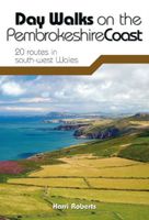
Wandelgids Day Walks on the Pembrokeshire Coast | Vertebrate Publishing
Day Walks on the Pembrokeshire Coast features 20 classic coastal routes between 6.5 miles and 13 miles (10.4km and 20.8km) in length, suitable for hillwalkers of all abilities. Local author and walker Harri Roberts shares his favourite walks in the national park, including a meander along Bosherston Lily Ponds ¿ a series of interconnected lakes, rich in wildlife; the 650-million-year-old sea cliffs of St Brides, studded with the less-common, upland-loving sessile oak; and retracing the steps of Wales¿s patron saint, from St Davids to St Justinian¿s. The routes are in five areas: the South Pembrokeshire Coast, Daugleddau, the West Pembrokeshire Coast, the North Pembrokeshire Coast, and the Preseli Hills. Written by a local author, each route features Ordnance Survey 1:25,000 maps; easy-to-follow directions; details and distance and navigation info, and refreshment stops and local information.
20,95
Nieuw
Wandelgids Walking in the Algarve | Cicerone
Uitstekende wandelgids van de Algarve. Goed beschreven met veel praktische informatie om de routes te kunnen lopen, inclusief redelijke kaarten. This guidebook describes 33 walks in the beautiful Algarve in southern Portugal. Boasting good weather, easy access, stunning scenery and some great hiking trails, the region is a perfect destination for a walking holiday. It is best known for its spectacular coastline: the coastal trails presented here afford ample opportunity to admire the plunging sinkholes, striking sea-cliffs and rock-hugged beaches. However, the interior is every bit as beautiful and other walks explore the forested slopes of Monchique and the tranquil countryside between the mountains and coast.   The routes range from 3.5 to 17km and cover the sun-kissed south coast, the rugged Vicentina Coast, the Monchique mountains and traditional villages of the eastern Algarve. Many can be accessed by public transport and details, along with tips on refreshment opportunities on r…
23,95
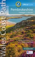
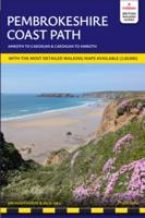
Wandelgids Wales Coast Path: Pembrokeshire | Northern Eye Books
Official Guide: Wales Coast Path: Pembrokeshire   One of seven Official Guides to the Wales Coast Path   The 186 mile/300km long Pembrokeshire section of the Wales Coast Path runs through some of Wales’ most varied and dramatic coastal scenery — high, rugged cliffs and long sandy bays, Pembroke Castle, St David’s cathedral and St Govan’s remote cliff-wrapped chapel, with several large offshore islands. Pembrokeshire is also Britain’s only coastal National Park.   This Official Guide splits the route into 14 convenient day sections, each of about 10-17 miles / 16-27 kilometres. It contains everything local and long-distance walkers need to enjoy the path and includes:   An overview of Pembrokeshire with dedicated history and wildlife sections Fourteen day-walk sections with detailed route descriptions and full, enhanced Ordnance Survey mapping Distance charts, section overviews, background information and interpretation of places of interest Stunning professional photographs throughout…
22,50
Nieuw
Wandelgids Walking in Northumberland | Cicerone
De wandelgidsen van Cicerone zijn toonaangevend als het gaat om kwaliteit en de hoeveelheid verschillende bestemmingen. De routes zijn helder en duidelijk beschreven, kaartmateriaal is veelal van de topografische dienst op schaal 1:50.000 en de praktische informatie is bondig maar zeer relevant.    The book comprises 36 short walking routes between 4 and 14 miles in Northumberland, England's most sparsely populated county. Ranging from easy ambles and gentle woodland trails to long days on the hills: there is something for all types of walker - and all types of weather. Taking in the beautiful coast with its immense, empty beaches and dramatic crag-top castles to the remote hills of the Cheviots and Pennines, the whole county is covered. Most of the routes are circular, but there are a few linear walks that make use of local bus services.    The landscapes are rich in history, featuring Hadrian's Wall, Lindisfarne Priory, Bamburgh and Dunstanburgh castles, and much more.    The walks …
18,50
Nieuw
Wandelgids Wales: The Ceredigion and Snowdonia Coast Paths | Cicerone
As part of the Wales Coast Path, the Ceredigion Coast Path and Snowdonia Coast Path trace a curve of 233km (145 miles) of coastal and inland walking down Cardigan Bay. This guidebook describes a 16-stage guide to the walk from Porthmadog to St Dogmaels covering the trail between the Llyn Peninsula and the Pembrokeshire Coast Path. .In 16 day stages from Porthmadog to St Dogmaels, this guidebook offers all the information walkers need to complete the 233km (145 miles) section of the Wales Coast Path that curve down Cardigan Bay, passing through a range of contrasting landscapes.   Six days are spent on the Snowdonia Coast Path, two around the Dyfi Estuary, seven on the Ceredigion Coast Path and one from Cardigan to St Dogmaels.   Linking the Llyn Peninsula Coast Path with that of the Pembrokeshire Coastal Path, this section takes in Snowdonia National Park’s splendid coastal plains, leads inland through beautiful hill country around the Dyfi Estuary and follows some of the finest coast…
18,50
Nieuw
Wandelgids Walking on the Gower | Cicerone
Wandelgids met 30 wandelroutes in het zuiden van Wales This guidebook presents 30 circular day walks across the Gower Area of Outstanding Natural Beauty, taking in the rich variety of landscapes across this beautiful area of South Wales. Ranging from 2½ to 14 miles long, there are walks to suit all abilities. The peninsula is famous for its spectacularly steep, rugged coastline and golden sandy beaches but this guide also takes walkers to the inland valleys, hills and ridges little explored by most holidaymakers.   Routes are illustrated with OS mapping extracts and inspiring photography and accompanied by a route summary table to help you choose walks to suit your location and ability. Along the way, the author provides a wealth of information on plants, animals, geology, history and archaeology of a region. There is something for everyone, all within a compact area easily accessible from Swansea and Mumbles.   Coastal areas such as those around Langland, Oxwich and Port Eynon are we…
19,50
Nieuw
Wandelgids Walking the Pembrokeshire Coast Path | Cicerone
Engelstalige beschrijving van een mooie wandeltocht in Wales. De gids voldoet aan alle verwachtingen die je kunt hebben. Met apart gidsje met prima wandelkaarten.  This guidebook describes the Pembrokeshire Coast Path National Trail, a scenic 180-mile long-distance walk from Amroth, near Tenby, to St Dogmaels, north of Newport. The route, which takes roughly two weeks to complete, is divided into 14 stages of between 9 and 16 miles. Neither technically demanding nor difficult to navigate, the trail is suitable both for experienced distance walkers and those looking to cut their teeth on a long-distance route.   Detailed two-way route instructions are accompanied by 1:100,000 OS mapping. A route summary table and comprehensive trek planner are also included, with invaluable information on transport, accommodation and facilities en route. The guidebook is packed with interesting snippets of information about the places, landscapes and wildlife encountered along the way. It also includes…
25,95
Nieuw
Wandelgids 087 Pathfinder Guides Northumberland | Ordnance Survey
Pathfinder® Guide to Northumberland, featuring 28 outstanding walks designed for a range of abilities covering 180 miles of walking.   Features:   28 guided walks for a range of abilities Large detailed Ordnance Survey map extracts Key information such as parking and type of terrain GPS waypoints for each route Weather-resistant book cover Durable rounded corners   This new guide to Northumberland has ten brand-new Pathfinder walks across the county. There are new short walks at Berwick-upon-Tweed, Almouth and Bellingham. There are new half-day walks in the Coquet Valley at Felton, in the Humbleton Hills from Wooler, exploring the countryside south of the River Tyne from Hexham, and taking you along the scenic Wansbeck Valley to Morpeth from Bothal. And there are new longer walks in Hulne Park, Alnwick; along the coast and inland from Bamburgh; and a lengthy but hugely enjoyable ramble in a circuit from Druridge Bay to Warkworth and a return via Amble along the Northumberl…
18,50

Klanten-reviews van Wandelgids Walking in Pembrokeshire | Cicerone

Er zijn nog geen beoordelingen voor dit productBen jij de eerste die een review plaatst?

Meer over Wandelgids Walking in Pembrokeshire | Cicerone

Productomschrijving

Uitstekende wandelgids van dit mooie gebied aan de kust van Wales: het Pembrokeshire Coast national park. Goed beschreven met veel praktische informatie om de route te kunnen lopen, inclusief redelijke kaarten.

Guidebook to 40 circular walks in Pembrokeshire in Wales. The routes, which range from 1 to 12 miles, take in the dramatic beauty of the national park and its coast, the Daugleddau and the Preseli Hills, while exploring wooded gorges, prehistoric hillforts and medieval castles.   Step-by-step route descriptions are accompanied by 1:50,000 mapping. For each route, information is also given regarding parking and public transport options, as well as toilets and refreshments available along the way. The guide also includes a useful route summary table, plus information on tides, the terrain, and weather in the region.   This collection of walks includes something for everyone, from novices to experienced ramblers. None of the walks demand technical skill and, in good weather, pose few navigational problems. Whether following the coast, wandering the hills or exploring the valleys and woods, the walking everywhere is superb and will invariably reveal something unexpected along the way.   Steden en Dorpen Tenby, Pembroke, Narberth, Haverfordwest, St David's, Fishguard, Cardigan  


Verken gerelateerde categorieën

Webshop.nl maakt gebruik van cookies. Ga je verder op onze website, ga dan akkoord met het plaatsen van cookies en de verwerking van deze data door ons en vermelde partners.