Wandelgids Walking in Northumberland | Cicerone

0
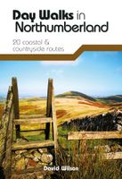
De wandelgidsen van Cicerone zijn toonaangevend als het gaat om kwaliteit en de hoeveelheid verschillende bestemmingen. De routes zijn helder en duidelijk beschreven, kaartmateriaal is veelal van de topografische dienst op schaal 1:50.000 en de praktische informatie is bondig maar zeer relevant.    A guidebook to 36 walks exploring Northumberland...

Verkopers met dit product

Verkoper
Bezorging
Prijs
DeZwerver.nl logo
DeZwerver.nl
2,95
20,95

Anderen bekeken ook

Nieuw
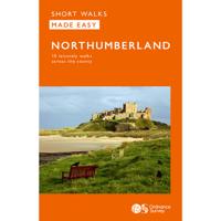
Wandelgids Northumberland | Ordnance Survey
Explore the castles and coast of Northumberland from Dunstanburgh to Hadrian’s Wall with ten walks suitable for all ages and abilities. Discover England’s most northerly county from the North Sea coast to the North Pennines on hand-picked, leisurely rambles for the whole family.   Northumberland Short Walks Made Easy include:   - Circle dramatic Bamburgh Castle, looking out to the Farne Islands from wildlife-rich dunes, and see the grave of lifeboat heroine Grace Darling - Enjoy the tranquility of secluded Wooler Common with its wealth of wildlife and ancient remains on the edge of the Cheviots - Start at picturesque Craster and follow the coast path to Dunstanburgh Castle, a rugged ruin perched on a rocky, wave-battered headland - Ramble the shores of Kielder Water, spot nesting ospreys and stumble upon the fascinating artworks in the forest - Follow Hadrian’s Wall from Cawfields near Haltwhistle to see the iconic Roman structure close up, with stunning views in both directions - Str…
10,95
Nieuw
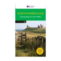
Wandelgids 087 Pathfinder Guides Northumberland | Ordnance Survey
Pathfinder® Guide to Northumberland, featuring 28 outstanding walks designed for a range of abilities covering 180 miles of walking.   Features:   28 guided walks for a range of abilities Large detailed Ordnance Survey map extracts Key information such as parking and type of terrain GPS waypoints for each route Weather-resistant book cover Durable rounded corners   This new guide to Northumberland has ten brand-new Pathfinder walks across the county. There are new short walks at Berwick-upon-Tweed, Almouth and Bellingham. There are new half-day walks in the Coquet Valley at Felton, in the Humbleton Hills from Wooler, exploring the countryside south of the River Tyne from Hexham, and taking you along the scenic Wansbeck Valley to Morpeth from Bothal. And there are new longer walks in Hulne Park, Alnwick; along the coast and inland from Bamburgh; and a lengthy but hugely enjoyable ramble in a circuit from Druridge Bay to Warkworth and a return via Amble along the Northumberl…
18,50
Wandelgids Walking in Provence - East | Cicerone
This guide offers 30 circular day walks in the eastern half of Provence, the large sun-kissed coastal region of south-east France. Spanning from the red rocks in the Ésterel on the Mediterranean to high mountains inland, the walks are set in the areas of the Alpes Maritimes, the Alpes de Haute-Provence and the Mercantour. Provence’s sunshine and Mediterranean charm attract many visitors to its coast, yet the area also has much more to offer the walker. The countryside inland boasts a range of scenery from remote mountaintops to spectacular gorges. History is everywhere, in medieval villages, arcaded streets, abbeys, churches and castles.    This guide covers the eastern regions, with its companion volume, Walking in Provence: West, covering the rest of this fascinating and historic landscape. The walking is incredibly diverse, and explores the country that hugs the Côte d'Azur and Italian border. The Alpes Maritimes rise craggy and wild above towns as unique as Grasse, Cannes and Mona…
21,95
Nieuw
Wandelgids Walking in Provence - West | Cicerone
This guide offers 30 circular day walks in the western half of Provence, the large sun-kissed coastal region of south-east France. Spanning from the Baronnies in the north to the Ste-Baume ridge in the south, the walks are set in the areas of the Drôme Provençale, Vaucluse and the Var. Provence’s sunshine and Mediterranean charm attract many visitors to its coast, yet the area also has much more to offer the walker. The countryside inland boasts a range of scenery from remote mountaintops to spectacular gorges. History is everywhere, in medieval villages, arcaded streets, abbeys, churches and castles.    This guide covers the western regions, with its companion volume, Walking in Provence: East, covering the rest of this fascinating and historic landscape. The walking is incredibly diverse; from the green waves of the Barronies hills in Drôme Provençale, to the unforgettable silhouette of Mont Ventoux giving way to limestone plateaux cut with ravines in the Vauclause. Further south li…
21,95
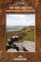
Wandelgids The Reivers Way - Walking Through Historic Northumberland | Cicerone
A guide to walking The Reivers Way, through Northumberland, northern England, from Corbridge to Alnmouth for 150 miles (240km) through the wildest parts of Northumberland - the North Pennines, Hadrian’s Wall, Tynedale, Redesdale, the Simonside Hills, Coquetdale and the Cheviot Hills. Includes a national park, AONBs and a fine heritage coast. Activities walking, backpacking, trekking, bird-watching (Farne Islands)Seasons spring can be the most attractive time; in summer accommodation needs to be booked ahead but ferries will be running to the Farne Islands; weather is less reliable in the autumn; in winter some accommodation providers will be closed and walking may be harder (in deep snow or after prolonged rain)Centres Newcastle-upon-Tyne, Corbridge, Rothbury, Bamburgh, Alnwick, AlnmouthDifficulty walking is straightforward but sometimes remote and not specifically waymarked so navigation skills are required; terrain is varied; the route is described in 9 day stages but experienced lo…
15,50
Nieuw
Wandelgids Walking in Carmarthenshire | Cicerone
This guidebook presents 30 contrasting day walks exploring the mountains, valleys and coastline of Carmarthernshire in south-west Wales. Ranging from 2 to 10 miles in length and suitable for walkers of all abilities, the routes introduce the varied walking on offer in this county, including parts of the Brecon Beacons and the Cambrian Mountains.   Alongside detailed route descriptions and clear OS mapping, the book is packed with interesting information about the places and heritage encountered. Notes on landscape, geology and wildlife of the area are included, and for each walk there is useful practical information on transport and refreshments.   A county of contrasts with around 1850 miles of footpaths, Carmarthernshire is a walker's paradise. Highlights include the Black Mountains (Mynydd Du), the Teifi Valley, Camarthen Bay, the southwestern Coast, and 'Dylan Thomas Country' around Laugharne.   Activities Walking   Seasons The walks can be done at any time of year, but the drier …
19,50
Nieuw
Wandelgids Walking in the Algarve | Cicerone
Uitstekende wandelgids van de Algarve. Goed beschreven met veel praktische informatie om de routes te kunnen lopen, inclusief redelijke kaarten. This guidebook describes 33 walks in the beautiful Algarve in southern Portugal. Boasting good weather, easy access, stunning scenery and some great hiking trails, the region is a perfect destination for a walking holiday. It is best known for its spectacular coastline: the coastal trails presented here afford ample opportunity to admire the plunging sinkholes, striking sea-cliffs and rock-hugged beaches. However, the interior is every bit as beautiful and other walks explore the forested slopes of Monchique and the tranquil countryside between the mountains and coast.   The routes range from 3.5 to 17km and cover the sun-kissed south coast, the rugged Vicentina Coast, the Monchique mountains and traditional villages of the eastern Algarve. Many can be accessed by public transport and details, along with tips on refreshment opportunities on r…
23,95
Wandelgids Walking in Norfolk | Cicerone
This guidebook describes 40 circular walks in Norfolk, including walks along the coast and walks exploring the Fens and the Broads. From 4 to 12 miles, these mostly flat walks use footpaths, bridleways and quiet country lanes, and some involve parts of long-distance paths, including the Peddars Way, Norfolk Coast Path, Boudica's Way and Weavers Way. The walks are divided into five sections: walks on the northeast coast and the Broads; walks in south Norfolk, the Yare and Waveney; walks in North Norfolk and the Coast; walks in Central Norfolk and Breckland; and walks in West Norfolk and the Fens. All routes are easy to moderate and can be done by anyone of reasonable fitness and enjoyed all year round.   Each route is described step-by-step, illustrated with 1:40K OS map extracts and packed with historical, geological and other information about the landscape the route passes through. The Fenland region of Norfolk's far west is flat and low-lying, as are the marshes and waterways of t…
20,95
Nieuw
Wandelgids Walking on Malta | Cicerone
Wandelgids met 33 dagtochten op Malta, Gozo en Comino. Goede omschrijvingen, veel praktische informatie. Redelijk kaartmateriaal. (goede wandelkaart Kompass / zie landkaarten) The Maltese Islands of Malta, Gozo and Comino bask in sunshine at the heart of the Mediterranean, between Europe and Africa. History has ensured that the islands have been colonised time and time again, leaving them with a colourful and complex history and heritage. The islands are a popular tourist destination. They offer plenty of historic walks, stunningly beautiful and dramatic architecture, and a good amount of excellent scenery, especially around the cliffs and coastlines. This guidebook describes 33 walks on Malta and its neighbouring islands of Gozo and Comino. Walks generally range from 3 to 17 km, and include Valetta, heritage trails, coastal walks and explorations inland, including the 30km 'Victoria Lines' route between Mgarr and Bahar ic-Caghaq. Malta offers year-round walking. This guidebook descri…
21,95
Wandelgids Walking in the Thames Valley | Cicerone
Walking in the Thames Valley offers 25 challenging circular walks around the River Thames and River Kennet in the south of England, taking in the Southern Chilterns, the Berkshire and North Hampshire Downs, Southern Oxfordshire and the eastern edge of Wiltshire. All routes are within easy reach of Reading, Newbury, Abingdon and London. While some walks visit Iron Age hill forts, others pass more modern features such as Wilton Windmill and the Kennet and Avon Canal. Some follow sections of the Ridgeway, while others meander along the banks of the Thames. What they all have in common is that they take the keen rambler to some of the best parts of the Thames Valley – a patchwork of open chalk grassland, broadleaved woodland and farmland and home to two Areas of Outstanding Natural Beauty. • walks from 10 to 18 miles, including one 2-day route • shorter, less strenuous alternatives for many of the walks • detailed route descriptions with information on local points of interest, OS mapping…
18,50

Klanten-reviews van Wandelgids Walking in Northumberland | Cicerone

Er zijn nog geen beoordelingen voor dit productBen jij de eerste die een review plaatst?

Meer over Wandelgids Walking in Northumberland | Cicerone

Productomschrijving

De wandelgidsen van Cicerone zijn toonaangevend als het gaat om kwaliteit en de hoeveelheid verschillende bestemmingen. De routes zijn helder en duidelijk beschreven, kaartmateriaal is veelal van de topografische dienst op schaal 1:50.000 en de praktische informatie is bondig maar zeer relevant.    A guidebook to 36 walks exploring Northumberland, including the national park, coast, Cheviots, North Pennines and Kielder. The walks cover a wide variety of terrain and include full days on the hills and coast and shorter walks at lower levels, so there is something for everyone. The walks are graded (although none present any technical difficulties) and accessible from bases such as Alnwick, Rothbury and Hexham.   They range from 7 to 21km (4–13 miles) and can be enjoyed in 2–7 hours. 1:50,000 OS maps included for each walkHighlights include Hadrian's Wall, Lindisfarne Priory, The Cheviot, Berwick and Bamburgh and Dunstanburgh CastlesNotes on refreshments and public transportBackground information on the historic remains encounteredInformation on the region’s rich geology, history and wildlife


Productinformatie

    Verken gerelateerde categorieën

    Webshop.nl maakt gebruik van cookies. Ga je verder op onze website, ga dan akkoord met het plaatsen van cookies en de verwerking van deze data door ons en vermelde partners.