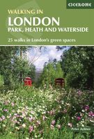
Wandelgids Walking in London | Cicerone

0
A guidebook to 25 walks in London's green spaces and nature reserves, covering both the city centre and Greater London area. Taking in woods and forests, parks and heaths, canals and rivers, the guide includes a wealth of information about some of the species you might encounter, as well as the history and conservation of these areas. This guidebo...

Verkopers met dit product

Verkoper
Bezorging
Prijs
DeZwerver.nl logo
DeZwerver.nl
2,95
20,95

Anderen bekeken ook

Wandelgids Walking in London | Cicerone
A guidebook to 25 walks in London's green spaces and nature reserves, covering both the city centre and Greater London area. Taking in woods and forests, parks and heaths, canals and rivers, the guide includes a wealth of information about some of the species you might encounter, as well as the history and conservation of these areas. This guidebook presents 25 varied walks exploring London's green and open spaces. Covering both the city centre and the Greater London area, it takes in royal parks, heaths, forests, canals and rivers, including Epping Forest, Hampstead Heath, the World Heritage site of Kew Gardens and Wimbledon Common. Walks range from 4 to 14 miles and most can be accessed by public transport.Alongside detailed route descriptions and OS mapping, the book features practical information on parking, public transport and refreshments. Each walk showcases a particular species of wildlife that you might encounter, and there is fascinating background information the history a…
20,95
Wandelgids Walking in Essex | Cicerone
Wandelgids met 25 dagtochten en een meerdaagse tocht in Essex.  Goede omschrijvingen, veel praktische informatie. Redelijk kaartmateriaal   This guidebook describes 25 coastal and inland day walks covering the whole of the county of Essex, stretching from the Lea Valley in the west and the Thames in the south over to the North Sea and up to the River Stour in the north. Walks range from 4 to 18 miles and are mostly circular. Also included is a description of the Essex Way which crosses the county in 11 stages from Manor Park, on the fringes of London, to the port of Harwich - a distance of 96 miles. The walks are suitable for all abilities and there are shorter alternatives for many of the longer routes.   With a huge variety of scenery and walking landscapes, Essex surprises and delights in equal measure. It boasts a 350-mile coastline (which, away from the busy seaside resorts, is barely known), numerous estuaries and river valleys, great and ancient forests, and more green lanes th…
18,95
Wandelgids Walking in the Thames Valley | Cicerone
Walking in the Thames Valley offers 25 challenging circular walks around the River Thames and River Kennet in the south of England, taking in the Southern Chilterns, the Berkshire and North Hampshire Downs, Southern Oxfordshire and the eastern edge of Wiltshire. All routes are within easy reach of Reading, Newbury, Abingdon and London. While some walks visit Iron Age hill forts, others pass more modern features such as Wilton Windmill and the Kennet and Avon Canal. Some follow sections of the Ridgeway, while others meander along the banks of the Thames. What they all have in common is that they take the keen rambler to some of the best parts of the Thames Valley – a patchwork of open chalk grassland, broadleaved woodland and farmland and home to two Areas of Outstanding Natural Beauty. • walks from 10 to 18 miles, including one 2-day route • shorter, less strenuous alternatives for many of the walks • detailed route descriptions with information on local points of interest, OS mapping…
18,50
Wandelgids Walking in Carmarthenshire | Cicerone
This guidebook presents 30 contrasting day walks exploring the mountains, valleys and coastline of Carmarthernshire in south-west Wales. Ranging from 2 to 10 miles in length and suitable for walkers of all abilities, the routes introduce the varied walking on offer in this county, including parts of the Brecon Beacons and the Cambrian Mountains.   Alongside detailed route descriptions and clear OS mapping, the book is packed with interesting information about the places and heritage encountered. Notes on landscape, geology and wildlife of the area are included, and for each walk there is useful practical information on transport and refreshments.   A county of contrasts with around 1850 miles of footpaths, Carmarthernshire is a walker's paradise. Highlights include the Black Mountains (Mynydd Du), the Teifi Valley, Camarthen Bay, the southwestern Coast, and 'Dylan Thomas Country' around Laugharne.   Activities Walking   Seasons The walks can be done at any time of year, but the drier …
19,50
Wandelgids Walking in County Durham | Cicerone
Guidebook of walking routes in County Durham. The 40 day walks, ranging between 5 and 24km in length, explore all corners of this varied county, encompassing wild moorland, rolling pastures, riverbanks and the low cliff coast. With such a range of possibilities, there are walks here for all abilities.   They take in highlights such as Beamish, Durham City, Tan Hill and High Force. Featuring 1:50K OS mapping, step-by-step route descriptions, as well as information on the history of the region, the guidebook details everything you need to walk in the region. The county lies between two mighty rivers - the Tyne and the Tees - and between the high Pennines in the west and the North Sea to the east.   Into this small space is crammed a wide variety of landscape and two centuries of turbulent history, waiting to be explored on foot
20,95
Wandelgids Walking in the Briançonnais | Cicerone
Handige duidelijke wandelgids van een mooi wandelgebied. De routes zijn accuraat beschreven met praktische informatie erbij. Kaartmateriaal is redelijk, soms wat schetsmatig. In berggebieden zijn wandelkaarten wel belangrijk! Bij de routes worden de juiste kaartnummers gegeven.    This guidebook presents 40 walks exploring the area around Briançon in France. The walks are divided into 6 sections covering the valleys of Clarée, Cerveyrette, Ayes, Durance and Guisane, as well as the area around Vallouise and Montgenèvre. The walks are circular and range in distance from 4 to 21 km. Graded easy to very hard, there is a walk to suit all abilities.    Dominated on all sides by jagged peaks, and perched on a rocky spur at the nucleus of five beautiful valleys, the city of Briançon lies almost at the southernmost tip of the main Alpine range. The Briançonnais, the surrounding region to which it gives its name, is a stunning mountain wilderness packed with everything one would expect from a h…
23,95
Wandelgids Walking in Catalunya - Barcelona | Cicerone
Uitstekende wandelgids van dit gebied. goed beschreven met veel praktische informatie om de route te kunnen lopen, inclusief redelijke kaarten. The delights of Spain's Catalunya region are revealed in this new walking guide, which covers 32 graded walks of 6.5 to 28km across Montseny, Sant Llorenç del Munt I l-Obac, Montserrat and Penedès and Garraf - all within easy access of Barcelona. Walks are included for all abilities, from easy strolls to more demanding walks, and some of the walks are accessible by public transport.   The guide provides detailed route descriptions, 1:50,000 mapping and a route summary table to help with choosing appropriate walks. All the walks are illustrated with stunning photos. A list of local campsites and other useful contacts is included at the back, plus notes on refreshment opportunities along the routes. There's also background information on local geology, wildlife and history, and planning details on when to go, where to stay and what to take.   Wh…
22,95
Wandelgids Walking in Cyprus | Cicerone
Uitstekende wandelgids, goed beschreven met veel praktische informatie om de route te kunnen lopen, inclusief redelijke kaarten There's far more to Cyprus than just the bustling resorts: the favourable climate, attractive scenery and many kilometres of footpaths and nature trails make it an ideal destination for walkers. This guidebook presents 44 graded walks spread across the island, covering both southern and northern Cyprus, with a slight focus on the central Troodos region. Clear description and mapping is presented for each route and a route summary table makes it easy to choose an appropriate walk.   The walks, of 3 to 20km, range from gentle strolls to longer, more demanding routes, sometimes involving steep ascents, difficult terrain or navigational challenge. They showcase Cyprus's captivating landscapes, from the sun-kissed coastline lapped by clear turquoise waters to the pine-clad slopes of the Troodos and Besparmak Mountains. Many visit sites of historical interest – inc…
23,95
Wandelgids Walking in Pembrokeshire | Cicerone
Uitstekende wandelgids van dit mooie gebied aan de kust van Wales: het Pembrokeshire Coast national park. Goed beschreven met veel praktische informatie om de route te kunnen lopen, inclusief redelijke kaarten. Guidebook to 40 circular walks in Pembrokeshire in Wales. The routes, which range from 1 to 12 miles, take in the dramatic beauty of the national park and its coast, the Daugleddau and the Preseli Hills, while exploring wooded gorges, prehistoric hillforts and medieval castles.   Step-by-step route descriptions are accompanied by 1:50,000 mapping. For each route, information is also given regarding parking and public transport options, as well as toilets and refreshments available along the way. The guide also includes a useful route summary table, plus information on tides, the terrain, and weather in the region.   This collection of walks includes something for everyone, from novices to experienced ramblers. None of the walks demand technical skill and, in good weather, pose …
18,50
Wandelgids Walking in Norfolk | Cicerone
This guidebook describes 40 circular walks in Norfolk, including walks along the coast and walks exploring the Fens and the Broads. From 4 to 12 miles, these mostly flat walks use footpaths, bridleways and quiet country lanes, and some involve parts of long-distance paths, including the Peddars Way, Norfolk Coast Path, Boudica's Way and Weavers Way. The walks are divided into five sections: walks on the northeast coast and the Broads; walks in south Norfolk, the Yare and Waveney; walks in North Norfolk and the Coast; walks in Central Norfolk and Breckland; and walks in West Norfolk and the Fens. All routes are easy to moderate and can be done by anyone of reasonable fitness and enjoyed all year round.   Each route is described step-by-step, illustrated with 1:40K OS map extracts and packed with historical, geological and other information about the landscape the route passes through. The Fenland region of Norfolk's far west is flat and low-lying, as are the marshes and waterways of t…
20,95

Klanten-reviews van Wandelgids Walking in London | Cicerone

Er zijn nog geen beoordelingen voor dit productBen jij de eerste die een review plaatst?

Meer over Wandelgids Walking in London | Cicerone

Productomschrijving

A guidebook to 25 walks in London's green spaces and nature reserves, covering both the city centre and Greater London area. Taking in woods and forests, parks and heaths, canals and rivers, the guide includes a wealth of information about some of the species you might encounter, as well as the history and conservation of these areas.

This guidebook presents 25 varied walks exploring London's green and open spaces. Covering both the city centre and the Greater London area, it takes in royal parks, heaths, forests, canals and rivers, including Epping Forest, Hampstead Heath, the World Heritage site of Kew Gardens and Wimbledon Common. Walks range from 4 to 14 miles and most can be accessed by public transport.Alongside detailed route descriptions and OS mapping, the book features practical information on parking, public transport and refreshments. Each walk showcases a particular species of wildlife that you might encounter, and there is fascinating background information the history and conservation of the capital's wild spaces.London is a city of 8 million people and 8 million trees, and its vast open spaces are home to 13,000 species of wildlife. This book is an ideal companion to exploring a greener, more gentle side to the city.

Productinformatie

    Verken gerelateerde categorieën

    Webshop.nl maakt gebruik van cookies. Ga je verder op onze website, ga dan akkoord met het plaatsen van cookies en de verwerking van deze data door ons en vermelde partners.