webshop.nl
Categorieën
  Sluiten

Meer Cicerone

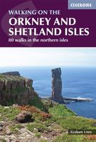
Wandelgids Walking guide to the Orkney and Shetland Isles | Cicerone

0
Uitstekende wandelgids van dit geweldige gebied. goed beschreven met veel praktische informatie om de route te kunnen lopen, inclusief redelijke kaarten. A guidebook to 80 walking routes on Scotland's Northern Isles of Orkney and Shetland. Routes are described on the islands of Orkney (Orkney Mainland, Hoy, South Ronaldsay, Burray, Rousay, Eday, We...

Webshops met dit product

Webshop
Bezorging
Prijs

Anderen bekeken ook

Wandelgids Walking guide to the Orkney and Shetland Isles | Cicerone
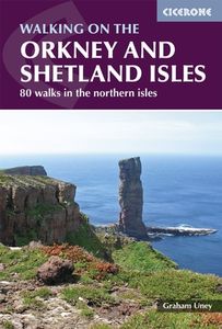
Uitstekende wandelgids van dit geweldige gebied. goed beschreven met veel praktische informatie om de route te kunnen lopen, inclusief redelijke kaarten. A guidebook to 80 walking routes on Scotland's Northern Isles of Orkney and Shetland. Routes are described on the islands of Orkney (Orkney Mainland, Hoy, South Ronaldsay, Burray, Rousay, Eday, Westray, Papa Westray, North Ronaldsay) and the islands of Shetland (Shetland Mainland, West Burra, East Burra, Foula, Fair Isle, Isle of Noss, Bressay, Whalsay, Papa Stour, Muckle Roe, Out Skerries, Esha Ness, Yell, Fetlar and Unst).   Routes vary in length from 1 mile to 16 miles, with something to suit all abilities. Offering a variety of landscapes together with a wealth of remarkable archaeological sites such as Skara Brae and Jarlshof, Orkney and Shetland are a walker's dream.   Step-by-step route descriptions are accompanied by clear OS mapping and a time estimate for completing each route. The book includes plenty of information on the …
22,50
Wandelgids 82 Pathfinder Guides Orkney and Shetland | Ordnance Survey
Wandelgids van een deel van Engeland. Deze gids bevat 28 dagwandelingen, variërend van korte tochten tot pittige dagtochten. De bijbehorende kaarten zijn uitstekend: men heeft de topografische kaarten van Ordnance Survey gebruikt waarop de route is ingetekend. Daarnaast praktische informatie over de wandeling en wat beschrijvingen van het gebied. 28 outstanding walks – 23 circular and five there-and-back routes visiting eleven islands across both archipelagos. The size and nature of the islands lend themselves best to short and half-day walks where unhurried and free-range walking is encouraged and the endless distractions of scenery, seabirds, wildflowers and sea watching are best appreciated and enjoyed at a relaxed pace.   In Orkney, the first walk is a short stroll around Hoxa Head with its extensive views across Scapa Flow and subsequent routes go on to explore more widely over Mainland Orkney and take in the islands of Hoy, Rousay and South Ronaldsay, concluding with a ramble alo…
18,50
Wandelgids Shetland | Pocket Mountains
Handige compacte wandelgids met 40 dagwandelingen. Deze gids bevat kleine kaartjes en leuke uitgebreide informatie over wat er langs de route te zien is. Goede wandelkaarten zijn echter we noodzakelijk voor deze tochten: de Ordnance Survey explorer maps of Landanger maps zijn zeer geschikt. The most northerly of Britain's island groups, Shetland is so far removed from the rest of the UK that it usually appears as an inset on maps. Although relatively little known to those from outside the islands, Shetland is a magnificent terrain for walkers, especially those who love to really explore and get away from the beaten track. The coastal walking here includes some of the finest in the country, with superb cliffs, towering sea stacks, caves and natural arches seemingly around every corner. Added to this is Shetland's better known claim to fame for its spectacular seabird colonies, huge gannetries, moorland packed with arctic and great skuas, arctic terns in the more sheltered spots, and eve…
10,95
Reisgids British Breaks Orkney | Rough Guides
Deze praktische zakgidsen, zorgvuldig samengesteld door experts, belichten minder bekende Britse bestemmingen voor stedentrips, kustvakanties en eilanduitjes. Ze bieden een schat aan informatie over wat er te zien en te doen is, inclusief gedetailleerde verkenning van elke wijk of buurt in de bestemming, met de beste bezienswaardigheden, winkels, restaurants, cafés en bars. Bovendien bieden ze excursies naar nabijgelegen gebieden voor diegenen die een langere vakantie willen genieten. These expert-curated pocket guide books shine a spotlight on more unusual British city break, coastal and island holiday destinations, with a wealth of practical information on what to see and do. Each area or neighbourhood in the destination is explored in-depth with detailed coverage of the points of interest, shops, restaurants, cafes and bars on offer. Excursions to surrounding areas give plenty of options for those looking to enjoy a longer stay. The Pocket Rough Guide to Orkney covers: Stromness, S…
13,95
Reisgids Shetland Guide Book | Charles Tait
The Shetland Guide Book offers unrivalled detail on the more than 100 islands that make up the Shetland Isles. The islands have a wealth of archaeological history, from viking farms to bronze age burial mounds, but the natural wonders are just as impressive and this guide will tell you where you can catch a glimpse of everything from puffins to ponies.   Charles Tait Guidebooks   Charles Tait Guidebooks are photographed, researched, designed and written by the author. Being an Orcadian photographer and travel writer, Charles Tait has been publishing guidebooks based on the natural and cultural history of the Highlands and Islands since 1991. The aim is to create authoritative, readable, informative, easily assimilated handbooks to each area. Each book is extensively illustrated with photographs by Charles Tait, as well as Ordnance Survey maps, old photographs and prints. The guides include introductions covering natural history, archaeology, history and the economy. The Gazetteer cover…
19,95
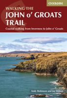
Wandelgids Walking the John o' Groats Trail | Cicerone
Guide to the John o' Groats Trail, a 233km walking route linking Inverness with John o' Groats on the northeast tip of mainland Britain. Much of the walking is coastal, with the northern half characterised by its spectacular seacliffs; however, there is some inland walking too, and the scenery is varied, ranging from dunes and deserted sandy beaches to beautiful woodland. With rough ground and some exposed clifftop walking, the route is suited to experienced hikers.   It takes around a fortnight to complete. The route is described in 14 stages, each of which includes: an overview map; step-by-step route description illustrated with custom mapping; details of accommodation, facilities and transport links; and information on local points of interest. While the main route description is from south to north, notes are supplied for southbound walkers.   Also included is a bonus route linking the trail with the Great Glen, for the benefit of walkers undertaking the Land's End to John o' Groa…
23,95
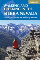
Wandelgids Walking and trekking in the Sierra Nevada | Cicerone
Uitstekende wandelgids voor de Sierra Nevada. Goed beschreven met veel praktische informatie om de route te kunnen lopen, inclusief redelijke kaarten. Aanbevolen wandelkaarten Wandelkaart NP Sierra Nevada met Alpujarras | Editorial Penibetica 1:40.000 of Wandelkaart Sierra Nevada en Alpujarras | Editorial Alpina - 1:40.000 Wandelkaart Sierra Nevada - la integral de los 3000 | Editorial Piolet 1:25.000   This guidebook presents 33 graded walks and 5 high mountain scrambles in the striking Sierra Nevada, the highest mountain range in mainland Spain and in western Europe outside the Alps. Easily accessible from Granada and Málaga, it is a world of soaring, snow-clad peaks and deep valleys, far removed from the crowded beaches of the Costa del Sol just two hours away. The routes are spread across the national park, with attractive towns and villages such as Trevélez, Lanjarón, Hoya de la Mora and Cumbres Verdes serving as potential bases for a walking holiday.   The walks have been careful…
20,95

Klanten-reviews van Wandelgids Walking guide to the Orkney and Shetland Isles | Cicerone

Er zijn nog geen beoordelingen voor dit productBen jij de eerste die een review plaatst?

Meer over Wandelgids Walking guide to the Orkney and Shetland Isles | Cicerone

Productomschrijving

Uitstekende wandelgids van dit geweldige gebied. goed beschreven met veel praktische informatie om de route te kunnen lopen, inclusief redelijke kaarten. A guidebook to 80 walking routes on Scotland's Northern Isles of Orkney and Shetland. Routes are described on the islands of Orkney (Orkney Mainland, Hoy, South Ronaldsay, Burray, Rousay, Eday, Westray, Papa Westray, North Ronaldsay) and the islands of Shetland (Shetland Mainland, West Burra, East Burra, Foula, Fair Isle, Isle of Noss, Bressay, Whalsay, Papa Stour, Muckle Roe, Out Skerries, Esha Ness, Yell, Fetlar and Unst).   Routes vary in length from 1 mile to 16 miles, with something to suit all abilities. Offering a variety of landscapes together with a wealth of remarkable archaeological sites such as Skara Brae and Jarlshof, Orkney and Shetland are a walker's dream.   Step-by-step route descriptions are accompanied by clear OS mapping and a time estimate for completing each route. The book includes plenty of information on the region's wildlife, archaeology and history, as well as practical tips such as when to go, what to take and getting to and around Orkney and Shetland.   Quiet, remote and abounding in rare plants and wildlife, together with some of the world's most fascinating archaeological sites, Orkney and Shetland offer a treasure trove of natural and historic wonders, and makes an ideal walking holiday destination.    Dorpen en Steden Sumburgh, Kirkwall, Lerwick, Stromness, Hamnavoe, Scalloway

Productspecificaties

Artikelnummer(s)
Brand
Cicerone
Webshop.nl maakt gebruik van cookies. Ga je verder op onze website, ga dan akkoord met het plaatsen van cookies en de verwerking van deze data door ons en vermelde partners.