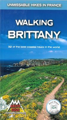
Wandelgids Walking Brittany - Bretagne | Knife Edge Outdoor

0
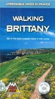
Wild coastline: endless towering cliffs, remote rocky headlands, almost forgotten islands and stunning beaches which would not be out of place on a Caribbean island.   Explore a region packed with beauty and historical interest: megalithic sites, World War 2 fortifications, ancient villages and much more. Real IGN Maps inside: 1:25,000.   Also inc...

Verkopers met dit product

Verkoper
Bezorging
Prijs
DeZwerver.nl logo
DeZwerver.nl
2,95
19,50

Anderen bekeken ook

Wandelgids Walking Brittany - Bretagne | Knife Edge Outdoor
Wild coastline: endless towering cliffs, remote rocky headlands, almost forgotten islands and stunning beaches which would not be out of place on a Caribbean island.   Explore a region packed with beauty and historical interest: megalithic sites, World War 2 fortifications, ancient villages and much more. Real IGN Maps inside: 1:25,000.   Also includes:   Numbered waypoints linking the Real Maps to our clear descriptions Graded routes to suit all abilities Everything the hiker needs to know: route descriptions,  difficulty, weather, how to get there, and more Information on Wildlife and Plants Carnac and other Megalithic sites  Section on World War 2 and the 'Atlantic Wall'   France is a large country with a huge and varied coastline. This coastline is very wild and very beautiful but rarely is it both wilder and more beautiful than in Brittany. This stunning part of the world's most visited country has around 3,000 km of sea frontage so you could spend a lifetime here walking along …
19,50
Reisgids Brittany and Normandy - Bretagne en Normandië | Rough Guides
Zeer goede reisgids voor zowel de georganiseerde maar vooral voor de zelfstandige reiziger. Boordevol informatie over reizen, slapen, eten, maar ook musea en cultuur. Voor Europese landen meestal completer en beter dan de Lonely Planet ! Practical travel guide to Brittany and Normandy with a free eBook featuring points-of-interest structured lists of all sights and off-the-beaten-track treasures, with detailed colour-coded maps, practical details about what to see and to do in Brittany and Normandy, how to get there and around, pre-departure information, as well as top time-saving tips, like a visual list of things not to miss in Brittany and Normandy, expert author picks and itineraries to help you plan your trip. The Rough Guide to Brittany and Normandy covers: Seine-Maritime; The Lower Normandy Coast; Inland Normandy; The North Coast and Rennes; Finistere; Inland Brittany: The Nantes-Brest Canal; The South Coast. Inside this travel guide you'll find:RECOMMENDATIONS FOR EVERY TYPE O…
24,95
Wandelgids Walking Chamonix Mont Blanc | Knife Edge Outdoor
The 20 hikes in the Chamonix Valley that need to be on your Bucket List. No fillers. Only must-do hikes are included.   Real IGN Maps inside: 1:25,000 Detailed information on public transport, including cable cars Our secret tips on how to get away from the crowds Numbered waypoints linking the Real Maps to our clear descriptions Graded routes to suit all abilities Everything the hiker needs to know: route descriptions, difficulty, weather, how to get there, and more Information on Wildlife and Plants   Our walks have been carefully selected to enable easy access by public transport, including the Chamonix Valley’s incredible cable car network.   Chamonix is the most famous mountain town in the world. It is where mountaineering began.  Its peerless reputation owes everything to the mighty Mont Blanc, the highest peak in Western Europe: our hikes will take you to the finest viewpoints of the mountain and its glaciers.
19,50
Wandelgids Trekking the Cleveland Way | Knife Edge Outdoor
The definitive two-way guide to the Cleveland Way, one of England's epic National Trails: both eastbound and westbound routes are described in full.   Real Maps: Full Ordnance Survey mapping inside (1:25,000). All accommodation is numbered and marked on the maps. 20 different itineraries: schedules of 5, 6, 7, 8, 9, 10 and 11 days for hikers and runners. Includes both eastbound and westbound itineraries. Difficult calculations of time, distance and altitude gain/loss are done for you.   Also includes: - Detailed information on equipment and travelling light - Full accommodation listings: the best pubs, B&Bs and hotels - Detailed section on camping, including wild camping - Everything the trekker needs to know: route, costs, difficulty, weather, travel, and more - Essential info for both self-guided and guided trekkers - Information on plants and wildlife - Numbered waypoints linking the Real Maps to our clear descriptions   Yorkshire's Cleveland Way is one of the most beautiful long-d…
23,95
Wandelgids Trekking the Dolomites Av1 | Knife Edge Outdoor
Superhandige wandelgids voor de Alta Via 1 in de Dolomieten. Met deze gids heb je verder niks nodig: alle benodigde Tabacco wandelkaarten zitten in deze gids! The only guidebook exclusively for the AV1.Everything you need to know to plan and walk Italy's most popular long distance route.Real maps inside (Tabacco 1:25,000): the finest maps available for the Dolomites. This makes navigation easy and there is no need to carry additional maps. Also includes:* Numbered waypoints linking maps to text* Unique Itinerary Planner: plan a bespoke itinerary to match your ability and vacation schedule. All difficult calculations of time, distance and altitude gain are done for you* 7 Proposed Itineraries of between 6 and 11 days* Everything the trekker needs to know to plan the route: route descriptions, costs, budget, difficulty, weather, how to get there, and more* Full accommodation listings: spectacularly situated mountain huts* Section on Camping* Exciting variants to the main route* Informat…
19,95
Wandelgids Trekking Everest Base Camp: | Knife Edge Outdoor
The definitive guidebook for trekking in the Everest Region: essential reading for both guided and self-guided trekkers. This book really knocks the ball out of the park. It fully describes the Classic Everest Base Camp Trek, 3-Passes Trek, Gokyo Lakes & 7 other incredible treks. It contains all the information you need to plan and execute your trek including: - How to organise a trek in the Everest region: booking a guided trip, independent trekking (which is still permitted around Everest), guides & porters. - Detailed advice on choice of trek: 29 different itineraries. - Altitude acclimatisation: how to avoid altitude sickness (AMS). - Travel to the trail-heads: air travel & hiking into the Everest region. - What equipment you need to bring. - What to expect on the trail: accommodation, food & daily routine. The book is also packed full of information that you will not find in any other guide: - Orientation charts show exactly which peaks are visible from each significant viewpo…
24,95
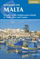
Wandelgids Walking on Malta | Cicerone
Wandelgids met 33 dagtochten op Malta, Gozo en Comino. Goede omschrijvingen, veel praktische informatie. Redelijk kaartmateriaal. (goede wandelkaart Kompass / zie landkaarten) The Maltese Islands of Malta, Gozo and Comino bask in sunshine at the heart of the Mediterranean, between Europe and Africa. History has ensured that the islands have been colonised time and time again, leaving them with a colourful and complex history and heritage. The islands are a popular tourist destination. They offer plenty of historic walks, stunningly beautiful and dramatic architecture, and a good amount of excellent scenery, especially around the cliffs and coastlines. This guidebook describes 33 walks on Malta and its neighbouring islands of Gozo and Comino. Walks generally range from 3 to 17 km, and include Valetta, heritage trails, coastal walks and explorations inland, including the 30km 'Victoria Lines' route between Mgarr and Bahar ic-Caghaq. Malta offers year-round walking. This guidebook descri…
21,95
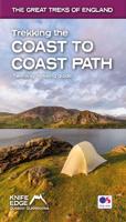
Wandelgids Trekking the Coast to Coast Path | Knife Edge Outdoor
The definitive two-way guide to the Coast to Coast Path: both eastbound and westbound routes are described in full. Real Maps: Full Ordnance Survey mapping inside (1:25,000). All accommodation is numbered and marked on the maps. 19 different itineraries: schedules of 11, 12, 13, 14, 15, 16, 17, 18 and 19 days for hikers and runners. Includes both eastbound and westbound itineraries. Difficult calculations of time, distance and altitude gain/loss are done for you. Also includes: - Detailed information on equipment and traveling light - Full accommodation listings: the best pubs, B&B's and hotels - Detailed section on camping, including wild camping - Everything the trekker needs to know: route, costs, difficulty, weather, travel, and more - Essential info for both self-guided and guided trekkers - Information on plants and wildlife - Numbered way points linking the Real Maps to our clear descriptions The Coast to Coast Path is the most popular and aspirational long-distance walking …
21,95
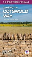
Wandelgids Trekking the Cotswold Way | Knife Edge Outdoor
The definitive two-way guide to the Cotswold Way: both southbound and northbound routes are described in full. Real Maps: Full Ordnance Survey mapping inside (1:25,000). All accommodation is numbered and marked on the maps. 18 different itineraries: schedules of 4, 5, 6, 7, 8, 9, 10, 11 and 12 days for hikers and runners. Includes both southbound and northbound itineraries. Difficult calculations of time, distance and altitude gain/loss are done for you. Also includes: - Detailed information on equipment and travelling light - Everything the trekker needs to know: route, costs, difficulty, weather, travel, and more - Full accommodation listings: the best inns, B&Bs and hotels - Detailed section on camping - What to see in the City of Bath - Essential info for both self-guided and guided trekkers - Information on history, plants and wildlife - Numbered waypoints linking the Real Maps to our clear descriptions The Cotswold Way travels 102 miles through the sublime scenery of the Cots…
22,50
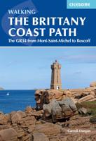
Wandelgids The Brittany Coast Path | Cicerone
Uitstekende wandelgids van deze mooie route. goed beschreven met veel praktische informatie om de route te kunnen lopen, inclusief redelijke kaarten This guide describes a 624km section of French long-distance route the GR34, following the north coast of Brittany from ever-popular Mont-Saint-Michel to the port of Roscoff. (The full GR34--also known as 'Sentier des Douaniers, ' the Customs Officers Path--totals some 2000km and follows in the footsteps of customs officers of old who patrolled the coast in attempt to curb smuggling.) The trail is waymarked and well maintained, offering mainly easy hiking, though there are a few more strenuous sections and some short steep ascents and descents. It takes around a month to complete but the guide also includes suggestions for four five-day 'highlight' sections. The route is described from east to west and presented in 28 stages. For each stage, you will find clear route description and mapping, summary statistics and notes on facilities, acc…
23,95

Klanten-reviews van Wandelgids Walking Brittany - Bretagne | Knife Edge Outdoor

Er zijn nog geen beoordelingen voor dit productBen jij de eerste die een review plaatst?

Meer over Wandelgids Walking Brittany - Bretagne | Knife Edge Outdoor

Productomschrijving

Wild coastline: endless towering cliffs, remote rocky headlands, almost forgotten islands and stunning beaches which would not be out of place on a Caribbean island.   Explore a region packed with beauty and historical interest: megalithic sites, World War 2 fortifications, ancient villages and much more. Real IGN Maps inside: 1:25,000.   Also includes:   Numbered waypoints linking the Real Maps to our clear descriptions Graded routes to suit all abilities Everything the hiker needs to know: route descriptions,  difficulty, weather, how to get there, and more Information on Wildlife and Plants Carnac and other Megalithic sites  Section on World War 2 and the 'Atlantic Wall'   France is a large country with a huge and varied coastline. This coastline is very wild and very beautiful but rarely is it both wilder and more beautiful than in Brittany. This stunning part of the world's most visited country has around 3,000 km of sea frontage so you could spend a lifetime here walking along the tops of the spectacular and seemingly endless cliffs; around the remote rocky headlands and peninsulas jutting out into the Atlantic; and across innumerable white sand beaches which would not be out of place on a Caribbean island.   With so much coast on offer, it is understandable that Brittany, and its people, have a strong connection with the sea: evidenced by the countless yachts, fishing boats and other watercraft which are moored in the ports, harbours, bays and estuaries.   In fact, there are many who would argue, with much justification, that Brittany has the finest stretch of coastline in Europe. Of course, that is a subjective matter but it is indisputable that the coast of Brittany is vast. So vast that it is not possible to see everything on a single trip. So vast, in fact, that it is difficult to know where to start and that is where this guidebook comes in. To make planning easy for you, we have included here only the very finest of the thousands of possible walks on Brittany's coast. There are no 'fillers': only the most spectacular routes made the cut. We have 'sifted the wheat from the chaff' so that you do not have to.
 

Productinformatie

    Verken gerelateerde categorieën

    Webshop.nl maakt gebruik van cookies. Ga je verder op onze website, ga dan akkoord met het plaatsen van cookies en de verwerking van deze data door ons en vermelde partners.