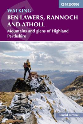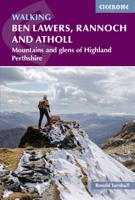
Wandelgids Walking Ben Lawers, Rannoch and Atholl | Cicerone

0
Wandelgids met 80 wandelingen van verschillende niveaus in het gebied van de Perthshire Highlands.  The south-eastern Grampians of the former county of Perthshire may be grassier and less rugged than other Scottish mountains, but they are just as big. The routes in this guide take you to the summits of these 'jolly green giants' - covering all of ...

Verkopers met dit product

Verkoper
Bezorging
Prijs
DeZwerver.nl logo
DeZwerver.nl
2,95
19,95

Anderen bekeken ook

Nieuw
Wandelgids 1 Walking The Munros Vol 1 Southern, Central and Western Highlands - Schotland | Cicerone
Uitstekende wandelgids van het zuiden, midden en westen van de Schotse Hooglanden. Goed beschreven met veel praktische informatie om de route te kunnen lopen, inclusief redelijke kaarten. Guidebook to walking the Munros in southern, central and western Highlands. Describes 69 challenging routes across 139 of the iconic 3000ft+ mountains covering areas such as Glencoe, Bridge of Orchy and Mull. Includes routes up Ben More, Ben Alder, Ben Lomond and Ben Nevis, the highest mountain in the British Isles. Volume 1 of two guidebooks.   Seasons The guide is intended for summer hillwalkers (usually April/May to October in Scotland). In winter conditions the routes become more serious mountaineering expeditions requiring appropriate skills, equipment and experience.   Centres Arrochar, Crianlarich, Killin, Pitlochry, Tyndrum, Glencoe, Fort William, Spean Bridge, Dalwhinnie, Braemar, Glenshee   Difficulty Most of the Munros are straightforward walks but some involve ridge walking, sc…
20,95
Nieuw
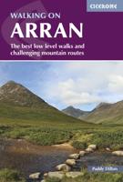
Wandelgids Walking on Arran | Cicerone
Uitstekende wandelgids voor dit uitdagende wandelgebied in Schotland. Dagtochten. The 45 walking routes in this Isle of Arran guidebook range from easy 3km (2 miles) nature trails to long arduous mountain routes with scrambles (up to 32km) providing thorough coverage of Arran, including the ascent of Goatfell and nearby Holy Isle. Most routes are 10km to 15km long but many give opportunities to create longer cross island walks. This guidebook presents a selection of 45 day walks on the popular and accessible Isle of Arran. The routes are between 2 miles (3km) and 20 miles (32km) in length, from easy waymarked forest trails to more arduous mountain walks, exposed ridge routes and scrambles. There are linear and circular walks to choose from, and opportunities to link routes together and create longer walks across the length and breadth of the island. With highlights including Goatfell, Beinn Tarsuinn, the Sannox Horseshoe, Glen Rosa and the Cock of Arran, there's something here to suit…
23,95
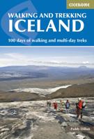
Wandelgids Walking and Trekking in Iceland - IJsland | Cicerone
Wandelgids met beschrijvingen, kaarten en praktische informatie zoals bussen, overnachten, etc. voor meerdaagse wandelroutes en dagwandeltochten op IJsland. A country of extraordinary beauty, Iceland’s incredible variety of volcanic and glacial landscapes makes it a unique destination for walking and trekking holidays. Its three national parks include the mighty Vatnajökull, largest national park in Europe.   The wide range of routes in this book introduce walkers and backpackers to this ‘Land of Ice and Fire’. There are 100 days of walking in this guidebook, stretching over 1722km, split between 49 day walks and 10 multi-stage treks. They climb mountains, cross glaciers, pass lakes and explore coastlines and geothermal areas, and range from easy nature trails to challenging treks. So, there is enough variation to satisfy all kinds of walkers. The routes are spread all around Iceland, grouped into twelve regions. Detailed information is given at the start of each route or trekking sta…
26,95
Nieuw
Wandelgids Walking in the Thames Valley | Cicerone
Walking in the Thames Valley offers 25 challenging circular walks around the River Thames and River Kennet in the south of England, taking in the Southern Chilterns, the Berkshire and North Hampshire Downs, Southern Oxfordshire and the eastern edge of Wiltshire. All routes are within easy reach of Reading, Newbury, Abingdon and London. While some walks visit Iron Age hill forts, others pass more modern features such as Wilton Windmill and the Kennet and Avon Canal. Some follow sections of the Ridgeway, while others meander along the banks of the Thames. What they all have in common is that they take the keen rambler to some of the best parts of the Thames Valley – a patchwork of open chalk grassland, broadleaved woodland and farmland and home to two Areas of Outstanding Natural Beauty. • walks from 10 to 18 miles, including one 2-day route • shorter, less strenuous alternatives for many of the walks • detailed route descriptions with information on local points of interest, OS mapping…
18,50
Nieuw
Wandelgids Walking on Jura, Islay and Colonsay | Cicerone
Uitstekende wandelgids van deze weldadige eilanden. goed beschreven met veel praktische informatie om de route te kunnen lopen, inclusief redelijke kaarten. This guidebook presents a selection of 23 walking routes on the wild and beautiful southern islands of Scotland's Inner Hebrides, with nine walks on Jura, one on neighbouring Scarba, seven on Islay and five on Colonsay, plus a spectacular 5-day trek along Jura's dramatic west coast. The wildest of the southern Hebrides, the walking on Jura is frequently rugged, with many routes crossing remote and often pathless terrain that calls for fitness, self-reliance and navigational competence. The routes on the other islands are somewhat easier, but should still not be underestimated.   In addition to clear route description illustrated with 1:50,000 OS mapping, the guide offers practical advice on the various options for getting to the islands, accommodation and amenities. There are suggestions for linking walks and notes on the islands'…
20,95
Nieuw
Wandelgids Walking in Zermatt and Saas-Fee | Cicerone
Wandelgids met dagtochten: goed beschreven met veel praktische informatie om de route te kunnen lopen, inclusief redelijke kaarten. Enorm veel keus in een groot gebied! Guidebook describing 50 varied walks in the Valais region in the heart of the Swiss Alps. The graded day walks based around the popular resort towns of Zermatt and Saas-Fee explore the Mattertal and Saastal valleys and the surrounding mountains. Ranging from 4 to 18km, the easily accessible routes make use of the area's extensive network of well-made mountain paths and its lift system. There are walks here to suit all tastes, from low-level lake walks or easy strolls up to mountain restaurants, through to serious mountain outings on steep and rocky trails. Distance, walking time and difficulty are shown for each route, and the detailed route description is accompanied by clear mapping.   Dominated by 4000m the giants, the Matterhorn and Monte Rosa, this is a land of contrasts, with snow-capped mountains and glaciers ab…
23,95
Wandelgids Walking in the Auvergne | Cicerone
Uitgebreide wandelgids van de Auvergne: goede beschrijvingen, veel keuze, kaarten wat minder goed. This handy guidebook offers the finest day walks in five different areas of the Auvergne, an often-forgotten region in central France perfect for accessible day walking in a unique and spectacular landscape. Towns such as Vichy, Clermont-Ferrand and Puy-en-Velay also offer delightful places to base yourself for that perfect walking holiday. The ridges, rocky peaks and verdant valleys of the Cantal supervolcano dominate south-western Auvergne. The centre of the region hosts the unique chain of 'puys' with their pudding bowl forms and the pristine crater lakes of the Sancy massif. In the north, the Montagne Bourbonnaise preserves a pastoral way of life which is quintessentially French while the Haute Loire's rivers and medieval abbeys reward those venturing further off the beaten track. Notes on the geology and history of points of interest passed en route help you to get the most out of y…
19,95
Nieuw
Wandelgids Walking and Trekking in the Japan Alps and Mount Fuji | Cicerone
This guidebook presents nine day-walks and thirteen treks of 2-8 days in the magnificent Japanese Alps, plus the four main routes up Japan's highest mountain, Mount Fuji (3776m), and a further route on neighbouring Mount Kurodake. The Japanese Alps stretch across the middle of the main island of Honshu and include several peaks over 3000m. Mount Fuji lies to the south: an active stratovolcano (though with minimal risk of eruption), it has become an iconic symbol of Japan and sees 300,000 visitors to its summit every year. The guide includes all the information you will need to plan a successful walking or trekking holiday, with a wealth of advice on travel, bases, accommodation and facilities. The Japan Alps and Mount Fuji boast a well-developed walking infrastructure, and the routes make use of the many mountain huts and campgrounds, full details of which are given in the guide. Some also include the opportunity to visit a traditional hot spring bath for a refreshing soak after your…
29,95
Wandelgids Walk! La Gomera | Discovery Walking Guides
La Gomera is the ultimate get-away-from-it-all island: easy-going, unspoilt, friendly, isolated from the hustle and bustle of modern living, and so laid back it’s virtually supine - even the volcanoes have been dormant for millions of years. The walks, however, are a bit more energetic. For the new 4th edition of Walk! La Gomera Charles Davis has teamed up with Jan Kostura. Jan brings his wide experience and passion for the Canaries, checking, re-walking and revising existing routes, and adding a couple of his own adventures, including a new Top Three Gomeran walk. Two routes have been dropped as having become too dangerous, but the good news is that many of the more harum-scarum walks have been improved through path clearing and the addition of railings to the vertiginous stretches. Other good news is that the devastating forest fires of 2012 have proved not nearly as damaging as we feared, leaving most of our itineraries unscathed. In short, there is every reason to take off and ex…
17,50
Wandelgids Walking in Torridon, Fisherfield, Fannichs and An Teallach | Cicerone
Guide to 50 walks and easy scrambles in north-western Scotland, covering Southern Torridon, Northern Torridon, Letterewe and Fisherfield, and the Fannichs. Ascents of 27 Munros, 20 Corbetts and 14 Grahams are included, with highlights including Liathach, Beinn Eighe, Beinn Alligin, An Teallach and Slioch. The walks are suitable for those with good navigation skills who are competent in a mountain environment.   All the walks in the guide are graded, with summary statistics provided, and each includes clear route description and mapping. There's also a route summary table to help with choosing appropriate walks. Background information on local geology, wildlife and history, and planning details on when to go, where to stay and what to take are included to make the most out of any trip to Torridon.   The region boasts spectacular and distinctive landscapes and breathtaking views. Steep-sided rocky mountains rise above long winding lochs, both freshwater and sea. From the hills there are…
23,95

Klanten-reviews van Wandelgids Walking Ben Lawers, Rannoch and Atholl | Cicerone

Er zijn nog geen beoordelingen voor dit productBen jij de eerste die een review plaatst?

Meer over Wandelgids Walking Ben Lawers, Rannoch and Atholl | Cicerone

Productomschrijving

Wandelgids met 80 wandelingen van verschillende niveaus in het gebied van de Perthshire Highlands. 

The south-eastern Grampians of the former county of Perthshire may be grassier and less rugged than other Scottish mountains, but they are just as big. The routes in this guide take you to the summits of these 'jolly green giants' - covering all of the region's Munros, often by unconventional routes, as well as several Corbetts and smaller hills - and also over the Atholl passes, along rivers and through the woods of Perthshire's 'Big Tree Country'. The 80 walks comprise a mixture of low-level, mid-level and mountain routes and are graded by both length and difficulty. Many are demanding, crossing remote, uneven, steep and/or pathless terrain, but also included are gentler walks on clear paths taking in local features of interest.   The route description is illustrated with clear mapping (a mixture of OS 1:50,000 and smaller-scale maps for the longer routes) and the route summary table and grading information make it easy to choose an appropriate route. There is a wealth of information about the landscape and the region's fascinating history. Finally, appendices cover local facilities and access to the hills during the deer-stalking season.   With highlights including the mighty Ben Lawers, Beinn Dorain, Ben Alder and Beinn a' Ghlo; Schiehallion; the great rivers Tay and Garry; the Birks of Aberfeldy; and old drovers' routes over the passes of Minigaig and Gaick, Perthshire has plenty to offer. And with historic towns, such as Perth and Pitlochry, and attractive villages, this is an ideal base for a walking holiday.

Verken gerelateerde categorieën

Webshop.nl maakt gebruik van cookies. Ga je verder op onze website, ga dan akkoord met het plaatsen van cookies en de verwerking van deze data door ons en vermelde partners.