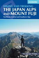
Wandelgids Walking and Trekking in the Japan Alps and Mount Fuji | Cicerone

0
This guidebook presents nine day-walks and thirteen treks of 2-8 days in the magnificent Japanese Alps, plus the four main routes up Japan's highest mountain, Mount Fuji (3776m), and a further route on neighbouring Mount Kurodake. The Japanese Alps stretch across the middle of the main island of Honshu and include several peaks over 3000m. Mount F...

Verkopers met dit product

Verkoper
Bezorging
Prijs
DeZwerver.nl logo
DeZwerver.nl
2,95
29,95

Anderen bekeken ook

Wandelgids Walking and Trekking in the Japan Alps and Mount Fuji | Cicerone
This guidebook presents nine day-walks and thirteen treks of 2-8 days in the magnificent Japanese Alps, plus the four main routes up Japan's highest mountain, Mount Fuji (3776m), and a further route on neighbouring Mount Kurodake. The Japanese Alps stretch across the middle of the main island of Honshu and include several peaks over 3000m. Mount Fuji lies to the south: an active stratovolcano (though with minimal risk of eruption), it has become an iconic symbol of Japan and sees 300,000 visitors to its summit every year. The guide includes all the information you will need to plan a successful walking or trekking holiday, with a wealth of advice on travel, bases, accommodation and facilities. The Japan Alps and Mount Fuji boast a well-developed walking infrastructure, and the routes make use of the many mountain huts and campgrounds, full details of which are given in the guide. Some also include the opportunity to visit a traditional hot spring bath for a refreshing soak after your…
29,95
Wandelgids Walking and trekking in the Sierra Nevada | Cicerone
Uitstekende wandelgids voor de Sierra Nevada. Goed beschreven met veel praktische informatie om de route te kunnen lopen, inclusief redelijke kaarten. Aanbevolen wandelkaarten Wandelkaart NP Sierra Nevada met Alpujarras | Editorial Penibetica 1:40.000 of Wandelkaart Sierra Nevada en Alpujarras | Editorial Alpina - 1:40.000 Wandelkaart Sierra Nevada - la integral de los 3000 | Editorial Piolet 1:25.000   This guidebook presents 33 graded walks and 5 high mountain scrambles in the striking Sierra Nevada, the highest mountain range in mainland Spain and in western Europe outside the Alps. Easily accessible from Granada and Málaga, it is a world of soaring, snow-clad peaks and deep valleys, far removed from the crowded beaches of the Costa del Sol just two hours away. The routes are spread across the national park, with attractive towns and villages such as Trevélez, Lanjarón, Hoya de la Mora and Cumbres Verdes serving as potential bases for a walking holiday.   The walks have been carefu…
20,95
Wandelgids Walking and Trekking in Iceland - IJsland | Cicerone
Wandelgids met beschrijvingen, kaarten en praktische informatie zoals bussen, overnachten, etc. voor meerdaagse wandelroutes en dagwandeltochten op IJsland. A country of extraordinary beauty, Iceland’s incredible variety of volcanic and glacial landscapes makes it a unique destination for walking and trekking holidays. Its three national parks include the mighty Vatnajökull, largest national park in Europe.   The wide range of routes in this book introduce walkers and backpackers to this ‘Land of Ice and Fire’. There are 100 days of walking in this guidebook, stretching over 1722km, split between 49 day walks and 10 multi-stage treks. They climb mountains, cross glaciers, pass lakes and explore coastlines and geothermal areas, and range from easy nature trails to challenging treks. So, there is enough variation to satisfy all kinds of walkers. The routes are spread all around Iceland, grouped into twelve regions. Detailed information is given at the start of each route or trekking sta…
26,95
Wandelgids Walking and Trekking in the Zagori | Cicerone
Uitstekende wandelgids van Zagori. Goed beschreven met veel praktische informatie om de routes te kunnen lopen, inclusief redelijke kaarten. Zagori in Greece's Northern Pindos National Park is among the last relatively undiscovered and unspoilt hiking destinations in Europe. This guide presents a selection of thirty walks and three short treks showcasing the region's captivating scenery, from dramatic gorges to mystical forests, crystal-clear turquoise rivers, rugged alpine peaks and characterful mountain villages. Routes vary from easy walks on clear paths to strenuous ascents and mountain traverses, meaning that there is something to suit most ambitions and abilities. Clear mapping accompanies the route description, and the introduction to the guide covers all the practicalities, including getting to Zagori, accommodation, equipment, maps and safety. There is also a wealth of information about the region's rich history, architecture, geology, plants and wildlife, as well as fascina…
23,95
Wandelgids Walking in the Alps | Cicerone
Geweldig overzichtswerk van prachtige wandelroutes in de Alpen. Suggests many routes, and covers the range from the Maritime Alps of southern France to the Julian Alps of Slovenia. Walks vary from undemanding to long and tough, and everything in between. Walking is unquestionably the best method of exploring, and it is the mountain walker for whom journeys in the Alps reveal some of the finest views, the greatest contrasts. This book then is a definitive guide to the many thousands of possible routes, with a geographical span that ranges from the Maritime Alps of southern France to the Julians of Slovenia, from Italy's Gran Paradiso to the little-known Turnitzer Alps of eastern Austria, from the ice-bound giants of the Bernese Oberland to the green rolling Kitzbuheler Alps and the bizarre towers of the Dolomites of South Tirol, showing the amazing diversity of this wonderful mountain chain. There are walks to suit every taste: gentle and undemanding, long and tough, and everything in …
33,95
Wandelgids Trekking in the Silvretta and Ratikon Alps | Cicerone
Aanbevolen wandelkaarten bij deze gids: Schaal 1:60.000 Wandelkaart 14 Unterengadin | Kümmerly & Frey Wandelkaart 13 Davos - Arosa | Kümmerly & Frey Of schaal 1:25.000 Wandelkaart 26 Alpenvereinskarte Silvrettagruppe This guide describes three treks, between 5 and 8 days, in the Silvretta and Rätikon Alps starting near Klosters, and 12 half-day hut-to-hut routes. These contrasting ranges form a line on the borders of Switzerland, Austria and Liechtenstein. The Tour of the Silvretta, the Prättigauer Höhenweg and the Rätikon Höhenweg. Straddling the borders of Austria, Switzerland and Liechtenstein, the limestone Rätikon Alps reach into the snow-bound and glacier-hung Silvretta Alps to provide a richly diverse series of landscapes. The Tour of the Silvretta, the Prättigauer Höhenweg and the Rätikon Höhenweg, all within easy reach of Klosters, have been devised to help trekkers explore the best of the region. Given sifficient time they can also be combined to create a continuous 2-week t…
25,95
Wandelgids Beieren - Walking in the Bavarian Alps | Cicerone
Wandelgids met dagtochten: goed beschreven met veel praktische informatie om de route te kunnen lopen, inclusief redelijke kaarten. Enorm veel keus in een groot gebied! This guidebook of walks explores Germany's Bavarian Alps. Lying along the German-Austrian border in a thin sliver of land roughly 300km long, this area contains some of the most spectacular walking and beautiful scenery that Germany has to offer. 70 graded walks explore mountain landscapes, wild mountain gorges and alpine meadows as well as the region's picturesque villages, opulent baroque churches and fairy-tale castles like Neuschwanstein. The walks are divided into six mountain areas, grouped around base towns to make planning a walking holiday as easy as possible. Bases include Oberstdorf, Garmisch-Partenkirchen, Mittenwald, Marquartstein, Inzell, Oberammergau and Ramsau among others. Mountain walks are mainly between 3 and 8 hours duration, though some longer walks are included staying at mountain huts. The guide…
24,95
Wandelgids Trekking in the Alps | Cicerone
All the rich scenic diversity for which the Alps are renowned is celebrated here, while the 20 treks described include well-known classics as well as newly-created multi-day routes. The eight talented writers and photographers brought together to produce this book are among the most experienced of Alpine trekkers. Between them they have explored every corner of Europe’s premier mountain range, written dozens of guides and, in some cases, led trekking holidays there in order to share their enthusiasm for the Alps with other walkers. And that is the prime motivation for Trekking in the Alps – an inspiration and a celebration of the very best of these mountains. Best-known treks Tour of Mont Blanc; Tour of the Matterhorn; Tour of Monte Rosa; Walker’s Haute Route; Tour of the Jungfrau Region; Tour of the Vanoise; Dolomites AV 1 & 2 Longer trans-Alpine treks GR5 (Lake Geneva to Nice); Eastern Alps E5; Italian Alps GTA; Traverse of the Slovenian Alps For the Alpine adventurer Alpine Pass Ro…
28,95
Wandelgids Karawanken - Slovenie - Walking in the Karavanke | Cicerone
Goede wandelgids met veel dagtochten; redelijk kaartmateriaal en goede praktische informatie. This guidebook offers 23 walking routes set across the magnificent 120km-long Karavanke mountain range, which forms a natural border between Austria and Slovenia. Commonly known as 'the way the Alps used to be', as it is yet to experience the extent of commercial development known by the Western Alps, it is one of the longest ranges in Western Europe but it remains genuinely unspoilt and relatively unvisited by English-speaking hillwalkers. The guide's walks begin in pretty towns and villages, and most of them access the peaks from the relatively more gentle Slovenian side of the range, where forest-clad slopes lead to grassy summits where spectacular views can be enjoyed. Arranged by peak from west to east along the range, most of the summits can be reached by waymarked paths and trails. The guide gives all the practical details you need on transport, accessing the routes, accommodation and …
20,95
Wandelgids Walking in Zermatt and Saas-Fee | Cicerone
Wandelgids met dagtochten: goed beschreven met veel praktische informatie om de route te kunnen lopen, inclusief redelijke kaarten. Enorm veel keus in een groot gebied! Guidebook describing 50 varied walks in the Valais region in the heart of the Swiss Alps. The graded day walks based around the popular resort towns of Zermatt and Saas-Fee explore the Mattertal and Saastal valleys and the surrounding mountains. Ranging from 4 to 18km, the easily accessible routes make use of the area's extensive network of well-made mountain paths and its lift system. There are walks here to suit all tastes, from low-level lake walks or easy strolls up to mountain restaurants, through to serious mountain outings on steep and rocky trails. Distance, walking time and difficulty are shown for each route, and the detailed route description is accompanied by clear mapping.   Dominated by 4000m the giants, the Matterhorn and Monte Rosa, this is a land of contrasts, with snow-capped mountains and glaciers ab…
23,95

Klanten-reviews van Wandelgids Walking and Trekking in the Japan Alps and Mount Fuji | Cicerone

Er zijn nog geen beoordelingen voor dit productBen jij de eerste die een review plaatst?

Meer over Wandelgids Walking and Trekking in the Japan Alps and Mount Fuji | Cicerone

Productomschrijving

This guidebook presents nine day-walks and thirteen treks of 2-8 days in the magnificent Japanese Alps, plus the four main routes up Japan's highest mountain, Mount Fuji (3776m), and a further route on neighbouring Mount Kurodake. The Japanese Alps stretch across the middle of the main island of Honshu and include several peaks over 3000m. Mount Fuji lies to the south: an active stratovolcano (though with minimal risk of eruption), it has become an iconic symbol of Japan and sees 300,000 visitors to its summit every year.

The guide includes all the information you will need to plan a successful walking or trekking holiday, with a wealth of advice on travel, bases, accommodation and facilities. The Japan Alps and Mount Fuji boast a well-developed walking infrastructure, and the routes make use of the many mountain huts and campgrounds, full details of which are given in the guide. Some also include the opportunity to visit a traditional hot spring bath for a refreshing soak after your hike.

The routes visit many of the region's key summits, including several over 3000m. They are graded according to difficulty, although several entail steep ascents and difficult terrain and some include scrambling and exposure calling for a sure foot and a good head for heights. Comprehensive step-by-step route descriptions are accompanied by clear mapping and there are additional notes on plants and wildlife, the history of hiking in Japan and safety in the mountains, as well as full mountain hut listings and a helpful glossary. Inspirational colour photography completes the package.

Hakuba, Murod and Kamikchi (North Alps), Komagane (Central Alps), Hirogawara and Sawarajima (South Alps), Kawaguchiko and Mt Fuji area  

Productinformatie

    Verken gerelateerde categorieën

    Webshop.nl maakt gebruik van cookies. Ga je verder op onze website, ga dan akkoord met het plaatsen van cookies en de verwerking van deze data door ons en vermelde partners.