webshop.nl
Categorieën
  Sluiten

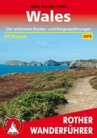
Wandelgids Wales | Uitgeverij Elmar

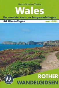
De Rother wandelgids Wales beschrijft de 50 mooiste kust- en bergwandelingen in het westen van het Verenigd Koninkrijk - van Pembrokeshire tot Anglesey, van de Ierse Zee tot de grens met Engeland, in de bergachtige regio's, het binnenland en langs de kust.   * Betrouwbare routebeschrijvingen * Gedetailleerde wandelkaarten * Informatieve hoogteprofi...
18,99

Webshops met dit product

Webshop
Bezorging
Prijs

Anderen bekeken ook

Wandelgids Wales | Rother Bergverlag
Uitstekende wandelgids met 50 dagtochten in dal en hoger gelegen delen van het gebergte. Met praktische informatie en beperkt kaartmateriaal! Wandelingen in verschillende zwaarte weergegeven in rood/blauw/zwart. Deze wandelgidsen uitgever staat hoog aangeschreven en is een begrip onder de wandelaars! Aanbevolen wandelkaarten bij deze gids:   The Gower + directe omgeving Wandelkaart - Topografische kaart 164 Explorer Gower, Gwyr | Ordnance Survey 1:25.000 Wandelkaart - Topografische kaart 178 Explorer Llanelli, Ammanford, Rhydaman | Ordnance Survey 1:25.000   Pembrokeshire Wandelkaart - Topografische kaart OL35 Explorer Pembrokeshire North - Gogledd Sir Benfro | Ordnance Survey 1:25.000 Wandelkaart - Topografische kaart OL36 Explorer South Pembrokeshire - De Sir Benfro | Ordnance Survey 1:25.000 Wandelkaart - Topografische kaart 198 Explorer Cardigan, New Quay | Ordnance Survey 1:25.000 Wandelkaart - Topografische kaart 185 Explorer Newcastle Emlyn | Ordnance Survey 1:25.000 Wandelkaart…
17,50
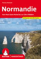
Wandelgids Normandië | Uitgeverij Elmar
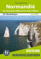
De Rother wandelgids Normandië beschrijft 50 prachtige wandelingen aan de kust en in het binnenland van Normandië. Langs mooie zandstranden en wilde kliffen en door idyllische weiden en moerasgebieden.   Zoals gebruikelijk zijn er verschillende wandelingen voor beginnende en ervaren wandelaars en is er onmisbare informatie over de streek, de bezienswaardigheden en recreatiemogelijkheden.   De betrouwbare routebeschrijvingen, gedetailleerde kaarten en hoogteprofielen zorgen voor een onvergetelijke wandelervaring.   1 3.10 uur Pointe de Roche Torin 2 3.00 uur Le Grouin du Sud 3 3.30 uur Aan de Bec d’Andaine  4 2.15 uur Falaises de Champeaux 5 2.45 uur Le Roc de Granville  6 3.10 uur Havre de la Vanlée   7 3.30 uur Rondom La Pointe d’Agon   8 2.15 uur Pointe du Becquet en Havre de St-Germain-sur-Ay  9 4.30 uur Pointe du Banc en de duinen van Surville  10 2.30 uur Portbail en Lindbergh-Plage   11 4.20 uur Van Carteret naar Portbail-Plage   12 2.45 uur Cap de Carteret en Dunes d…
18,99
Wandelgids Corsica | Uitgeverij Elmar
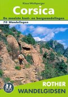
De Rother wandelgids Corsica telt maar liefst zeventig wandelingen. Corsica is een populaire vakantiebestemming vanwege het gunstige klimaat, de kilometer lange zandstranden, gezellige dorpjes, uitgestrekte wouden en kristalheldere meren en beken. Maar het zijn vooral de imposante berglandschappen die Corsica bij wandelaars populair maakt. De Rother wandelgids Corsica bevat een rijke keus aan wandelingen. Van eenvoudige strandwandelingen tot zwaardere hoogtetochten voor de gevorderde wandelaar. De wandelingen zijn voorzien van betrouwbare routebeschrijvingen, gedetailleerde wandelkaarten en informatieve hoogteprofielen. Aanbevolen wandelkaarten bij deze gids:  In het noorden van Corsica (wandeling 1 t/m 14): IGN kaarten 1:25.000 Wandelkaart - Topografische kaart 4347OT Cap Corse | IGN Wandelkaart - Topografische kaart 4348OT Bastia | IGN Wandelkaart - Topografische kaart 4349OT Vescovato | IGN Wandelkaart - Topografische kaart 4351OT Cervione | IGN Wandelkaart - Topografische kaart 414…
19,99
Nieuw
Wandelkaart Pembrokeshire | Northern Eye Books
OS Map Books: Wales Coast Path: Pembrokeshire Coast Path Map Atlas | Ordnance Survey ‘Explorer’ Large-scale 1:25,000 maps for the Pembrokeshire Coast in compact book format | Pocket Atlas | Walking Wales | UK Long-Distance Trails | Hiking | Adventure   One of seven handy Ordnance Survey Map Books covering the entire 870 mile/1400 kilometre-long, world-class Wales Coast Path — from Chester in the north to Chepstow in the south.   Enjoy enhanced, large scale (1:25,000) Ordnance Survey Explorer mapping in compact atlas format with all the detailed mapping you need to walk the Pembrokeshire Coast section of the Wales Coast Path.   Continuous, full colour OS mapping covering the Wales Coast Path between Cardigan and Amroth. Contains extracts from large scale Explorer maps OL 35 and OL 36. The enhanced OS 1:25,000 maps are accurate, up-to-date and reliable. Additional map symbols show tea shops, cafes, extra parking, and public toilets.   A brief introduction to Pembrokeshire Coast includes …
17,50
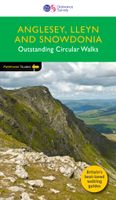
Wandelgids 78 Pathfinder Guides Anglesey, Lleyn and Snowdonia | Ordnance Survey
Fraaie, goed verzorgde wandelgidsjes met 28 wandelingen van max. een dag, (beginnend bij korte, eindigend bij langere wandelingen). Weergegeven op duidelijke topografische kaartjes (1:25.000). Bevat verder wetenswaardigheden en praktische informatie voor onderweg. Experience breathtaking north Wales with 28 unforgettable walks through Anglesey, the Lleyn Peninsula and the Snowdonia National Park. Find stunning views of the Welsh coast, the ‘holy isle’ of Ynys Mon and sublime Snowdonia with a range of walks graded by length and difficulty, from relaxed rambles to challenging climbs.   Featured Anglesey, Lleyn and Snowdonia walks include:   - Enjoy views of Snowdon from the shores of Llyn Padarn, dotted with remnants of the Llanberis slate quarries and a medieval castle - Climb to Holyhead Mountain, Anglesey’s highest point, through the South Stacks Cliff Nature Reserve - See the glorious Lleyn Heritage Coast from the headland of Trywn-y-Tâl, circling back to the pleasant village of Tref…
18,50
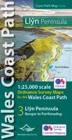
Wandelkaart Wales Coast Path Llyn Peninsula Map | Northern Eye Books
Enhanced, large scale (1: 25,000) Ordnance Survey mapping in a handy atlas format with all the mapping you need to walk a complete circuit of the Anglesey section of the Wales Coast Path.   Continuous OS mapping covering the complete route from Bangor to Porthmadog. Contains coastal extracts from large scale Explorer maps 253 and 254.   The Llyn Peninsula Ordnance Survey mapping book is part of a series of map atlases covering the whole of the 870-mile long Wales Coast Path. The enhanced OS 1:25,000 maps are accurate, up-to-date and reliable. Additional map symbols show tea shops, cafes, extra parking, and public toilets.   A brief introduction to the Llyn Peninsula includes a fascinating photo mosaic highlighting notable views, places of interest and wildlife you’ll meet along the way. There is also a section of detailed Useful Information at the back of the atlas.   Laminated flapped covers showing Wales Coast Path signs and waymarkers, route details and map symbols make these atlase…
16,50
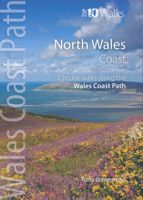
Wandelgids North Wales Coast walks | Northern Eye Books
Zeer handzaam boekje van een tiental rondwandelingen, met goede kaarten en beschrijving. Leuke toevoeging op de route of als je alleen maar naar die streek gaat en op zoek bent naar mooie dagtochten.   One of a series of nine books in the new Top 10 Walks: Wales Coast Path series. Handy, pocket-sized, full colour walking guides written by experts. The perfect impulse buy. Each volume outlines the most popular circular walks along key sections of the Wales Coast Path. Other titles in the series include: Isle of Anglesey, Llyn Peninsula, Cardigan Bay North, Ceredigion Coast Path, Pembrokeshire North, Pembrokeshire South, Carmarthen Bay & Gower and South Wales Coast. These attractive and cleverly structured guidebooks give walkers the ten finest circular routes on a section of the Wales Coast Path in a popular pocketable format. With clear information, an overview and introduction for each walk, expertly written numbered directions, enhanced Ordnance Survey maps, eye-grabbing panoramic ph…
10,95
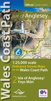
Wandelkaart Wales Coast Path: Isle of Anglesey | Northern Eye Books
Enhanced, large scale (1: 25,000) Ordnance Survey mapping in a handy atlas format with all the mapping you need to walk a complete circuit of the Anglesey section of the Wales Coast Path.   Continuous OS mapping covering the complete circuit from Menai Bridge. Contains coastal extracts from large scale Explorer maps 262 and 263.   The Isle of Anglesey/Ynys Mon Ordnance Survey mapping book is part of a series of map atlases covering the whole of the 870-mile long Wales Coast Path. The enhanced OS 1:25,000 maps are accurate, up-to-date and reliable. Additional map symbols show tea shops, cafes, extra parking, and public toilets.   A brief introduction to Anglesey includes a fascinating photo mosaic highlighting notable views, places of interest and wildlife you’ll meet along the way. There is also a section of detailed Useful Information at the back of the atlas.   Laminated flapped covers showing Wales Coast Path signs and waymarkers, route details and map symbols make these atlases sim…
16,50
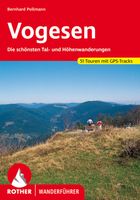
Wandelgids Vogesen - Vogezen | Rother Bergverlag
Uitstekende wandelgids met een groot aantal dagtochten in dal en hooggebergte. Met praktische informatie en beperkt kaartmateriaal! Wandelingen in verschillende zwaarte weergegeven in rood/blauw/zwart. Aanbevolen wandelkaarten bij deze gids:   Vosges du Nord (wandeling 1 t/m 10) Wandelkaart - Topografische kaart 3713ET Pays de Bitche - Dambach - PNR des Vosges du Nord | IGN 1:25.000 Wandelkaart - Topografische kaart 3814ET Hagenau - Lembach - PNR des Vosges du Nord | IGN 1:25.000 Wandelkaart - Topografische kaart 3614ET Sarre-Union - Phalsbourg | IGN 1:25.000 Wandelkaart - Topografische kaart 3714ET la Petite Pierre - Petite Pierre, Niederbronn-les-Bains, PNR Vosges du Nord | IGN 1:25.000 Wandelkaart - Topografische kaart 3715OT Sarrebourg - Phalsbourg - Pays des Etangs | IGN 1:25.000 Wandelkaart - Topografische kaart 3715ET Wasselone - Rocher de Dabo - Saverne | IGN 1:25.000   Centrale Vogezen (wandeling 11 t/m 29) Wandelkaart - Topografische kaart 3515SB Lorquin - Avricourt | IGN 1:2…
18,50
Wandelgids 260 Normandie - Normandië | Rother Bergverlag
Uitstekende wandelgids met een groot aantal dagtochten in dal en hooggebergte; in dit geval vooral prachtige kustwandelingen. Met praktische informatie en beperkt kaartmateriaal! Wandelingen in verschillende zwaarte weergegeven in rood/blauw/zwart. Aanbevolen wandelkaarten bij deze gids: Wandeling 1 t/m 27 (schaal 1:25.000) Wandelkaart - Topografische kaart 1315SB Brécey - Ducey - Avranches | IGN Wandelkaart - Topografische kaart 1215ET Avranches, Granville, Le Mont Saint Michel | IGN Wandelkaart - Topografische kaart 1214ET Granville, Coutances, Iles Chausey | IGN Wandelkaart - Topografische kaart 1212ET La Haye-du-Puits Lessay | IGN Wandelkaart - Topografische kaart 1211OT Les Pieux, Barneville, Carteret | IGN Wandelkaart - Topografische kaart 1210OT Cherbourg-en-Cotentin, Cap de la Hague | IGN Wandelkaart - Topografische kaart 1310OT Cherbourg, Pointe de Barfleur | IGN Wandelkaart - Topografische kaart 1412OT Pointe Du Hoc - Omaha Beach | IGN Wandelkaart - Topografische kaart 1512OT…
18,50

Klanten-reviews van Wandelgids Wales | Uitgeverij Elmar

Er zijn nog geen beoordelingen voor dit productBen jij de eerste die een review plaatst?

Meer over Wandelgids Wales | Uitgeverij Elmar

Productomschrijving

De Rother wandelgids Wales beschrijft de 50 mooiste kust- en bergwandelingen in het westen van het Verenigd Koninkrijk - van Pembrokeshire tot Anglesey, van de Ierse Zee tot de grens met Engeland, in de bergachtige regio's, het binnenland en langs de kust.   * Betrouwbare routebeschrijvingen * Gedetailleerde wandelkaarten * Informatieve hoogteprofielen * Downloadbare GPS Tracks   Aanbevolen wandelkaarten bij deze gids:   The Gower + directe omgeving Wandelkaart - Topografische kaart 164 Explorer Gower, Gwyr | Ordnance Survey 1:25.000 Wandelkaart - Topografische kaart 178 Explorer Llanelli, Ammanford, Rhydaman | Ordnance Survey 1:25.000   Pembrokeshire Wandelkaart - Topografische kaart OL35 Explorer Pembrokeshire North - Gogledd Sir Benfro | Ordnance Survey 1:25.000 Wandelkaart - Topografische kaart OL36 Explorer South Pembrokeshire - De Sir Benfro | Ordnance Survey 1:25.000 Wandelkaart - Topografische kaart 198 Explorer Cardigan, New Quay | Ordnance Survey 1:25.000 Wandelkaart - Topografische kaart 185 Explorer Newcastle Emlyn | Ordnance Survey 1:25.000 Wandelkaart - Topografische kaart 177 Explorer Carmarthen, Kidwelly | Ordnance Survey 1:25.000   Snowdonia National Park Wandelkaart - Topografische kaart OL17 Explorer Snowdon - Conwy Valley - Dyffryn Conwy | Ordnance Survey 1:25.000 Wandelkaart - Topografische kaart OL18 Explorer Harlech - Porthmadog - Y Bala | Ordnance Survey 1:25.000 Wandelkaart - Topografische kaart OL23 Explorer Cadair Idris - Llyn Tegid | Ordnance Survey 1:25.000 Wandelkaart - Topografische kaart 254 Explorer Lleyn Peninsula East | Ordnance Survey 1:25.000   Lleyn Peninsula  & Anglesey Wandelkaart - Topografische kaart 253 Explorer Lleyn Peninsula West | Ordnance Survey 1:25.000 Wandelkaart - Topografische kaart 254 Explorer Lleyn Peninsula East | Ordnance Survey 1:25.000 Wandelkaart - Topografische kaart 262 Explorer Anglesey West | Ordnance Survey 1:25.000 Wandelkaart - Topografische kaart 263 Explorer Anglesey East | Ordnance Survey 1:25.000   Noordoost Wales Wandelkaart - Topografische kaart 264 Explorer Vale of Clwyd, Dyffryn Clwyd | Ordnance Survey 1:25.000 Wandelkaart - Topografische kaart 265 Explorer Clwydian Range, Bryniau Clwyd | Ordnance Survey 1:25.000 Wandelkaart - Topografische kaart 266 Explorer Wirral, Chester, Caer | Ordnance Survey 1:25.000 Wandelkaart - Topografische kaart 256 Explorer Wrexham, Wrecsam, Llangollen | Ordnance Survey 1:25.000 Wandelkaart - Topografische kaart 255 Explorer Llangollen, Berwyn | Ordnance Survey 1:25.000 Wandelkaart - Topografische kaart 239 Explorer Lake Vyrnwy, Efyrnwy | Ordnance Survey 1:25.000 Wandelkaart - Topografische kaart 240 Explorer Oswestry, Croesoswallt | Ordnance Survey 1:25.000 Wandelkaart - Topografische kaart 216 Explorer Welshpool, Montgomery | Ordnance Survey 1:25.000   Brecon Beacons Wandelkaart - Topografische kaart OL13 Explorer Brecon Beacons NP East | Ordnance Survey 1:25.000 Wandelkaart - Topografische kaart OL12 Explorer Brecon Beacons NP West | Ordnance Survey 1:25.000 Wandelkaart - Topografische kaart 186 Explorer Llandeilo, Brechfa Forest | Ordnance Survey 1:25.000   Wye Valley Wandelkaart - Topografische kaart OL14 Explorer Wye Valley - Forest of Dean - Dyfryn Gwy | Ordnance Survey 1:25.000   Aberystwyth kust + landinwaarts Wandelkaart - Topografische kaart 213 Explorer Aberystwyth, Cwm Rheidol | Ordnance Survey 1:25.000 Wandelkaart - Topografische kaart 214 Explorer Llanidloes, Newtown, Y Drenewydd | Ordnance Survey 1:25.000 Wandelkaart - Topografische kaart 187 Explorer Llandovery | Ordnance Survey 1:25.000 Wandelkaart - Topografische kaart 200 Explorer Llandrindod Wells, Elan Valley | Ordnance Survey 1:25.000 Wandelkaart - Topografische kaart 188 Explorer Builth Wells, Llanfair-ym-Muallt | Ordnance Survey 1:25.000    NB Ordnance Survey heeft ook goede kaarten met een schaal van 1:50.000, mocht u liever een iets grovere schaal gebruiken.    Let op: er is enige verwarring omtrent het jaartal van deze Nederlandse wandelgidsen van uitgever Elmar. Dit is een vertaling van de Duitse uitgever Rother maar daarna NIET bijgewerkt. De datum die wij vermelden is het moment van vertaling; er zijn andere – meer recente jaartallen – in omloop maar dat is de datum van een nieuwe druk ZONDER aanpassingen. Wilt u de meest recente wandelgids van dit gebied van deze uitgever: kies dan de Duitstalige versie van uitgever Rother. Deze zijn recent en WEL bijgewerkt.                                     
Webshop.nl maakt gebruik van cookies. Ga je verder op onze website, ga dan akkoord met het plaatsen van cookies en de verwerking van deze data door ons en vermelde partners.