webshop.nl
Categorieën
  Sluiten

Meer Aurum Press
Meer Aurum Press in Literatuur boeken

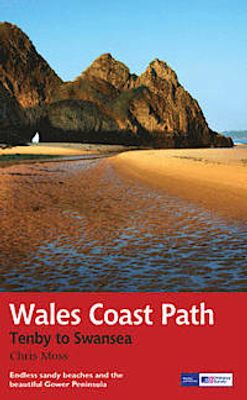
Wandelgids Wales Coast Path: Tenby-Swansea | Aurum Press

0
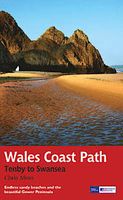
Wales Coast Path National Trail Guide is een wandelgids voor meerdaagse wandeltochten - De opzet van deze gidsen is heel duidelijk met kaartmateriaal van Ordnance Survey waarop de tocht is ingetekend.   2012 saw the opening of the entire Welsh coastline as an official long-distance footpath. Now, to complement its existing National Trail Guide to t...

Webshops met dit product

Webshop
Bezorging
Prijs

Anderen bekeken ook

Wandelgids Wales Coast Path: Tenby-Swansea | Aurum Press
Wales Coast Path National Trail Guide is een wandelgids voor meerdaagse wandeltochten - De opzet van deze gidsen is heel duidelijk met kaartmateriaal van Ordnance Survey waarop de tocht is ingetekend.   2012 saw the opening of the entire Welsh coastline as an official long-distance footpath. Now, to complement its existing National Trail Guide to the Pembrokeshire Coast Path, which makes up the section of the Path from Fishguard to just beyond Tenby, Aurum publishes a completely new guide to the other most scenic and popular stretch of the Wales coast – the section eastwards from Tenby to Swansea.   Starting in the superbly picturesque tourism centre of Tenby itself, Chris Moss’s guide follows the coast through Laugharne, famous as the birthplace of Dylan Thomas, Pendine Sands, whose vast level beach was the historic venue for the early attempts on the world land-speed record by buccaneering drivers like Parry-Thomas and Sir Henry Segrave, before winding right round the beautiful Gower…
19,50
Wandelgids Wales Coast Path Carmarthen Bay & Gower | Northern Eye Book
Official Guide: Wales Coast Path: Carmarthen Bay & Gower   One of seven Official Guides to the Wales Coast Path   The Carmarthen Bay and Gower section of the Wales Coast Path runs for 120 miles/193 kilometres between the popular seaside town of Tenby, via Amroth on the eastern edge of the Pembrokeshire Coast National Park, to Swansea, on the landward side of the Gower Peninsula.   This Official Guide splits the route into 12 convenient day sections, each of about 10-17 miles / 16-27 kilometres. It contains everything local and long-distance walkers need to enjoy the path and includes:   An overview of Carmarthen Bay and Gower with dedicated history and wildlife sections Twelve day-walk sections with detailed route descriptions and full, enhanced Ordnance Survey mapping Distance charts, section overviews, background information and interpretation of places of interest Stunning professional photographs throughout Information on accommodation, public transport, local information, weather,…
22,50
Wandelgids Wales Coast Path: Pembrokeshire | Northern Eye Books
Official Guide: Wales Coast Path: Pembrokeshire   One of seven Official Guides to the Wales Coast Path   The 186 mile/300km long Pembrokeshire section of the Wales Coast Path runs through some of Wales’ most varied and dramatic coastal scenery — high, rugged cliffs and long sandy bays, Pembroke Castle, St David’s cathedral and St Govan’s remote cliff-wrapped chapel, with several large offshore islands. Pembrokeshire is also Britain’s only coastal National Park.   This Official Guide splits the route into 14 convenient day sections, each of about 10-17 miles / 16-27 kilometres. It contains everything local and long-distance walkers need to enjoy the path and includes:   An overview of Pembrokeshire with dedicated history and wildlife sections Fourteen day-walk sections with detailed route descriptions and full, enhanced Ordnance Survey mapping Distance charts, section overviews, background information and interpretation of places of interest Stunning professional photographs throughout …
22,50
Wandelgids Wales Coast Path: Snowdonia and Ceredigion | Northern Eye B
Official Guide: Wales Coast Path: Snowdonia & Ceredigion Coast One of seven Official Guides to the Wales Coast Path This Official Guide to the Snowdonia & Ceredigion Coast section of the Wales Coast Path contains everything local and long-distance walkers need to enjoy the path.   Cardigan Bay probably offers a more diverse walking experience than any other section of the Wales Coast Path. The stretch covered in this book – from Porthmadog in the north to Cardigan in the south – largely covers two contrasting Welsh counties.   The first 97 kilometres pass through Gwynedd, along the western edge of the Snowdonia National Park. Here, just before the rivers that rise in the highest of the Welsh mountains reach the sea, they fan out to form broad estuaries that provide rich pickings for waders and other birdlife. The estuaries of the Dwyryd, the Mawddach and the Dyfi are the largest of these. Between them are some very large dune systems, including Morfa Harlech and Morfa Dyffryn – home to…
23,95
Wandelgids Wales: The Ceredigion and Snowdonia Coast Paths | Cicerone
As part of the Wales Coast Path, the Ceredigion Coast Path and Snowdonia Coast Path trace a curve of 233km (145 miles) of coastal and inland walking down Cardigan Bay. This guidebook describes a 16-stage guide to the walk from Porthmadog to St Dogmaels covering the trail between the Llyn Peninsula and the Pembrokeshire Coast Path. .In 16 day stages from Porthmadog to St Dogmaels, this guidebook offers all the information walkers need to complete the 233km (145 miles) section of the Wales Coast Path that curve down Cardigan Bay, passing through a range of contrasting landscapes.   Six days are spent on the Snowdonia Coast Path, two around the Dyfi Estuary, seven on the Ceredigion Coast Path and one from Cardigan to St Dogmaels.   Linking the Llyn Peninsula Coast Path with that of the Pembrokeshire Coastal Path, this section takes in Snowdonia National Park’s splendid coastal plains, leads inland through beautiful hill country around the Dyfi Estuary and follows some of the finest coastl…
18,50
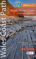
Wandelgids South Wales Coast | Northern Eye Books
The 115 mile/185km long South Wales Coast section of the Wales Coast Path runs through unexpectedly varied and dramatic coastal scenery. Highlights of the route include the historic coastal cities of Swansea and Cardiff, vast sand dune systems at Merthyr Mawr and Kenfig Burrows, the stunning limestone scenery and fossil-rich cliffs of the 14-mile long Glamorgan Heritage Coast, the Newport Wetlands RSPB reserve, the open Wentlooge Levels, and of course pretty Chepstow itself. This Official Guide splits the route into nine achievable day sections, each of about 10-17 miles / 16-27 kilometres, starting and ending at accessible towns and villages that offer places to stay, eat and drink. This guide contains everything local and long-distance walkers need to enjoy the path and includes: An overview of the South Wales Coast with dedicated history and wildlife sections Nine day-walk sections with detailed route descriptions and full, enhanced Ordnance Survey mapping Distance charts, sectio…
19,95

Klanten-reviews van Wandelgids Wales Coast Path: Tenby-Swansea | Aurum Press

Er zijn nog geen beoordelingen voor dit productBen jij de eerste die een review plaatst?

Meer over Wandelgids Wales Coast Path: Tenby-Swansea | Aurum Press

Productomschrijving

Wales Coast Path National Trail Guide is een wandelgids voor meerdaagse wandeltochten - De opzet van deze gidsen is heel duidelijk met kaartmateriaal van Ordnance Survey waarop de tocht is ingetekend.   2012 saw the opening of the entire Welsh coastline as an official long-distance footpath. Now, to complement its existing National Trail Guide to the Pembrokeshire Coast Path, which makes up the section of the Path from Fishguard to just beyond Tenby, Aurum publishes a completely new guide to the other most scenic and popular stretch of the Wales coast – the section eastwards from Tenby to Swansea.   Starting in the superbly picturesque tourism centre of Tenby itself, Chris Moss’s guide follows the coast through Laugharne, famous as the birthplace of Dylan Thomas, Pendine Sands, whose vast level beach was the historic venue for the early attempts on the world land-speed record by buccaneering drivers like Parry-Thomas and Sir Henry Segrave, before winding right round the beautiful Gower Peninsula – an extremely popular holiday destination – before taking in the Mumbles to end in the bustling city of Swansea.   With full route descriptions, OS 1:25,000 maps throughout, and dozens of stunning colour photographs, as well as a wealth of background history along the way, this new guide is the complete companion for both the seasoned walker and the weekend stroller.

Productspecificaties

Artikelnummer(s)
Brand
Aurum Press

Verken gerelateerde categorieën

Webshop.nl maakt gebruik van cookies. Ga je verder op onze website, ga dan akkoord met het plaatsen van cookies en de verwerking van deze data door ons en vermelde partners.