Productomschrijving
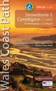
Official Guide: Wales Coast Path: Snowdonia & Ceredigion Coast One of seven Official Guides to the Wales Coast Path This Official Guide to the Snowdonia & Ceredigion Coast section of the Wales Coast Path contains everything local and long-distance walkers need to enjoy the path. Cardigan Bay probably offers a more diverse walking experience than any other section of the Wales Coast Path. The stretch covered in this book – from Porthmadog in the north to Cardigan in the south – largely covers two contrasting Welsh counties. The first 97 kilometres pass through Gwynedd, along the western edge of the Snowdonia National Park. Here, just before the rivers that rise in the highest of the Welsh mountains reach the sea, they fan out to form broad estuaries that provide rich pickings for waders and other birdlife. The estuaries of the Dwyryd, the Mawddach and the Dyfi are the largest of these. Between them are some very large dune systems, including Morfa Harlech and Morfa Dyffryn – home to rare wildlife. Here, walkers are able to stride out along seemingly endless beaches, often with spectacular views inland to the mountains of Snowdonia or across the bay to the peaks of the Llŷn peninsula. Beyond Aberdyfi, at the southwestern tip of the Snowdonia National Park, the coast path heads inland – into the hills – before crossing the Afon Dyfi. After a brief flirtation with the county of Powys, it then passes into Ceredigion, rejoining the coast at Borth. To the north lie the last of the route’s marsh and dune systems while, to the south, the route takes on a completely new character: it is here that the rugged cliffs begin. For the next 91 kilometres, the Wales Coast Path dips in and out of wooded ravines, crosses high cliff-tops where seabirds wheel and dive, and drops in on pretty coastal settlements that will do their best to tempt walkers to linger. Spectacular coastal scenery and a growing sense of solitude are typical of the second half of the route. In total, the 213 kilometres should take about 11 days to walk. And, with no two days the same, it promises to be a varied and fascinating experience. This Official Guide contains everything local and long-distance walkers need to enjoy the path and include An overview of the Snowdonia & Ceredigion Coast with dedicated history and wildlife sections Eleven day-walk sections with detailed route descriptions and full, enhanced Ordnance Survey mapping Distance charts, section overviews, background information and interpretation of places of interest Stunning professional photographs throughout Information on accommodation, public transport, local information, weather, and tidal links. Contents Wales Coast Path: An 870-mile coastal adventure The Best of the Snowdonia & Ceredigion Coast Snowdonia & Ceredigion Coast: Part of the Wales Coast Path Walking the Snowdonia & Ceredigion Coast — map and distance chart Limited for time? The Snowdonia & Ceredigion Coast in a nutshell A brief history of the Snowdonia & Ceredigion Coast Wildlife along the Snowdonia & Ceredigion Coast Sand dunes, expansive estuaries and rugged cliffsDay Section 1: Porthmadog to Harlech Heritage railways An ‘Iron Ring’ of castles Day Section 2: Harlech to Barmouth Day Section 3: Barmouth to Lwyngwril Day Section 4: Lwyngwril to Aberdyfi Day Section 5: Aberdyfi to Machynlleth Day Section 6: Machynlleth to Borth (or Ynyslas) Day Section 7: Borth (or Ynyslas) to Aberystwyth Bottlenose dolphins Day Section 8: Aberystwyth to Llan-non Day Section 9: Llan-non to New Quay Day Section 10: New Quay to Aberporth Day Section 11: Aberporth to Cardigan Welsh Coastal Place Names Visitor Information


