webshop.nl

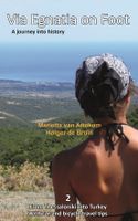
Wandelgids Via Egnatia on foot deel 1 (Albanië - Griekenland) | Via Egnatia Foundation

0
Deze Engelstalige gids is deel 1 in een serie van 3 delen. In dit boek is het stuk tussen Dürres en Thessaloniki beschreven, de complete route is van Dürres tot Istanbul. De overige 2 delen moeten nog verschijnen.   De gids bevat een stap voor stap beschrijving van de route (460km) met gedetailleerde topografische kaarten, stadsplattegronden met s...

Webshops met dit product

Webshop
Bezorging
Prijs
DeZwerver.nl logo
DeZwerver.nl
niet bekend
22,95

Anderen bekeken ook

Wandelgids Via Egnatia on Foot 2 | Via Egnatia Foundation
Via Egnatia on foot, Part 2, covers a distance of more than 550 kilometers. The book starts just as our first book with practical tips for travellers (chapter 1) and a description of the history of the Via Egnatia (chapter 2). In chapter 3 all relevant aspects of the trail are described in a general way. For instance conditions of the road, description of the landscape and the practical use of the maps. In chapter 4 you will find detailed information on the original Via Egnatia stages of the trail; long distances are cut up into separate walking sections. Each stage/section provides a description and a map of the track, interesting historical and cultural facts and monuments, illustrated with beautiful pictures. At the end we present the traveller two options to enter Turkey: one leads you to Edirne, the other one crosses the border to Ipsala.   In general this trail is not difficult for walkers, although after heavy rain it may be less easy and circumstances may differ considerably, …
22,95
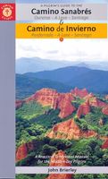
Wandelgids Camino Sanabrés & Camino Invierno | Camino Guides Brierley
140 pages paperback in full colour including:   Overview route planners Daily stage maps Contour guides Alternative routes & detours Detailed town plans List of all pilgrim hostels & hotels Historical notes Myths and Legends…   This guidebook combines two ancient routes into Santiago that remain largely undiscovered despite their historic significance. Each route offers a very different camino experience but are combined in one volume as they join in A Laxe for the final stages. Each provides the minimum distance required for a pilgrim to apply for a Compostela; but that is not the purpose of this guidebook which seeks to off er alternatives to the busy routes through Sarria and Tui which account for over 80% of all pilgrims to Santiago; by contrast the Camino Invierno currently carries less than 1%.    Camino Sanabrés offers a link from the Via de le Plata. This guide offers the last 5 stages of that itinerary commencing in Ourense with its rich Roman heritage and extant thermal bath…
21,50
Wandelgids Evliya Celebi Way | Kate Clow
Deze gids beschrijft een lange afstandsroute van 160 km ten zuiden van Istanbul. De route begint in Altinova en eindigt in Simav. This is the guidebook to Turkey's new long-distance Cultural Route, complete with route description, map, historical background, and places to see. The route follows the Ottoman gentleman adventurer Evliya Celibi on his way to Mecca in 1671; it runs for 600km from the Sea of Marmara via Bursa, Kutahya and Afyon to Usak and Simav. The route follows, as far as possible, ancient paved roads and visits the cities, sights and tiny villages that Evliya rode through and recorded in his "Seyatname" ("Book of Travels"). It can be explored by walkers, horse-riders and bikers. The UN has declared Evliya 'Man of the Year' for 2011, the 400th anniversary of his birth. This route is a practical addition to these celebrations - it enables modern travellers to directly experience Evliya's life, times and travels. It is brought to you by the noted Ottoman historian and auth…
23,95
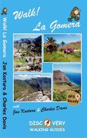
Wandelgids Walk! La Gomera | Discovery Walking Guides
La Gomera is the ultimate get-away-from-it-all island: easy-going, unspoilt, friendly, isolated from the hustle and bustle of modern living, and so laid back it’s virtually supine - even the volcanoes have been dormant for millions of years. The walks, however, are a bit more energetic. For the new 4th edition of Walk! La Gomera Charles Davis has teamed up with Jan Kostura. Jan brings his wide experience and passion for the Canaries, checking, re-walking and revising existing routes, and adding a couple of his own adventures, including a new Top Three Gomeran walk. Two routes have been dropped as having become too dangerous, but the good news is that many of the more harum-scarum walks have been improved through path clearing and the addition of railings to the vertiginous stretches. Other good news is that the devastating forest fires of 2012 have proved not nearly as damaging as we feared, leaving most of our itineraries unscathed. In short, there is every reason to take off and ex…
17,50
Fietskaart 01 Cycling guides Cornwall | Goldeneye
Our maps are double-sided, printed on an A2 sheet with a concertina fold. This allows for easy folding and folding, and an ease of access to the mapping. The material is rain and tear-resistant. Our early maps were designed at the scale of 2 miles to 1 inch/1:126,720. The later designs along with digitalisation are 1: 100,000. We were encouraged by the Cycle Touring Club to convert our cartography toward the cycle market (to replace the out-of-print Bartholomew series). As time and the series progressed we have added more data: The National Cycle Network routes, Regional Routes, and Traffic-Free Family Routes, as and when they are developed. These routes are in addition to the Circular Routes Goldeneye Commissioned at the outset of our publishing schedule. We are also adding to new editions; bike shops, cycle hire, and tea rooms, along with the tourist attractions already featured. Our plan is to make available digital versions for cell phones and tablets and to update, on an annual b…
15,95
Fietskaart 14 Cycling guides Suffolk | Goldeneye
To be confronted with the variety and complexity of the cycling routes, trails and paths in Suffolk can be a bewildering experience.  For it appears that the Suffolk County Council and the three District Councils are all trying hard to promote their areas. This is indeed encouraging for the growth of cycling, but it can be confusing.  Our purpose is to provide clear, easy to use and easy to follow, cycling maps, and to illustrate these in a comprehensive form.    Suffolk must be one of the most charming of counties to explore by bicycle. When Al Churcher delivered his routes to us at Goldeneye we couldn’t keep him quiet, such was his enthusiasm and wonder at Suffolk’s country lanes and byways. He has cycled all over the UK, Canada, Mallorca, New Zealand and Sicily, but Suffolk remained a firm favourite.    The inland scenery is not spectacular for the county’s main glory lies with its attractive villages; the local architecture jealously preserved from modern depredation. There is an …
15,95
Wandelgids Via Dinarica | Bradt Travel Guides
Bijzondere wandelgids : het beschrijft de wandelroute in Bosnie Herzegovina van de Via Dinarica, the White trail. Veel praktische informatie, redelijk kaartmateriaal en een goede beschrijving van de route.  This is the first detailed guide to the Bosnian part of the new Via Dinarica hiking trail that carves its way through the Dinaric Alps, one of Europe's least explored mountain ranges and last true wilderness frontiers, connecting the seven nations of Slovenia, Croatia, Bosnia and Herzegovina, Montenegro, Serbia, Kosovo, and Albania. In total, this trail system will span over 1,350km, 333km of which is in Bosnia Herzegovina. The Via Dinarica consists of three routes - White, Green and Blue - and this guide focuses primarily on the White Trail through Bosnia and Herzegovina, following the natural flow of the highest peaks of the Dinaric Alps. Detailed descriptions of each of the 12 stages of the White Trail through Bosnia and Herzegovina are included, along with maps, altitude charts…
20,95
Wandelgids Coast to Coast Walk - van Ierse Zee tot Noordzee | Aurum Press
Goede gids over dit inmiddels beroemde pad. Kaartmateriaal is perfect, alsmede achtergrondinformatie. Praktische info wat minder, maar die is op de ramblerssite op internet te vinden! The Coast to Coast Walk is unique among Britain's long-distance footpaths in that it was the invention of one man, the legendary Alfred Wainwright, and enjoys no official status like, for example, the National trails in England and Wales. Nevertheless, it has become one of Britain's most popular long-distance walks, which is hardly surprising as it traverses some of the finest walking territory in the country. Starting at St Bees on the Cumbrian coast, the route runs for 192 miles (307 km) to Robin Hood's Bay on the North Sea and lies, for the most part, within the boundaries of three of Britain's loveliest National Parks - the Lake District, the Yorkshire Dales and the North York Moors. As well as the main route there are also alternatives available at several points. Martin Wainwright's description of …
20,95
Fietsgids London - Land's End Cycle Route | EOS Cycling Holidays Ltd
The guidebook contains routes from both Dover and Harwich ferry ports to London. This makes it possible to cycle around the English Channel, when also using the Plymouth link. The Dover to London route takes you though the fruit orchards of Kent, historic Canterbury and the Medway estuary with its impressive castles.   The Harwich to London route provides pleasant countryside cycling in Essex and takes you through Roman Colchester. Cycling through the heart of London, our route manages to stay away from busy roads, the occasional busy junction crossing excepted. Most of the cycling takes place on towpaths along the River Thames with spectacular views to enjoy.   You will cycle under the Tower Bridge and you'll pass the London Eye, Big Ben, the Houses of Parliament and Buckingham Palace on the way. Greenwich Park, Hyde Park and Richmond Park all provide superb green traffic-free routes. Heading west you'll cycle by Windsor Park and Windsor Castle before making your way to the Aon & Ken…
41,50
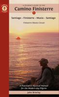
Pelgrimsroute - Wandelgids Camino Finisterre | Camino Guides Brierley
Camino Finisterre: Pilgrims who continue to the 'End of the Earth' Finis Terrae often refer to this as a highlight in their journeying. In the first edition it was described as the road less travelled but that acclaim has now passed to Muxía which has become the ideal extension for those seeking space for rest and reflection before returning home. The paths to Finisterre and Muxía are uniquely beautiful, full of the flavours of Galicia and her deliciously authentic culture. The spirit of St. James is alive in the deep river valleys and rolling hills that make up her Landscape Temple. Come and experience her untamed beauty and the purity of the light that has attracted spiritual seekers for countless millennia. The light, while obscured, lies hidden in our memory. It is no coincidence that the path to the end of the world ends at a lighthouse and the Ara Solis. This guidebook describes the only camino that departs from Santiago. However, in recent years it has been recognised for a Com…
21,95

Klanten-reviews van Wandelgids Via Egnatia on foot deel 1 (Albanië - Griekenland) | Via Egnatia Foundation

Er zijn nog geen beoordelingen voor dit productBen jij de eerste die een review plaatst?

Meer over Wandelgids Via Egnatia on foot deel 1 (Albanië - Griekenland) | Via Egnatia Foundation

Productomschrijving

Deze Engelstalige gids is deel 1 in een serie van 3 delen. In dit boek is het stuk tussen Dürres en Thessaloniki beschreven, de complete route is van Dürres tot Istanbul. De overige 2 delen moeten nog verschijnen.   De gids bevat een stap voor stap beschrijving van de route (460km) met gedetailleerde topografische kaarten, stadsplattegronden met stadswandelingen en GPS-coördinaten. Ruime aandacht wordt besteed aan de geschiedenis, achtergronden, praktische informatie en nuttige tips. Een tabel van de meest gebruikte woorden in het Albanees, Macedonisch en Grieks is inbegrepen. Aantal pagina's: 256 Met gedetailleerde full colour kaarten en foto's.    Via Egnatia is the ancient Roman road to Istanbul that starts in Dürres, Albania, extending the Via Appia from Rome. Through mountains and valleys, along riverbeds, past lakes and seaside, villages and cities, Via Egnatia goes 1000 km eastward to Turkey. Parts of the old road are still there to enjoy for the observant hiker. Making use of the Roman stations, this is a journey into history.   Via Egnatia stands for the cultural connection between East and West. Walking here offers a special insight into the amalgam of cultures that have become the Balkans. A book for the interested traveller - whether hiking, riding or driving - on a fascinating way, that may become a life's addiction.

Verken gerelateerde categorieën

Webshop.nl maakt gebruik van cookies. Ga je verder op onze website, ga dan akkoord met het plaatsen van cookies en de verwerking van deze data door ons en vermelde partners.