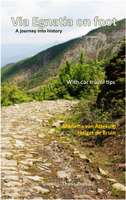
Wandelgids Via Egnatia on foot deel 1 (Albanië - Griekenland) | Via Egnatia Foundation

0
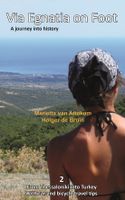
Deze Engelstalige gids is deel 1 in een serie van 3 delen. In dit boek is het stuk tussen Dürres en Thessaloniki beschreven, de complete route is van Dürres tot Istanbul. De overige 2 delen moeten nog verschijnen.   De gids bevat een stap voor stap beschrijving van de route (460km) met gedetailleerde topografische kaarten, stadsplattegronden met s...

Verkopers met dit product

Verkoper
Bezorging
Prijs
DeZwerver.nl logo
DeZwerver.nl
2,95
22,95

Anderen bekeken ook

Wandelgids Via Egnatia on Foot 2 | Via Egnatia Foundation
Via Egnatia on foot, Part 2, covers a distance of more than 550 kilometers. The book starts just as our first book with practical tips for travellers (chapter 1) and a description of the history of the Via Egnatia (chapter 2). In chapter 3 all relevant aspects of the trail are described in a general way. For instance conditions of the road, description of the landscape and the practical use of the maps. In chapter 4 you will find detailed information on the original Via Egnatia stages of the trail; long distances are cut up into separate walking sections. Each stage/section provides a description and a map of the track, interesting historical and cultural facts and monuments, illustrated with beautiful pictures. At the end we present the traveller two options to enter Turkey: one leads you to Edirne, the other one crosses the border to Ipsala.   In general this trail is not difficult for walkers, although after heavy rain it may be less easy and circumstances may differ considerably, …
22,95
Wandelgids - Pelgrimsroute Via Francigena part 2 | Cicerone
Guidebook to the Via Francigena pilgrim route from Lausanne to Lucca. Starting at Lake Geneva (Lac Léman), the 725km route crosses the Alps at historic Great Saint Bernard Pass, descends the Po Valley, then climbs to cross the Cisa Pass into Tuscany. Described in 32 stages, with information on facilities and pilgrim hostels.   Seasons Suitable for walking in spring, summer and autumn. The Great Saint Bernard Pass is fully open to hikers only in August and September.   Centres Lausanne, Martigny, Great Saint Bernard Pass, Aosta, Ivrea, Vercelli, Pavia, Piacenza, Pontremoli, Pietrasanta, Lucca.   Difficulty Each stage is graded for difficulty (1-4). A few mountainous stages include steep and slippery slopes. No special gear is required to walk the Via Francigena in season, but off-season crossings of the Great Saint Bernard Pass require winter mountain gear and careful attention to changing mountain conditions.   Must See Dazzling Lake Geneva, the 1500-year-old Abbey of Sai…
24,95
Wandelgids Camino Sanabrés & Camino Invierno | Camino Guides Brierley
140 pages paperback in full colour including:   Overview route planners Daily stage maps Contour guides Alternative routes & detours Detailed town plans List of all pilgrim hostels & hotels Historical notes Myths and Legends…   This guidebook combines two ancient routes into Santiago that remain largely undiscovered despite their historic significance. Each route offers a very different camino experience but are combined in one volume as they join in A Laxe for the final stages. Each provides the minimum distance required for a pilgrim to apply for a Compostela; but that is not the purpose of this guidebook which seeks to off er alternatives to the busy routes through Sarria and Tui which account for over 80% of all pilgrims to Santiago; by contrast the Camino Invierno currently carries less than 1%.    Camino Sanabrés offers a link from the Via de le Plata. This guide offers the last 5 stages of that itinerary commencing in Ourense with its rich Roman heritage and extant thermal bath…
21,50
Nieuw
Wandelgids 1 Via Francigena Pilgrim Route Part 1 | Cicerone
The 2000km Via Francigena from Canterbury to Rome is one of the world's great pilgrim routes, with a history spanning well over a millennium. This guide describes the first section, from Canterbury to Lausanne on the shores of Lake Geneva, a journey of 1090km passing through England, France and Switzerland. The route is suitable for walkers of all levels of ability, and the section from Canterbury to Besancon is also suitable for cyclists (mountain or hybrid/gravel bike).   There are various options for accommodation, ranging from hotels and B&Bs to camping (although it is not essential to carry a tent), and the French section offers a unique opportunity to lodge with host families in welcoming chambres d'hotes. The guide has all the information you need to plan and prepare for a journey on the Via Francigena. You'll find a wealth of detail about facilities on route and accommodation, as well as tips on training, kit, travel and pilgrim credentials.   The route is presented in 52 stag…
26,50
Nieuw
Wandelgids GR 70: The Robert Louis Stevenson Trail van Le Puy tot St-Jean du Gard | Cicerone
Uitstekende wandelgids van een gerenommeerde Engelse uitgever. De tochten zijn met zorg beschreven en voorzien van allerhande nuttige informatie. Met beperkt kaartmateriaal. Aanbevolen wandelkaarten bij deze gids 1:100.000 Wandelkaart GR 70 The Stevenson Trail | IGN - Institut Géographique National Als overzichtskaart Of Wegenkaart 156 Le Puy en Velay - Privas - Mende | IGN - Institut Géographique National Wegenkaart 163 Avignon - Nimes | IGN - Institut Géographique National  of 1:25.000 1. Wandelkaart - Topografische kaart 2835OT Le Puy-en-Velay | IGN - Institut Géographique National 2. Wandelkaart - Topografische kaart 2836OT Gerbier de Jonc | IGN - Institut Géographique National 3. Wandelkaart - Topografische kaart 2736SB Monistrol d'Allier, Solignac-sur-Loire, Cayres | IGN - Institut Géographique National 4. Wandelkaart - Topografische kaart 2737SB Langogne - Grandrieu | IGN - Institut Géographique National 5. Wandelkaart - Topografische kaart 2738SB Le Bleymard | IGN - Institut G…
23,95
Pelgrimsroute - Wandelgids Camino Finisterre | Camino Guides Brierley
Camino Finisterre: Pilgrims who continue to the 'End of the Earth' Finis Terrae often refer to this as a highlight in their journeying. In the first edition it was described as the road less travelled but that acclaim has now passed to Muxía which has become the ideal extension for those seeking space for rest and reflection before returning home. The paths to Finisterre and Muxía are uniquely beautiful, full of the flavours of Galicia and her deliciously authentic culture. The spirit of St. James is alive in the deep river valleys and rolling hills that make up her Landscape Temple. Come and experience her untamed beauty and the purity of the light that has attracted spiritual seekers for countless millennia. The light, while obscured, lies hidden in our memory. It is no coincidence that the path to the end of the world ends at a lighthouse and the Ara Solis. This guidebook describes the only camino that departs from Santiago. However, in recent years it has been recognised for a Com…
21,95
Nieuw
Wandelgids Camino de Santiago - Via Podiensis GR65 | Cicerone
Handzaam boekje met de routebeschrijving inclusief een heleboel praktische informatie. Uitstekende beschrijving en redelijke kaarten.   This guidebook describes in full the 735km Via Podiensis (GR65), a historic pilgrimage route through southern France from Le Puy-en-Velay to Saint-Jean-Pied-de-Port, where the trail meets the famous Camino Francés to Santiago de Compostela (Spain). Also detailed are 2 major variants: the Célé Valley (GR651) and Rocamadour (GR6 and GR46). Split into 28 stages, the full route takes 4 to 6 weeks to complete but can be divided into shorter sections - Figeac and Condom are well positioned to break the walk into three 2-week chunks. It can be adapted to suit all abilities, with regularly spaced accommodation and baggage transport available, and is best walked in spring and autumn, with May and September the most popular months. Abundant accommodation options offer a warm welcome to walkers and pilgrims and a chance to enjoy delicious home-cooked meals made…
26,95
Nieuw
Wandelgids Camino de Santiago - Jakobsweg - Sint Jacobs route | Rother Bergverlag
With over 1000 years of history, the Way of St. James is one of the classic long distance walks. This historical route along almost 1000 kilometres from the Pyrenees to Santiago de Compostela offers unique cultural, scenic and nature experiences. Since the Holy Year of 2010 the Way of St. James has gained even more in popularity and attracts more and more people from very different backgrounds, faiths and generations. It does not matter what the reason might be for setting out on the path to Santiago de Compostela - in the end you are confident that you have had a quite special experience. The Rother walking guide describes in a total of 42 stages the whole of the Camino francés from Saint-Jean-Pied-de-Port via Roncesvalles, as well as the Aragon route from the Somport pass via Jaca to Santiago de Compostela, including possible secondary routes and the extension to Finisterre or Muxía. Thus the Way of St. James leads through a wealth of diverse landscapes, continuously interrupted by …
17,50
Wandelgids Walk! La Gomera | Discovery Walking Guides
La Gomera is the ultimate get-away-from-it-all island: easy-going, unspoilt, friendly, isolated from the hustle and bustle of modern living, and so laid back it’s virtually supine - even the volcanoes have been dormant for millions of years. The walks, however, are a bit more energetic. For the new 4th edition of Walk! La Gomera Charles Davis has teamed up with Jan Kostura. Jan brings his wide experience and passion for the Canaries, checking, re-walking and revising existing routes, and adding a couple of his own adventures, including a new Top Three Gomeran walk. Two routes have been dropped as having become too dangerous, but the good news is that many of the more harum-scarum walks have been improved through path clearing and the addition of railings to the vertiginous stretches. Other good news is that the devastating forest fires of 2012 have proved not nearly as damaging as we feared, leaving most of our itineraries unscathed. In short, there is every reason to take off and ex…
17,50
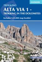
Wandelgids Alta Via 1 - Trekking in the Dolomites | Cicerone
Uitstekende wandelgids van een gerenommeerde Engelse uitgever. De tochten zijn met zorg beschreven en voorzien van allerhande nuttige informatie. The Alta Via 1 is one of Italy's most famous and most popular long-distance routes and is the easiest of six Alta Via routes that traverse the magnificent Dolomites. The hut-to-hut trail extends 115km from Lago di Braies to La Pissa, boasting spectacular alpine vistas. Although it demands a moderate level of fitness, it is well waymarked and follows clear well-trodden paths, making for an ideal introduction to trekking in the Dolomites.   Welcoming refuges offer meals and accommodation along the way, though camping is also possible on the middle stages (restrictions apply elsewhere). The route is presented in 11 stages, each with overview statistics, a brief summary of the day's walking and detailed route description illustrated with clear mapping. There are also comprehensive notes on the huts the route passes, with contact details and tips…
23,95

Klanten-reviews van Wandelgids Via Egnatia on foot deel 1 (Albanië - Griekenland) | Via Egnatia Foundation

Er zijn nog geen beoordelingen voor dit productBen jij de eerste die een review plaatst?

Meer over Wandelgids Via Egnatia on foot deel 1 (Albanië - Griekenland) | Via Egnatia Foundation

Productomschrijving

Deze Engelstalige gids is deel 1 in een serie van 3 delen. In dit boek is het stuk tussen Dürres en Thessaloniki beschreven, de complete route is van Dürres tot Istanbul. De overige 2 delen moeten nog verschijnen.   De gids bevat een stap voor stap beschrijving van de route (460km) met gedetailleerde topografische kaarten, stadsplattegronden met stadswandelingen en GPS-coördinaten. Ruime aandacht wordt besteed aan de geschiedenis, achtergronden, praktische informatie en nuttige tips. Een tabel van de meest gebruikte woorden in het Albanees, Macedonisch en Grieks is inbegrepen. Aantal pagina's: 256 Met gedetailleerde full colour kaarten en foto's.    Via Egnatia is the ancient Roman road to Istanbul that starts in Dürres, Albania, extending the Via Appia from Rome. Through mountains and valleys, along riverbeds, past lakes and seaside, villages and cities, Via Egnatia goes 1000 km eastward to Turkey. Parts of the old road are still there to enjoy for the observant hiker. Making use of the Roman stations, this is a journey into history.   Via Egnatia stands for the cultural connection between East and West. Walking here offers a special insight into the amalgam of cultures that have become the Balkans. A book for the interested traveller - whether hiking, riding or driving - on a fascinating way, that may become a life's addiction.

Productinformatie

    Verken gerelateerde categorieën

    Webshop.nl maakt gebruik van cookies. Ga je verder op onze website, ga dan akkoord met het plaatsen van cookies en de verwerking van deze data door ons en vermelde partners.