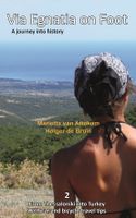
Wandelgids Via Egnatia on Foot 2 | Via Egnatia Foundation

0
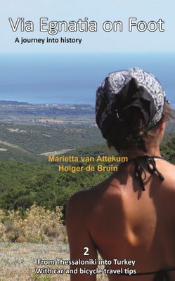
Via Egnatia on foot, Part 2, covers a distance of more than 550 kilometers. The book starts just as our first book with practical tips for travellers (chapter 1) and a description of the history of the Via Egnatia (chapter 2). In chapter 3 all relevant aspects of the trail are described in a general way. For instance conditions of the road, descri...

Verkopers met dit product

Verkoper
Bezorging
Prijs
DeZwerver.nl logo
DeZwerver.nl
niet bekend
22,95

Anderen bekeken ook

Wandelgids Via Egnatia on foot deel 1 (Albanië - Griekenland) | Via Egnatia Foundation
Deze Engelstalige gids is deel 1 in een serie van 3 delen. In dit boek is het stuk tussen Dürres en Thessaloniki beschreven, de complete route is van Dürres tot Istanbul. De overige 2 delen moeten nog verschijnen.   De gids bevat een stap voor stap beschrijving van de route (460km) met gedetailleerde topografische kaarten, stadsplattegronden met stadswandelingen en GPS-coördinaten. Ruime aandacht wordt besteed aan de geschiedenis, achtergronden, praktische informatie en nuttige tips. Een tabel van de meest gebruikte woorden in het Albanees, Macedonisch en Grieks is inbegrepen. Aantal pagina's: 256 Met gedetailleerde full colour kaarten en foto's.    Via Egnatia is the ancient Roman road to Istanbul that starts in Dürres, Albania, extending the Via Appia from Rome. Through mountains and valleys, along riverbeds, past lakes and seaside, villages and cities, Via Egnatia goes 1000 km eastward to Turkey. Parts of the old road are still there to enjoy for the observant hiker. Making use of …
22,95
Wandelgids - Klimgids - Klettersteiggids Via Ferratas of the French Alps | Cicerone
This guidebook covers 66 varied via ferratas in the French Alps. The routes are spread over six areas: Geneva and the Northern Alps, Chambéry, Tarentaise and Maurienne valleys, Grenoble and Briançon, amid the Mont Blanc, Vanoise and Queyras ranges. Difficulty ranges from easy, protected routes through to exposed, technical challenges. With some of the most beautiful scenery in the world, the French Alps have long been a popular destination for a wide range of outdoor activities. In recent years, the region has seen the arrival of a growing number of via ferrata routes.   Via ferrata climbing – using fixed cables, bridges and ladders to explore terrain that is normally only accessible to experienced rock climbers – combines elements of scrambling, mountaineering and rock climbing, yet is a very distinct pursuit. Increasingly popular, recent years have seen a surge in the number of routes being established in these iconic mountains.   The routes in this guidebook range from straightforw…
25,95
Wandelgids Walk! Lanzarote | Discovery Walking Guides
Engelstalige wandelgids Lanzarote, met uitgebreide beschrijvingen van wandelroutes, routekaartjes, praktische informatie zoals bussen en accommodatie. Walk! Lanzarote 5th edition builds on the reputation of our earlier editions with more walks and comprehensive updating so that it caters for the needs of the increasing number of people who would like to combine some walking with a holiday on the Fire island. Walk Lanzarote explodes the myth that there is nowhere worth walking on the island as we range through strolling on coastal promenades, walking across alpine style meadows, striding over the lava sea, dropping into volcanoes, sitting on high mountain seats - quite simply you will be amazed at the wide variety of stunning landscapes the Fire island has to offer the adventurous leisure walker.   new extended coastal route from Arrieta to Los Cocoteros to Costa Teguise, new Playa Blanca to Las Brenas to Yaiza on the GR131, which also updates our Yaiza to Las Brenas circular, newly re…
18,50
Wandelgids Kilimanjaro trekking | Cicerone
Goede trekking - wandelgids van de Kilimanjaro. Beklimmingen kunnen van alle kanten in vele vormen en vrijwel alle routes staan goed beschreven  in deze gids. Veel praktische informatie en een duidelijke routebeschrijving, duidelijke enigszins schetsmatige kaarten en een uitgebreide inleiding over wat je wel en niet moet meenemen, regelen en voorbereiden. At 5895m, Kilimanjaro is Africa's highest point and the highest freestanding mountain in the world, yet it is possible to reach its summit, Uhuru Peak, without any technical climbing ability. However, that is not to say that it is an easy undertaking: each year, many people fail in their attempt, often due to poor preparation or insufficient acclimatisation. Those who do make it to 'the Roof of Africa' are richly rewarded, enjoying outstanding views, the unique experience of being 'on top of the world' and, of course, a tremendous sense of achievement.   Guidebook describing all the trekking routes on Kilimanjaro (5895m), one of the …
23,95
Wandelgids Alta Via 2 - Trekking in the Dolomites | Cicerone
Uitstekende wandelgids van een gerenommeerde Engelse uitgever. De tochten zijn met zorg beschreven en voorzien van allerhande nuttige informatie. Guidebook describing Alta Via 2, a challenging hut-to-hut trek through the Italian Dolomites. Stretching 174km from Bressanone (Brixen) to Feltre, the route involves some aided and exposed sections (although several can be bypassed) calling for a sure foot and a good head for heights. It can be walked in under a fortnight - although it is also possible to walk shorter chunks should you only have limited time, and the guide highlights potential exit routes and transport options. Also included are summaries of Alte Vie 3-6, which are more demanding and include remote terrain and stretches of via ferrata for which climbing experience is essential. On Alte Vie 3-6 some nights will be spent in unmanned bivouac huts, meaning trekkers must carry their own kit, although it is possible to walk shorter hut-to-hut sections. The easiest of the Alta Via …
23,95
Reisinspiratieboek - Reisboek Book of the Alps | Marmota Maps
The Book of the Alps  the great illustrated book about the Alps.290 pages with over 1000 illustrations, graphics, and maps on geography, sports, history, culture, climate, environment and much more. Understand the Alps like never before.Created in cooperation with the Alpine clubs of Germany, Austria, and South Tyrol. CONTENTS The Book of the Alps has 46 chapters in seven subject areas: Geography   Flora and Fauna   Climate and Environment    Alpinism   Mountain Sports   Society and Economy   Arts and Culture   GEOGRAPHY Geological Formation Ice Age Mountains Valleys Mountain Passes Lakes and Rivers Glaciers The Alps are unique. How did they form and evolve? How do glaciers, passes, valleys, lakes, and rivers shape the landscape? Answers to these and many more questions can be found in the geography chapter.   FLORA AND FAUNA Biodiversity Plants Forests Animals National Parks The Alpine environment is fascinating. Alpine flowers such as the edelweiss and Alpine anima…
44,95
Wandelgids Trekking the Dolomites Av1 | Knife Edge Outdoor
Superhandige wandelgids voor de Alta Via 1 in de Dolomieten. Met deze gids heb je verder niks nodig: alle benodigde Tabacco wandelkaarten zitten in deze gids! The only guidebook exclusively for the AV1.Everything you need to know to plan and walk Italy's most popular long distance route.Real maps inside (Tabacco 1:25,000): the finest maps available for the Dolomites. This makes navigation easy and there is no need to carry additional maps. Also includes:* Numbered waypoints linking maps to text* Unique Itinerary Planner: plan a bespoke itinerary to match your ability and vacation schedule. All difficult calculations of time, distance and altitude gain are done for you* 7 Proposed Itineraries of between 6 and 11 days* Everything the trekker needs to know to plan the route: route descriptions, costs, budget, difficulty, weather, how to get there, and more* Full accommodation listings: spectacularly situated mountain huts* Section on Camping* Exciting variants to the main route* Informat…
19,95
Wandelgids Walking in the Thames Valley | Cicerone
Walking in the Thames Valley offers 25 challenging circular walks around the River Thames and River Kennet in the south of England, taking in the Southern Chilterns, the Berkshire and North Hampshire Downs, Southern Oxfordshire and the eastern edge of Wiltshire. All routes are within easy reach of Reading, Newbury, Abingdon and London. While some walks visit Iron Age hill forts, others pass more modern features such as Wilton Windmill and the Kennet and Avon Canal. Some follow sections of the Ridgeway, while others meander along the banks of the Thames. What they all have in common is that they take the keen rambler to some of the best parts of the Thames Valley – a patchwork of open chalk grassland, broadleaved woodland and farmland and home to two Areas of Outstanding Natural Beauty. • walks from 10 to 18 miles, including one 2-day route • shorter, less strenuous alternatives for many of the walks • detailed route descriptions with information on local points of interest, OS mapping…
18,50
Wandelgids Walk! La Gomera | Discovery Walking Guides
La Gomera is the ultimate get-away-from-it-all island: easy-going, unspoilt, friendly, isolated from the hustle and bustle of modern living, and so laid back it’s virtually supine - even the volcanoes have been dormant for millions of years. The walks, however, are a bit more energetic. For the new 4th edition of Walk! La Gomera Charles Davis has teamed up with Jan Kostura. Jan brings his wide experience and passion for the Canaries, checking, re-walking and revising existing routes, and adding a couple of his own adventures, including a new Top Three Gomeran walk. Two routes have been dropped as having become too dangerous, but the good news is that many of the more harum-scarum walks have been improved through path clearing and the addition of railings to the vertiginous stretches. Other good news is that the devastating forest fires of 2012 have proved not nearly as damaging as we feared, leaving most of our itineraries unscathed. In short, there is every reason to take off and ex…
17,50
Wandelgids - Pelgrimsroute Via Francigena part 2 | Cicerone
Guidebook to the Via Francigena pilgrim route from Lausanne to Lucca. Starting at Lake Geneva (Lac Léman), the 725km route crosses the Alps at historic Great Saint Bernard Pass, descends the Po Valley, then climbs to cross the Cisa Pass into Tuscany. Described in 32 stages, with information on facilities and pilgrim hostels.   Seasons Suitable for walking in spring, summer and autumn. The Great Saint Bernard Pass is fully open to hikers only in August and September.   Centres Lausanne, Martigny, Great Saint Bernard Pass, Aosta, Ivrea, Vercelli, Pavia, Piacenza, Pontremoli, Pietrasanta, Lucca.   Difficulty Each stage is graded for difficulty (1-4). A few mountainous stages include steep and slippery slopes. No special gear is required to walk the Via Francigena in season, but off-season crossings of the Great Saint Bernard Pass require winter mountain gear and careful attention to changing mountain conditions.   Must See Dazzling Lake Geneva, the 1500-year-old Abbey of Sai…
24,95

Klanten-reviews van Wandelgids Via Egnatia on Foot 2 | Via Egnatia Foundation

Er zijn nog geen beoordelingen voor dit productBen jij de eerste die een review plaatst?

Meer over Wandelgids Via Egnatia on Foot 2 | Via Egnatia Foundation

Productomschrijving

Via Egnatia on foot, Part 2, covers a distance of more than 550 kilometers. The book starts just as our first book with practical tips for travellers (chapter 1) and a description of the history of the Via Egnatia (chapter 2). In chapter 3 all relevant aspects of the trail are described in a general way. For instance conditions of the road, description of the landscape and the practical use of the maps. In chapter 4 you will find detailed information on the original Via Egnatia stages of the trail; long distances are cut up into separate walking sections. Each stage/section provides a description and a map of the track, interesting historical and cultural facts and monuments, illustrated with beautiful pictures. At the end we present the traveller two options to enter Turkey: one leads you to Edirne, the other one crosses the border to Ipsala.   In general this trail is not difficult for walkers, although after heavy rain it may be less easy and circumstances may differ considerably, so some improvisation can be requested. Although our description aims at walkers, in chapter 5 we include special information for people who want to discover the Via Egnatia by bike or by car. In chapter 6 we give information on the historical and actual background of the region.   Both Via Egnatia books are meant for the traveller who is interested in the history and culture of the Balkans. The landscape is beautiful, there are many remnants of the interesting past, people are hospitable as ever, so you can expect a wonderful experience. If you want to know more about the people along the road and their history, you can find suggestions for further reading in appendix B. In appendix A we have included a list with useful words and expressions in Greek and in Turkish, so you will be able to communicate at a basic level with the people you meet on the way.

Verken gerelateerde categorieën

Webshop.nl maakt gebruik van cookies. Ga je verder op onze website, ga dan akkoord met het plaatsen van cookies en de verwerking van deze data door ons en vermelde partners.