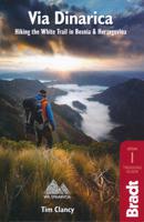
Wandelgids Via Dinarica | Bradt Travel Guides

0
Bijzondere wandelgids : het beschrijft de wandelroute in Bosnie Herzegovina van de Via Dinarica, the White trail. Veel praktische informatie, redelijk kaartmateriaal en een goede beschrijving van de route.  This is the first detailed guide to the Bosnian part of the new Via Dinarica hiking trail that carves its way through the Dinaric Alps, one of...

Verkopers met dit product

Verkoper
Bezorging
Prijs
DeZwerver.nl logo
DeZwerver.nl
niet bekend
20,95

Anderen bekeken ook

Wegenkaart - landkaart 3327 Adventure Map Western Balkans - Westelijke Balkan | National Geographic
Wegenkaart van de Westelijke Balkan met vermelding van veel bezienswaardigheden en attrakties. Watervast en scheurvast. Juist door deze vermeldingen onderscheidt de kaart zich van andere wegenkaarten. Landen: Slovenië, Kroatië, Bosnië Herzegovina, Montenegro, Albanië, Servië,  Kosovo, and Macedonië.   The Western Balkans region, an adventure playground and rising star of Europe, is loaded with Old World traditions, slow food culture, ancient towns, and rarely visited villages. The area stretches from the Adriatic Sea in the west, up and over mountain ranges, raging rivers, tectonic lakes, steep gorges, and thousands of miles of paths, trails, and routes. Discover eight countries—all with their special brand of Balkan magic: Slovenia, Croatia, Bosnia and Herzegovina, Montenegro, Albania, Serbia, Kosovo, and Macedonia.   National Geographic's Western Balkans Adventure Map will meet the needs of travelers with its detailed and accurate information. The map includes the locations of UNESC…
17,50
Reisgids Bosnia & Herzegovina - Bosnië | Bradt Travel Guides
Voor vele landen net zo goed, zo niet beter dan de Planet. Beduidend soberder uitgevoerd, maar ook met veel informatie voor backpackers en met veel kaartmateriaal. Een aanrader! Two decades after the conflict that ravaged the region, Bosnia and Herzegovina has emerged as a unique, dynamic tourism destination. Whether you go in search of bears in the primeval Sutjeska National Park, wander the winding streets of Sarajevo’s Turkish quarter or put your feet up in Mostar with a glass of chilled ilavka, you are guaranteed to be charmed by the country’s rich natural and cultural heritage. Still the only standalone guidebook to the country in English, Bradt’s Bosnia & Herzegovina is packed with practical information and insider tips on how to make the most of your trip to the land where East meets West.   Explore Sarajevo on foot with our extensive walking tours   Go skiing on the world-class slopes of Jahorina and Bjelanica   Visit the mysterious pilgrimage site of Medugorje   Learn your ku…
26,50
Fietskaart 01 Cycling guides Cornwall | Goldeneye
Our maps are double-sided, printed on an A2 sheet with a concertina fold. This allows for easy folding and folding, and an ease of access to the mapping. The material is rain and tear-resistant. Our early maps were designed at the scale of 2 miles to 1 inch/1:126,720. The later designs along with digitalisation are 1: 100,000. We were encouraged by the Cycle Touring Club to convert our cartography toward the cycle market (to replace the out-of-print Bartholomew series). As time and the series progressed we have added more data: The National Cycle Network routes, Regional Routes, and Traffic-Free Family Routes, as and when they are developed. These routes are in addition to the Circular Routes Goldeneye Commissioned at the outset of our publishing schedule. We are also adding to new editions; bike shops, cycle hire, and tea rooms, along with the tourist attractions already featured. Our plan is to make available digital versions for cell phones and tablets and to update, on an annual b…
15,95
Wandelgids Alpe-Adria Trail | Bradt Travel Guides
Goede wandelgids met heel veel praktische informatie. Naast een duidelijke beschrijving van de route veel adressen om te kunnen overnachten. Per etappe wordt er een hoogteprofiel gegeven, kaartmateriaal is iets minder van kwaliteit, per deel van de route wordt verwezen naar de echte wandelkaarten.  This is the first English-language guide to the epic new 750-km hiking route through the mountains of Austria, Slovenia and Italy, from the foot of the Grossglockner (at 3,798m, the highest peak in Austria and the Eastern Alps) to Muggia near Trieste on the Adriatic coast. Detailed maps and route descriptions for all 44 stages of the route are included, with a clear breakdown of time, distance and ascent for each stage. Published in a small, handy-sized format which is easy to pack and carry, it is written by an expert who has authored over half a dozen hiking guides and who specialises in Eastern and Central Europe. He has been a regular visitor to the borderlands of Slovenia, Austria and …
20,95
Wandelgids - Klimgids - Klettersteiggids Via Ferratas of the French Alps | Cicerone
This guidebook covers 66 varied via ferratas in the French Alps. The routes are spread over six areas: Geneva and the Northern Alps, Chambéry, Tarentaise and Maurienne valleys, Grenoble and Briançon, amid the Mont Blanc, Vanoise and Queyras ranges. Difficulty ranges from easy, protected routes through to exposed, technical challenges. With some of the most beautiful scenery in the world, the French Alps have long been a popular destination for a wide range of outdoor activities. In recent years, the region has seen the arrival of a growing number of via ferrata routes.   Via ferrata climbing – using fixed cables, bridges and ladders to explore terrain that is normally only accessible to experienced rock climbers – combines elements of scrambling, mountaineering and rock climbing, yet is a very distinct pursuit. Increasingly popular, recent years have seen a surge in the number of routes being established in these iconic mountains.   The routes in this guidebook range from straightforw…
25,95
Wandelgids Camino Ignaciano Loyola - Manresa 675 km | Bradt Travel Guides
In 1522 Ignatius of Loyola made a pilgrimage from his home in Spain's Basque country to Montserrat and Manresa. This new guide from Bradt provides all the information needed to follow in his footsteps in a neat, easy-to-carry portable format, including an essential mix of practicalities, such as when to go, where to stay along the route, national parks and public transport, and a detailed breakdown of the route's 27 stages. Start and finish points, level of difficulty, duration, distance, ascent and descent, and route descriptions are all included, as well as elevation charts, maps and what to see along the way. This is a unique secular walking guide to a religious-themed walk which takes intrepid hikers from the imposing tower house and sanctuary of Loyola in the Basque Country, up through the stunning Basque mountains and down to the beautiful town of Laguardia with its myriad wine caves. Through the vineyards of Alava and world-famous La Rioja, the trail visits lively Logroño and f…
23,95
Wandelgids Thames Path | Trailblazer Guides
This book follows the Thames Path National Trail from the river's source in Gloucestershire to the Thames Barrier in London. Officially 184 miles (294km) in length (although the actual distance you walk will depend on a number of decisions you make en route), the path meanders, accompanied by its watery muse, through pristine and tranquil countryside, past historic sites and buildings, via pub, lock, weir, and the occasional scattering of waterfowl, to a city, once the fulcrum of an empire, and now the heart of modern day England. The river, responsible for the metropolis' very being, tells tales, inspires artists, accommodates swans, geese, and water voles, reflects the silhouettes of red kites and kingfishers, provides employment, entices adventure, and allows time for carefree pilgrims to procrastinate and think. Following its banks is a grand way to go for a ramble. The path begins, as the river does, in a meadow in the Cotswolds; its upper reaches lonely and wild, the meadows and…
19,95
Reisgids Montenegro | Bradt Travel Guides
Voor vele landen net zo goed, zo niet beter dan de Planet. Beduidend soberder uitgevoerd, maar ook met veel informatie voor backpackers en met veel kaartmateriaal. Een aanrader! This new, sixth edition of Bradt's Montenegro is the most comprehensive guide available to one of Europe's hidden corners and features many areas not covered by other guides. Thoroughly updated to incorporate all the most recent developments, from practical information on where to go, stay and eat to vivid descriptions, historical insights and in-depth background on both well-known and off-the-beaten track sights, it is an ideal companion for both independent and group travellers. Beach lovers, culture aficionados, hikers, adrenaline-seekers, birding and wildlife enthusiasts and foodies are all catered for, with details of everything from coastal retreats, the Buljarica wetlands and Ulcinj saltpans to Durmitor and Biogradska national parks, Prokletije Mountains and cultural big-hitters such as Cetinje and Koto…
20,95
Reisgids Slow Travel Cotswolds | Bradt Travel Guides
Reisgids over een specifiek deel van Engeland met veel cultuur en geschiedenis, maar zeker ook praktische tips zoals je van uitgever Bradt mag verwachten.  In this new, thoroughly updated third edition of Bradt’s The Cotswolds, part of Bradt’s distinctive ‘Slow travel’ series of guides to UK regions, local resident and experienced travel writer Caroline Mills shares her favourite places in a region that remains as popular as ever. Drawing on more than 50 years’ living in the Cotswolds, and combining engaging first-person narrative with authoritative advice, Mills slows readers down and helps them delve deeply into a range of regions: the Cotswolds National Landscape Area of Outstanding Natural Beauty (AONB); the Cotswold escarpment, hills and valleys; the Wiltshire Cotswolds and the area known as the Four Shires; three Cotswold ‘gateways’ (Stratford-upon-Avon, Bath and Oxford); the lesser-known ‘hidden’ fringes of the Cotswolds; and – new for this edition – the Oxfordshire Cotswolds, …
23,95
Wandelgids The Giants' Trail: Alta Via 1 Through the Italian Pennine Alps | Cicerone
Uitstekende wandelgids van een gerenommeerde Engelse uitgever. De tochten zijn met zorg beschreven en voorzien van allerhande nuttige informatie. Italy's Alta Via 1, a 180km hiking trail through the Italian Alps following the northern flank of the Aosta Valley, boasts magnificent views of the Alpine giants: Mont Blanc, the Matterhorn, the Grand Combin and Monte Rosa. Indeed, it is sometimes known as the Giants' Trail and can be combined with a sister-route, the Alta Via 2 (covered in a separate Cicerone guide), which runs along the southern flank of the valley, to form the Tor des Geants. Stretching from Donnas to Courmayeur, the Alta Via 1 offers fantastic alpine walking, with welcoming refuges and small hotels providing overnight accommodation (and great food) along the way. The guide presents the route in two sections, for the advantage of those who can't spare the full fortnight-plus needed to walk the entire AV1. The trail is described in 16 stages, with alternative stages coveri…
23,95

Klanten-reviews van Wandelgids Via Dinarica | Bradt Travel Guides

Er zijn nog geen beoordelingen voor dit productBen jij de eerste die een review plaatst?

Meer over Wandelgids Via Dinarica | Bradt Travel Guides

Productomschrijving

Bijzondere wandelgids : het beschrijft de wandelroute in Bosnie Herzegovina van de Via Dinarica, the White trail. Veel praktische informatie, redelijk kaartmateriaal en een goede beschrijving van de route. 

This is the first detailed guide to the Bosnian part of the new Via Dinarica hiking trail that carves its way through the Dinaric Alps, one of Europe's least explored mountain ranges and last true wilderness frontiers, connecting the seven nations of Slovenia, Croatia, Bosnia and Herzegovina, Montenegro, Serbia, Kosovo, and Albania. In total, this trail system will span over 1,350km, 333km of which is in Bosnia Herzegovina.

The Via Dinarica consists of three routes - White, Green and Blue - and this guide focuses primarily on the White Trail through Bosnia and Herzegovina, following the natural flow of the highest peaks of the Dinaric Alps. Detailed descriptions of each of the 12 stages of the White Trail through Bosnia and Herzegovina are included, along with maps, altitude charts and helpful tips, as well as recommendations for waypoint visits and nearby highlights. Also included are an overview of the flora and fauna of the region, details of accommodation for each step of the way, and information on local public transport, culture, food and language. 

The natural and cultural wonders of the Dinaric Alps are the best-kept secret of the Balkans, a region with some of the wildest, most impressive natural beauty in the world. All of the countries along the Via Dinarica boast beautiful mountains, alpine lakes, karst caves, forest preserves and pristine rivers that have forged extraordinary canyons and gorges. Here, there is also an abundance of enduring mountain communities that maintain their traditional ways of life and sustainable reliance on the land.


Although the Via Dinarica is primarily a hiking trail, there are opportunities for many different outdoor adventure sports along the way, such as rafting, skiing, mountain biking, rock climbing, canyoning, caving, etc. The Via Dinarica White Trail in Bosnia and Herzegovina is 333km long, takes an estimated 125 hours to complete, climbs the highest, often snow-capped mountains of the Dinaric Alps, and passes through or near over 5 national parks and many nature preserves, as well as one of the two remaining European rainforests, the Perucica primeval forest. With this handy, portably guide, you can discover it all.

Verken gerelateerde categorieën

Webshop.nl maakt gebruik van cookies. Ga je verder op onze website, ga dan akkoord met het plaatsen van cookies en de verwerking van deze data door ons en vermelde partners.