webshop.nl

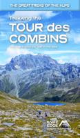
Wandelgids Trekking the Tour Des Combins | Knife Edge Outdoor

0
The definitive guidebook for the Tour des Combins: the new bucket list trek in the Swiss/Italian Alps. A superb alternative to the more famous Tour du Mont Blanc. Two-way guide: both clockwise and anti-clockwise routes are described in full. Real Maps: full mapping inside (1:40,000), made specifically for Knife Edge Outdoor Guidebooks. All acco...

Webshops met dit product

Webshop
Bezorging
Prijs
DeZwerver.nl logo
DeZwerver.nl
niet bekend
27,50

Anderen bekeken ook

Wandelkaart Tour des Combins trekking map | Knife Edge Outdoor
The best sheet map for the Tour des Combins. Displays the entire route and variants on a single sheet: perfect for planning and navigation.       1:40,000 - larger scale and more detail than any other map.       Made specifically for the Tour des Combins by Knife Edge Outdoor Guidebooks:       English/French/German map key 1:40,000 Numerous variants Includes free GPX downloads for the trail GPS compatible Tougher than traditional maps: try to tear it! More water-resistant than traditional maps Lighter than traditional maps Huts/accommodation marked on the map     The Tour des Combins is an epic trek in the Swiss and Italian Alps. It traverses some of Europe's wildest mountain terrain. The sublime scenery makes it a worthy alternative to the more famous Tour du Mont Blanc (which is only a stone's throw away).       Hike along the edge of the Corbassière Glacier, one of the longest in Europe. Enjoy snow frosted summits, magnificent valleys and pastures, sparkling azure lakes, carpets of…
23,90
Wandelgids Trekking the Cleveland Way | Knife Edge Outdoor
The definitive two-way guide to the Cleveland Way, one of England's epic National Trails: both eastbound and westbound routes are described in full.   Real Maps: Full Ordnance Survey mapping inside (1:25,000). All accommodation is numbered and marked on the maps. 20 different itineraries: schedules of 5, 6, 7, 8, 9, 10 and 11 days for hikers and runners. Includes both eastbound and westbound itineraries. Difficult calculations of time, distance and altitude gain/loss are done for you.   Also includes: - Detailed information on equipment and travelling light - Full accommodation listings: the best pubs, B&Bs and hotels - Detailed section on camping, including wild camping - Everything the trekker needs to know: route, costs, difficulty, weather, travel, and more - Essential info for both self-guided and guided trekkers - Information on plants and wildlife - Numbered waypoints linking the Real Maps to our clear descriptions   Yorkshire's Cleveland Way is one of the most beautiful long-d…
23,95
Wandelgids Tour of the Ecrins National Park GR54 | Knife Edge Outdoor
Overzichtelijke routegids van deze prachtige wandelroute. Per etappe vind je een hoogteprofiel, goede beschrijvingen van de wandelroute, een topografische kaart op gedetailleerde schaal. Voor en achterin de gids staat aanvullende praktische informatie zoals adressen van campings, andere accommodaties en bijvoorbeeld een paar pagina's over de flora en fauna.  The Tour of the Ecrins National Park is also known as the GR54. It is arguably the best trek in the Alps. It is an incredible walk of 193km (120 miles) around the incomparable Ecrins National Park in the Southern French Alps. It takes  9-12 days. On the way, 14 magnificent mountain passes are crossed. It is almost certainly the finest trek that you have never heard of! The Ecrins Massif is the second highest range of mountains in the French Alps: the Mont Blanc Massif is of course the highest.   Unspoilt and remote high mountain terrain: snow frosted summits, beautiful valleys and pastures, sparkling azure lakes, carpets of wil…
26,95
Wandelkaart Walker's Haute Route: Chamonix to Zermatt | Knife Edge Outdoor
Een hele goede kaart van én van de grote wandeltochten in de Alpen: Haute Route Chamonix-Zermatt. Deze wandelkaart op scheur- en watervast papier gedrukt geeft de hele route weer op een gedetailleerde schaal. Alle noodzakelijke informatie vind je er op terug.   The best sheet map for the Walker's Haute Route: Chamonix to Zermatt. This is the only map available that displays the entire route and numerous variants on a single sheet: perfect for planning and navigation. 1:40,000 - larger scale and more detail than any other map. 1:10,000: for select areas where navigation is challenging. Made specifically for the Walker's Haute Route by Knife Edge Outdoor Guidebooks:   - English/French/German map key - 1:40,000/1:10,000 - Numerous variants - Includes free GPX downloads for the trail - GPS compatible - Tougher than traditional maps: try to tear me! - More water-resistant than traditional maps - Lighter than traditional maps - Huts/accommodation marked on the map   The Walker's Haute Route…
23,95
Reisgids Europe - Europa | Eyewitness
DK Eyewitness Travel Guide: Europe will lead you straight to the best attractions this diverse continent has to offer, from the majestic peaks of the Alps to the turquoise waters of the Mediterranean. This newly updated guidebook is packed with information on the culture, history, architecture, and art of the continent, in addition to the best of Europe's gardens, beaches, cathedrals, castles, and shopping. DK's insider travel tips and essential local information will help you discover Europe your way, whether you want to explore the luscious green landscape of Ireland, relax on a beach in Greece, or both. Discover DK Eyewitness Travel Guide: Europe.    • Detailed itineraries and "don't-miss" destination highlights at a glance.    • Illustrated cutaway 3-D drawings of important sights.    • Floor plans and guided visitor information for major museums.    • Local drink and dining specialties to try, things to do, and places to eat, drink, and shop by area.    • Area maps marked with si…
27,95
Reisgids - Wandelgids Glacier National Park | Moon Travel Guides
Through lush green parkland and up to the top of jagged summits, forge your own path with Moon Glacier National Park. Flexible Itineraries: Unique and adventure-packed ideas for day trips, a week on the road, families with kids, wildlife enthusiasts, and more The Best Hikes in Glacier: Individual trail maps, mileage and elevation gains, and backpacking options Experience the Outdoors: Trek through fields of alpine wildflowers and walk beneath waterfalls. Go whitewater rafting, cast a line into the Flathead River for wild trout, or hop on a guided horseback ride. Drive or bike the Going-to-Sun Road, take in views of snowy peaks and glaciers, and spot wild moose or grizzlies roaming the mountainside How to Get There: Up-to-date information on gateway towns, park entrances, park fees, and tours Where to Stay: Spend a night in a historic lakeside lodge, or sleep under the stars with campgrounds, resorts, and more both inside and outside the park Planning Tips: When to go, what to pa…
23,95
Wandelgids Best Day Walks France - Frankrijk | Lonely Planet
Lonely Planet heeft een nieuwe serie uitgebracht: Best Day Walks in verschillende landen. Het zijn de - door Lonely Planet uitgekozen - mooiste wandelingen verspreid over het land. Goed beschreven, met een schetsmatige kaart erbij ... het werkt heel stimulerend met mooie foto's! Lonely Planet's Best Day Walks France is your passport to 60 easy escapes into nature. Stretch your legs away from the city by picking a walk that works for you, from just a couple of hours to a full day, from easy to hard. Hike the Alps and the Pyrenees and admire lavender fields in Provence.         Inside Lonely Planet's Best Day Walks France Travel Guide:   Colour maps and images throughout   Special features - on France's highlights for walkers, kid-friendly walks, accessible trails and what to take Best for… section helps you plan your trip and select walks that appeal to your interests Region profiles cover when to go, where to stay, what's on, cultural insights, and local food and drink recommendations…
25,95
Wandelkaart Tour & Trail La Gomera & El Hierro | Discovery Walking Guides
Super gedetailleerde kaart van het hele eiland. Met heel veel wandelroutes, al dan niet gemarkeerd. Quite simply La Gomera and El Hierro Tour & Trail Super-Durable Maps are the most detailed, accurate, toughest, easy to read, large scale maps of La Gomera and El Hierro that you can buy. Our map sheet is 840mm by 680mm. On the cover side you get the latest 35k scale 8th edition La Gomera Tour & Trail Super-Durable Map by David Brawn.   On the reverse side is our 35k scale 1st edition El Hierro Tour & Trail Super-Durable Map by Jan Kostura. Both maps are produced to our 'Tour & Trail' level of detail ranging from major roads to secondary roads to minor roads to streets and camino rural narrow country roads, plus dirt roads and walking trails. Walking trails are specially highlighted, GR (Gran Recorido trails in green) and Walk La Gomera (in red), making them easier to identify on the maps and easier to find on the ground.   Altitude background colouring is designed to clearly show …
15,95
Reisgids Eyewitness Travel Belgium and Luxembourg | Dorling Kindersley
Prachtig geillustreerde reisgids met o.a. 3D tekeningen, fraaie kaarten en geweldige foto’s. Daarnaast uitgebreide achtergrondbeschrijvingen. Echt om in de stemming te komen! Groot formaat gids. Engelstalig The ideal travel companion, full of insider advice on what to see and do, plus detailed itineraries and comprehensive maps for exploring these historic countries. Appreciate the architectural splendour of Brussels, wander through picture-postcard Bruges, take a tour of the World War I battlefields, marvel at the caves and grottoes of the Ardennes or explore the medieval Old Town of Luxembourg City: everything you need to know is clearly laid out within colour-coded chapters. Discover the best of Belgium and Luxembourg with this indispensable travel guide. Inside DK Eyewitness Travel Guide Belgium and Luxembourg: - Over 25 colour maps help you navigate with ease - Simple layout makes it easy to find the information you need - Comprehensive tours and itineraries of Belgium and Luxe…
20,95
Wandelgids Walk! La Gomera | Discovery Walking Guides
La Gomera is the ultimate get-away-from-it-all island: easy-going, unspoilt, friendly, isolated from the hustle and bustle of modern living, and so laid back it’s virtually supine - even the volcanoes have been dormant for millions of years. The walks, however, are a bit more energetic. For the new 4th edition of Walk! La Gomera Charles Davis has teamed up with Jan Kostura. Jan brings his wide experience and passion for the Canaries, checking, re-walking and revising existing routes, and adding a couple of his own adventures, including a new Top Three Gomeran walk. Two routes have been dropped as having become too dangerous, but the good news is that many of the more harum-scarum walks have been improved through path clearing and the addition of railings to the vertiginous stretches. Other good news is that the devastating forest fires of 2012 have proved not nearly as damaging as we feared, leaving most of our itineraries unscathed. In short, there is every reason to take off and ex…
17,50

Klanten-reviews van Wandelgids Trekking the Tour Des Combins | Knife Edge Outdoor

Er zijn nog geen beoordelingen voor dit productBen jij de eerste die een review plaatst?

Meer over Wandelgids Trekking the Tour Des Combins | Knife Edge Outdoor

Productomschrijving

The definitive guidebook for the Tour des Combins: the new bucket list trek in the Swiss/Italian Alps. A superb alternative to the more famous Tour du Mont Blanc.

Two-way guide: both clockwise and anti-clockwise routes are described in full.

Real Maps: full mapping inside (1:40,000), made specifically for Knife Edge Outdoor Guidebooks.

All accommodation/campsites are numbered and marked on the maps.

10 different itineraries: schedules of 6, 7, 8 and 9 days for hikers and runners. Includes both clockwise and anti-clockwise itineraries. Difficult calculations of time, distance and altitude gain/loss are done for you.


Also includes:

* Detailed information on equipment and travelling light

* Full accommodation/campsite listings

* Wild camping rules explained

* Everything the trekker needs to know: route, costs, difficulty, weather and more

* Travel to the trail-head

* Essential info for both self-guided and guided trekkers

* Information on plants and wildlife

* Numbered waypoints linking the Real Maps to our clear descriptions


The Tour des Combins is an epic trek in the Swiss and Italian Alps. It traverses some of Europe's wildest mountain terrain. The sublime scenery makes it a worthy alternative to the more famous Tour du Mont Blanc (which is only a stone's throw away).

Hike along the edge of the Corbassière Glacier, one of the longest in Europe. Enjoy snow frosted summits, magnificent valleys and pastures, sparkling azure lakes, carpets of wild flowers, the soothing sound of cow bells and easy to follow paths. Stay in spectacularly situated villages and remote mountain huts. This will be a trip that you will never forget.

Verken gerelateerde categorieën

Webshop.nl maakt gebruik van cookies. Ga je verder op onze website, ga dan akkoord met het plaatsen van cookies en de verwerking van deze data door ons en vermelde partners.