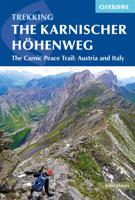
Wandelgids Trekking the Karnischer Höhenweg | Cicerone

0
Uitstekende wandelgids van deze mooie route. goed beschreven met veel praktische informatie om de route te kunnen lopen, inclusief redelijke kaarten This guidebook describes the Karnischer Höhenweg, a 169km long-distance walk through the beautiful Carnic Alps which straddle the border between Austria and Italy. Following a high Alpine trail along ...

Verkopers met dit product

Verkoper
Bezorging
Prijs
DeZwerver.nl logo
DeZwerver.nl
2,95
22,50

Anderen bekeken ook

Wandelgids Trekking the Karnischer Höhenweg | Cicerone
Uitstekende wandelgids van deze mooie route. goed beschreven met veel praktische informatie om de route te kunnen lopen, inclusief redelijke kaarten This guidebook describes the Karnischer Höhenweg, a 169km long-distance walk through the beautiful Carnic Alps which straddle the border between Austria and Italy. Following a high Alpine trail along the main ridge, the route is clearly waymarked and requires a reasonable level of fitness, a sense of adventure and a head for heights, but no special equipment or technical expertise. It can be walked between mid-July and the end of September and takes up to a fortnight, though it is possible to devise shorter itineraries taking in the highlights. The guide describes the full route of the Karnischer Höhenweg from Arnbach, near Sillian, to Arnoldstein, near Villach, and includes plenty of practical information to help you prepare for the walk. Each stage features comprehensive route description, clear mapping and fascinating insights into th…
22,50
Wandelgids 5633 Kompass Wanderführer Karnischer Höhenweg | Kompass
Goede Duitstalige wandelgids met heldere beschrijvingen van de wandeltochten. Met hoogteprofiel, kaartje en de benodigde praktische informatie als bijvoorbeeld de startlocatie met GPS coordinaten. De wandelingen zijn ingedeeld in zwaarte en dan op verschillende kleuren weergegeven. Beschreven worden eenvoudige wandelingen tot pittige (berg)tochten, voor getrainde en ongetrainde wandelaars, een aantal wandelingen zijn geschikt om met kinderen te doen. Belangrijke toevoeging bij de Kompass wandelgidsen is een bijgevoegde losse wandelkaart van het betreffende gebied waarop de wandelingen uit de gids op de kaart heel duidelijk zijn ingetekend.    Die Vorteile des Wanderführers auf einen Blick: • Von KOMPASS-Experten erwanderte Touren • Jede Tour mit Höhenprofil und Kartenausschnitt • Ausflugs- und Übernachtungstipps • Kostenloser Download der GPX-Daten   Die Vorteile der Extra-Tourenkarte auf einen Blick: • Unterstützt die Tourenauswahl • Kartografische Gesamtübersicht • Touren können ein…
18,90
Wandelgids Trekking in the Silvretta and Ratikon Alps | Cicerone
Aanbevolen wandelkaarten bij deze gids: Schaal 1:60.000 Wandelkaart 14 Unterengadin | Kümmerly & Frey Wandelkaart 13 Davos - Arosa | Kümmerly & Frey Of schaal 1:25.000 Wandelkaart 26 Alpenvereinskarte Silvrettagruppe This guide describes three treks, between 5 and 8 days, in the Silvretta and Rätikon Alps starting near Klosters, and 12 half-day hut-to-hut routes. These contrasting ranges form a line on the borders of Switzerland, Austria and Liechtenstein. The Tour of the Silvretta, the Prättigauer Höhenweg and the Rätikon Höhenweg. Straddling the borders of Austria, Switzerland and Liechtenstein, the limestone Rätikon Alps reach into the snow-bound and glacier-hung Silvretta Alps to provide a richly diverse series of landscapes. The Tour of the Silvretta, the Prättigauer Höhenweg and the Rätikon Höhenweg, all within easy reach of Klosters, have been devised to help trekkers explore the best of the region. Given sifficient time they can also be combined to create a continuous 2-week t…
25,95
Wandelgids Höhenweg Meran - Ortler | Tappeiner Verlag
De gids - groot formaat en zwaar - geeft uitgebreide informatie over de route maar vooral ook over de streek over alle aspecten: zeer gedegen en iteressant. De wandeling zelf kun je goed doen met de losse kaart die bij het boek zit: op schaal 1:25.000 en een bijzonder duidelijk accuraat kaartbeeld zijn alle belangrijke punten die je nodig hebt vor de route uitstekend leesbaar en goed ingetekend. In diesem Buch über den neuen Höhenweg Meran – Ortler werden einerseits die 6 Etappen des Weges detailliert beschrieben und bebildert, andererseits aber auch auf Varianten und Gipfelziele in der Nähe hingewiesen. Es werden der Verlauf einer jeden Etappe auf einem übersichtlichen 3D-Panorama eingezeichnet, die Einkehr- und Übernachtungsmöglichkeiten aufgeführt sowie Besonderheiten am Wegesrand dargestellt. Der Höhenweg Meran – Ortler wird mit seiner Flora und Fauna beschrieben und bebildert. Selbstverständlich dürfen Ausrüstungs- und Verpflegungstipps, Infos zu den öffentlichen Verkehrsmitteln …
17,95
Wandelgids Stubaier Höhenweg | Rother Bergverlag
Uitstekende wandelgids met een t aantal meerdaagse tochten in dal en hooggebergte. Met praktische informatie en beperkt kaartmateriaal! Wandelingen in verschillende zwaarte weergegeven in rood/blauw/zwart. Die Stubaier Alpen im Herzen Tirols sind ein ideales Gebiet für alpines Hüttentrekking. Drei der schönsten alpinen Mehrtagestouren führen durch die Stubaier Alpen: der Stubaier Höhenweg, die Sellrainer Hüttenrunde und die Gschnitzer Runde. Diese Trekkingtouren bieten jedem passionierten Bergwanderer landschaftlichen Hochgenuss. Der Rother Wanderführer »Stubaier Höhenweg, Sellrainer Hüttenrunde, Gschnitzer Runde« stellt die drei Weitwanderwege mit allen wichtigen Infos vor.   Der Stubaier Höhenweg ist ein Klassiker der alpinen Hüttentouren. Er verläuft um das Stubaital und begeistert mit zahlreichen Dreitausendern: Rinnenspitze, Wilder Freiger, Habicht und noch einige weitere hohen Gipfel machen den Stubaier Höhenweg zu einer wahren Highlight-Trekkingtour. Auch auf der malerischen…
18,50
Wandelgids Trekking in the Alps | Cicerone
All the rich scenic diversity for which the Alps are renowned is celebrated here, while the 20 treks described include well-known classics as well as newly-created multi-day routes. The eight talented writers and photographers brought together to produce this book are among the most experienced of Alpine trekkers. Between them they have explored every corner of Europe’s premier mountain range, written dozens of guides and, in some cases, led trekking holidays there in order to share their enthusiasm for the Alps with other walkers. And that is the prime motivation for Trekking in the Alps – an inspiration and a celebration of the very best of these mountains. Best-known treks Tour of Mont Blanc; Tour of the Matterhorn; Tour of Monte Rosa; Walker’s Haute Route; Tour of the Jungfrau Region; Tour of the Vanoise; Dolomites AV 1 & 2 Longer trans-Alpine treks GR5 (Lake Geneva to Nice); Eastern Alps E5; Italian Alps GTA; Traverse of the Slovenian Alps For the Alpine adventurer Alpine Pass Ro…
28,95
Wandelgids Der Meraner Höhenweg | Tappeiner Verlag
Prachtig uitgevoerde wandelgids met veel foto's en uitgebreide tekst. Bijgevoegd een gedetailleerde kaart van 1:30.000 met de ingetekende route. De kaart is toereikend om te gebruiken op de route; op de achterkant staat dan de praktische informatie nog een extra vermeld.    In diesem Buch über den Meraner Höhenweg werden einerseits die Entstehung des Weges anhand von historischen Bildern und vielen Hintergrundinformationen beleuchtet; andererseits werden die 5 Etappen des Weges detailliert beschrieben und bebildert. Zusätzlich wird der Verlauf jeder Etappe auf einem 3D-Panorama eingezeichnet, die Einkehr- und Übernachtungsmöglichkeiten aufgeführt, Berg-Varianten entlang des Weges dargestellt. Der Naturpark Texelgruppe wird mit seiner Geologie, Flora und Fauna beschrieben und bebildert und die schönsten Fotopunkte entlang des Meraner Höhenweges werden ausgemessen, lokalisiert und fotografisch festgehalten. Eine zusätzliche Karte zum Entnehmen mit topografischen und 3D-Ausschnitten erle…
32,95
Wandelgids Tiroler Höhenweg | Rother Bergverlag
Uitstekende beschrijvingen van deze steeds populairder wordende bergtocht! Goede routebeschrijving, veel praktische informatie, hoogteprofielen en redelike kaartjes. Met alle noodzakelijke info. Zie voor beschrijving de duitse tekst hieronder ...   Der Tiroler Höhenweg ist ein hochalpiner Weitwanderweg der Superlative, der in grandioser Landschaft durch Bergregionen unterschiedlichster Charakteristik verläuft. Als grenzüberschreitender Fernwanderweg verbindet er, was der Erste Weltkrieg einst getrennt hat. Durch die Zillertaler Alpen mit ihren beeindruckenden Eisriesen führt er zum Brennerpass, anschließend durch die Tribulaune mit ihren bleichen Dolomit-Zacken. Danach streift der Höhenweg die Stubaier und die Ötztaler Alpen, bevor er nach Durchquerung der Texelgruppe mit den Spronser Seen absteigt, um schließlich die Apfelgärten Merans zu erreichen.   Der Rother Wanderführer »Tiroler Höhenweg« beschreibt neben den 13 Original-Etappen zahlreiche Varianten und Gipfelbesteigungen (da…
18,50
Wandelgids Trekking The Kungsleden | Cicerone
Sweden's most famous long-distance trail, the Kungsleden (King's Trail) traverses the land of the Sámi people and the midnight sun, stretching 460km between Abisko and Hemavan. Around half the route lies within the Arctic Circle showcasing an ever-changing landscape of snowy mountains, deep glacial valleys, open fell, expansive lakes and verdant forest. The fully waymarked trail is comprised of five continuous and distinct sections: these can be walked individually or a thru-hike will take around a month. The guide also includes the popular Abisko to Nikkaluokta circuit, which can be completed in a week, and an ascent of Kebnekaise, Sweden's highest peak at 2098m. In addition to clear route description and mapping, you'll find a wealth of practical advice covering accommodation and facilities, equipment and resupply and detailed notes on how to get to and from the section start and finish-points. A Swedish and Fell Sámi glossary can be found in the appendix. Although there are plenti…
24,95

Klanten-reviews van Wandelgids Trekking the Karnischer Höhenweg | Cicerone

Er zijn nog geen beoordelingen voor dit productBen jij de eerste die een review plaatst?

Meer over Wandelgids Trekking the Karnischer Höhenweg | Cicerone

Productomschrijving

Uitstekende wandelgids van deze mooie route. goed beschreven met veel praktische informatie om de route te kunnen lopen, inclusief redelijke kaarten

This guidebook describes the Karnischer Höhenweg, a 169km long-distance walk through the beautiful Carnic Alps which straddle the border between Austria and Italy. Following a high Alpine trail along the main ridge, the route is clearly waymarked and requires a reasonable level of fitness, a sense of adventure and a head for heights, but no special equipment or technical expertise. It can be walked between mid-July and the end of September and takes up to a fortnight, though it is possible to devise shorter itineraries taking in the highlights.

The guide describes the full route of the Karnischer Höhenweg from Arnbach, near Sillian, to Arnoldstein, near Villach, and includes plenty of practical information to help you prepare for the walk. Each stage features comprehensive route description, clear mapping and fascinating insights into the history of the 'war in the mountains' plus other local points of interest. Accommodation listings and other useful contacts can be found in the appendices.

Also known as the Friedensweg ('Peace Trail'), the route follows the First World War front line, and reminders of the conflict are everywhere. But the trail isn't just rich in historical interest: this is Alpine ridge-walking at its best, boasting spectacular mountain vistas and views of the Dolomites, Hohe Tauern and Julian Alps. The guide covers two key variants of the trail, one on the Austrian side of the border, the other on the Italian side. Also included is an optional ascent of Monte Coglians, the highest peak in the Carnic Alps, and a visit to the open-air museum at the Plöckenpass.

Productinformatie

    Verken gerelateerde categorieën

    Webshop.nl maakt gebruik van cookies. Ga je verder op onze website, ga dan akkoord met het plaatsen van cookies en de verwerking van deze data door ons en vermelde partners.