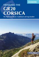
Wandelgids Trekking the GR20 Corsica | Cicerone

0
Engelstalige beschrijving van de mooiste wandeltocht op Corsica. De gids voldoet aan alle verwachtingen die je kunt hebben. Wel heb je voor de zwaardere gedeelte voor de zekerheid goede kaarten nodig ...... The GR20, on the mountainous Mediterranean island of Corsica, is reputated to be the toughest waymarked trail in Europe. This ambitious route ...

Verkopers met dit product

Verkoper
Bezorging
Prijs
DeZwerver.nl logo
DeZwerver.nl
2,95
24,95

Anderen bekeken ook

Wandelgids Short Treks in Corsica | Cicerone
Uitstekende wandelgids van dit geweldige gebied. goed beschreven met veel praktische informatie om de route te kunnen lopen, inclusief redelijke kaarten. With spectacular mountain landscapes, beautiful rugged coast, forests, maquis and striking river gorges, Corsica is a walker's paradise. This guidebook details five of the islands's most popular shorter treks: the 2-day coastal Sentier du Douanier (Customs Officer's Path) around Cap Corse; two coast-to-coast routes through the central mountains, the 11-day Mare a Mare Nord and the 5-day Mare a Mare Sud; and two 'coast and mountains' routes, the 10-day Mare e Monti and the 5-day Mare e Monti Sud. (Corsica's famous 190km GR20 trail is described in a separate Cicerone guide.) The routes can be linked to create longer excursions and accommodation is provided by a mixture of walkers' hostels, B&Bs and hotels; camping is also an option. The guide presents each of the waymarked trails in daily stages averaging around 12-13km per day, with r…
23,95
Wandelgids Trekking the Corsica GR20 | Knife Edge Outdoor
The only two-way guidebook to the GR20: both northbound and southbound routes are described in full. Real IGN Maps included (1:25,000): no need to carry separate maps. 15 different itineraries: schedules of 9, 10, 11, 12, 13, 14, 15 and 16 days. Includes both northbound and southbound itineraries. Difficult calculations of time, distance and altitude gain are done for you. Also includes: * Detailed information on equipment and travelling light * Detailed information on getting to/from all trail-heads * Everything the trekker needs to know: route, costs, difficulty, weather, travel, and more * Full accommodation listings: spectacularly situated mountain huts and campsites * Information for both self-guided and guided trekkers * Numbered waypoints linking the Real Maps to our clear descriptions * Information on Wildlife and Plants. The GR20 is the stuff of legend. Most seasoned trekkers have it on their bucket lists. It crosses the rugged and spectacular mountains on the Me…
25,95
Wandelgids The Swiss Alps | Cicerone
  The Swiss Alps are home to the highest and most spectacular mountains in Western Europe. This stunning guidebook describes each mountain area throughout Switzerland – the peaks, passes, valleys and bases – to help you identify the best destinations to plan your trip.   Questions such as ‘Where to walk, climb or ski?’, ‘What multi-day treks are available’ and ‘Where do they go?’, ‘Where are the mountain huts, what are their facilities, which peaks do they serve?’ And where are the most suitable valley bases?’ – all these and more are addressed in detail in this essential guidebook.   The Swiss Alps does not give detailed route directions but information is given about all the guides and maps available for every region.   The Swiss Alps by Kev Reynolds is the third book in Cicerone’s World Mountain Ranges series, which include The Pyrenees and Scotland.   descriptions of all the Swiss Alps, area-by-area from the Chablais Alps in the south west to the Silvretta in the north east classi…
34,95
Wandelgids Corsica | Rother Bergverlag
Uitstekende wandelgids met een groot aantal dagtochten in dal en hooggebergte. Met praktische informatie en beperkt kaartmateriaal! Wandelingen in verschillende zwaarte weergegeven in rood/blauw/zwart. Bizarre coastal cliffs, charming sandy bays, beautiful chestnut and pine forests, sparkling clean brooks, magical mountain lakes, summit destinations at over 2700 metres high, as well as predominantly unspoilt nature – what other holiday destination in Europe can boast a similar offer? There is hardly another place where a walking and bathing holiday can be combined in such an ideal way as on this Mediterranean island. Among hikers and mountain climbers, Corsica is no longer a secret. The long-distance alpine hiking trail »GR 20« is especially popular, and a few tours in this guide follow portions of that route. The undisputed highlight, however, are the towering peaks of the two-thousand metre mountains Monte Cinto, Monte Rotondo, Paglia Orba and Monte d’Oro, which place the breathtaki…
17,50
Wandelgids Walking on Corsica | Cicerone
Uitstekende wandelgids van Corsica met dagwandelingen. Goed beschreven met veel praktische informatie om de routes te kunnen lopen, inclusief redelijke kaarten. With stunning coastlines and impressive craggy mountains, Corsica is an island with diverse landscapes for day walkers of all abilities to enjoy. Across 25 day walks, this guidebook explores sandy beaches, forested river valleys, and waterfalls, as well as high mountain passes to lookouts and glacial lakes. This guidebook is a brilliant introduction to walking on Corsica, and offers plenty of information on food, plant life, and history. Bases include coastal towns of Bastia, Bonifacio, Porto Vecchio, and Ajaccio, as well as mountain villages of Corte, Evisa and Zonza.   Each walk features detailed mapping alongside comprehensive route description. All the walks are graded for difficulty and range from easy-going low-level walks on good tracks or paths, to challenging and exposed high-level routes for experienced walkers. The …
19,95
Wandelgids Walking the GR7 in Andalucia | Cicerone
Uitstekende wandelgids van een gerenommeerde Engelse uitgever. De tochten zijn met zorg beschreven en voorzien van allerhande nuttige informatie. With its white sandy beaches, pine forests, snow-capped peaks, traditional villages, lush river valleys and olive groves, the GR7 in Andalucía takes you on a journey through the most geographically diverse region on the Iberian peninsula. This wonderfully varied route starts at the southernmost tip of Spain at Tarifa, and meanders through the provinces of Cádiz and Málaga before dividing. The northern route heads through Córdoba and Jaén provinces (711km in total), whilst the southern route passes through Almería and Granada (720km). The route crosses seven stunning natural parks and the Sierra Nevada national park. • The first guide to cover the whole of the GR7 in Andalucía. • Detailed route description for around 60 days of walking, with options for creating shorter sections and days. • Information on all the villages en route offering ac…
26,50
Wandelgids Trekking the Karnischer Höhenweg | Cicerone
Uitstekende wandelgids van deze mooie route. goed beschreven met veel praktische informatie om de route te kunnen lopen, inclusief redelijke kaarten This guidebook describes the Karnischer Höhenweg, a 169km long-distance walk through the beautiful Carnic Alps which straddle the border between Austria and Italy. Following a high Alpine trail along the main ridge, the route is clearly waymarked and requires a reasonable level of fitness, a sense of adventure and a head for heights, but no special equipment or technical expertise. It can be walked between mid-July and the end of September and takes up to a fortnight, though it is possible to devise shorter itineraries taking in the highlights. The guide describes the full route of the Karnischer Höhenweg from Arnbach, near Sillian, to Arnoldstein, near Villach, and includes plenty of practical information to help you prepare for the walk. Each stage features comprehensive route description, clear mapping and fascinating insights into th…
22,50
Wandelgids Trekking in the Vanoise | Cicerone
Uitstekende wandelgids van dit geweldige gebied. goed beschreven met veel praktische informatie om de route te kunnen lopen, inclusief redelijke kaarten. This guide describes the eleven-day 163km Tour of the Vanoise and the five-day 72km Tour des Glaciers de la Vanoise, two fantastic hut-to-hut treks through the pristine Alpine landscapes of France's Vanoise National Park. Three other short treks - the Tour of the Eastern Vanoise, the Tour of the Western Vanoise and a Traverse of the Vanoise via the GR5 and GR55 - are also summarised. The routes tackle several passes in excess of 2500m but there are no glacier crossings, no significant scrambling and no lengthy paths exposed to either stonefall or vertigo-inspiring exposure (though optional variants may involve some slightly more challenging sections), and waymarking is usually clear - making this an ideal route for those new to Alpine trekking.   The guide contains everything you need to plan and walk the routes, with advice on trave…
23,95
Wandelgids The South West Coast Path | Cicerone
Goede wandelgids van het langste gemarkeerde wandelpad van Groot Brittanië; 1015 km! Uit de bekende Cicerone serie, dus met mooie foto's en duidelijke routebeschrijvingen en kaartjes. The South West Coast Path is Britain's longest way-marked trail, measuring a staggering 1015km (630 miles). Written by the well-known outdoor writer, Paddy Dillon, the guide provides a wealth of detailed knowledge to help tackle this immense route with confidence. It describes the way-marked trail from Minehead to Poole along the north Devon, Cornish and south Devon coastline to finish at Poole Harbour. A full introduction provides the route's historical background, advice on accommodation along the route and details on travelling to and around the South West.There is detailed information on how to use this guide to make the most of your walk, whether you choose to walk the whole route in one go or decide to achieve sections at intervals.Day-by-day route summaries accompany the 45-day stages and the fina…
24,95
Wandelgids The Cathar Way | Cicerone
Guidebook to the GR367 Cathar Way (Sentier Cathare) in the Languedoc region of southern France. The 260km waymarked trail from Port la Nouvelle on the Mediterranean to Foix traces the history of the Cathars through the Eastern foothills of the Pyrenees. Split into 13 stages and offering a northern variant, the route takes about 2 weeks to complete. Two of the southernmost départements of France, the Pyrénées-Orientales and Ariège are inextricably linked with the history of the Cathars, a heretical Christian sect who were subjected to a crusade in the thirteenth century. Striking castles built on jagged rocky precipices are a highlight of the region and a reminder of those turbulent times. This guidebook describes the 260km Cathar Way (Sentier Cathare or GR367), a long-distance trail from Port-la-Nouvelle on the Mediterranean coast to Ariége's departmental capital Foix linking several of the impressive Cathar castles. The route follows ancient footpaths, jeep tracks and country lanes a…
22,95

Klanten-reviews van Wandelgids Trekking the GR20 Corsica | Cicerone

Er zijn nog geen beoordelingen voor dit productBen jij de eerste die een review plaatst?

Meer over Wandelgids Trekking the GR20 Corsica | Cicerone

Productomschrijving

Engelstalige beschrijving van de mooiste wandeltocht op Corsica. De gids voldoet aan alle verwachtingen die je kunt hebben. Wel heb je voor de zwaardere gedeelte voor de zekerheid goede kaarten nodig ......

The GR20, on the mountainous Mediterranean island of Corsica, is reputated to be the toughest waymarked trail in Europe. This ambitious route for fit and agile walker covers 190km as it makes a complete traverse through the island's high mountains. It can be completed in about two weeks, and calls for backpacking the whole way, sometimes with hands-on scrambling along the way. Facilities are limited to a dozen mountain refuges and a mere handful of hotels or gîtes.

The ‘classic’ route is described in the guide, along with high and low-level alternatives, plus extra mountain climbs.

This guide explains exactly what is involved in following the GR20, including what walkers need to carry. In the past, many have carried too much, or carried the wrong things, or simply had no idea how difficult the route is in places, but this guide reveals everything you need to know. Detailed route descriptions and stunning photographs leave walkers in no doubt as to what is required of them to walk this exceptionally beautiful, dramatic and rugged route.

Productinformatie

    Verken gerelateerde categorieën

    Webshop.nl maakt gebruik van cookies. Ga je verder op onze website, ga dan akkoord met het plaatsen van cookies en de verwerking van deze data door ons en vermelde partners.