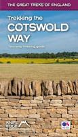
Wandelgids Trekking the Cotswold Way | Knife Edge Outdoor

0
The definitive two-way guide to the Cotswold Way: both southbound and northbound routes are described in full. Real Maps: Full Ordnance Survey mapping inside (1:25,000). All accommodation is numbered and marked on the maps. 18 different itineraries: schedules of 4, 5, 6, 7, 8, 9, 10, 11 and 12 days for hikers and runners. Includes both southbound...

Verkopers met dit product

Webshop
Bezorging
Prijs
DeZwerver.nl logo
DeZwerver.nl
2,95
22,50

Anderen bekeken ook

Wandelgids Trekking the Cleveland Way | Knife Edge Outdoor
The definitive two-way guide to the Cleveland Way, one of England's epic National Trails: both eastbound and westbound routes are described in full.   Real Maps: Full Ordnance Survey mapping inside (1:25,000). All accommodation is numbered and marked on the maps. 20 different itineraries: schedules of 5, 6, 7, 8, 9, 10 and 11 days for hikers and runners. Includes both eastbound and westbound itineraries. Difficult calculations of time, distance and altitude gain/loss are done for you.   Also includes: - Detailed information on equipment and travelling light - Full accommodation listings: the best pubs, B&Bs and hotels - Detailed section on camping, including wild camping - Everything the trekker needs to know: route, costs, difficulty, weather, travel, and more - Essential info for both self-guided and guided trekkers - Information on plants and wildlife - Numbered waypoints linking the Real Maps to our clear descriptions   Yorkshire's Cleveland Way is one of the most beautiful long-d…
23,95
Wandelgids Trekking the Tour Des Combins | Knife Edge Outdoor
The definitive guidebook for the Tour des Combins: the new bucket list trek in the Swiss/Italian Alps. A superb alternative to the more famous Tour du Mont Blanc. Two-way guide: both clockwise and anti-clockwise routes are described in full. Real Maps: full mapping inside (1:40,000), made specifically for Knife Edge Outdoor Guidebooks. All accommodation/campsites are numbered and marked on the maps. 10 different itineraries: schedules of 6, 7, 8 and 9 days for hikers and runners. Includes both clockwise and anti-clockwise itineraries. Difficult calculations of time, distance and altitude gain/loss are done for you. Also includes: * Detailed information on equipment and travelling light * Full accommodation/campsite listings * Wild camping rules explained * Everything the trekker needs to know: route, costs, difficulty, weather and more * Travel to the trail-head * Essential info for both self-guided and guided trekkers * Information on plants and wildlife * Numbered wayp…
27,50
Wandelgids Cotswold Way | Trailblazer Guides
Goede wandelgids van de hele route van Chipping Campden naar Bath. Met veel details zijn alle etappes beschreven. Tevens informatie over overnachtingen en openbaar vervoer. All-in-one hiking route guide and maps for the Cotswold Way, a 102-mile National Trail that runs from Chipping Campden to Bath, following the beautiful Cotswold escarpment, this is the fully revised and updated 4th edition. The trail leads through quintessentially English countryside with little villages of honey-coloured stone to the well-known town of Bath. Includes:   * 44 large-scale maps at just under 1:20,000 (3 1/8 inches to 1 mile) - showing route times, places to stay, points of interest and much more and trail profiles;   * 8 town plans - Chipping Campden, Broadway, Winchcombe, Cheltenham, Painswick, Dursley, Wotton-under-Edge, and the city of Bath and 8 overview maps.   * Full details of all accommodations and campsites, teashops, restaurants and pubs with reviews.   * Itineraries for all walkers - wheth…
21,95
Reisgids Cotswolds | Rough Guides
Handige pocketgids met enkele auto- en wandelroutes.   Inspirational and informative new pocket guide, with free eBook, making the most of holidaying at home in the UK through clearly laid-out walks and tours.   Explore the best of the Cotswolds with this unique travel guide, packed full of insider information and stunning images. From making sure you don't miss out on must-see, top attractions like Stratford-upon-Avon, Cheltenham and Gloucester to discovering cultural gems including the stunning National Arboretum in Westonbirt, a picturesque hike along the Cotswold Way, and a typical Cotswold-stone manor house at Snowshill Manor, the easy-to-follow, ready-made walking and driving routes will save you time, and help you plan and enhance your staycation in the Cotswolds.   Features of this travel guide to the Cotswolds: - Eight walks and tours: detailed itineraries feature all the best places to visit, including where to eat along the way - Local highlights: discover the area's…
12,95
Nieuw
Wandelgids Walking Brittany - Bretagne | Knife Edge Outdoor
Wild coastline: endless towering cliffs, remote rocky headlands, almost forgotten islands and stunning beaches which would not be out of place on a Caribbean island.   Explore a region packed with beauty and historical interest: megalithic sites, World War 2 fortifications, ancient villages and much more. Real IGN Maps inside: 1:25,000.   Also includes:   ▶ Numbered waypoints linking the Real Maps to our clear descriptions ▶ Graded routes to suit all abilities ▶ Everything the hiker needs to know: route descriptions,  difficulty, weather, how to get there, and more ▶ Information on Wildlife and Plants ▶ Carnac and other Megalithic sites  ▶ Section on World War 2 and the 'Atlantic Wall'   France is a large country with a huge and varied coastline. This coastline is very wild and very beautiful but rarely is it both wilder and more beautiful than in Brittany. This stunning part of the world's most visited country has around 3,000 km of sea frontage so you could spend a lifetime here wa…
19,50
Wandelgids Thames Path | Trailblazer Guides
This book follows the Thames Path National Trail from the river's source in Gloucestershire to the Thames Barrier in London. Officially 184 miles (294km) in length (although the actual distance you walk will depend on a number of decisions you make en route), the path meanders, accompanied by its watery muse, through pristine and tranquil countryside, past historic sites and buildings, via pub, lock, weir, and the occasional scattering of waterfowl, to a city, once the fulcrum of an empire, and now the heart of modern day England. The river, responsible for the metropolis' very being, tells tales, inspires artists, accommodates swans, geese, and water voles, reflects the silhouettes of red kites and kingfishers, provides employment, entices adventure, and allows time for carefree pilgrims to procrastinate and think. Following its banks is a grand way to go for a ramble. The path begins, as the river does, in a meadow in the Cotswolds; its upper reaches lonely and wild, the meadows and…
19,95
Wandelkaart Tour des Combins trekking map | Knife Edge Outdoor
The best sheet map for the Tour des Combins. Displays the entire route and variants on a single sheet: perfect for planning and navigation.       1:40,000 - larger scale and more detail than any other map.       Made specifically for the Tour des Combins by Knife Edge Outdoor Guidebooks:       English/French/German map key 1:40,000 Numerous variants Includes free GPX downloads for the trail GPS compatible Tougher than traditional maps: try to tear it! More water-resistant than traditional maps Lighter than traditional maps Huts/accommodation marked on the map     The Tour des Combins is an epic trek in the Swiss and Italian Alps. It traverses some of Europe's wildest mountain terrain. The sublime scenery makes it a worthy alternative to the more famous Tour du Mont Blanc (which is only a stone's throw away).       Hike along the edge of the Corbassière Glacier, one of the longest in Europe. Enjoy snow frosted summits, magnificent valleys and pastures, sparkling azure lakes, carpets of…
23,90
Wandelgids West Highland Way | Trailblazer Guides
All the information you need to enjoy your hiking adventure along the West Highland Way in this fully revised 8th edition.   The West Highland Way passes through some of the most spectacular scenery in all of Britain. From the outskirts of Glasgow it winds for 96 miles (154.5km) along the wooded banks of Loch Lomond, across the wilderness of Rannoch Moor, over the mountains above Glencoe to a dramatic finish passing Ben Nevis - Britain's highest mountain - into the centre of Fort William.   4 large-scale town plans, 8 overview maps and 53 large-scale walking maps, in NEW two-colour style - at just under 1:20,000 - showing route times, places to stay, places to eat, points of interest and much more. These are not general-purpose maps but fully-edited maps drawn by walkers for walkers. Itineraries for all walkers - whether walking the route in its entirety over a week to 10 days or sampling the highlights on day walks and short break. Practical information for all budgets - camping, …
19,95
Wandelkaart Rob Roy Way | Harvey Maps
Mooie, duidelijke kaart van de Rob Roy Way in Schotland. Geplastificeerd met veel extra informatie en uitsnedes van de route.    One of Scotland's Great Trails   Rob Roy Way is a walk across part of the Southern Highlands of Scotland taking in some of the most beautiful countryside in the UK. Starting from Drymen it goes north east to finish in Pitlochry. The Way is 77mls or 94 mls (124Km or 151Km) depending on your route choice. The tracks and paths you follow were used by Rob RoyMacGregor in the 17th & 18th centuries, other historical characters throughout the Jacobite uprisings and during the feuds between the local clans. Places you will pass through include Aberfoyle, Callander, Strathyre, Killin or Amulree and Aberfeldy. Lochs you will walk along include Venachar, Lubnaig and Tay passing by Ben Ledi, Ben Chonzie and Ben Lawers.   XT40 New generation of tough polyethylene maps   The HARVEY series of Long Distance Route maps is an established success. Now the advanced technology u…
25,95
Wandelkaart Walker's Haute Route: Chamonix to Zermatt | Knife Edge Outdoor
Een hele goede kaart van én van de grote wandeltochten in de Alpen: Haute Route Chamonix-Zermatt. Deze wandelkaart op scheur- en watervast papier gedrukt geeft de hele route weer op een gedetailleerde schaal. Alle noodzakelijke informatie vind je er op terug.   The best sheet map for the Walker's Haute Route: Chamonix to Zermatt. This is the only map available that displays the entire route and numerous variants on a single sheet: perfect for planning and navigation. 1:40,000 - larger scale and more detail than any other map. 1:10,000: for select areas where navigation is challenging. Made specifically for the Walker's Haute Route by Knife Edge Outdoor Guidebooks:   - English/French/German map key - 1:40,000/1:10,000 - Numerous variants - Includes free GPX downloads for the trail - GPS compatible - Tougher than traditional maps: try to tear me! - More water-resistant than traditional maps - Lighter than traditional maps - Huts/accommodation marked on the map   The Walker's Haute Route…
23,95

Klanten-reviews van Wandelgids Trekking the Cotswold Way | Knife Edge Outdoor

Er zijn nog geen beoordelingen voor dit productBen jij de eerste die een review plaatst?

Meer over Wandelgids Trekking the Cotswold Way | Knife Edge Outdoor

Productomschrijving

The definitive two-way guide to the Cotswold Way: both southbound and northbound routes are described in full.
Real Maps: Full Ordnance Survey mapping inside (1:25,000). All accommodation is numbered and marked on the maps.

18 different itineraries: schedules of 4, 5, 6, 7, 8, 9, 10, 11 and 12 days for hikers and runners. Includes both southbound and northbound itineraries. Difficult calculations of time, distance and altitude gain/loss are done for you.

Also includes:
- Detailed information on equipment and travelling light
- Everything the trekker needs to know: route, costs, difficulty, weather, travel, and more
- Full accommodation listings: the best inns, B&Bs and hotels
- Detailed section on camping
- What to see in the City of Bath
- Essential info for both self-guided and guided trekkers
- Information on history, plants and wildlife
- Numbered waypoints linking the Real Maps to our clear descriptions

The Cotswold Way travels 102 miles through the sublime scenery of the Cotswolds, a region which is the epitome of historic England. Along the way, you will travel the crest of the Cotswold Escarpment through exquisite rolling countryside and historic chocolate-box villages, built from lovely honey-coloured stone, which have remained unchanged for centuries.

The trekker negotiates this wonderful terrain on a meticulously waymarked series of paths and tracks, far removed from the region's large urban centres. Occasionally, you will pass through a small village or hamlet (with little more than a local pub and a few places to stay) but otherwise, the experience is one of tranquillity. This is England at its best and it will be an adventure that you will never forget.

Webshop.nl maakt gebruik van cookies. Ga je verder op onze website, ga dan akkoord met het plaatsen van cookies en de verwerking van deze data door ons en vermelde partners.