webshop.nl
Categorieën
  Sluiten

Meer Knife Edge Outdoor
Meer Knife Edge Outdoor in Literatuur boeken

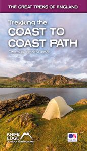
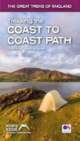
Wandelgids Trekking the Coast to Coast Path | Knife Edge Outdoor

0
The definitive two-way guide to the Coast to Coast Path: both eastbound and westbound routes are described in full. Real Maps: Full Ordnance Survey mapping inside (1:25,000). All accommodation is numbered and marked on the maps. 19 different itineraries: schedules of 11, 12, 13, 14, 15, 16, 17, 18 and 19 days for hikers and runners. Includes both ...

Webshops met dit product

Webshop
Bezorging
Prijs

Anderen bekeken ook

Wandelgids Trekking the Coast to Coast Path | Knife Edge Outdoor
The definitive two-way guide to the Coast to Coast Path: both eastbound and westbound routes are described in full. Real Maps: Full Ordnance Survey mapping inside (1:25,000). All accommodation is numbered and marked on the maps. 19 different itineraries: schedules of 11, 12, 13, 14, 15, 16, 17, 18 and 19 days for hikers and runners. Includes both eastbound and westbound itineraries. Difficult calculations of time, distance and altitude gain/loss are done for you. Also includes: - Detailed information on equipment and traveling light - Full accommodation listings: the best pubs, B&B's and hotels - Detailed section on camping, including wild camping - Everything the trekker needs to know: route, costs, difficulty, weather, travel, and more - Essential info for both self-guided and guided trekkers - Information on plants and wildlife - Numbered way points linking the Real Maps to our clear descriptions The Coast to Coast Path is the most popular and aspirational long-distance walking r…
21,95
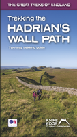
Wandelgids Trekking the Hadrian's Wall Path | Knife Edge Outdoor
Real OS maps 1:25,000   The definitive two-way guide to the Hadrian’s Wall Path: both eastbound and westbound routes are described in full.   Hadrian's Wall was one of the Romans' most ambitious structures. When completed, it ran for 73 miles between the west and east coasts of Northern England. It crossed the crags and hills of some of Britain's wildest and most beautiful terrain.   The Hadrian's Wall path is one of England's official 'National Trails'. It leads you on an unforgettable journey of discovery along the route of the Wall. Discover the incredible surviving sections of the Wall and its forts, milecastles and turrets.   This definitive two-way guide to the Hadrian's Wall Path contains real OS mapping at 1:25,000 and both eastbound and westbound routes are described in full. There are 14 different itineraries with schedules of 3, 4, 5, 6, 7, 8 and 9 days for walkers and runners and the guide includes both northbound and southbound itineraries. Difficult calculations of t…
19,50
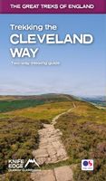
Wandelgids Trekking the Cleveland Way | Knife Edge Outdoor
The definitive two-way guide to the Cleveland Way, one of England's epic National Trails: both eastbound and westbound routes are described in full.   Real Maps: Full Ordnance Survey mapping inside (1:25,000). All accommodation is numbered and marked on the maps. 20 different itineraries: schedules of 5, 6, 7, 8, 9, 10 and 11 days for hikers and runners. Includes both eastbound and westbound itineraries. Difficult calculations of time, distance and altitude gain/loss are done for you.   Also includes: - Detailed information on equipment and travelling light - Full accommodation listings: the best pubs, B&Bs and hotels - Detailed section on camping, including wild camping - Everything the trekker needs to know: route, costs, difficulty, weather, travel, and more - Essential info for both self-guided and guided trekkers - Information on plants and wildlife - Numbered waypoints linking the Real Maps to our clear descriptions   Yorkshire's Cleveland Way is one of the most beautiful long-di…
23,95
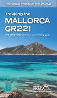
Wandelgids Trekking the Mallorca GR221 | Knife Edge Outdoor
Goede wandelgids met duidelijke routekaarten en praktische informatie.   The definitive two-way guide to the Mallorca GR221 (the Drystone Way): both northbound and southbound routes are described in full.   The GR221 is one of Europe’s most beautiful and aspirational treks in Europe. It travels the length of Mallorca’s rugged mountain range, the Serra de Tramuntana. Along the way, you find a textbook Mediterranean landscape of azure waters, sandy beaches, rocky coves, all overlooked by rugged limestone peaks. As you pass the numerous drystone structures on the trail, you will learn plenty of the island’s fascinating history and you will spend the night in some of its finest villages. This is Spain at its best and it will be an adventure that you will never forget.   Real Maps: Full mapping inside (1:25,000) by Editorial Alpina. All accommodation is numbered and marked on the maps.   12 different itineraries: schedules of 7, 8, 9, 10 and 11 days for hikers and runners. Includes both nor…
21,95
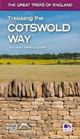
Wandelgids Trekking the Cotswold Way | Knife Edge Outdoor
The definitive two-way guide to the Cotswold Way: both southbound and northbound routes are described in full. Real Maps: Full Ordnance Survey mapping inside (1:25,000). All accommodation is numbered and marked on the maps. 18 different itineraries: schedules of 4, 5, 6, 7, 8, 9, 10, 11 and 12 days for hikers and runners. Includes both southbound and northbound itineraries. Difficult calculations of time, distance and altitude gain/loss are done for you. Also includes: - Detailed information on equipment and travelling light - Everything the trekker needs to know: route, costs, difficulty, weather, travel, and more - Full accommodation listings: the best inns, B&Bs and hotels - Detailed section on camping - What to see in the City of Bath - Essential info for both self-guided and guided trekkers - Information on history, plants and wildlife - Numbered waypoints linking the Real Maps to our clear descriptions The Cotswold Way travels 102 miles through the sublime scenery of the Cotsw…
22,50
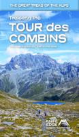
Wandelgids Trekking the Tour Des Combins | Knife Edge Outdoor
The definitive guidebook for the Tour des Combins: the new bucket list trek in the Swiss/Italian Alps. A superb alternative to the more famous Tour du Mont Blanc. Two-way guide: both clockwise and anti-clockwise routes are described in full. Real Maps: full mapping inside (1:40,000), made specifically for Knife Edge Outdoor Guidebooks. All accommodation/campsites are numbered and marked on the maps. 10 different itineraries: schedules of 6, 7, 8 and 9 days for hikers and runners. Includes both clockwise and anti-clockwise itineraries. Difficult calculations of time, distance and altitude gain/loss are done for you. Also includes: * Detailed information on equipment and travelling light * Full accommodation/campsite listings * Wild camping rules explained * Everything the trekker needs to know: route, costs, difficulty, weather and more * Travel to the trail-head * Essential info for both self-guided and guided trekkers * Information on plants and wildlife * Numbered waypo…
27,50
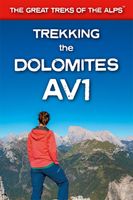
Wandelgids Trekking the Dolomites Av1 | Knife Edge Outdoor
Superhandige wandelgids voor de Alta Via 1 in de Dolomieten. Met deze gids heb je verder niks nodig: alle benodigde Tabacco wandelkaarten zitten in deze gids! The only guidebook exclusively for the AV1.Everything you need to know to plan and walk Italy's most popular long distance route.Real maps inside (Tabacco 1:25,000): the finest maps available for the Dolomites. This makes navigation easy and there is no need to carry additional maps. Also includes:* Numbered waypoints linking maps to text* Unique Itinerary Planner: plan a bespoke itinerary to match your ability and vacation schedule. All difficult calculations of time, distance and altitude gain are done for you* 7 Proposed Itineraries of between 6 and 11 days* Everything the trekker needs to know to plan the route: route descriptions, costs, budget, difficulty, weather, how to get there, and more* Full accommodation listings: spectacularly situated mountain huts* Section on Camping* Exciting variants to the main route* Informati…
19,95

Klanten-reviews van Wandelgids Trekking the Coast to Coast Path | Knife Edge Outdoor

Er zijn nog geen beoordelingen voor dit productBen jij de eerste die een review plaatst?

Meer over Wandelgids Trekking the Coast to Coast Path | Knife Edge Outdoor

Productomschrijving

The definitive two-way guide to the Coast to Coast Path: both eastbound and westbound routes are described in full. Real Maps: Full Ordnance Survey mapping inside (1:25,000). All accommodation is numbered and marked on the maps. 19 different itineraries: schedules of 11, 12, 13, 14, 15, 16, 17, 18 and 19 days for hikers and runners. Includes both eastbound and westbound itineraries. Difficult calculations of time, distance and altitude gain/loss are done for you. Also includes: - Detailed information on equipment and traveling light - Full accommodation listings: the best pubs, B&B's and hotels - Detailed section on camping, including wild camping - Everything the trekker needs to know: route, costs, difficulty, weather, travel, and more - Essential info for both self-guided and guided trekkers - Information on plants and wildlife - Numbered way points linking the Real Maps to our clear descriptions The Coast to Coast Path is the most popular and aspirational long-distance walking route in Britain. It was designed by Alfred Wainwright, the famous author of guidebooks to the Lake District. It travels across England from the Irish Sea to the North Sea. On the way, it traverses three stunning National Parks, each with its own unique scenery and character: the Lake District, the Yorkshire Dales and the North York Moors. This is England at its best and it will be an adventure that you will never forget.

Productspecificaties

Artikelnummer(s)
Brand
Knife Edge Outdoor

Verken gerelateerde categorieën

Webshop.nl maakt gebruik van cookies. Ga je verder op onze website, ga dan akkoord met het plaatsen van cookies en de verwerking van deze data door ons en vermelde partners.