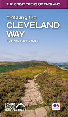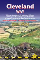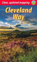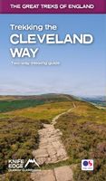
Wandelgids Trekking the Cleveland Way | Knife Edge Outdoor

0
The definitive two-way guide to the Cleveland Way, one of England's epic National Trails: both eastbound and westbound routes are described in full.   Real Maps: Full Ordnance Survey mapping inside (1:25,000). All accommodation is numbered and marked on the maps. 20 different itineraries: schedules of 5, 6, 7, 8, 9, 10 and 11 days for hikers and r...

Verkopers met dit product

Webshop
Bezorging
Prijs
DeZwerver.nl logo
DeZwerver.nl
niet bekend
23,95

Anderen bekeken ook

Nieuw
Wandelgids Trekking the Cotswold Way | Knife Edge Outdoor
The definitive two-way guide to the Cotswold Way: both southbound and northbound routes are described in full. Real Maps: Full Ordnance Survey mapping inside (1:25,000). All accommodation is numbered and marked on the maps. 18 different itineraries: schedules of 4, 5, 6, 7, 8, 9, 10, 11 and 12 days for hikers and runners. Includes both southbound and northbound itineraries. Difficult calculations of time, distance and altitude gain/loss are done for you. Also includes: - Detailed information on equipment and travelling light - Everything the trekker needs to know: route, costs, difficulty, weather, travel, and more - Full accommodation listings: the best inns, B&Bs and hotels - Detailed section on camping - What to see in the City of Bath - Essential info for both self-guided and guided trekkers - Information on history, plants and wildlife - Numbered waypoints linking the Real Maps to our clear descriptions The Cotswold Way travels 102 miles through the sublime scenery of the Cots…
22,50
Wandelgids Trekking the Tour Des Combins | Knife Edge Outdoor
The definitive guidebook for the Tour des Combins: the new bucket list trek in the Swiss/Italian Alps. A superb alternative to the more famous Tour du Mont Blanc. Two-way guide: both clockwise and anti-clockwise routes are described in full. Real Maps: full mapping inside (1:40,000), made specifically for Knife Edge Outdoor Guidebooks. All accommodation/campsites are numbered and marked on the maps. 10 different itineraries: schedules of 6, 7, 8 and 9 days for hikers and runners. Includes both clockwise and anti-clockwise itineraries. Difficult calculations of time, distance and altitude gain/loss are done for you. Also includes: * Detailed information on equipment and travelling light * Full accommodation/campsite listings * Wild camping rules explained * Everything the trekker needs to know: route, costs, difficulty, weather and more * Travel to the trail-head * Essential info for both self-guided and guided trekkers * Information on plants and wildlife * Numbered wayp…
27,50
Wandelgids Cleveland Way | Trailblazer Guides
All the information you need to enjoy your hiking adventure along the Cleveland Way in this fully revised and updated 2nd edition. In the beautiful, wild countryside of the North York Moors National Park in northern England lies this fabulous trail, the Cleveland Way. The 110-mile route runs from Helmsley near Thirsk around the western edge of the park to reach the coast at Saltburn-by-the-Sea.   It then continues along the eastern edge of the park south down the coast through Whitby, Robin Hood's Bay and Scarborough to finish in Filey. Combining moorland and coast there's wonderful scenic variety to this walk, with crumbling castles and idyllic fishing villages to explore. The guide includes:48 large-scale walking maps - at just under 1:20,000 - showing route times, places to stay, places to eat, points of interest, and 8 town plans10 colour stage maps to help plan your walk, including hills and descents, and two colour overview mapsPlaces to stay with reviews - campsites, bunkhouses…
21,95
Wandelgids Cleveland Way | Aurum Press
Uitstekend routeboek met goede kaarten van Ordnance Survey. Praktische info voor overnachten enigzins beperkt achterin. The beautifully varied Cleveland Way winds for over a hundred miles around the North York Moors National Park, from the ancient moorland town of Helmsley to the seafront at Filey, passing stunning historic sites like Helmsley Castle and Rievaulx Abbey along the way.  Attractive farmland, woods and heather moorland, a blaze of purple in late-summer, dominate the first half of the walk, later replaced by dramatic cliffs, secluded coves and sandy beaches.   This comprehensive, fully updated official guide is the only companion you need – whether you’re interested in the industrial history of ironstone mining, or a weekend stroller seeking a coastal walk out of the seaside resort of Scarborough.   Ordnance Survey maps for the whole route Background information on everything from archaeology to wildlife Comprehensive information on places of interest, public transport …
20,95
Wandelkaart Cleveland Way | Harvey Maps
Mooie, duidelijke kaart van de Cleveland Way in Noord-Engeland. Geplastificeerd met veel extra informatie en uitsnedes van de route.    Leap forward in technical excellence. Tough, light and 100% waterproof Compact and light - the map itself weighs just 60gms - a third of the weight of a laminated map, and much less bulky. And you can fold or refold it time and again, or stuff it in your back pocket and it won't fall to pieces. Shows the entire route on one sheet.   174km (109 miles) from Helmsley across the North York Moors National Park to Saltburn and along the coast via Scarborough ending at Filey.   Information on finding accommodation, camping, food. Directions to the start. Also Ranger Service contact numbers and enlargements of towns/villages showing facilities available and tips on weather and clothing.   Detailed mapping, full legend. National Grid - can be used with GPS. 1:40,000 scale. Waterproof. Supplied in clear plastic pocket
25,95
Reisgids - Wandelgids Glacier National Park | Moon Travel Guides
Through lush green parkland and up to the top of jagged summits, forge your own path with Moon Glacier National Park. Flexible Itineraries: Unique and adventure-packed ideas for day trips, a week on the road, families with kids, wildlife enthusiasts, and more The Best Hikes in Glacier: Individual trail maps, mileage and elevation gains, and backpacking options Experience the Outdoors: Trek through fields of alpine wildflowers and walk beneath waterfalls. Go whitewater rafting, cast a line into the Flathead River for wild trout, or hop on a guided horseback ride. Drive or bike the Going-to-Sun Road, take in views of snowy peaks and glaciers, and spot wild moose or grizzlies roaming the mountainside How to Get There: Up-to-date information on gateway towns, park entrances, park fees, and tours Where to Stay: Spend a night in a historic lakeside lodge, or sleep under the stars with campgrounds, resorts, and more both inside and outside the park Planning Tips: When to go, what to pa…
23,95
Wandelgids Tour of the Ecrins National Park GR54 | Knife Edge Outdoor
Overzichtelijke routegids van deze prachtige wandelroute. Per etappe vind je een hoogteprofiel, goede beschrijvingen van de wandelroute, een topografische kaart op gedetailleerde schaal. Voor en achterin de gids staat aanvullende praktische informatie zoals adressen van campings, andere accommodaties en bijvoorbeeld een paar pagina's over de flora en fauna.  The Tour of the Ecrins National Park is also known as the GR54. It is arguably the best trek in the Alps. It is an incredible walk of 193km (120 miles) around the incomparable Ecrins National Park in the Southern French Alps. It takes  9-12 days. On the way, 14 magnificent mountain passes are crossed. It is almost certainly the finest trek that you have never heard of! The Ecrins Massif is the second highest range of mountains in the French Alps: the Mont Blanc Massif is of course the highest.   Unspoilt and remote high mountain terrain: snow frosted summits, beautiful valleys and pastures, sparkling azure lakes, carpets of wil…
26,95
Wandelgids Cotswold Way | Trailblazer Guides
Goede wandelgids van de hele route van Chipping Campden naar Bath. Met veel details zijn alle etappes beschreven. Tevens informatie over overnachtingen en openbaar vervoer. All-in-one hiking route guide and maps for the Cotswold Way, a 102-mile National Trail that runs from Chipping Campden to Bath, following the beautiful Cotswold escarpment, this is the fully revised and updated 4th edition. The trail leads through quintessentially English countryside with little villages of honey-coloured stone to the well-known town of Bath. Includes:   * 44 large-scale maps at just under 1:20,000 (3 1/8 inches to 1 mile) - showing route times, places to stay, points of interest and much more and trail profiles;   * 8 town plans - Chipping Campden, Broadway, Winchcombe, Cheltenham, Painswick, Dursley, Wotton-under-Edge, and the city of Bath and 8 overview maps.   * Full details of all accommodations and campsites, teashops, restaurants and pubs with reviews.   * Itineraries for all walkers - wheth…
21,95
Nieuw
Wandelgids Walking Brittany - Bretagne | Knife Edge Outdoor
Wild coastline: endless towering cliffs, remote rocky headlands, almost forgotten islands and stunning beaches which would not be out of place on a Caribbean island.   Explore a region packed with beauty and historical interest: megalithic sites, World War 2 fortifications, ancient villages and much more. Real IGN Maps inside: 1:25,000.   Also includes:   ▶ Numbered waypoints linking the Real Maps to our clear descriptions ▶ Graded routes to suit all abilities ▶ Everything the hiker needs to know: route descriptions,  difficulty, weather, how to get there, and more ▶ Information on Wildlife and Plants ▶ Carnac and other Megalithic sites  ▶ Section on World War 2 and the 'Atlantic Wall'   France is a large country with a huge and varied coastline. This coastline is very wild and very beautiful but rarely is it both wilder and more beautiful than in Brittany. This stunning part of the world's most visited country has around 3,000 km of sea frontage so you could spend a lifetime here wa…
19,50
Fietskaart 10 Cycling guides North York Moors | Goldeneye
Scheur- en watervast foetskaart van de North York Moors  met ingetekende fietsroutes.   Our maps are double-sided, printed on an A2 sheet with a concertina fold. This allows for easy folding and folding, and an ease of access to the mapping. The material is rain and tear-resistant. Our early maps were designed at the scale of 2 miles to 1 inch/1:126,720. The later designs along with digitalisation are 1: 100,000. We were encouraged by the Cycle Touring Club to convert our cartography toward the cycle market (to replace the out-of-print Bartholomew series). As time and the series progressed we have added more data: The National Cycle Network routes, Regional Routes, and Traffic-Free Family Routes, as and when they are developed. These routes are in addition to the Circular Routes Goldeneye Commissioned at the outset of our publishing schedule. We are also adding to new editions; bike shops, cycle hire, and tea rooms, along with the tourist attractions already featured. Our plan is to m…
14,95

Klanten-reviews van Wandelgids Trekking the Cleveland Way | Knife Edge Outdoor

Er zijn nog geen beoordelingen voor dit productBen jij de eerste die een review plaatst?

Meer over Wandelgids Trekking the Cleveland Way | Knife Edge Outdoor

Productomschrijving

The definitive two-way guide to the Cleveland Way, one of England's epic National Trails: both eastbound and westbound routes are described in full.   Real Maps: Full Ordnance Survey mapping inside (1:25,000). All accommodation is numbered and marked on the maps. 20 different itineraries: schedules of 5, 6, 7, 8, 9, 10 and 11 days for hikers and runners. Includes both eastbound and westbound itineraries. Difficult calculations of time, distance and altitude gain/loss are done for you.   Also includes: - Detailed information on equipment and travelling light - Full accommodation listings: the best pubs, B&Bs and hotels - Detailed section on camping, including wild camping - Everything the trekker needs to know: route, costs, difficulty, weather, travel, and more - Essential info for both self-guided and guided trekkers - Information on plants and wildlife - Numbered waypoints linking the Real Maps to our clear descriptions   Yorkshire's Cleveland Way is one of the most beautiful long-distance walking routes in Britain. It is one of England's official 'National Trails'.   The route circumnavigates the spectacular North York Moors National Park. It explores both the evocative expanses of Yorkshire's famous heather moorland and the never-ending cliffs of its coastline. This is England at its best and it will be an adventure that you will never forget.

Verken gerelateerde categorieën

Webshop.nl maakt gebruik van cookies. Ga je verder op onze website, ga dan akkoord met het plaatsen van cookies en de verwerking van deze data door ons en vermelde partners.