Wandelgids Trekking Slovenia's Juliana Trail | Cicerone

0
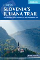
The Juliana Trail is a 330-km-long circular long-distance hiking trail through the Julian Alps in Triglav National Park, Slovenia. The trek takes in some less familiar valleys along with well-known spots such as Lake Bohinj and Bled, swings briefly through the corner of Italy, and into the Brda wine region. Accessible by public transport, the trek...

Verkopers met dit product

Verkoper
Bezorging
Prijs
DeZwerver.nl logo
DeZwerver.nl
2,95
26,50

Anderen bekeken ook

Wandelgids Trekking Slovenia's Juliana Trail | Cicerone
The Juliana Trail is a 330-km-long circular long-distance hiking trail through the Julian Alps in Triglav National Park, Slovenia. The trek takes in some less familiar valleys along with well-known spots such as Lake Bohinj and Bled, swings briefly through the corner of Italy, and into the Brda wine region. Accessible by public transport, the trek is straightforward and relatively easy, perfect for hikers of various skill levels.   The guidebook offers route description for every stage of this 20-day trekking route, along with providing background information on local history, geology, and wildlife, as well as planning details on when to go, where to stay, and what facilities are available along the trail. 1:50,000 mapping is provided for each stage. Designed to promote sustainable tourism this trail is a true gem of Slovenia's Julian Alps.
26,50
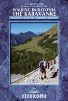
Wandelgids Karawanken - Slovenie - Walking in the Karavanke | Cicerone
Goede wandelgids met veel dagtochten; redelijk kaartmateriaal en goede praktische informatie. This guidebook offers 23 walking routes set across the magnificent 120km-long Karavanke mountain range, which forms a natural border between Austria and Slovenia. Commonly known as 'the way the Alps used to be', as it is yet to experience the extent of commercial development known by the Western Alps, it is one of the longest ranges in Western Europe but it remains genuinely unspoilt and relatively unvisited by English-speaking hillwalkers. The guide's walks begin in pretty towns and villages, and most of them access the peaks from the relatively more gentle Slovenian side of the range, where forest-clad slopes lead to grassy summits where spectacular views can be enjoyed. Arranged by peak from west to east along the range, most of the summits can be reached by waymarked paths and trails. The guide gives all the practical details you need on transport, accessing the routes, accommodation and …
20,95
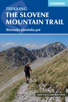
Wandelgids The Slovene Mountain Trail | Cicerone
Uitstekende wandelgids van de Slovenska Planinska Pot. Goed beschreven met veel praktische informatie om de route te kunnen lopen, inclusief redelijke kaarten. A guidebook to trekking the Slovene Mountain Trail, crossing Slovenia from Austria to the Adriatic. The 550km route is presented in a series of 12 3 to 6-day treks of all levels of difficulty, all featuring start and finish points that can be accessed by public transport. They can be completed as single sections or linked to create a longer trip. Each day is graded: low-grade walking is mostly on tracks or lanes with no steep ascents, whereas the most difficult stages may involve steep and technical terrain including fixed protection or sections of via ferrata, for which a helmet, self-belaying equipment and the appropriate experience are required.   In addition to clear route description and mapping, the guide provides all the practical information you will need to plan your trip, covering transport, accommodation and safet…
23,95
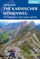
Wandelgids Trekking the Karnischer Höhenweg | Cicerone
Uitstekende wandelgids van deze mooie route. goed beschreven met veel praktische informatie om de route te kunnen lopen, inclusief redelijke kaarten This guidebook describes the Karnischer Höhenweg, a 169km long-distance walk through the beautiful Carnic Alps which straddle the border between Austria and Italy. Following a high Alpine trail along the main ridge, the route is clearly waymarked and requires a reasonable level of fitness, a sense of adventure and a head for heights, but no special equipment or technical expertise. It can be walked between mid-July and the end of September and takes up to a fortnight, though it is possible to devise shorter itineraries taking in the highlights. The guide describes the full route of the Karnischer Höhenweg from Arnbach, near Sillian, to Arnoldstein, near Villach, and includes plenty of practical information to help you prepare for the walk. Each stage features comprehensive route description, clear mapping and fascinating insights into th…
22,50
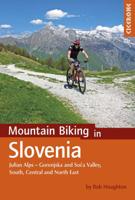
Fietsgids - Mountainbikegids Mountain biking in Slovenia - Slovenië | Cicerone
Degelijke fietsgids met 35 mountainbike routes in Slovenië. Goede beschrijvingen en duidelijke kaarten. Guidebook to 35 full and half day mountain biking routes in Slovenia. The graded routes, which range from technically not difficult but requiring a reasonable level of fitness to highly technical, requiring a high level of fitness and confident bike handling skills, vary in length from 12km to 59km. Routes are located in Gorenjska, Soca Valley, the South, as well as Central and North Eastern Slovenia.   Full route descriptions are accompanied by gradient profiles and 1:75,000 mapping, together with practical information such as getting to and around Slovenia, travelling with the bike, arranging accommodation and dealing with emergency situations. A handy Slovenian language glossary is also included.   Showcasing a remarkably diverse landscape, Slovenia is an idyllic (and incredibly, little known) mountain biking destination. From the towering peaks of Gorenjska and the stunning rive…
23,95
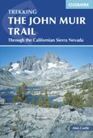
Wandelgids The John Muir Trail | Cicerone
Een uitstekende beschrijving van het beroemde lange afstandspad in Californie. Guidebook to walking the John Muir Trail through California's High Sierra from Yosemite (El Capitan and Half Dome) to the summit of Mount Witney. The 216 mile hike is split into 21 daily stages, with full information on preparation, permits, wilderness, bears, water and trekking skills. Part of the Pacific Crest Trail. The John Muir Trail (JMT) is one of the world’s most spectacular treks and is North America’s best known mid-distance walking trail. It runs for 216 miles through the high Sierra Nevada mountains of California, from Yosemite Valley to the summit of Mount Whitney (14, 496ft), the highest peak in the USA outside Alaska. The walking trail, which is named after the great 19th-century Scottish naturalist, conservationist and writer John Muir, is entirely through the unspoilt wilderness of the American West and passes through three national parks: Yosemite, Kings Canyon and Sequoia National Parks. …
25,95
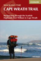
Wandelgids The Cape Wrath Trail | Cicerone
Uitstekende wandelgids die in etappes de route nauwkeurig beschijft.  A guidebook to the Cape Wrath Trail, a long-distance trek through the Scottish Highlands from Fort William to Cape Wrath. The Cape Wrath Trail is a 230-mile, three-week challenge through wild and magnificent landscapes, such as Morar, Knoydart, Torridon and Assynt. Crossing such empty country, it is for the experienced backpacker only. Activities Long-distance walking and backpacking   Seasons April, May and June are ideal months to walk the trail. September and October are also good, but there may be diversions due to deer stalking and military operations at the cape. In July and August the days are superbly long and the weather can be fine, but midges will be in full flight. The limited accommodation along the trail may also be booked up at this time of year   Centres Fort William, Glenfinnan, Barisdale, Kinloch Hourn, Shiel Bridge, Strathcarron, Kinlochewe, Dundonnell, Ullapool, Bridge of Orchy, Inchnadamph, Kyle…
25,95
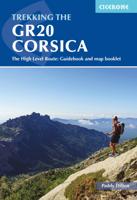
Wandelgids Trekking the GR20 Corsica | Cicerone
Engelstalige beschrijving van de mooiste wandeltocht op Corsica. De gids voldoet aan alle verwachtingen die je kunt hebben. Wel heb je voor de zwaardere gedeelte voor de zekerheid goede kaarten nodig ...... The GR20, on the mountainous Mediterranean island of Corsica, is reputated to be the toughest waymarked trail in Europe. This ambitious route for fit and agile walker covers 190km as it makes a complete traverse through the island's high mountains. It can be completed in about two weeks, and calls for backpacking the whole way, sometimes with hands-on scrambling along the way. Facilities are limited to a dozen mountain refuges and a mere handful of hotels or gîtes. The ‘classic’ route is described in the guide, along with high and low-level alternatives, plus extra mountain climbs. This guide explains exactly what is involved in following the GR20, including what walkers need to carry. In the past, many have carried too much, or carried the wrong things, or simply had no idea how d…
24,95
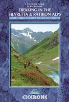
Wandelgids Trekking in the Silvretta and Ratikon Alps | Cicerone
Aanbevolen wandelkaarten bij deze gids: Schaal 1:60.000 Wandelkaart 14 Unterengadin | Kümmerly & Frey Wandelkaart 13 Davos - Arosa | Kümmerly & Frey Of schaal 1:25.000 Wandelkaart 26 Alpenvereinskarte Silvrettagruppe This guide describes three treks, between 5 and 8 days, in the Silvretta and Rätikon Alps starting near Klosters, and 12 half-day hut-to-hut routes. These contrasting ranges form a line on the borders of Switzerland, Austria and Liechtenstein. The Tour of the Silvretta, the Prättigauer Höhenweg and the Rätikon Höhenweg. Straddling the borders of Austria, Switzerland and Liechtenstein, the limestone Rätikon Alps reach into the snow-bound and glacier-hung Silvretta Alps to provide a richly diverse series of landscapes. The Tour of the Silvretta, the Prättigauer Höhenweg and the Rätikon Höhenweg, all within easy reach of Klosters, have been devised to help trekkers explore the best of the region. Given sifficient time they can also be combined to create a continuous 2-week t…
25,95
Wandelgids Trekking in the Alps | Cicerone
All the rich scenic diversity for which the Alps are renowned is celebrated here, while the 20 treks described include well-known classics as well as newly-created multi-day routes. The eight talented writers and photographers brought together to produce this book are among the most experienced of Alpine trekkers. Between them they have explored every corner of Europe’s premier mountain range, written dozens of guides and, in some cases, led trekking holidays there in order to share their enthusiasm for the Alps with other walkers. And that is the prime motivation for Trekking in the Alps – an inspiration and a celebration of the very best of these mountains. Best-known treks Tour of Mont Blanc; Tour of the Matterhorn; Tour of Monte Rosa; Walker’s Haute Route; Tour of the Jungfrau Region; Tour of the Vanoise; Dolomites AV 1 & 2 Longer trans-Alpine treks GR5 (Lake Geneva to Nice); Eastern Alps E5; Italian Alps GTA; Traverse of the Slovenian Alps For the Alpine adventurer Alpine Pass Ro…
28,95

Klanten-reviews van Wandelgids Trekking Slovenia's Juliana Trail | Cicerone

Er zijn nog geen beoordelingen voor dit productBen jij de eerste die een review plaatst?

Meer over Wandelgids Trekking Slovenia's Juliana Trail | Cicerone

Productomschrijving

The Juliana Trail is a 330-km-long circular long-distance hiking trail through the Julian Alps in Triglav National Park, Slovenia. The trek takes in some less familiar valleys along with well-known spots such as Lake Bohinj and Bled, swings briefly through the corner of Italy, and into the Brda wine region. Accessible by public transport, the trek is straightforward and relatively easy, perfect for hikers of various skill levels.   The guidebook offers route description for every stage of this 20-day trekking route, along with providing background information on local history, geology, and wildlife, as well as planning details on when to go, where to stay, and what facilities are available along the trail. 1:50,000 mapping is provided for each stage. Designed to promote sustainable tourism this trail is a true gem of Slovenia's Julian Alps.

Productinformatie

    Verken gerelateerde categorieën

    Webshop.nl maakt gebruik van cookies. Ga je verder op onze website, ga dan akkoord met het plaatsen van cookies en de verwerking van deze data door ons en vermelde partners.