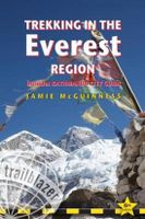
Wandelgids Trekking in the Everest Region | Trailblazer Guides

0
Een groot aantal trekkings worden per etappe beschreven. Veel praktische informatie. Een uitstekende reisgids, kaarten zijn soms wat beperkt. Fully revised six edition of this practical guide with 60 detailed route maps covering not only the classic treks but also the wild routes: Everest expedition route Rolwaling Trekking from Lukla Salpa-Arun T...

Verkopers met dit product

Verkoper
Bezorging
Prijs
DeZwerver.nl logo
DeZwerver.nl
2,95
23,50

Anderen bekeken ook

Wandelgids Trekking in the Everest Region | Trailblazer Guides
Een groot aantal trekkings worden per etappe beschreven. Veel praktische informatie. Een uitstekende reisgids, kaarten zijn soms wat beperkt. Fully revised six edition of this practical guide with 60 detailed route maps covering not only the classic treks but also the wild routes: Everest expedition route Rolwaling Trekking from Lukla Salpa-Arun The Gokyo trek High passes Trekking peaks - including Mera and Island Peak Information for all budgets and trekking styles Ranging from lush terraced fields to the highest mountain on earth, the scenery is breath-taking. There are trekking possibilities to suit all budgets - from independent trekkers on a shoestring staying in simple lodges with Sherpa families to travelers on all-inclusive guided treks with every luxury provided. Getting to Nepal from Europe, North America and Australasia Kathmandu -- trekking preparations and what to see Where to stay and eat -- Kathmandu and along the trails Employing a guide or porter in Nepal The environm…
23,50
Wandelgids Sinai Trekking Guide | Trailblazer Guides
Bijzondere gids over fantastische tochten in de Sinai: wandelgids met goede schetskaarten, veel praktische informatie. Onmisbaar voor zo'n tocht! Trek with the Bedouin and their camels and discover one of the most exciting new trekking destinations in the world. Egypt's Sinai peninsula is the small tooth of land between Africa and Asia, and the fabled Biblical setting of The Exodus. It's a region of high mountains and sweeping deserts, home to crumbling Egyptian temples, Byzantine monasteries and more. The millions that visit Sinai each year come mostly for its beaches and reefs but for a true adventure, the best way to see Sinai is to trek with the Bedouin. Walking with their camels gives access to the most remote and waterless parts of the peninsula and no other mode of travel immerses you so fully in your surroundings nor gives such a close feel for the desert - its freedoms and hardships. Trekking is becoming ever-better established and it's perfectly possible to arrive and organi…
21,95
Wandelgids Peru's Cordilleras Blanca & Huayhuash | Trailblazer Guides
The Cordilleras Blanca and Huayhuash boast some of the most spectacular scenery in the Andes, and some of the most accessible high altitude trekking and cycling in the world. Perfect pyramidal peaks, gargantuan ice falls and turquoise alpine lakes are all easily reached from Huaraz, the region's capital and centre of tourist comforts.   This practical guide contains 50 detailed route maps and descriptions covering 20 hiking trails and 30 days of paved and dirt road cycle touring. Trekking – the classic treks: Huayhuash Circuit, Santa Cruz and Alpamayo Basecamp, as well as lesser known, wild walks in valleys which see few visitors. Ranging from easy day hikes to challenging routes of 10 days or more, all can be trekked independently or in guided groups. Cycling – includes the Huascarán Circuit, a loop of Peru's highest mountain, as well as four other multi-day rides and five day-cycles from Huaraz. Covers all the information cyclists need to pedal past glaciers on 6000m peaks or fly do…
25,50
Wandelgids Nepal Trekking and the Great Himalaya Trail: A Route and Planning Guide | Trailblazer Guides
With extensive sections to help you choose your trekking region, this is a route and planning guide for anyone organising a trekking holiday in Nepal. It includes the most popular routes as well as the newest trekking areas plus the most extreme route of all, the Great Himalaya Trail. There are route guides to the following regions: Kanchenjunga, Makalu, Rolwaling, Solu-Khumbu (Everest Region), Helambu & Langtang, Ganesh & Manaslu Annapurna, Naar & Phu, Mustang Dolpo, The Far West The guide covers: Visas, permits, fees and equipment Choosing a trek – independent tea-house trekking or guided treks arranged through trekking agencies; choosing a guide and crew; when to go; trekking grades and duration Kathmandu & Pokhara city guides – hotels, restaurants, what to see Nepal background – people, religions, festivals and etiquette Health, safety and responsible tourism Colour mapping – showing the main trekking routes in Nepal The Great Himalaya Trail Running the entire 4500 km length of th…
23,50
Wandelgids Kilimanjaro - A Trekking Guide to Africa's Highest Mountain | Trailblazer Guides
Dat dit boek je met de planning helpt is geen loze kreet. Werkelijk alle facetten van de berg en zijn omgeving komen aan bod. De auteur geeft informatie over hoe je een reis naar de Kili kunt boeken, hoe je er komt, wat je er kunt verwachten en hoe je vervolgens de top kunt bereiken. Maar hij is ook erg duidelijk voor wat betreft het bereiken van die top: doe dat alleen onder begeleiding van een erkende gids en doe het op je gemak. Kilimanjaro is immers niet voor niets de hoogste berg van Afrika en daarmee één van de beruchte 'seven summits'. Practical, best-selling guide to climbing Mount Kilimanjaro, Africa's highest mountain and most popular trek.   Fully updated 6th edition with amendments in 2024.   At 5895m (19,341ft) Kilimanjaro is Africa's highest mountain. Yet with no mountaineering skills necessary to reach the summit, even non-climbers can experience the thrill of climbing one of the world's greatest peaks. Taking you from the dusty plains of East Africa through jungle…
25,95
Wandelgids Tour Du Mont Blanc | Trailblazer Guides
Goede wandelgids van deze beroemde route. Veel informatie vooraf en een zeer gedegen duidelijke beschrijving van de te volgen route. Opvallend blijft dat deze uitgever geen gebruik van gewone detailkaarten, maar van getekende schetskaarten waarbij ze de nadruk kunnen leggen op opvallende details langs de route als een markant punt van een boom of rots. At 4810m (15,781ft), Mont Blanc is the highest mountain in western Europe, and one of the most famous mountains in the world. The trail (105 miles, 168km) that circumnavigates the massif, passing through France, Italy and Switzerland, is the most popular long distance walk in Europe.   62 maps – 12 town and village plans and 50 large-scale walking maps – at 1:20,000 – showing route times, gradients, where to stay, interesting features   Itineraries for all walkers – whether walking the 105 mile (168km) route in its entirety, or sampling the highlights on day walks and short breaks   Practical information for all budgets – where to stay …
23,95
Wandelgids Cotswold Way | Trailblazer Guides
Goede wandelgids van de hele route van Chipping Campden naar Bath. Met veel details zijn alle etappes beschreven. Tevens informatie over overnachtingen en openbaar vervoer. All-in-one hiking route guide and maps for the Cotswold Way, a 102-mile National Trail that runs from Chipping Campden to Bath, following the beautiful Cotswold escarpment, this is the fully revised and updated 4th edition. The trail leads through quintessentially English countryside with little villages of honey-coloured stone to the well-known town of Bath. Includes:   * 44 large-scale maps at just under 1:20,000 (3 1/8 inches to 1 mile) - showing route times, places to stay, points of interest and much more and trail profiles;   * 8 town plans - Chipping Campden, Broadway, Winchcombe, Cheltenham, Painswick, Dursley, Wotton-under-Edge, and the city of Bath and 8 overview maps.   * Full details of all accommodations and campsites, teashops, restaurants and pubs with reviews.   * Itineraries for all walkers - wheth…
21,95
Wandelgids Thames Path | Trailblazer Guides
This book follows the Thames Path National Trail from the river's source in Gloucestershire to the Thames Barrier in London. Officially 184 miles (294km) in length (although the actual distance you walk will depend on a number of decisions you make en route), the path meanders, accompanied by its watery muse, through pristine and tranquil countryside, past historic sites and buildings, via pub, lock, weir, and the occasional scattering of waterfowl, to a city, once the fulcrum of an empire, and now the heart of modern day England. The river, responsible for the metropolis' very being, tells tales, inspires artists, accommodates swans, geese, and water voles, reflects the silhouettes of red kites and kingfishers, provides employment, entices adventure, and allows time for carefree pilgrims to procrastinate and think. Following its banks is a grand way to go for a ramble. The path begins, as the river does, in a meadow in the Cotswolds; its upper reaches lonely and wild, the meadows and…
19,95
Wandelgids The Ridgeway | Trailblazer Guides
Goede wandelgids waarin met veel details alle etappes zijn beschreven. Tevens informatie over overnachtingen en openbaar vervoer. The go-to, all-in-one guide to walking The Ridgeway path. Running from Wiltshire to Buckinghamshire, in southern England, this ancient trackway is Britain's oldest road. In this fully revised and updated, two-way edition all routes have been completely rewalked in both directions from Avebury to Ivinghoe Beacon near Aylesbury and Ivinghoe Beacon to Avebury.   Coverage includes: Marlborough, Avebury, West Overton, Avebury Stone Circle, Kennett and East Kennett, Foxhill, Liddington, Wantage, Bishopstone, Ashbury, Woolstone, Uffington, Goring, Streatley, Wallingford, Crowmarsh Gifford, Watlington, Princes Risborough, Tring, Ivinghoe Beacon   In this guide you will find: - 53 detailed walking maps - the largest scale maps available - at just under 1:20,000 (8cm or 31/8 inches to one mile) these are bigger than even the most detailed walking maps currently avail…
21,95
Wandelgids Cornwall Coast Path | Trailblazer Guides
Wandelgids met uitgebreide beschrijvingen wandelingen en praktische informatie met eenvoudige kaarten van de wandelroutes. Practical, complete hiking route guide, with maps and accommodation for the 288-mile footpath that runs around the entire coastline of Cornwall, from Bude to Plymouth; Part 2 of the South-West-Coast Path, a 630-mile National Trail from Minehead to Poole. Includes * 142 large-scale walking maps in TWO-COLOUR style (3 1/8inches to 1 mile), 15 town plans, guides to 81 towns and villages, 24 stage maps and overview map. * Itineraries for all walkers - whether walking the route in its entirety over a week to 10 days or sampling the highlights on day walks and short breaks * GPS waypoints * Practical information for all budgets - camping, bunkhouses, hostels, B&Bs, pubs and hotels; where to stay, where to eat, what to see.   * Comprehensive public transport information - for all access points on the coast path * Flora and fauna - 6 page full colour, flower, butterfly, b…
20,95

Klanten-reviews van Wandelgids Trekking in the Everest Region | Trailblazer Guides

Er zijn nog geen beoordelingen voor dit productBen jij de eerste die een review plaatst?

Meer over Wandelgids Trekking in the Everest Region | Trailblazer Guides

Productomschrijving

Een groot aantal trekkings worden per etappe beschreven. Veel praktische informatie. Een uitstekende reisgids, kaarten zijn soms wat beperkt.

Fully revised six edition of this practical guide with 60 detailed route maps covering not only the classic treks but also the wild routes: Everest expedition route Rolwaling Trekking from Lukla Salpa-Arun The Gokyo trek High passes Trekking peaks - including Mera and Island Peak Information for all budgets and trekking styles Ranging from lush terraced fields to the highest mountain on earth, the scenery is breath-taking. There are trekking possibilities to suit all budgets - from independent trekkers on a shoestring staying in simple lodges with Sherpa families to travelers on all-inclusive guided treks with every luxury provided. Getting to Nepal from Europe, North America and Australasia Kathmandu -- trekking preparations and what to see Where to stay and eat -- Kathmandu and along the trails Employing a guide or porter in Nepal The environment -- how to minimize your impact on a fragile region and still take hot 'green' showers Health and safety 60 route maps and village plans Plus - 30 color photos


Productinformatie

    Verken gerelateerde categorieën

    Webshop.nl maakt gebruik van cookies. Ga je verder op onze website, ga dan akkoord met het plaatsen van cookies en de verwerking van deze data door ons en vermelde partners.