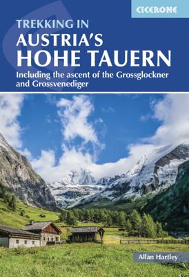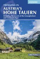
Wandelgids Trekking in Austria's Hohe Tauern. | Cicerone

0
Trekking-gids voor de Hohe Tauern in de Oostenrijkse oostelijke Alpen. Een vijftal tochten worden beschreven, vier tochten door de Glockner-, Venediger- en Reichengroepen. Eén tocht het het gehele Nationalpark Hohe Tauern. Although less well know than some other Alpine regions, Austria's Hohe Tauern National Park boasts spectacular mountain scener...

Verkopers met dit product

Verkoper
Bezorging
Prijs
DeZwerver.nl logo
DeZwerver.nl
2,95
26,50

Anderen bekeken ook

Nieuw
Wandelgids Trekking in the Stubaier Alps | Cicerone
Uitstekende wandelgids van Cicerone over de Stubaier Alpen, waarbij de nadruk ligt op een tweetal meerdaagse routes: Huttentochten voor een gemiddelde en wat meer gevorderde wandelaar. Goede praktische informatie, kaartmateriaal beperkt. Aanbevolen wandelkaarten bij deze gids Schaal 1:25.000 Wandelkaart 31/1 Alpenvereinskarte Stubaier Alpen - Hochstubai Wandelkaart 31/2 Alpenvereinskarte Stubaier Alpen - Sellrain Of schaal 1:50.000 Wandelkaart 83 Stubaier Alpen Kompass A guidebook to three hut-to-hut treks in Austria’s Stubai Alps: the 79km Stubai Rucksack Route, the 60km Stubai Glacier Tour – plus a South Tirol extension, and the 67km Gschnitztal Runde Tour. Whereas the rucksack route requires only good fitness and mountain walking experience, the glacier tour involves glacier crossings. The Stubai Rucksack Route is presented in 9 stages, the Stubai Glacier Tour in 7 (with the extension bringing it to 11) and the Gschnitzal Runde Tour in 7.   Also included are optional ascents of nei…
24,95
Nieuw
Wandelgids Trekking in Austria's Zillertal Alps | Cicerone
Guide detailing four short Alpine hut-to-hut treks in the stunning Zillertal region of the Austrian Tirol. Included are the 9-day Zillertal Rucksack Route (also known as the Berliner Hohenweg), the 7-day Zillertal South Tirol Tour, the 7-day Peter Habeler Tour and the 6-day Olperer Runde Tour, as well as optional ascents of neighbouring peaks, including the region's highest, the 3510m Hochfeiler. Good fitness and experience of mountain walking is necessary, and some of the treks include long days, steep and uneven terrain and aided sections.   The optional excursions may call for specialist equipment, mountaineering skills and experience of glacier crossing. The routes are presented in day stages, each with notes on the particular highlights and challenges/hazards of the day's route. In addition to clear route description illustrated with 1:50,000 mapping and elevation profiles, the guide also includes a wealth of practical information on transport, mountain huts, recommended kit and …
26,50
Nieuw
Wandelgids Trekking in the Silvretta and Ratikon Alps | Cicerone
Aanbevolen wandelkaarten bij deze gids: Schaal 1:60.000 Wandelkaart 14 Unterengadin | Kümmerly & Frey Wandelkaart 13 Davos - Arosa | Kümmerly & Frey Of schaal 1:25.000 Wandelkaart 26 Alpenvereinskarte Silvrettagruppe This guide describes three treks, between 5 and 8 days, in the Silvretta and Rätikon Alps starting near Klosters, and 12 half-day hut-to-hut routes. These contrasting ranges form a line on the borders of Switzerland, Austria and Liechtenstein. The Tour of the Silvretta, the Prättigauer Höhenweg and the Rätikon Höhenweg. Straddling the borders of Austria, Switzerland and Liechtenstein, the limestone Rätikon Alps reach into the snow-bound and glacier-hung Silvretta Alps to provide a richly diverse series of landscapes. The Tour of the Silvretta, the Prättigauer Höhenweg and the Rätikon Höhenweg, all within easy reach of Klosters, have been devised to help trekkers explore the best of the region. Given sifficient time they can also be combined to create a continuous 2-week t…
25,95
Nieuw
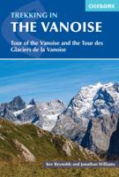
Wandelgids Trekking in the Vanoise | Cicerone
Uitstekende wandelgids van dit geweldige gebied. goed beschreven met veel praktische informatie om de route te kunnen lopen, inclusief redelijke kaarten. This guide describes the eleven-day 163km Tour of the Vanoise and the five-day 72km Tour des Glaciers de la Vanoise, two fantastic hut-to-hut treks through the pristine Alpine landscapes of France's Vanoise National Park. Three other short treks - the Tour of the Eastern Vanoise, the Tour of the Western Vanoise and a Traverse of the Vanoise via the GR5 and GR55 - are also summarised. The routes tackle several passes in excess of 2500m but there are no glacier crossings, no significant scrambling and no lengthy paths exposed to either stonefall or vertigo-inspiring exposure (though optional variants may involve some slightly more challenging sections), and waymarking is usually clear - making this an ideal route for those new to Alpine trekking.   The guide contains everything you need to plan and walk the routes, with advice on trave…
23,95
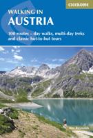
Wandelgids Oostenrijk - Walking in Austria | Cicerone
Uitstekende wandelgids van dit geweldige gebied. goed beschreven met veel praktische informatie om de route te kunnen lopen, inclusief redelijke kaarten. Bedenk wel - zie het overzicht- dat het voornamelijk routes zijn in het westen en zuiden van Oostenrijk. A comprehensive guidebook detailing walking routes in Austria. The 101 walks reflect the diversity of this popular region and cover Austria's magnificent Alps - including the Rätikon, Silvretta, Stubai and Zillertal - as well as the Dachsteingebirge, Hohe Tauern and the Karawanken. Graded according to difficulty and ranging from short walks of a few kilometres to day hikes and multi-day hut-to-hut tours, from the classic to the lesser-known, there is something to suit every level of ability and ambition.    A full description of each route is accompanied by clear sketch maps. This book has all the information you need to make the most of an active walking holiday in Austria, including information on public transport, accommodation…
24,95
Nieuw
Wandelgids 100 Hut Walks In The Alps | Cicerone
This guidebook has route descriptions for 100 day walks to suit alpine walkers of all abilities, with suggestions for some hut-to-hut tours. These routes take you through breathtaking scenery in the Maritime Alps, Julian Alps, Gran Paradiso, the Turnitzer Alps, Bernese Oberland, the Kitzbuheler Alps and the Dolomites of South Tirol. Extending in huge arc of more than 1000km (620 miles) from the Mediterranean coast near Nice to the low, wooded foothills outside Vienna, the Alps display the full gamut of mountain landscape features. All of the routes in this guide have been specially selected to show the amazing diversity of this wonderful mountain chain.   There are walks to suit every taste: gentle and undemanding, long and tough, and everything in between. Most of the routes avoid climbing of a technical nature except the odd scramble aided by a fixed rope. Glacier crossings where crevasses lurk for the unwary have also been avoided in the main, although just a small handful of walks…
22,95
Nieuw
Wandelgids Walking and Trekking in Iceland - IJsland | Cicerone
Wandelgids met beschrijvingen, kaarten en praktische informatie zoals bussen, overnachten, etc. voor meerdaagse wandelroutes en dagwandeltochten op IJsland. A country of extraordinary beauty, Iceland’s incredible variety of volcanic and glacial landscapes makes it a unique destination for walking and trekking holidays. Its three national parks include the mighty Vatnajökull, largest national park in Europe.   The wide range of routes in this book introduce walkers and backpackers to this ‘Land of Ice and Fire’. There are 100 days of walking in this guidebook, stretching over 1722km, split between 49 day walks and 10 multi-stage treks. They climb mountains, cross glaciers, pass lakes and explore coastlines and geothermal areas, and range from easy nature trails to challenging treks. So, there is enough variation to satisfy all kinds of walkers. The routes are spread all around Iceland, grouped into twelve regions. Detailed information is given at the start of each route or trekking sta…
26,95
Nieuw
Wandelgids Alta Via 1 - Trekking in the Dolomites | Cicerone
Uitstekende wandelgids van een gerenommeerde Engelse uitgever. De tochten zijn met zorg beschreven en voorzien van allerhande nuttige informatie. The Alta Via 1 is one of Italy's most famous and most popular long-distance routes and is the easiest of six Alta Via routes that traverse the magnificent Dolomites. The hut-to-hut trail extends 115km from Lago di Braies to La Pissa, boasting spectacular alpine vistas. Although it demands a moderate level of fitness, it is well waymarked and follows clear well-trodden paths, making for an ideal introduction to trekking in the Dolomites.   Welcoming refuges offer meals and accommodation along the way, though camping is also possible on the middle stages (restrictions apply elsewhere). The route is presented in 11 stages, each with overview statistics, a brief summary of the day's walking and detailed route description illustrated with clear mapping. There are also comprehensive notes on the huts the route passes, with contact details and tips…
23,95
Nieuw
Wandelgids Alta Via 2 - Trekking in the Dolomites | Cicerone
Uitstekende wandelgids van een gerenommeerde Engelse uitgever. De tochten zijn met zorg beschreven en voorzien van allerhande nuttige informatie. Guidebook describing Alta Via 2, a challenging hut-to-hut trek through the Italian Dolomites. Stretching 174km from Bressanone (Brixen) to Feltre, the route involves some aided and exposed sections (although several can be bypassed) calling for a sure foot and a good head for heights. It can be walked in under a fortnight - although it is also possible to walk shorter chunks should you only have limited time, and the guide highlights potential exit routes and transport options. Also included are summaries of Alte Vie 3-6, which are more demanding and include remote terrain and stretches of via ferrata for which climbing experience is essential. On Alte Vie 3-6 some nights will be spent in unmanned bivouac huts, meaning trekkers must carry their own kit, although it is possible to walk shorter hut-to-hut sections. The easiest of the Alta Via …
23,95
Nieuw
Wandelgids Trekking the Karnischer Höhenweg | Cicerone
Uitstekende wandelgids van deze mooie route. goed beschreven met veel praktische informatie om de route te kunnen lopen, inclusief redelijke kaarten This guidebook describes the Karnischer Höhenweg, a 169km long-distance walk through the beautiful Carnic Alps which straddle the border between Austria and Italy. Following a high Alpine trail along the main ridge, the route is clearly waymarked and requires a reasonable level of fitness, a sense of adventure and a head for heights, but no special equipment or technical expertise. It can be walked between mid-July and the end of September and takes up to a fortnight, though it is possible to devise shorter itineraries taking in the highlights. The guide describes the full route of the Karnischer Höhenweg from Arnbach, near Sillian, to Arnoldstein, near Villach, and includes plenty of practical information to help you prepare for the walk. Each stage features comprehensive route description, clear mapping and fascinating insights into th…
22,50

Klanten-reviews van Wandelgids Trekking in Austria's Hohe Tauern. | Cicerone

Er zijn nog geen beoordelingen voor dit productBen jij de eerste die een review plaatst?

Meer over Wandelgids Trekking in Austria's Hohe Tauern. | Cicerone

Productomschrijving

Trekking-gids voor de Hohe Tauern in de Oostenrijkse oostelijke Alpen. Een vijftal tochten worden beschreven, vier tochten door de Glockner-, Venediger- en Reichengroepen. Eén tocht het het gehele Nationalpark Hohe Tauern.

Although less well know than some other Alpine regions, Austria's Hohe Tauern National Park boasts spectacular mountain scenery, snow-clad peaks and a splendid network of attractive and welcoming mountain huts. It is also home to Austria's highest peak, the 3798m Gross Glockner.   This guide presents four short hut-to-hut treks in the Hohe Tauern region in the heart of the Austrian Tirol: the 7-day Reichen Group Rucksack Route, the 7-day Venediger Group Rucksack Route, the 8-day Venediger Glacier Tour and the 9-day Glockner Rucksack Route. Two other routes, linking stages of the main treks to complete a traverse of the Hohe Tauern National Park and an ascent of the Gross Glockner, are summarised in brief. Also included are multiple excursions to climb neighbouring peaks – including the Gross Glockner and 3660m Gross Venediger – and a hut directory listing the huts in the region and summarising link routes between them.   The routes are feasible from mid-June to late September. Whereas the three rucksack routes require only good fitness and mountain walking experience, the glacier tour involves glacier crossings and the optional ascents frequently call for mountaineering skills (grades F and PD). In addition to clear route description and mapping, each trek stage includes notes on the highlights and challenges of the day. There is also a wealth of information to help you plan and prepare for your trip.

Verken gerelateerde categorieën

Webshop.nl maakt gebruik van cookies. Ga je verder op onze website, ga dan akkoord met het plaatsen van cookies en de verwerking van deze data door ons en vermelde partners.