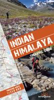
Wandelgids Trekking Guide Indian Himalaya | TerraQuest

0
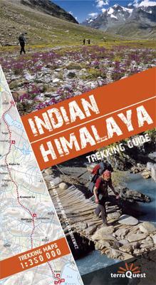
Gids met uitgebreide omschrijvingen van 22 wandelroutes. Inclusief detailkaarten, schaal 1:350.000, met gemarkeerde routes en hoogtelijnen. Verder informatie over eten en drinken, aanbevolen uitrusting, vervoer ter plaatse en informatie over afstand en tijd van de trektochten. De omschreven tochten zijn in de volgende gebieden: Kashmir, Ladakh, Za...

Verkopers met dit product

Verkoper
Bezorging
Prijs
DeZwerver.nl logo
DeZwerver.nl
2,95
30,95

Anderen bekeken ook

Wandelgids Trekking Guide Indian Himalaya | TerraQuest
Gids met uitgebreide omschrijvingen van 22 wandelroutes. Inclusief detailkaarten, schaal 1:350.000, met gemarkeerde routes en hoogtelijnen. Verder informatie over eten en drinken, aanbevolen uitrusting, vervoer ter plaatse en informatie over afstand en tijd van de trektochten. De omschreven tochten zijn in de volgende gebieden: Kashmir, Ladakh, Zanskar, Lahul, Rupshu, Spiti, Kinnaur, Garhwal, Kumaon en Sikim.   This guidebook is unique in presenting detailed descriptions of 22 trekking itineraries in the Indian Himalaya. The routes have been especially devised to pass through the most scenic and culturally interesting regions of northern India. The information on the distance and time needed to cover particular route sections makes it easy for experienced trekkers and trekking novices alike to plan their trip in great detail.    Maps and height profiles Each trek description includes a 1:350 000-scale map (with the route marked on it) and a height profile diagram that reflects landfor…
30,95
Wandelkaart Trekking map Indian Himalaya | TerraQuest
Mooie gedetailleerde kaart, geplastificeerd. De kaart heeft op de ene kant een algemeen overzicht van de Indische Himalaya met schaal 1/750.000 en op de andere zijde vind je de 22 trekking routes op schaal 1/350.000. Op zich geen zeer gedetailleerde wandelkaart. Er van uitgaande dat je de tochten toch met een gids of met een groep doet, dan is dit een uitstekende kaart. Dubbelzijdig geplastificeerde wandelkaart en overzichtskaart van de Indiase Himalaya (Noord-India) en op de achterzijde inzetkaarten met hoogtelijnen en trekkingroutes en voetpaden ingetekend van verschillende wandelroutes in Kashmir, Ladakh, Zanskar, Lahul, Rupshu, Spiti, Kinnaur, Garhwal, Kumaon en Sikim en verder toeristische informatie in symbolen aangegeven
22,50
Wandelgids Trekking in the Himalaya | Cicerone
Cicerone wandelgids van Himalaya met 20 uitdagende trekkingen.  The Himalaya have always fed the dreams and called to those who love wild places. Stretching from Pakistan through Northern India, Nepal, Tibet and Bhutan, this book includes 20 descriptions of the best, and most spectacular treks in the range. From glaciers to jungle, snow-swept passes to plunging valleys, remote plateaus to bustling base camps, the Himalaya offer an unparalleled wealth of landscapes and trekking opportunities.   This inspirational guide was edited by trekking specialist Kev Reynolds, and written by a team of eight experienced authors, writers and guides. A compilation of the best walking in the Himalaya, it looks at each trek in turn, and discovers what makes the trek special, and entices with vivid accounts and breathtaking photography.   The Treks:   Pakistan K2 and Concordia Snow Lake Nanga Parbat India Zanskar Dream Trek (Ladakh) Nanda Devi (Garhwal and Kumaon) Kanchenjunga: Singalila Ridge an…
30,95
Wandelgids Nepal Trekking and the Great Himalaya Trail: A Route and Planning Guide | Trailblazer Guides
With extensive sections to help you choose your trekking region, this is a route and planning guide for anyone organising a trekking holiday in Nepal. It includes the most popular routes as well as the newest trekking areas plus the most extreme route of all, the Great Himalaya Trail. There are route guides to the following regions: Kanchenjunga, Makalu, Rolwaling, Solu-Khumbu (Everest Region), Helambu & Langtang, Ganesh & Manaslu Annapurna, Naar & Phu, Mustang Dolpo, The Far West The guide covers: Visas, permits, fees and equipment Choosing a trek – independent tea-house trekking or guided treks arranged through trekking agencies; choosing a guide and crew; when to go; trekking grades and duration Kathmandu & Pokhara city guides – hotels, restaurants, what to see Nepal background – people, religions, festivals and etiquette Health, safety and responsible tourism Colour mapping – showing the main trekking routes in Nepal The Great Himalaya Trail Running the entire 4500 km length of th…
23,50
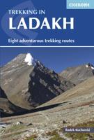
Wandelgids Trekking in Ladakh | Cicerone
Cicerone wandelgids van Ladakh met acht uitdagende trekkingen.    This trekking guidebook gives detailed descriptions of eight different treks across the Ladakh, Zanskar and Markha Valley in northern India. Ranging from moderate difficulty to very demanding, each trek is broken down into multiple stages, and has information on difficulty, available accommodation and access, as well as the many combinations and alternative routes open to exploration.    Known as Little Tibet; for both its landscape and culture, Ladakh lies at the northern tip of India. The region is bisected by the great River Indus and neighbours Tibet and Kashmir. This quiet corner of the Himalaya has developed a strong trekking culture over recent years for adventurous trekkers. Trekking in this remote, high-altitude region is extremely challenging, as paths are not signed and there are only a limited number of villages. However, its magnificent landscape (a huge area full of limitless trekking possibilities), ho…
33,95
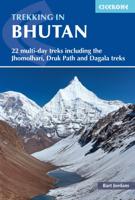
Wandelgids Trekking in Bhutan | Cicerone
Bijzondere uitgave van deze gerenommeerde wandelgidsen-uitgever: vol met dagtochten en meerdaagse trekkings in dit fascinerende koninkrijk. Praktische informatie als route, zwaarte etc en schetsmatig kaartmateriaal. A guidebook to 22 multi-day treks in the Himalayan Kingdom of Bhutan, including the Jhomolhari, Druk Path and Dagala treks. The trails vary from 2 to 23 days long. The routes are mostly in western and central Bhutan, and range from easy to strenuous depending on the length, altitude and difficulty. Includes advice on cultural awareness. Boasting soaring snow-clad peaks and tranquil valleys, and a rich Buddhist culture, Bhutan is an ideal destination for trekkers wishing to experience the magic of the Himalaya without the commercialism. Although independent trekking is not permitted, it can nonetheless prove difficult to obtain information. This guide describes 22 official treks and a handful of trek variants, with comprehensive advice about planning and preparation and ple…
27,95
Fotoboek My Himalaya | teNeues
The life's work of photographer Olivier Follmi and an homage to the incomparable landscape, people, and spirituality of the Himalayan region. The work of Olivier Follmi exudes authenticity and spirituality. For more than 40 years, the prize-winning photographer has documented the landscape and peoples of the Himalayas, a region he first got to know on a hiking trip in the 1980s. Captivated by Tibetan culture, people, and their harmonious coexistence with nature, Follmi returned to the mountain region on numerous occasions - at times as a mountain guide, at others to live and learn from spiritual leaders in a Buddhist temple. The Himalayas became his destiny, and he became one of the most sensitive and insightful observers of life in Tibet. This rich photo book of the Himalayas is at once a remarkable retrospective and an homage to the Tibetan culture and spirituality which has so defined and characterised Follmi's life and work. Page after page reveals photographs of extraordinary emo…
89,95
Nieuw
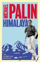
Reisverhaal Himalaya | Michael Palin
Michael Palin tackles the full length of the Himalaya in this terrific number one bestseller. Having risen to the challenge of seas, poles, dhows and deserts, the highest mountains in the world were a natural target for Michael Palin. In a journey rarely, if ever, attempted before, in 6 months of hard travelling Palin takes on the full length of the Himalaya including the Khyber Pass, the hidden valleys of the Hindu Kush, ancient cities like Peshawar and Lahore, the mighty peaks of K2, Annapurna and Everest, the gorges of the Yangtze, the tribal lands of the Indo-Burmese border and the vast Brahmaputra delta in Bangladesh.   Facing altitudes as high as 17,500 feet as well as some of the world's deepest gorges, Palin also passed through political flashpoints like Pakistan's remote north-west frontier, terrorist-torn Kashmir and the mountains of Nagaland, only recently open to visitors.
15,95
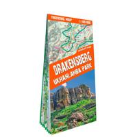
Wandelkaart Trekking map Drakensbergen - Zuid Afrika | TerraQuest
Geplastificeerde trekking-kaart. Relatief zeer gedetailleerd. Het Ukhahlamba Park ligt op de grens van Zuid-Afrika en Lesotho met de hoogste berg en het meest interessante gebied van de Draak. Met wandelroutes, toeristische info, GPS coordinaten in WGS-84. Hiking map of the Drakensberg in the Ukhahlamba Park, on the South Africa and Lesotho border. Waterproof and tear resistant map published by Terraquest. The map is double-sided and covers the park in two overlapping sections. Coverage extends north-west to include the Royal Natal National Park. The map covers the entire Ukhahlamba Park - the highest in the Drakensberg area.   The map is distinguished by its topographical accuracy (contour) and the detailed content focused on tourism (symbols show locations of hotels, mountain refuges and campsites, bivouac and picnic places, restaurants, car parks and petrol stations, medical facilities, viewpoints, etc...) The map shows rural roads and footpaths, and highlights trekking trails indi…
18,50
Wandelgids Trekking in the Karakoram | Cicerone
A guidebook to 3 high-altitude treks in Pakistan’s Karakoram mountains, plus 2 shorter routes on the flanks of Nanga Parbat in the neighbouring Himalaya. With the exception of the Fairy Meadows trek, all the routes are strenuous and are recommended for experienced trekkers.   The guide includes 3 treks of 12 days each (excluding rest days): Biafo to Hispar via Snow Lake; a K2 Base Camp Trek; and a crossing of Gondogoro La. The Nanga Parbat routes visit Fairy Meadows (3 days) and Diamir or West Face (5 days).   Route description illustrated with 1:100,000 mapping and elevation profiles Advice on planning and preparation, including trek operators Safety considerations History of mountaineering and exploration in the Karakoram Offers views of 5 of the world’s 8000m peaks
34,95

Klanten-reviews van Wandelgids Trekking Guide Indian Himalaya | TerraQuest

Er zijn nog geen beoordelingen voor dit productBen jij de eerste die een review plaatst?

Meer over Wandelgids Trekking Guide Indian Himalaya | TerraQuest

Productomschrijving

Gids met uitgebreide omschrijvingen van 22 wandelroutes. Inclusief detailkaarten, schaal 1:350.000, met gemarkeerde routes en hoogtelijnen. Verder informatie over eten en drinken, aanbevolen uitrusting, vervoer ter plaatse en informatie over afstand en tijd van de trektochten. De omschreven tochten zijn in de volgende gebieden: Kashmir, Ladakh, Zanskar, Lahul, Rupshu, Spiti, Kinnaur, Garhwal, Kumaon en Sikim.   This guidebook is unique in presenting detailed descriptions of 22 trekking itineraries in the Indian Himalaya. The routes have been especially devised to pass through the most scenic and culturally interesting regions of northern India. The information on the distance and time needed to cover particular route sections makes it easy for experienced trekkers and trekking novices alike to plan their trip in great detail.    Maps and height profiles Each trek description includes a 1:350 000-scale map (with the route marked on it) and a height profile diagram that reflects landform features. This is what makes the guidebook unique and – even more importantly – invaluably useful when trekking the Himalaya mountains.   Practical information The guidebook offers all kinds of indispensable tips: from food and drink, through recommended equipment, to transportation. You will find it priceless to learn which time of the year to choose for your expedition, and what to look out for to make it safe.   Exceptional part of the Himalaya The Indian Himalaya are less frequented than Nepal, another famous expanse of the highest mountains in the world. It is a truly extraordinary place, untouched by Western civilization. The region's allure is its amazing wildlife, as well as the inimitable culture and traditions of its native people.

Productinformatie

    Verken gerelateerde categorieën

    Webshop.nl maakt gebruik van cookies. Ga je verder op onze website, ga dan akkoord met het plaatsen van cookies en de verwerking van deze data door ons en vermelde partners.