webshop.nl
Categorieën
  Sluiten

Meer Cicerone
Meer Cicerone in Reisgidsen & talen boeken

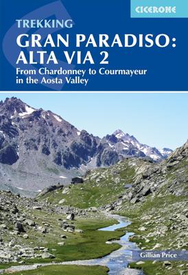
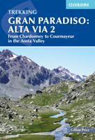
Wandelgids Trekking Gran Paradiso: Alta Via 2 : From Chardonney to Cou

A guidebook to trekking Alta Via 2, a route of 148km, from Chardonney and Courmayeur in the Gran Paradiso National Park. While not high on the difficulty scale, Alta Via 2 is strenuous, and best suited to trekkers with some alpine experience. Fittingly perfectly into a two-week time slot, the route is best undertaken between late June and late Sept...
27,50

Webshops met dit product

Webshop
Bezorging
Prijs

Anderen bekeken ook

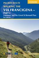
Wandelgids - Pelgrimsroute Via Francigena part 2 | Cicerone
Guidebook to the Via Francigena pilgrim route from Lausanne to Lucca. Starting at Lake Geneva (Lac Léman), the 725km route crosses the Alps at historic Great Saint Bernard Pass, descends the Po Valley, then climbs to cross the Cisa Pass into Tuscany. Described in 32 stages, with information on facilities and pilgrim hostels.   Seasons Suitable for walking in spring, summer and autumn. The Great Saint Bernard Pass is fully open to hikers only in August and September.   Centres Lausanne, Martigny, Great Saint Bernard Pass, Aosta, Ivrea, Vercelli, Pavia, Piacenza, Pontremoli, Pietrasanta, Lucca.   Difficulty Each stage is graded for difficulty (1-4). A few mountainous stages include steep and slippery slopes. No special gear is required to walk the Via Francigena in season, but off-season crossings of the Great Saint Bernard Pass require winter mountain gear and careful attention to changing mountain conditions.   Must See Dazzling Lake Geneva, the 1500-year-old Abbey of Saint…
22,95
Wandelgids Alta Via 2 - Trekking in the Dolomites | Cicerone
Uitstekende wandelgids van een gerenommeerde Engelse uitgever. De tochten zijn met zorg beschreven en voorzien van allerhande nuttige informatie. Guidebook describing Alta Via 2, a challenging hut-to-hut trek through the Italian Dolomites. Stretching 174km from Bressanone (Brixen) to Feltre, the route involves some aided and exposed sections (although several can be bypassed) calling for a sure foot and a good head for heights. It can be walked in under a fortnight - although it is also possible to walk shorter chunks should you only have limited time, and the guide highlights potential exit routes and transport options. Also included are summaries of Alte Vie 3-6, which are more demanding and include remote terrain and stretches of via ferrata for which climbing experience is essential. On Alte Vie 3-6 some nights will be spent in unmanned bivouac huts, meaning trekkers must carry their own kit, although it is possible to walk shorter hut-to-hut sections. The easiest of the Alta Via r…
23,95
Wandelgids Trekking in the Stubaier Alps | Cicerone
Uitstekende wandelgids van Cicerone over de Stubaier Alpen, waarbij de nadruk ligt op een tweetal meerdaagse routes: Huttentochten voor een gemiddelde en wat meer gevorderde wandelaar. Goede praktische informatie, kaartmateriaal beperkt. Aanbevolen wandelkaarten bij deze gids Schaal 1:25.000 Wandelkaart 31/1 Alpenvereinskarte Stubaier Alpen - Hochstubai Wandelkaart 31/2 Alpenvereinskarte Stubaier Alpen - Sellrain Of schaal 1:50.000 Wandelkaart 83 Stubaier Alpen Kompass Of all the many Alpine areas, few can match the Stubai in the Austrian Tyrol as a venue for a first Alpine season. Shapely peaks, good paths and some of the best huts in the Alps make it ideal for the novice who wants to extend their experience beyond Britain. Of all the many Alpine areas, few can match the Stubai in the Austrian Tyrol as a venue for a first Alpine season. Shapely peaks, good paths and some of the best huts in the Alps make it ideal for the novice who wants to extend their experience beyond Britain. This…
21,95
Wandelgids Alta Via 2 - Trekking in the Dolomites | Cicerone
Uitstekende wandelgids van een gerenommeerde Engelse uitgever. De tochten zijn met zorg beschreven en voorzien van allerhande nuttige informatie. Guidebook describing Alta Via 2, a challenging hut-to-hut trek through the Italian Dolomites. Stretching 174km from Bressanone (Brixen) to Feltre, the route involves some aided and exposed sections (although several can be bypassed) calling for a sure foot and a good head for heights. It can be walked in under a fortnight - although it is also possible to walk shorter chunks should you only have limited time, and the guide highlights potential exit routes and transport options. Also included are summaries of Alte Vie 3-6, which are more demanding and include remote terrain and stretches of via ferrata for which climbing experience is essential. On Alte Vie 3-6 some nights will be spent in unmanned bivouac huts, meaning trekkers must carry their own kit, although it is possible to walk shorter hut-to-hut sections. The easiest of the Alta Via r…
23,95
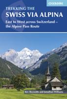
Wandelgids Swiss Alpine Pass Route - Via Alpina | Cicerone
Uistekende wandelgids van de Via Alpina dwars door Zwitserland.  A guidebook to the Swiss Via Alpina, a 400km (250 mile) trek east-to-west across Switzerland, from Sargans to Montreux on Lac Leman (Lake Geneva). Previously the Alpine Pass Route, the Via Alpina (VA) is a fully waymarked Swiss national trail that involves nearly 23,000m of ascent and descent over roughly 3 weeks of trekking - a serious challenge suitable for experienced trekkers. The main route is described in 19 stages of 12-29km (8-18 miles), as well as a 27km (17 mile) prologue stage from Liechtenstein and detour stages via Lenk and Gsteig.   Comprehensive route description is accompanied by 1:100,000 mapping, route profiles, facilities listings and advice on safety, transport, accommodation and language. Crossing 16 Alpine passes, the VA showcases some of the Switzerland's most breathtaking mountain landscapes, from flower-strewn meadows to snow-capped peaks including the majestic Todi, Titlis, Wetterhorn, Eiger, …
26,50
Wandelgids Trekking in the Stubaier Alps | Cicerone
Uitstekende wandelgids van Cicerone over de Stubaier Alpen, waarbij de nadruk ligt op een tweetal meerdaagse routes: Huttentochten voor een gemiddelde en wat meer gevorderde wandelaar. Goede praktische informatie, kaartmateriaal beperkt. Aanbevolen wandelkaarten bij deze gids Schaal 1:25.000 Wandelkaart 31/1 Alpenvereinskarte Stubaier Alpen - Hochstubai Wandelkaart 31/2 Alpenvereinskarte Stubaier Alpen - Sellrain Of schaal 1:50.000 Wandelkaart 83 Stubaier Alpen Kompass Of all the many Alpine areas, few can match the Stubai in the Austrian Tyrol as a venue for a first Alpine season. Shapely peaks, good paths and some of the best huts in the Alps make it ideal for the novice who wants to extend their experience beyond Britain. Of all the many Alpine areas, few can match the Stubai in the Austrian Tyrol as a venue for a first Alpine season. Shapely peaks, good paths and some of the best huts in the Alps make it ideal for the novice who wants to extend their experience beyond Britain. This…
21,95
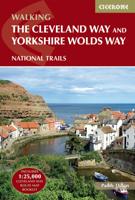
Wandelgids The Cleveland way and the Yorkshire Wolds way | Cicerone
Uitstekende wandelgids van de Cotswolds Way, waarbij naast alle noodzakelijke informatie ook gebruik gemaakt wordt van de echte topografische kaart. Inclusief gidsje met routekaarten van 1:25000 Guidebook to the Cleveland Way and Yorkshire Wolds Way National Trails, plus the Tabular Hills Walk link route. The guidebook also contains a 1:25,000 scale OS route map booklet of the Cleveland Way.   The Cleveland Way National Trail, described in seven day stages, is a fine 177km (110 miles) walk around the North York Moors National Park from Helmsley to Filey. The Yorkshire Wolds Way is one of the quietest of Britain's National Trails and wanders for 130km (80 miles) through gentle, cultivated and sparsely populated countryside. Described here in nine day stages, from Hessle near Redcar to Filey, it links end-to-end with the Cleveland Way on the coast. Also described is the three-day, 80km (50 mile) Tabular Hills Walk, a Regional Trail that allows walkers to close the loop of the Cleveland W…
25,95
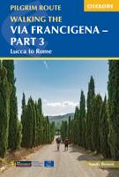
Wandelgids Walking the Via Francigena part 3 Lucca to Rome | Cicerone
Guidebook to the final 400km of the Via Francigena pilgrim route from Lucca to Rome. Crossing Tuscany in the heartland of Italy, the route goes through two of the region's most important cities, Lucca and Siena, and visits San Gimignano, Monteriggioni, and Radicofani. Described in 18 stages, with information on facilities and pilgrim hostels. Certified by the Council of Europe as an official Cultural Route, the Via Francigena from Canterbury to Rome brings to the modern pilgrim the cultural heritage of four nations--England, France, Switzerland, and Italy--and highlights their natural beauty and their history. Each stage has route directions and 1:100,000 mapping, which shows the route line and the facilities available at different locations. The book details accommodation along the route, including invaluable information on low-cost pilgrim hostels. There are city maps for Lucca, Siena, Rome, and Viterbi, and a stage planning guide that lists intermediate distances between pilgrim acc…
24,95

Klanten-reviews van Wandelgids Trekking Gran Paradiso: Alta Via 2 : From Chardonney to Cou

Er zijn nog geen beoordelingen voor dit productBen jij de eerste die een review plaatst?

Meer over Wandelgids Trekking Gran Paradiso: Alta Via 2 : From Chardonney to Cou

Productomschrijving

A guidebook to trekking Alta Via 2, a route of 148km, from Chardonney and Courmayeur in the Gran Paradiso National Park. While not high on the difficulty scale, Alta Via 2 is strenuous, and best suited to trekkers with some alpine experience. Fittingly perfectly into a two-week time slot, the route is best undertaken between late June and late September.   The route is described across 12 stages (with a 4-stage extension option in place of Stages 6 and 7). Stages range from 5 to 18km, with stage ascent varying from 50m (Stage 8) to 1400m (Stage 9). Net ascent is 9630m. The route is described east to west so trekkers are rewarded with the beauty of Mont Blanc at the journey's end.   GPX files available to download Detailed information on travel logistics, the mountain hut network, as well as kit requirements Trek-specific Italian-English glossary included Information given on local alpine flora and wildlife Sized to easily fit in a jacket pocket

Productspecificaties

Artikelnummer(s)
Brand
Cicerone

Verken gerelateerde categorieën

Webshop.nl maakt gebruik van cookies. Ga je verder op onze website, ga dan akkoord met het plaatsen van cookies en de verwerking van deze data door ons en vermelde partners.